Moab's River Road
Highway Tales - Favorite Drives
Article Date: January, 2015
Article and Photography by Mark Quasius

There is one road that has always held our fascination over the years. Originally thought of as a short cut it has become one
of our "go to" roads due to its surprising scenic beauty. Utah highway 128 connects Moab to I-70 to the north. Most travellers take US-191 when
travelling but when heading westbound on I-70 this road is a 45 mile shortcut that exits the interstate at the ghost town of Cisco and winds its way
south towards Moab.
Known by the locals as "The River Road", this road isn't up to the typical highway standards but it is nothing for an RV
traveler to be concerned about. Ideally, this road should first be travelled southbound to get the full effect of the scenic wonders that appear
around every corner. The first time we drove the River Road was in our pre-RV days. As we left Cisco we turned south and were strafed by a Golden
Eagle, who was close enough to our vehicle that I expected scratch marks on the sunroof from his Talons.
The Colorado River appeared far off to our left and gradually drew closer to the road until they met at the Dewey Bridge.
The Dewey Bridge, built in 1916, was Utah's longest suspension bridge until it was destroyed by fire during a brush fire that began with a 7 year
old child playing with matches. The bridge is listed on the National Register of Historic Places. We've driven on the original bridge 30 years ago
but a new, wider span now crosses the Colorado River nearby.
After we crossed the new bridge the Colorado River remained off to the right of the road. Gradually the scenic red rock cliffs
began to close in as the open plains narrowed down to a valley. The feeling as the road turned into the valley was that we had just wandered into the
set of a John Wayne western. In reality that wasn't far from the truth. This area was the location for numerous western films, including a number of
John Wayne westerns, such as Rio Grande.

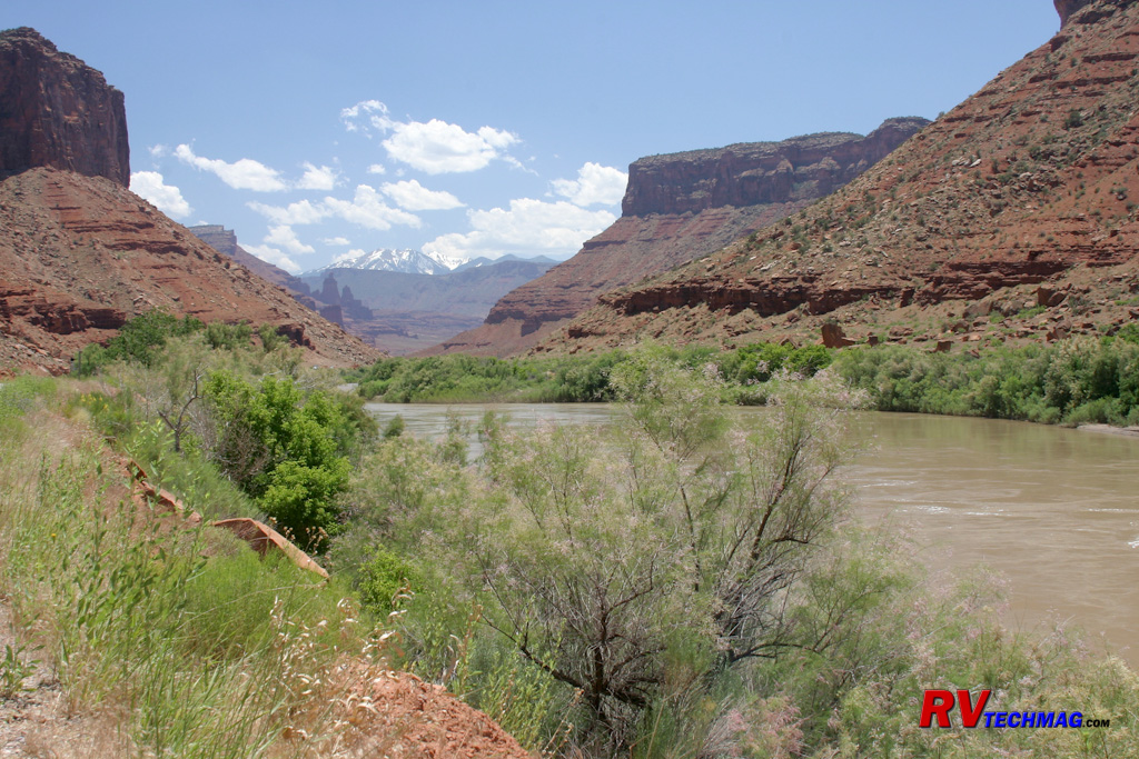
Colorado River with LaSal Mountains in Distance
This entire area just gets better and better as you head south toward Moab with each corner opening up a new scenic vista.
The Hittle Bottom area is your first chance for a bathroom break. A large dirt parking area leads to a launching area for white water rafting trips
down the Colorado. A grave near the entrance is from a pioneer woman who fell into the river back in the 1800s and died from pneumonia.
This hidden jewel of a road provides amazing views of the beautiful red rock country that slowly pinches towards the river and
road as well as the snow covered LaSal Mountains in the distance. Eventually you'll get to the Fisher Towers area where a Castle and Professor Valley
side road leads travellers past Castle Rock and onto the LaSal Mountains scenic loop. A number of BLM campsites are available alongside the river and
it's common to see rafters or maybe even a jet boat plying the waters of the Colorado.

White Water Rafters on the Colorado River
The final 13 miles of the road are along a narrow shelf with steep cliffs to the east and the Colorado River just to the right.
Steep red rock embankments are just off to the other side of the river. Negro Bill Canyon is here, which is the location of the trailhead for the
popular hiking trail to Morning Glory Natural Bridge. Eventually the road empties out into Spanish Valley and Moab.

Colorado River with La Salle Mountains in Distance
While the road doesn't have any shoulders, it isn't a white knuckle drive by any means. Its scenic wonders make it an excellent
choice for anyone travelling to Moab from the Grand Junction area. It's a drive you'll want to immortalize with photographs and there are places where
you can pull off to do that. I'd add it to your "must see" list.
Return to Home Page
If you enjoyed this article be sure to recommend RVtechMag.com to your friends, like us on Facebook or Twitter
or subscribe to our RSS feed.


|


