The Beartooth Highway
A Photo Journal of the Most Scenic Highway in the US
Article Date: January, 2015
Article and Photography by Mark Quasius
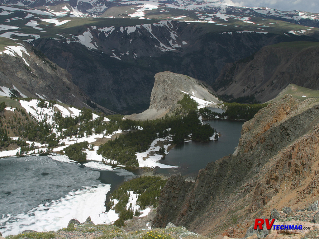
The Beartooth and Absaroka Mountains are found just outside the northeast side of Yellowstone National Park. The journey on
US-212, better known as the Beartooth Highway, begins at Red Lodge, Montana. Leaving Red Lodge the road begins a slow but steady climb through the
Custer National Forest. As you climb you'll arrive at a series of switchbacks that climb the north face of Beartooth Pass. Eventually the dense
forests of Lodgepole Pine give way to rocky cliffs as the road carves its way back and forth during the climb. Near the top a number of viewpoints
will allow you to see Rock Creek Valley below as well as the endless loop of roads making its way up the face of the mountains. Soon the road eases
back on the step ascent and you find yourself on top of an impressive alpine environment dotted with kettle lakes and surrounded by snow covered
mountains.
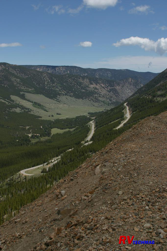
Switchbacks on North Face
As you make your way to the West Summit at around 11,000' you'll be looking down on these snow capped peaks as well as frozen lakes and
a ski lift area that frequently is still operating in the end of June. Winter comes early and stays late here so all summer long you'll see streams
of snowmelt passing though the land as well as numerous of waterfalls. Wildlife abounds here and you may see elk, moose, grizzly, or bald eagles on
your drive or you might just hear the occasional howl of the Gray Wolf. Passing over the top of the mountains is a wide alpine setting where you'll
find Top of the World Store at 10,000' of altitude. Leaving Top of the World you'll begin an easier trek down the other side of the mountains. You
can either split off and head to Cody, Wyoming via the Chief Joseph Highway, driving through places with names such as Sunlight Basin or Dead Indian
Pass, or continue on, passing through Cooke City before entering Yellowstone at its northeast entrance station. While not a drive for the timid,
it's truly the most impressive entrance to Yellowstone National Park.
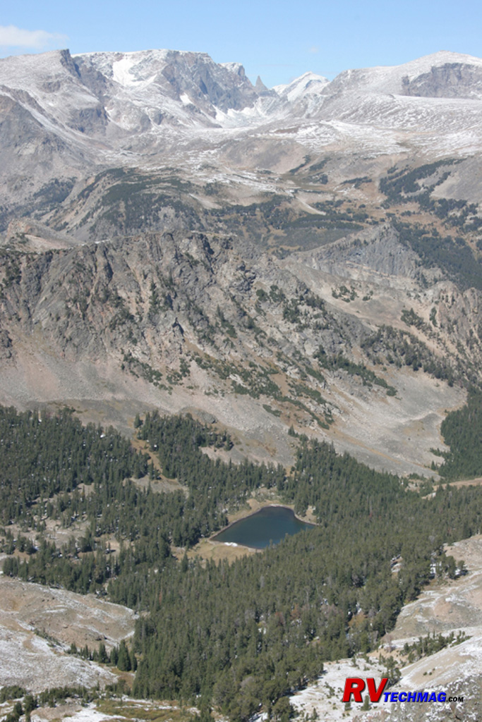
Beartooth Overlook
After climbing the switchbacks you'll be rewarded with views similar to this. Looking out you'll see hanging glaciers clinging
to the sides of mountains, their moraine slides extending to clear blue mountain lakes below.
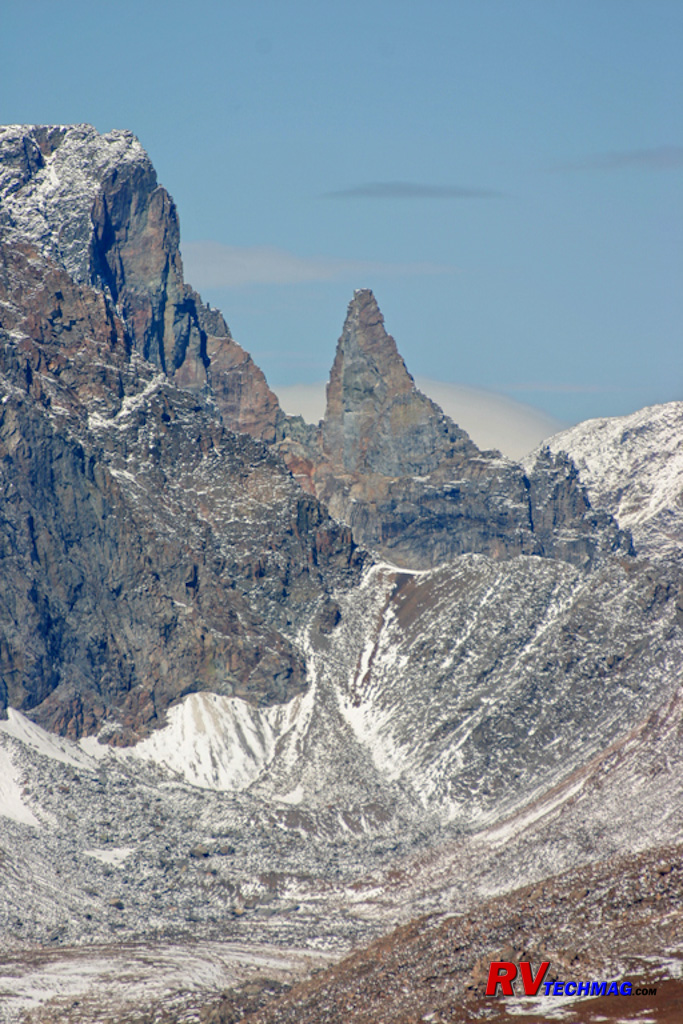
Beartooth Overlook
The Beartooth Mountains are not named that way because of grizzly bears that roam the area chewing on people. This is home to
the Grizzly but chances are you are not going to even see one on your journey. Rather, the Beartooth Mountains are named after one prominent feature,
namely the Bear's Tooth. This tooth shaped peak can be seen from the West Summit area. Its location can be seen in the previous image, where it is
barely visible at the top center of the image.
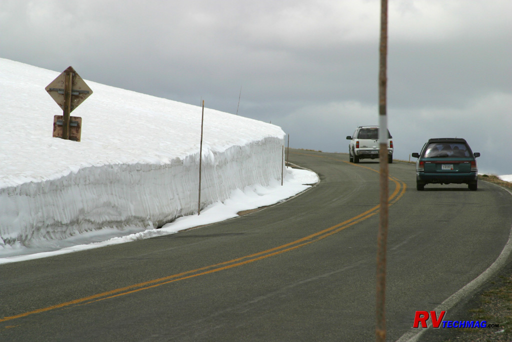
June Snow
The Beartooths receive plenty of snowfall and the highway is closed over winter. It generally opens up by Memorial Day,
although this is always weather dependant. Large snow drifts near the summit still remain mid-June, as this photo shows.
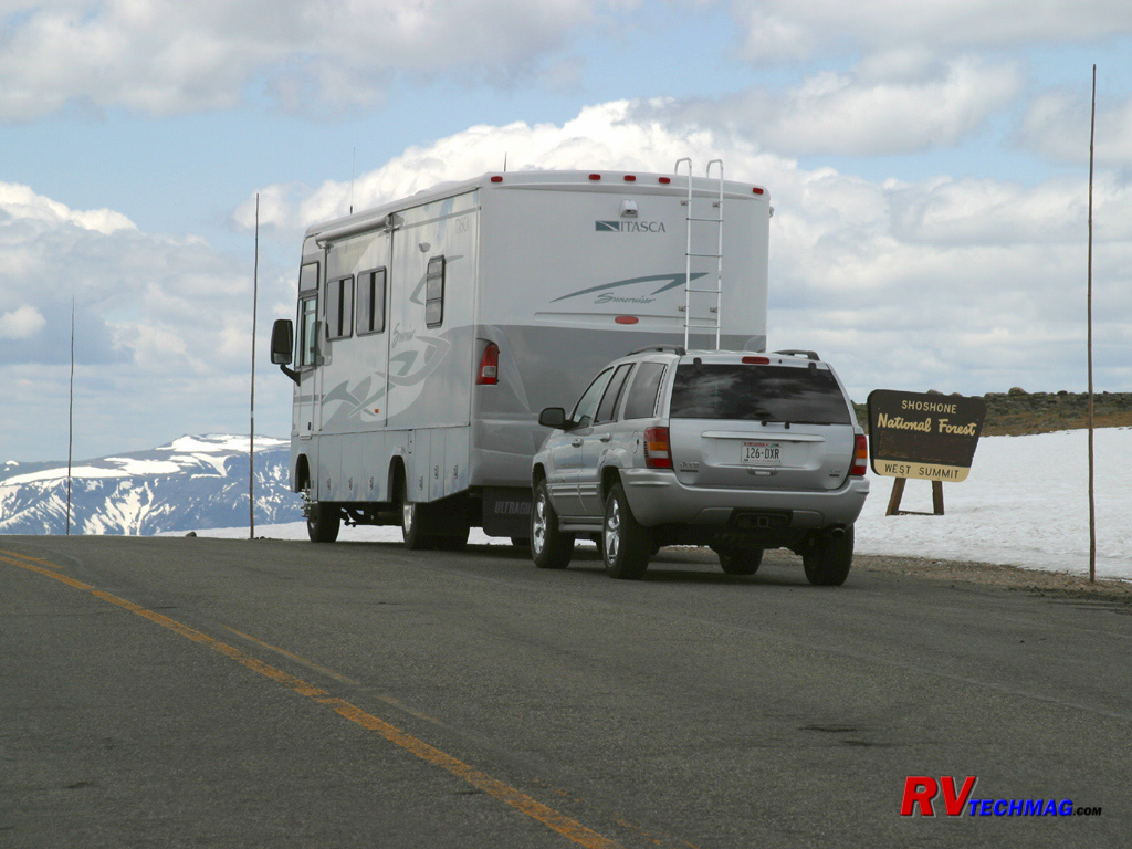
West Summit
The West Summit is located at 11,000' and marks the end of the steep switchbacks on the north face. The highway
continues across the top of the mountain for quite a while before dropping down to
Cooke City at its southern end.
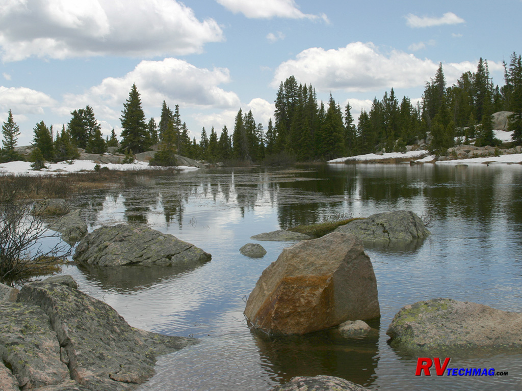
Little Bear Lake
The Beartooth Mountains are dotted with many small lakes. This image, taken in June, shows plenty of snow on the shores. At
this altitude the heavy winter snowfalls take a long time to melt.
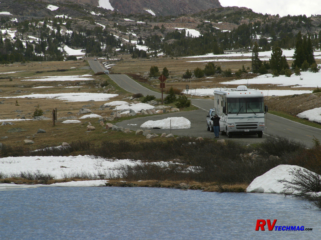
Alpine Tundra
Once over the West Summit, you'll drive through a wide saddle that straddles the mountain tops. There are numerous scenic
opportunities in this area. Eventually you'll reach Top of the World Store.
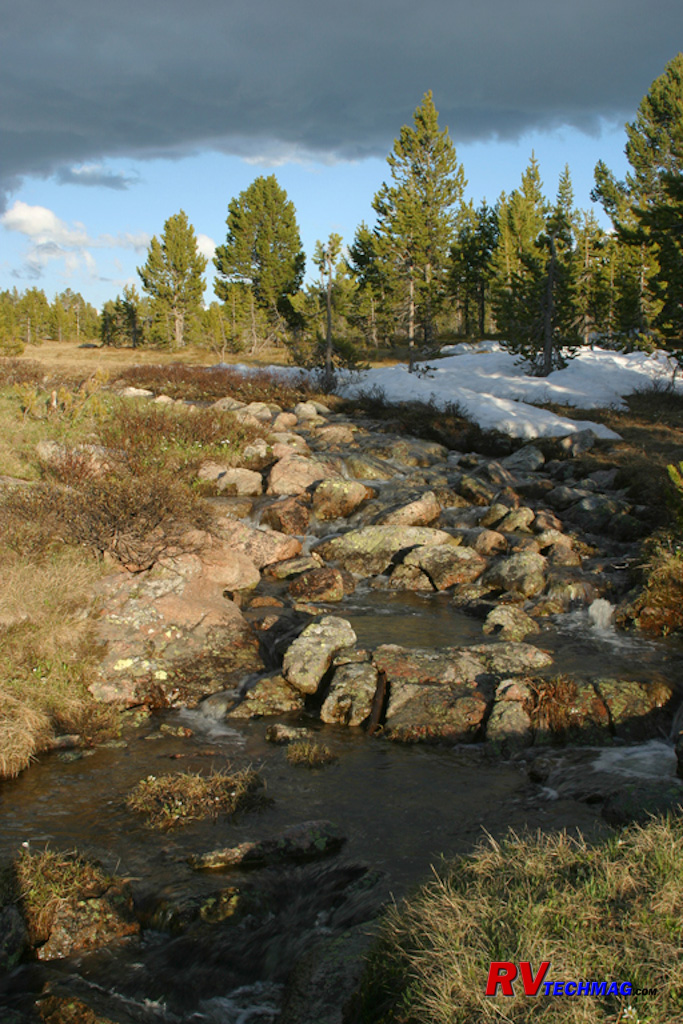
Beartooth Stream
This June image of a small stream is typical of many in the area and was found in the general area of the Top of the
World Store.
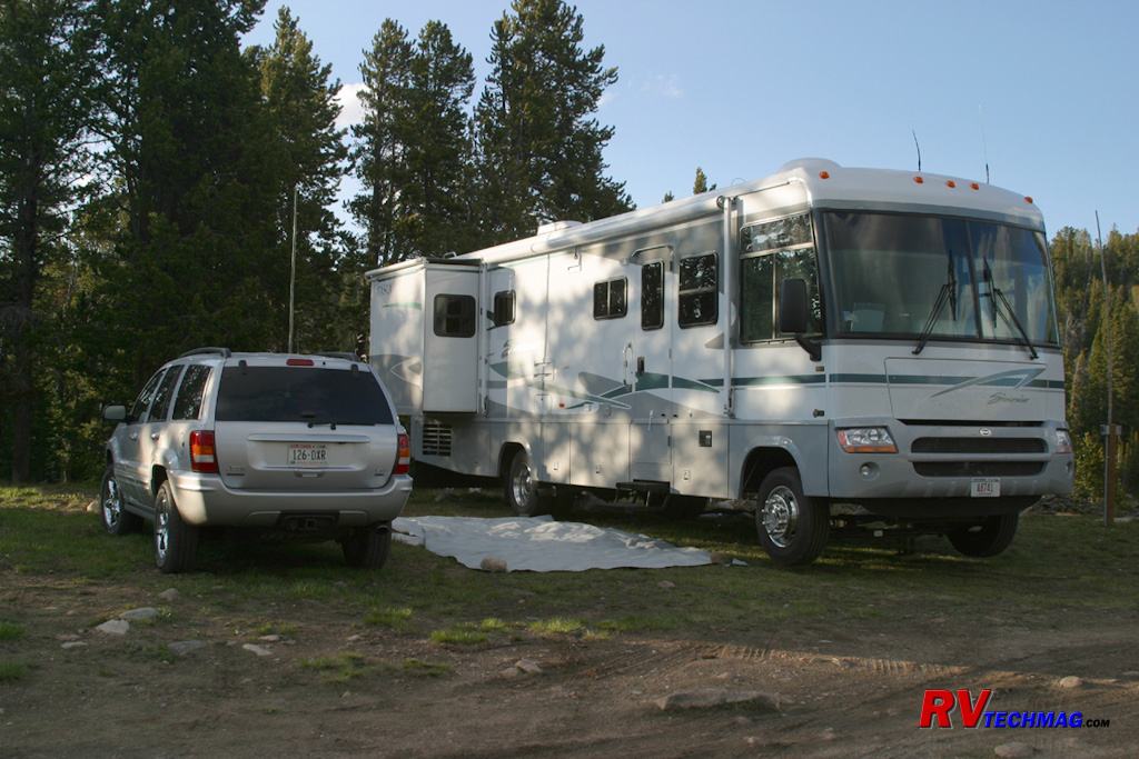
Camping at Top of the World
Top of the World Store sits at 10,000+ feet of altitude in the middle of the Beartooths. They have a few camping spots
available with water and sewer but no electricity. The store itself is run by a small generator so you'll need to use your RV's generator if you
need electricity.
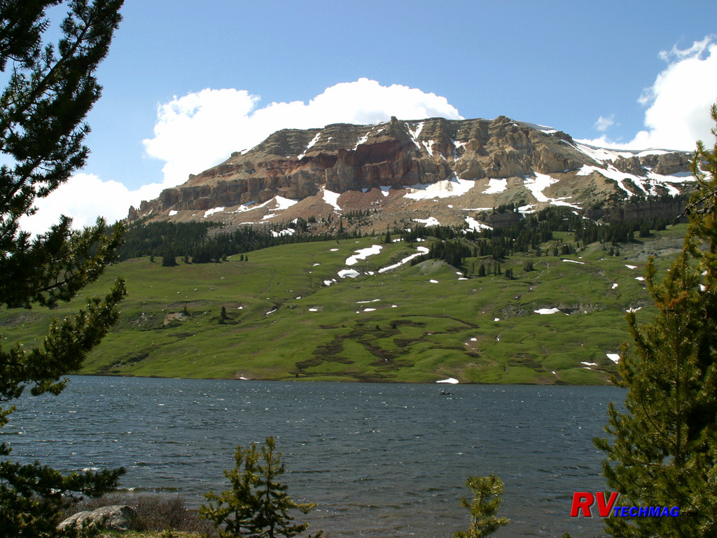
Beartooth Butte
Situated directly across from Beartooth Lake is Beartooth Butte. A hiking trail surrounds the lake and the butte can be seen
for miles when on Top of the World plateau.
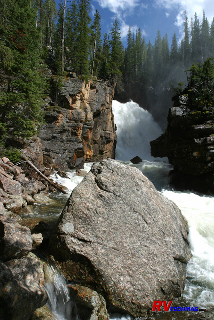
Sill Falls
After passing Beartooth Butte, the road hugs the side of a valley with a deep ravine. Emptying into this valley from high above
is Sill Falls. A climb down to the base of the falls reveals a thundering torrent of water as it rushes down through the ravine on its way to Clark's
Fork.
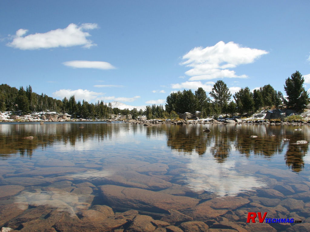
Beartooth Pond
Nestled in amongst the peaks that surround the winding Beartooth Highway are numerous kettle lakes. This small pond shows the
clarity of the water as well as the reflection of the blue sky. Footprints along the shore reveal that a wide variety of wildlife and predators frequent
this area.
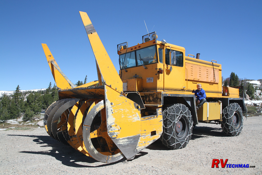
Snow Removal
The high level of snowfall every winter requires a major effort each spring to remove the deep snow to reopen the road for
travel. Snowblowers such as this are used to help clear the way.
Return to Home Page
If you enjoyed this article be sure to recommend RVtechMag.com to your friends, like us on Facebook or Twitter
or subscribe to our RSS feed.


|


