Cochise Country
Wheeling and Hiking in Arizona's Apache Stronghold
Article Date: March, 2015
Article and Photography by Mark Quasius
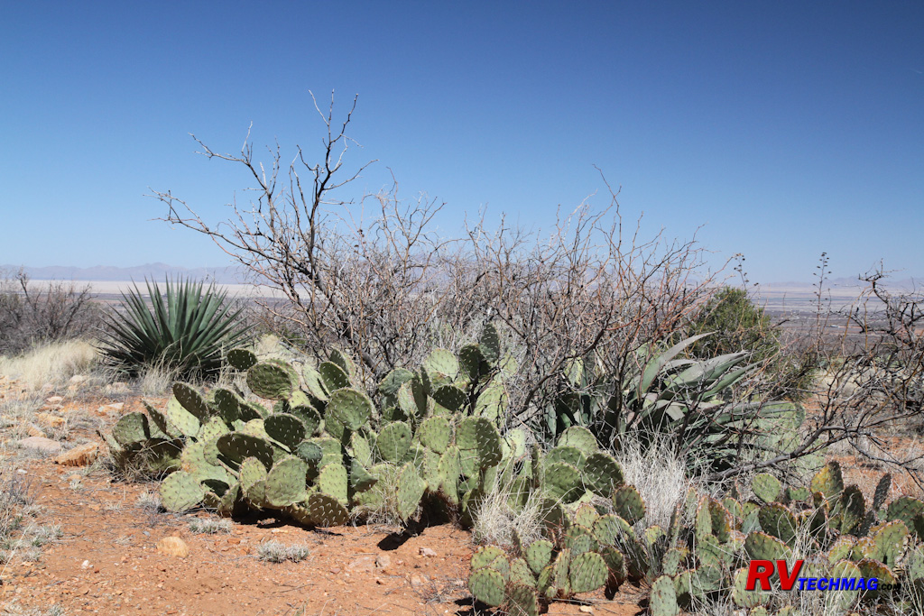
Many of those old western movies included scenes with Apache Indians waiting to ambush the cavalry or unsuspecting
stagecoach travelers. The scene was southern Arizona, which was the turf of Cochise and Geronimo and featured a rugged, dry landscape
populated with cactus and very littler water. Well times have changed but the scenery has not. You can still get out there and explore the
rugged majesty of that terrain. It's just that you won't need the cavalry for protection and you can stay at some nicely appointed RV parks.
Southern Arizona offers much to see and do and is a popular venue for RV travelers. Summer temperatures can get high,
although the humidity is quite low, so most RVers visit in the cooler winter months when the warm temperatures of this area are a welcome
respite from the colder northern states. An ideal area to stay when visiting this area is Benson, Arizona. Benson offers a number of nearby
RV parks and has a full range of services in town to handle any RVer's needs.
Cochise Stronghold
|
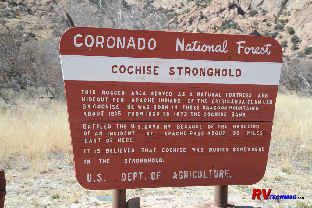
The Cochise Stronghold is located in the Coronado National Forest.
|
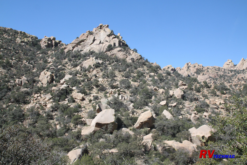
The Cochise Stronghold is surrounded by towering rocky peaks offering plenty of cover for avoiding contact or creating ambushes. |
The Apache tribes covered a wide area but the Chiricahua Apache were located south of Benson. The heart of their land
was the Cochise Stronghold on the east side of the Dragoon Mountains. The stronghold contained a number of locations for their base camp and
offered a protective hiding place where Cochise's tribe could spot approaching visitors at a distance. It also afforded excellent protection
and cover should they wish to avoid any visitors or from which to base an ambush. The location was important because it contained a spring and
stream for their all important water supply. Various camps were set up along the length of the stream.
Today, the US Forest Service maintains a picnic and camping site in the stronghold. Numerous hiking trails take you
through the valley so be sure to bring good hiking boots. The roads are good so you won't need 4 wheel drive or an SUV to access the site.
Access is gained by taking Interstate 10 exit 318 and heading through the small town of Dragoon. Follow Dragon Road east until it meets
Cochise Stronghold Road. Follow that road south to the graveled Ironwood Road, which will take you west into the stronghold. The Forest Service
campground and picnic area are at the end of the road. Be sure to bring plenty of drinking water because it does get hot when hiking in
the stronghold.
|
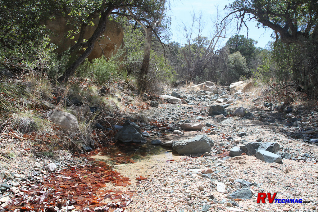
Apache campsites were strategically located near sources of water in the Stronghold.
|
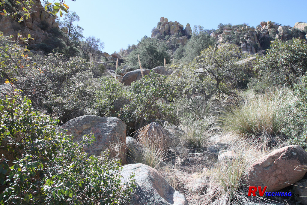
Hiking trails in the Cochise Stronghold pass through rough terrain.
|
Dragoon Springs
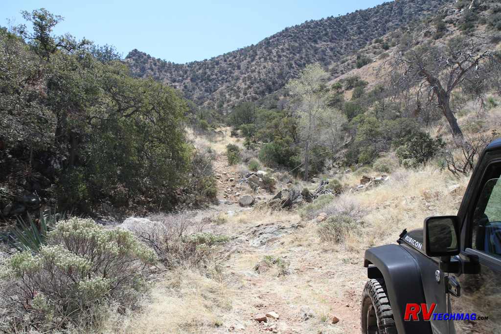
The trail to Dragoon Springs is rough but drivable by Jeep or other 4x4s. The stage station attendants would travel
this route by wagon to retrieve water from the springs.
Dragoon Springs is located on the west side of the Dragoon Mountains. The springs were a source of water for the
Apache as well as for the nearby Butterfield Stage Station. The Butterfield Stage ran from San Antonio, Texas to San Diego, California
and was established in 1857 when the need was seen for an overland mail route that serviced the west. The route traversed the southern
portion of the country, passing through El Paso and Yuma over some of the most grueling mountain and desert terrain possible. It took 22
days to cover the distance and 139 relay stations were placed along the route to service the 1,800 livestock and 250 coaches owned by
John Butterfield. The stage ran until 1861, when the civil war and increased hostilities with the Apaches relocated the route through
Utah to the north.
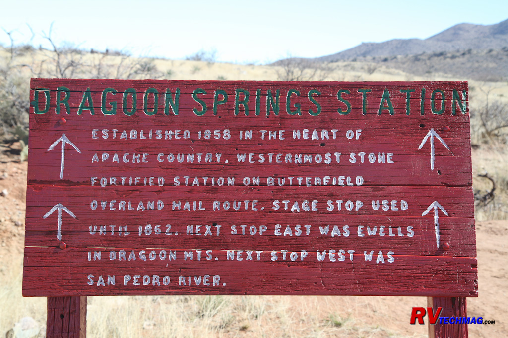
The Dragoon Springs Station was an important stopover spot on the Butterfield Stage route were teams of horses could be exchanged.
One relay station was located at the mouth of Jordan Canyon, just west of the Dragoon Mountains. A 45' by 55'
structure was built with a corral at one end and two 9' by 10' rooms at the other end. The stage station was not without trouble. In 1857 a
fight broke out amongst construction workers and three men were killed. In 1862, four confederate soldiers died in a battle with Apaches and
later that year two US army soldiers were killed in a similar altercation. The graves of several of these remain to this day.
|
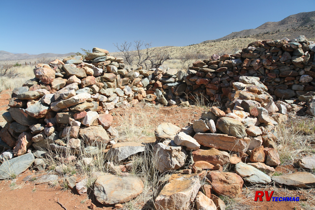
The Dragoon Springs Stage station was small and served as a corral for the horses and a small area for the attendants to live in.
|
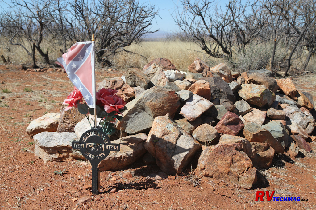
During the Civil War, Confederate troops were dispatched to Dragoon Springs to hold the stage station from any possible attack by
Union troops from California. They were massacred by Apaches in 1865 and the remains of four CSA soldiers are buried near the station.
|
Water for the stage station was provided via wagon from the head of Dragoon Springs. The springs and the stage station
along the way can be accessed via a Jeep trail that leads from the town of Dragoon. From Dragoon we headed south on the graveled Old Ranch Road
until it turned to dirt. We then followed the signs and continued south on the Jeep road towards the springs. The road ends at the springs but
a trail will let you hike the last bit to the source. The Butterfield Stage Station is located about a mile from the end. A small parking area
to the side of the trail will lead you up the short hiking trail to the stage station.
Fort Bowie
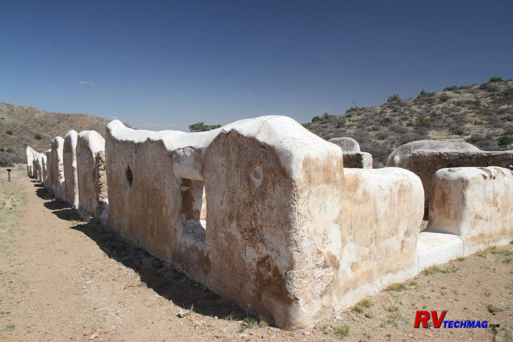
These adobe ruins are typical to Fort Bowie. The upper half was timber, which was stripped by local ranchers after the fort was abandoned. This
particular section was where Geronimo was kept after his capture.
Fort Bowie was originally established in 1862 as a result of a series of engagements between the US Army and the Chiricahua
Apaches and was situated to protect the important source of water at Apache Pass. The original temporary fort was small and was replaced in 1868 by
a larger more permanent fort on a plateau 300 yards to the south. While relations between the white settlers and Chiricahua Apaches were originally
quite good, that changed in 1861 when another band of Apaches raided the ranch of John Ward and made off with captives. The army intervened and
mistakenly blamed Cochise and the Chiricahuas for the raid and demanded that Cochise return the captives. Lieutenant George Bascom and a detachment
of 54 men went to Apache Pass to confront Cochise and demand the return of the captives. Cochise denied making the raid and even offered to help find
the hostages but Bascom decided to hold Cochise and some relatives captive instead. Cochise escaped and some of his family members were killed. This
set the stage for the future conflicts between the US Army and the Apaches for years to come, culminating in the capture of Geronimo in 1886. Geronimo
and his followers were held at Fort Bowie for a while until their eventual banishment to Florida.
|
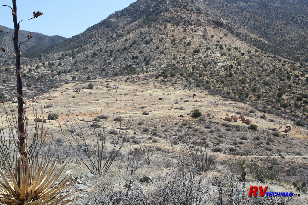
Fort Bowie was the headquarters for the U.S. Cavalry in the area and was established to protect the ranchers and the
travelers on the
Butterfield Stage routes. It can be reached by a one-hour hike from the parking area.
|
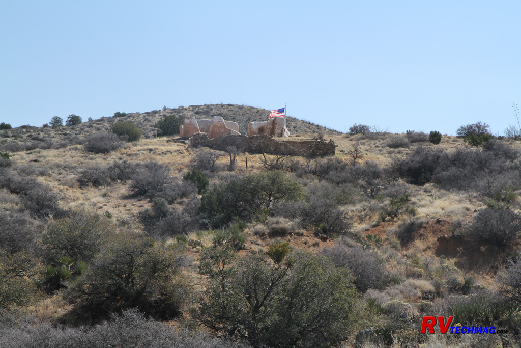
The first Fort Bowie was located high up on a hill and was deemed too small. The fort was then relocated to a larger area in the
valley below.
|
The fort's buildings were constructed with adobe exterior walls with wooden porches, roofs and interior walls. The thick adobe
walls kept the buildings cool during the hot summer days and warm at night. When the fort was abandoned in 1894 local ranchers pilfered the wood for
use in their own structures. What remains today is an extensive collection of adobe walls that mark where the various buildings were. Fort Bowie was
declared a National Historical Landmark in 1960. A visitor's center and museum serve as the park's headquarters.
|

Fort Bowie contains a large number of adobe ruins from the various buildings within the fort.
|

The cemetery at Fort Bowie contains grave markers for soldiers and civilians who died there, including one medal of honor recipient. The
remains have been re-interred elsewhere, but markers have been placed in their original location and the fence was constructed to the
exact dimensions and details of the original cemetery.
|
Access to Fort Bowie is gained by passenger car and a short 1.5 mile hike. From
Wilcox, AZ take highway 186 south for 20 miles
to the Fort Bowie turnoff. Head east on the gravel road another 8 miles to the parking area. The trail passes numerous interesting features along the
way to Fort Bowie. The remains of an old Butterfield Stage station, Apache Spring, Siphon Canyon, Bascom's Camp and the Fort cemetery are all located
along the trail. Be sure to bring plenty of water on the hike although you can refill your water containers at the visitor center. Toilets are located
at the parking area and at the visitor center.
Other Destinations
Benson is also located in a convenient location to explore other areas. Tombstone, "The Town too Tough to Die", is
located 24 miles to the south. You can walk the streets where Wyatt Earp roamed, visit the Bird Cage Saloon, or go check out the OK Corral where
the Earp brothers and Doc Holiday faced off against the Clanton gang in the famous shootout. The old county courthouse is now an excellent museum
showcasing the mining life and history of Tombstone. Daily gunfights are still common although slinging lead has now been replaced with blanks.
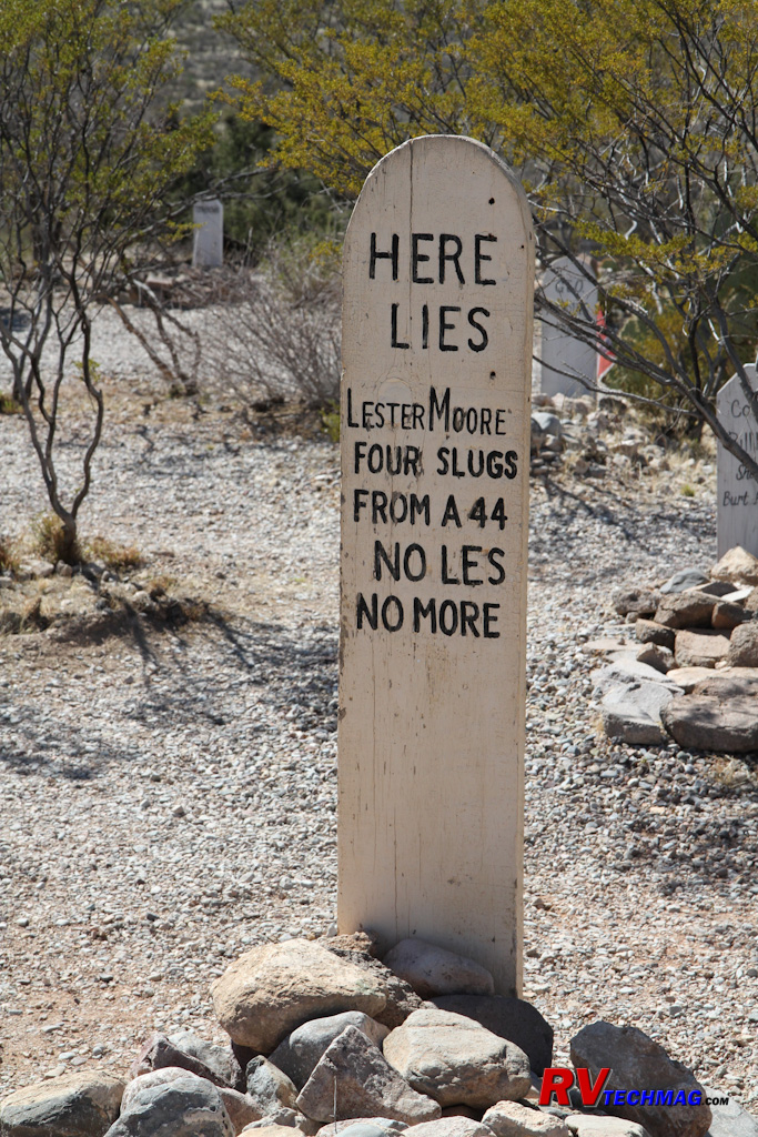
Tombstone is a popular destination. The Boot Hill graveyard is always one of the highlights.
Continuing on to the south, another 23 miles brings you to Bisbee, Arizona. Bisbee is a mining town known for copper mining.
The huge Lavender Pit mine is an open pit mine just south of town. The Copper Queen Mine is dug into the side of a mountain. Visitors to the mine
can enter the mine on the same electric shuttle trains that miners used to access the mine. The historic Copper Queen Hotel is located downtown,
across the plaza from the mining museum. Built in 1902 by the Copper Queen Mining Company it served up the good life for politicians, mining
officials, or visitors. Teddy Roosevelt stayed here during his time with the Rough Riders. The Copper Mines held out much longer than
Tombstone's silver mines to the north but eventually ceased production around 1975 after producing over eight billion pounds of copper.

Bisbee is a short drive from Benson and a popular tourist destination. Built around mining,
visitors can take a shuttle train into
the Copper Queen Mine.
Regardless of your tastes, you're bound to find tons of history, scenic wonders, and a warm climate in Cochise Country. One
interesting facts we learned is that the Apaches originated in Alaska and made their way down to this part of the country. Apparently they knew a
good thing when they saw it.
Source
Return to Home Page
If you enjoyed this article be sure to recommend RVtechMag.com to your friends, like us on Facebook or Twitter
or subscribe to our RSS feed.


|


