Exploring the Pacific Northwest by RV
Helpful Tips on Traveling the Pacific Coast from California's Redwoods Through Washington's Olympic Peninsula
Article Date: August, 2008
Article and Photography by Mark Quasius
Mount St. Helens
Mount St Helens was known as the Mount Fuji of North America, this beautiful snow covered peak was a popular destination for
outdoors people. Lodges dotted the shores of Spirit Lake, which lied at the feet of the mountain. In addition logging operations were prevalent in the
timber laden forests on and around the mountain. That all changed on May 18th, 1980 when Mount St. Helens erupted. The mountain was an active volcano,
with eruptions occurring every 100 years or so. In the weeks previous the mountain began a series of shudders and quakes so volcanologists were present
studying the mountain. A large bulge had formed on the north face of the mountain and the area was being evacuated and a "red zone" was created where
no one was allowed to enter. However, volcanoes being unpredictable, the volcano didn't always stick to the anticipated red zone and a number of events
unfolded that created some amazing stories of survival. Fortunately the area was basically barricaded off for the most part and resident were just about
ready to re-enter the area to remove more of their belongings when the volcano erupted at 8:32 AM.
Most people seem to think that volcanoes have craters that fill with hot molten lava when they erupt, which then flows down the
sides of the volcano. However, Mount St. Helens wasn't one of these. Mount St. Helens' crater had filled up over the last 100 years as lava slowly flowed
into the crater, building it back up into a mountain again. Eventually the weight of the new now hardened lava stopped up the flow and it became a scenic
snow capped mountain once again and forests surrounded the mountain and climbed its lower flanks. However, as the pressure built up it eventually got to
where it could no longer be contained. A weakness was found on the north face and the bulge formed after a series of quakes a few months prior to the
eruption. When the mountain finally blew, the bulge was the weak spot and superheated air blasted to the north at supersonic speeds. This lateral blast
caused the most damage and the massive blast was heard as far away as Canada. Like a massive shotgun, the lateral blast carried rocks and debris from
the mountainside and mowed down anything standing in a path some 20 miles wide. With a huger gaping hole in the side of the mountain, the top now fell
down into the blast hole and further fueled the shock wave. When the top was removed a vertical blast followed and ash darkened the sky for many miles
around. Heat and shock waves roared through the forests, previously thought to be safe and not in the red zone. The superheated air melted the snow and
frozen soil and large mudflows from the north face careened down the Toutle River, reaching as high as 65' over normal water level. New ridges were
formed, streams were diverted, and the landscape was changed forever.
Today, Mount St. Helens is once again accessible to travelers. What once was a laid back scenic area is now a national monument
and many visitor centers provide some great interpretive experiences that make this a very interesting sightseeing stop. The mountain is basically accessible
from two sides. The west side is the most popular access point and features the most opportunities for seeing the mountain and understanding what happened
with the least amount of time and effort. It's also very RV friendly. The east side requires more time. The roads twist and turn as they skirt around the
mountain, then climb to vantage points overlooking Spirit Lake. It also features a number of interesting side trips, such as Ape Cave, Lava Canyon, etc.
This trip is better taken with the toad, rather than the RV. If you only have one day in the area skip the east side and just do the west side. If you
have 2 or more days use 1 day for the west side and the others day or days for the east side.
Since the eruption, the area has shifted gears because tourism is now a huge part of the local economy. Many services have begun,
and this includes RV parks. RV parks for the most part are smaller and packed into trees. We liked the location of some of them, especially on the east
side, but didn't want to try to fit into them. Still, things change so be sure to check out the various campground reviews and keep in mind how large
of an RV the RVer who submitted the review had. Our choice was to stay in Woodland, Washington at
Columbia River RV Resort although their new restrictive policy of no dogs over 40 pounds will cause us to look elsehere next time - most likely in Kelso.
Woodland is a good place to set up base camp. It's just down I-5 from the west entrance to Mount St. Helens and it's also easy to get to the east side via Yale
and Cougar from there. There is a diesel fuel stop with easy access truck pumps just up the interstate and Woodland has a Safeway Store as well as other services
that you may need. Columbia River RV Resort is located right on the shores of the Columbia River. It's a quiet and scenic area and you may see large ships gliding
through the waters from the windshield of your RV.
Mount St. Helens is somewhat unique in it's management. It's a national monument so the National Park Service is involved. Much of
the land, and visitor centers are on US Forest Service land, and private enterprises are involved. So, to get information you'll have to check a number
of resources. The following links should be of some help:
The West Side Approach
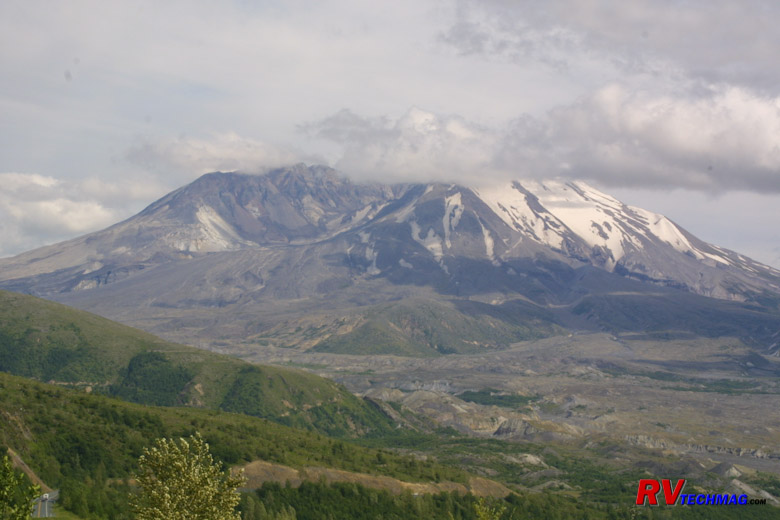
Mount St. Helens Blast Crater
The west side of Mount St. Helens can easily be accessed from I-5 exit # 49 at Castle Rock. Washington 504 is a nice blacktop road
that heads east through the Toutle River Valley until it terminates at Johnson Ridge Visitor Center about 52 miles later. There are a number of visitor
centers along the way and parking a large RV is not a problem at any of them. The very first Visitor Center is the US Forest Service visitor center at
Silver Lake, which is about 5 miles from the Castle Rock exit. This is a must see. When you enter the visitor center you will be shown exhibits of the
timeline of the eruption and the results of the eruption. It is very interesting and will help immensely in understanding everything else that you see.
Moving on down the road will get you to the Mount St. Helens
Forest Learning Center, which is put on by Weyerhaeuser. This free exhibit will show you the role that forestry has played in this area. After the
eruption, Weyerhaeuser hand planted over 18 million seedlings in this area to restore growth to the devastated hillsides.
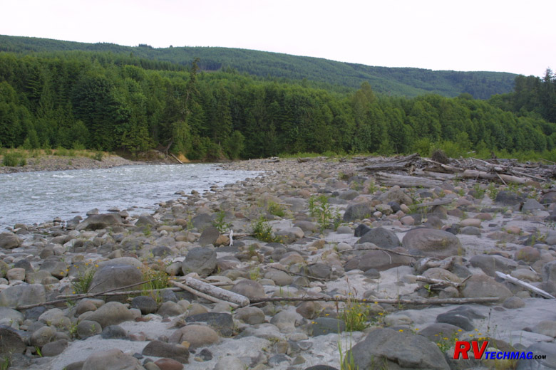
Pumice and Ash in the Touttle River Basin
About 18 miles from I-5 is the 18 Mile Diner. A small house has been made into a restaurant, serving burgers, shakes, and other
good stuff for a lunch or light supper. The balcony overlooks the Toutle River and is nearby where a large depot of logging equipment was destroyed by
the mudflows. This is outside the National Monument boundaries and there are logging roads nearby that will give you access to the Toutle River. The
river is now choked by debris from the blast and ash fallout is still evident throughout the area although it gets thinner and thinner every year as
the elements wash it downstream. They have a small museum as well that holds various vehicles and artifacts that were damaged by the eruption.
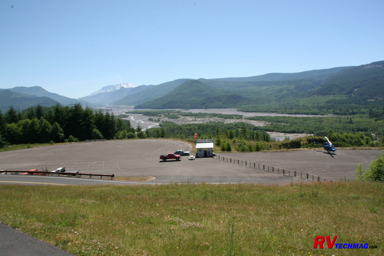
Hofstadt Bluffs Visitor Center
About 30 miles from I-5 is the Hoffstadt Bluffs Visitor Center.
This is a private concessionaire. It's the first real open view of the decimated Toutle River Valley and spotting scopes are provided to view the herds
of elk that have now returned to the valley. You can also take a helicopter tour down the valley that will take you to the edge of the lateral blast
crater. Flights are not permitted inside the crater but the bird's eye views you will get from this helicopter are spectacular.
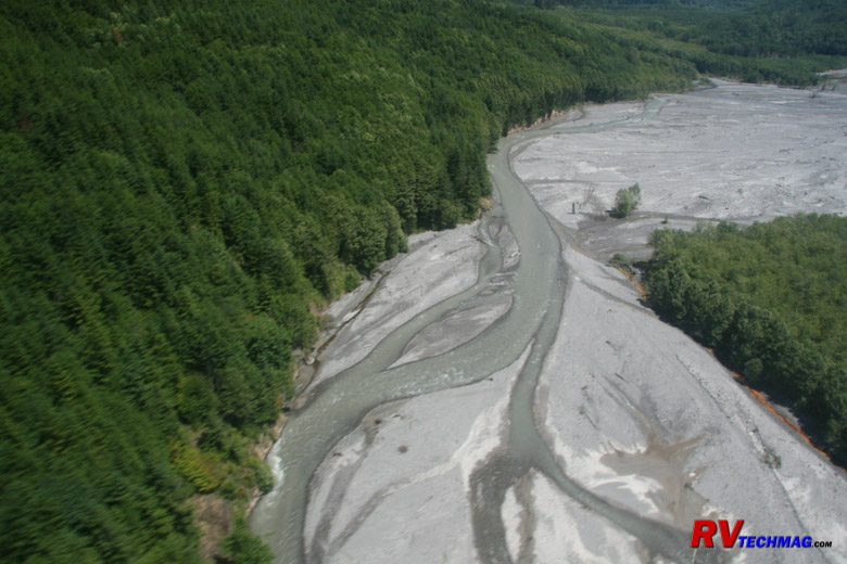
Touttle River Mudflows
When the lateral blast occurred large the extreme heat pretty much dissolved the mountainside. The melted snow combined with
dirt to create huge mudflows that roared down the Toutle River, carrying with it rocks, trees, and anything else in it's path. After the eruption
subsided and the ash fallout had ended, the landscape was vastly changed. The once clear Toutle River was now a meandering river that twisted and
turned around new soil deposits as it worked it's way out towards the Columbia River. Trees eventually were restored to the region but the mudflows
are slow to heal and cover the central part of the valley. The helicopter tour provides excellent views of this.
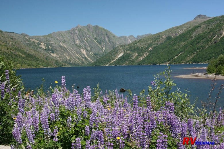
Wildflowers at Coldwater Lake
A visitor Center on Coldwater Ridge, 46 miles from I-5, has recently been closed due to lack of funding. However, across the
road is Coldwater Lake, which was formed when the debris from the lateral blast dammed up Coldwater Creek. A parking area and nature trail take you
along the edge of the lake and if you look across to the other side you will see heavy logging equipment that was damaged and left stranded from
the eruption. A hiking trail will take you to that ridge if you are want to see that up close.
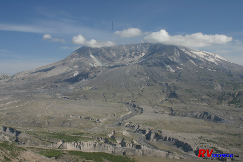
Crater View From Johnson Ridge
At 52 miles, the road ends at Johnson Ridge Visitor Center. This was named after the volcanologist who was here observing the
volcano when it erupted in May of 1980. He is buried somewhere beneath hundreds of feet of mountain that now cover this ridge. This visitor center
provides an up close view of the open blast crater. It seems so close, but in fact the mountain is 6 miles away but the crater is massive in size
so it just appears close. A very good movie is shown inside the theatre which is highly recommended. A number of hiking trails lead from this area
if you are so inclined.
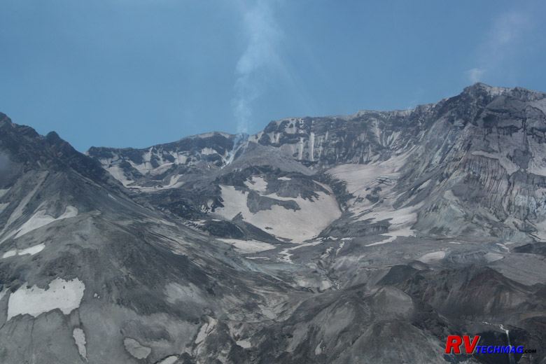
Lava Dome View From Johnson Ridge
After the blast first occurred, things settled down a bit and the volcano appeared to be resting. In the fall of 2004 the
volcano began making minor seismic rumblings and a steam vent appeared inside the crater. This constant venting allowed lava to slowly flow into
the crater, establishing a lava dome in the process. This is typical for Mount St. Helens as it now begins it cycle of mountain rebuilding. The
magma is poor in gas concentration so there is no danger from its slow steady flow. The explosive pressures won't return until after the mountain
rebuilds itself and corks itself up again. By that time I will no longer be around because this cycle repeats itself approximately every 100 years.
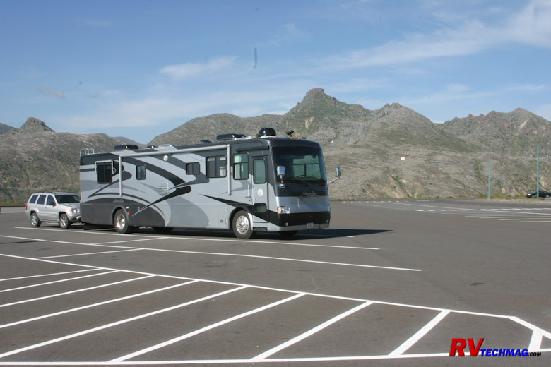
Johnson Ridge Visitor Center Parking
Generally, our itinerary puts us southbound on I-5. If we can reach I-5 exit 49 by mid morning we will take the motorhome and
toad combination and drive the above route. There's plenty of room to park the large RV at the various visitor centers and we generally eat lunch in
our RV after seeing the Silver Lake Visitor Center before heading east to see the other stops. That gives us enough time to see things and return
from Johnson Ridge in time to arrive at a campground in Woodland or Kelso in time to set up camp and have supper. We then take the toad to see the east
side the next few days. If your drive day is longer you may want to go to your RV park first and take the west side tour the next day in the toad.
The west side tour can easily be a day trip and does not require any extra days but it will take 1-1/2 hours just to get to Johnson Ridge from I-5
so the drive alone will take 3 hours out of your day with no stops. If you have enough time and plan on doing both sides of the mountain then be
sure to do the west side first. The east side is awesome but the sites are more spread out and remote so you won't be getting the interpretive
information on that side. If you do the west side first you'll have a much better understanding of what you are seeing on the east side when you do
travel there later.
The East Side
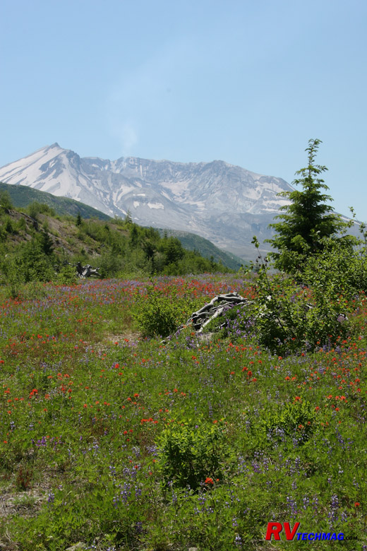
Mount St. Helens
To get to the east side you take I-5 exit #21 at Woodland, which is 28 miles south of the west side entrance. From here you
head east on Washington-503. It's a very scenic drive around this end of the mountain but it winds through the mountains and forests so it's best to
leave the motorhome behind and do this trip with the toad. After 21 miles you'll arrive in Yale. The Climber's Registry used to be at Jack's Store
until it burned down in December 2007 but now has been moved to the Lone Fir Resort, 6 miles to the east in Cougar.
Ape Cave isn't far from here. Ape Cave
is a lava tube formed by a previous eruption of Mount St. Helens. When the hot lava flowed through it left a shell of solidified lava behind. Ape
Cave is more of a tunnel than a cave and was discovered by boy scouts in 1950. This area is known for many Bigfoot sightings and if you talk to the
locals and read some of the local publications you may change your mind regarding Sasquatch. Tours of the cave are self-led and you can rent lanterns
at the USFS visitor center or bring your own lighting along. It's cool in the cave so bring a light jacket.
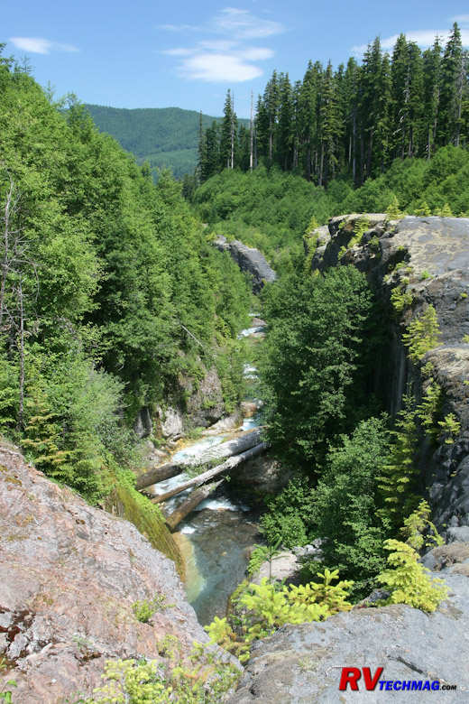
Lava Canyon
As you circumnavigate the south end of Mount St. Helens you'll pass by Lava Canyon. Lava Canyon was not discovered until after
the 1980 eruption. That eruption decimated any trees in the area, exposing Lava Canyon. Any trees now present have been new growth since the 1980
eruption. It's an interesting hike that you can take down one side of the canyon, then cross over on a
Suspension Bridge (click to see) and return down the other side.
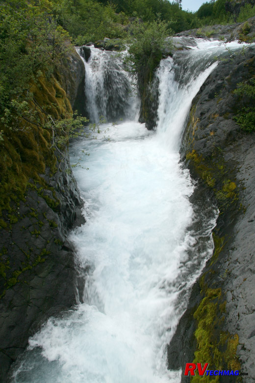
Lava Canyon Waterfalls
Much of the snow melt from Mount St. Helens runs to this area and falls into Lava Canyon, where it is carried downstream. The
waterfalls are beautiful and easy to see from the viewing platform but visitors are warned not to climb out on the rocks because they get very
slippery and others have fallen to their deaths by attempting this.
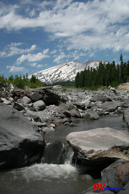
Ape Canyon
Ape Canyon used to be quite a bit deeper but the mudflows from the 1980 eruption filled in much of it. Much of the runoff
from the mountain's south face flows down this canyon. It was so named because of numerous Bigfoot sightings in this area. Prior to the 1980
eruption, when the canyon was still deep, a hunter shot one who fell into this canyon. That night as the hunters were gathered inside their cabin
a large racket began as a number of Bigfoots began throwing rocks and such at their cabin. Stories like these abound in the area. Whether or not
you believe them or not is immaterial. They are entertaining to say the least.
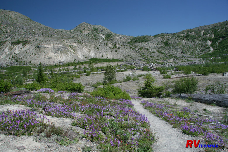
Harmony Basin Trail
After seeing Lava Canyon and Ape Canyon continue east on Forest Road 90 until Forest Road 25, which is about 52 miles from I-5,
and take it north. Note that these are excellent blacktop roads so don't let the term "Forest Road" scare you into thinking it's a rough dirt or gravel
road. When you get to the east end of the mountain, which is another 25 miles, turn left onto Forest Road 99. after another 14 miles you should be at
the Harmony Basin overlook. You can take the Harmony Basin trail down into the basin if you like.
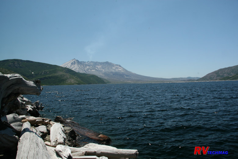
Spirit Lake
If you take the trail down into Harmony Basin you will wind up at the shores of Spirit Lake. When the mountain erupted a huge
landslide roared down Mount St. Helens towards Spirit Lake, burying Harry Truman and his resort home under hundreds of feet of mountain. The landslide
created a massive tidal wave that raced up the opposite shore of Spirit Lake at Harmony Basin, which at that time was heavily covered with forests.
The water, like a giant pendulum, then slammed back down towards the lake, stripped every tree from Harmony Basin and creating a floating log jam
that covered most of Spirit Lake. Eventually the trees filled with mineral in the water and settled to the bottom but a large number still remain
at the other end of the lake. Because the lake no longer had an outflow it was in danger of overfilling from snowmelt and flooding the Toutle River
valley and Castle Rock downstream so the Corps of Engineers built a tunnel and spillway to prevent this from happening.
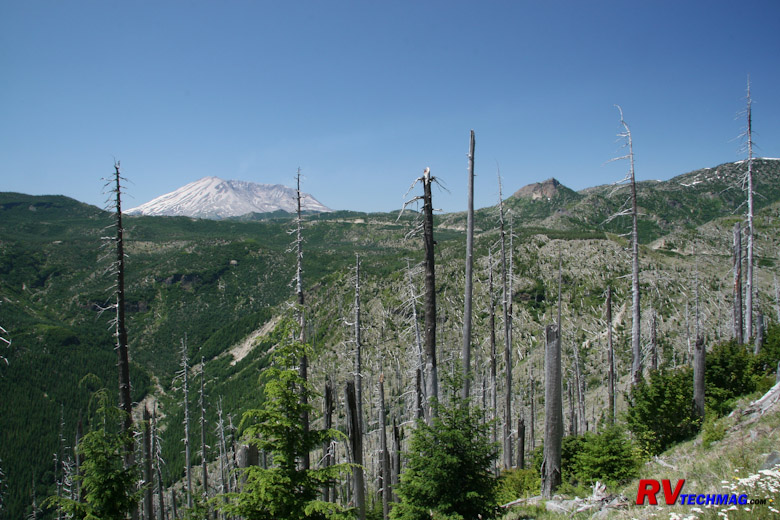
Windy Ridge
Just 3 more miles up the road will take you to Windy Ridge, a 94 mile drive from I-5 via Yale and Cougar. There is a visitors
center here as well as a snack shop, restrooms, and general store. There are many trails that wind through this lateral blast zone. Trees that were
partially protected by ridges may still have the bottom half remaining while others have totally disappeared. This can be a great place to explore
if you are an avid hiker.
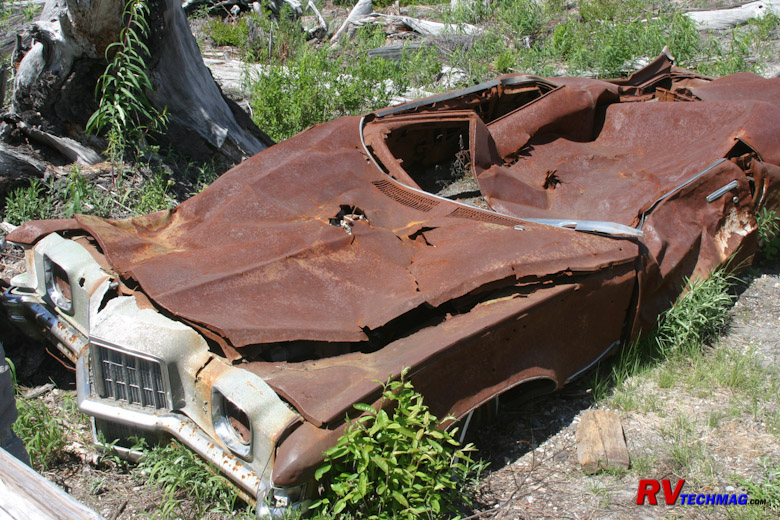
Flattened Car
On the road up to Windy Ridge you'll see this car that was flattened by the eruption. It belonged to a couple who were living
and mining in the area. The mine that they were in was all covered up by the blast and buried beneath a new hillside. Their car was ripped from the
hillside, tumbled down the ridge, and came to rest in this location.
Climbing The Mountain
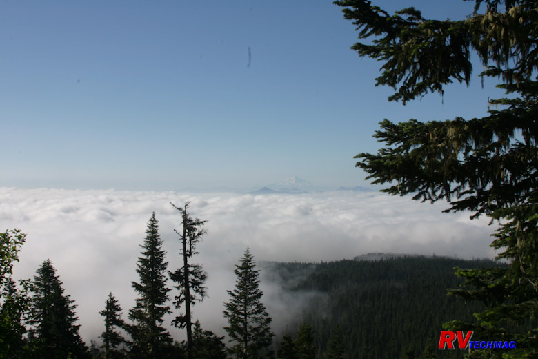
Mount Adams Poking Through The Clouds
If you want the ultimate view of Mount St. Helens, you need to climb it. I have to admit that this was one of the highlights of
my life. The mountain changes as you climb and peering down into the crater from the rim is just an amazing feeling. To learn more about climbing
the mountain be sure to check out the US Forest Service website. It will have much of the information that you need to know. The trek begins with a
pre-dawn drive from Woodland to the Climber's Bivouac, which is accessed via Forest Road 830 and is right off the road to Ape Cave on the south end
of the mountain, near Yale. You'll climb the south flank of the mountain and will begin with a steep 40 degree uphill trail through the wooded forest.
Pit toilets near the end of tree line are available. Hopefully it's not an overcast day, because as the tree line begins to break you'll be exposed
to views of Mount Hood to the south in Oregon and Mount Adams to the east as they poke through the cloud cover below you. Ideally you want to begin
this hike early in the morning, as soon as there is enough light to make your way through the wooded forest. This gives you plenty of time to take
this all day trip and helps keep the afternoon sun for the downhill portion of the trip.
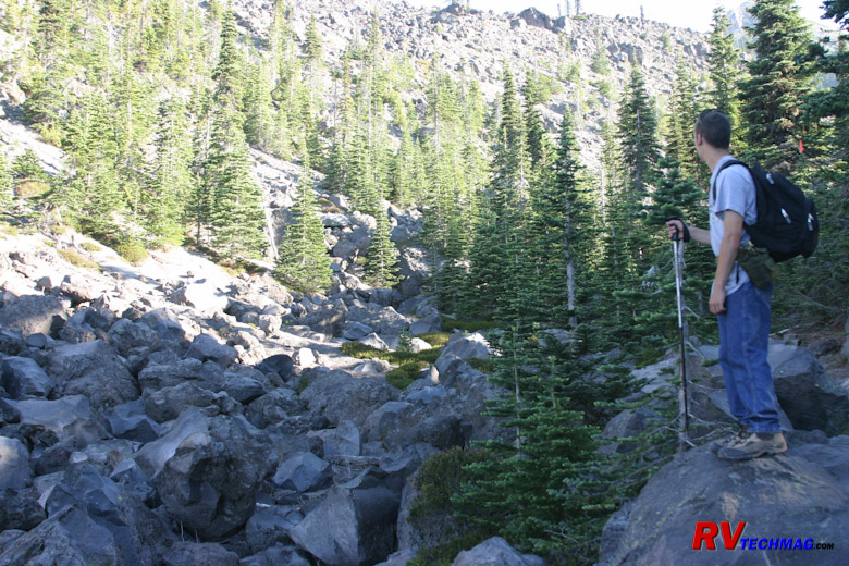
End of the Tree Line
When the tree line breaks you'll see a gulley that you have to cross. After this point you will need a climbing permit. The
wooded forest trail that brought you this far now gives way to a rocky trail where gloves can be just as useful as a hiking pole.
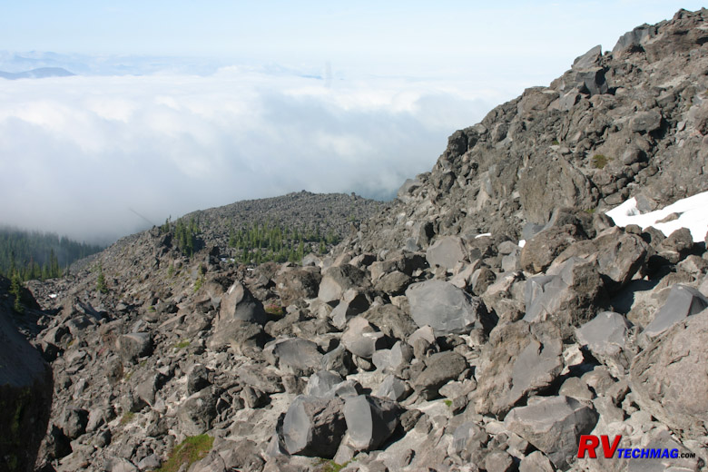
Hummocks
When the tree line ends the trail will be harder to find. The best route up follows Monitor Ridge which is covered with
Hummocks. At this point the hiking pole will get as much use as a pair of leather gloves to navigate over and around the various rocks.
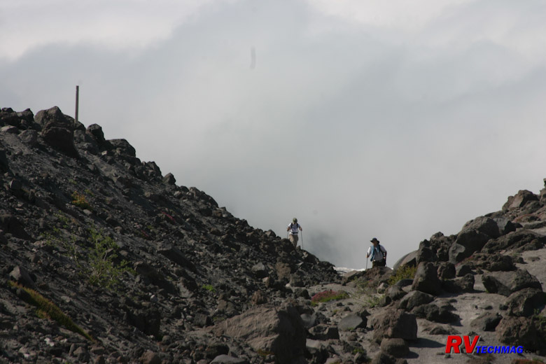
Trail Guide Posts
The terrain tends to look the same up there so there are wooden posts put into the ground every now and then to sort
of mark where the trail is. In actuality there are many trails that go all over the place but the posts will help to keep you from getting too
far off course. They won't always be visible but if you look fopr them whenever you reach the top of a ridge you'll be able to tell if you
are on course or not.
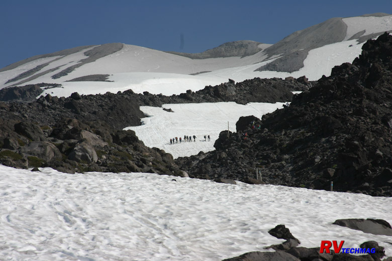
Glaciers and Snowfields
Surrounding Monitor Ridge are snowfields and glaciers. If you have crampons and poles you can save some time when
climbing by traveling across them rather than climbing through the hummocks. A slip and slide down the glaciers could be fatal if you hit
your head on the rocks below so helmets and ropes to tie in to other members of your party are good safety ideas.
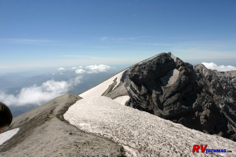
Crater Rim
Just prior to arriving at the rim you'll encounter the toughest part of the climb. While picking your way through
hummocks can be time consuming and laborious, the last 1,800' of the climb is the worst. At this point the hummocks give way to a slope of
pumice. This 40 degree slope is like walking on a tilted slab of ball bearings. You take three steps forward and slide back two. This was
the most physically draining portion of the climb and of course it happens at the highest altitudes where there is less oxygen to breathe.
However, once at the rim that is all forgotten. When you stand at the rim and look down into the crater, see the now tiny Johnson Ridge
Visitors Center 6 miles away you'll forget about all that. To the north you will see Mount Rainier. To the east is Mount Adams. To the
south in Oregon is Mount Hood. If the weather is not overcast at the coast you can see the Pacific Ocean and coastline - all at the same
time. This photo was taken on July 1st. The snow cornice is still fair sized this early in the summer. You don't want to step out on it
or it could give way and you would fall into the crater. If you climb later in July the cornice will be gone and it will be much easier
to get great views of the base of the crater without having to hunt for gaps in the snow cornice.
Heading downhill is much faster a climb that began at 6 AM got us to the rim at 2 PM and we would be able to return
to Woodland by 6 PM. Part of the speed gained when descending is found by taking the snowfields. Bringing crampons along will save you time
and energy on both the uphill and downhill legs. Some climbers try to glissade down the snowfields. The pumice laden snow can be very abrasive
on snow suits and tear them up unless you have something to use as a shield. You also need to wear helmets when glissading to protect your head
when you wipe out (and you will) should you hit a rock. Glissading is the fastest way down the mountain but remember that you also have to carry
that stuff up the mountain too.
Return to Home Page
If you enjoyed this article be sure to recommend RVtechMag.com to your friends, like us on Facebook or Twitter
or subscribe to our RSS feed.


|


