Yellowstone National Park
A Photo Journal of America's First and
Best National Park
Article Date: January, 2015
Article and Photography by Mark Quasius
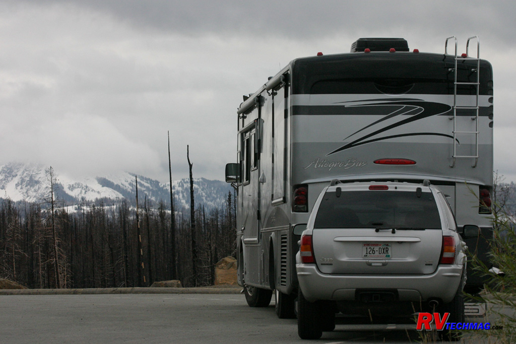
Mention the word "Yellowstone" to most people and the first thought that generally comes to mind is bears and Old Faithful.
While Old Faithful is the most popular tourist spot in the park, many visitors don't get to even see a bear on their first trip. But, Yellowstone is
so much more than that. Yellowstone is a unique place in nature that is not duplicated anywhere else in the world. The wonders of God's creation
come together in one spot and are impressively displayed for all to see. Nowhere on earth can you see such an impressive display of scenery and
wildlife. Yet, Yellowstone is a contrast of sorts. Originally formed by a huge super volcano blast in prehistoric times, it's caldera measures
30 miles x 45 miles across and houses more than two thirds of the world's geysers. Over 10,000 thermal features, such as hot springs, pools, and
geysers are fed by intense heat from the large underground magma pocket that is closest to the surface in Yellowstone than anywhere else in the
world. These thermal features are fed by the many streams and rivers within the park. Names such as Firehole River, Gibbon River, Madison River,
are teeming with cutthroat trout. The largest, the Yellowstone River, flows north out of the park after leaving Yellowstone Lake, which at 131.7
square miles is the largest lake in North America over 7,000' of altitude. As the river leaves Yellowstone Lake, it surges through the golden colored
cliffs of the Grand Canyon of the Yellowstone, where it crashes over numerous waterfalls as it makes it's way to the Missouri River. The tallest,
Lower Falls, is 308' and is taller than Niagara Falls. Much of the 2.2 million acre park is covered by Lodgepole Pine forests. Most of the areas devastated
by the fires of 1988 have now returned to a healthy state with new growth and life appearing where dead stands of mature trees once stood.
Wildlife thrive in this environment. Large bison herds can be seen throughout the park, particularly in Hayden Valley, where
they can number into the hundreds. The fall elk rut brings together bull elk as they gather their harems while Moose spend their time in the marshy
areas of the park. Bald eagles, Trumpeter Swans, and Osprey are seen plying the waters of the many rivers throughout the park while the grizzly and
wolf practice their hunting skills. The park's native Cutthroat Trout are popular pastimes for fly fishermen and can be seen jumping LeHardy Rapids
when it's time to travel upstream to spawn.
Its neighbor to the south, Grand Teton National Park,
seamlessly flows into Yellowstone. During the drive south the scenery gradually changes as the Snake River and Jackson Lake begin to unfold before a
backdrop of the spectacular Teton Mountain range. This alpine setting also serves host to a similar wildlife habitat.
Entering this wonderland requires crossing mountains to drop into this valley of splendor. There are 5 entrances into
Yellowstone National Park but the most awe inspiring drive is over the Beartooth
Mountains. The Beartooth Highway, referred to by Charles Kuralt as "the most scenic highway in America" takes you over 11,000' summits as the terrain
changes from heavy forest to sub-alpine terrain, and eventually alpine tundra before dropping down into Yellowstone national Park.
No pictures can truly convey the beauty of this area. You need to step inside in order to experience its sights and its smells.
Nothing can convey the sound of a bull elk's bugles echoing through the hills or the howls of wolves as they call out their wilderness song. You have
to be there to totally appreciate it. Hopefully these images may spark some desire to fully appreciate this and plan your own trip.
Founded in 1872, Yellowstone National Park is the nations first national park. At 2.2 million acres it encompasses a number of
areas, each unique and distinct in their own way. These areas are connected by a figure 8 shaped road system, originally built over 100 years ago by
the Army Corps of engineers and designed by Hiram Chittenden. There are specific areas that feature visitor services and ranger stations in key areas.
While there is much to see along the connecting areas, I've arranged this photo journal according to some of the main areas due to their unique
features and diversity. Simply select the desired link to go to that area or start at the beginning and begin your journey through the park.
Old Faithful
Mammoth Hot Springs
US-89 North of Gardiner
Mammoth is the park's headquarters and is located at the northwest corner of the park. It is easily accessed via the north
entrance from nearby Gardiner, Montana. Originally Yellowstone was administered by the US Army until 1918, when the National Park Service was formed
and took over the task of administering Yellowstone. The original army parade grounds, barracks, and offices remain and are now utilized by the park
service. The biggest feature that attracts visitors to Mammoth are it's thermal terraces. Thermal features come in many shapes and forms. The ever
popular geysers are mostly found in the Old Faithful, Norris, and West Thumb areas while bubbling mud pots and fumaroles are found in the Fountain
Paint Pots area. The Mammoth area doesn't have these but it's hot springs hang on the steep slopes towering over the village and have built up
travertine terraces that are unrivaled anywhere else. These terraces took many years to build themselves to this height but it's easy to see the
changes in them from year to year. The mineral laden boiling water rises to the surface, depositing the mineral in pools, building the terraces.
Eventually this water cascades down the sides and forms a castle like structure with many levels. Some will dry up while new ones appear in different
locations. Some previously dormant springs will return to life many years later as the subterranean plumbing constantly reroutes itself. In addition,
the Mammoth area is a very popular gathering spot in the fall for the northern range elk herd. The bugling of bull elk echoes throughout the
surrounding hills as they gather their harems. This is a popular gathering spot for tourists during the fall as they gather to view the show that the
elk put on. Leaving Mammoth, one can drive south through Golden Gate towards the Norris area or head east over the Blacktail Plateau to the
Tower-Roosevelt Area.

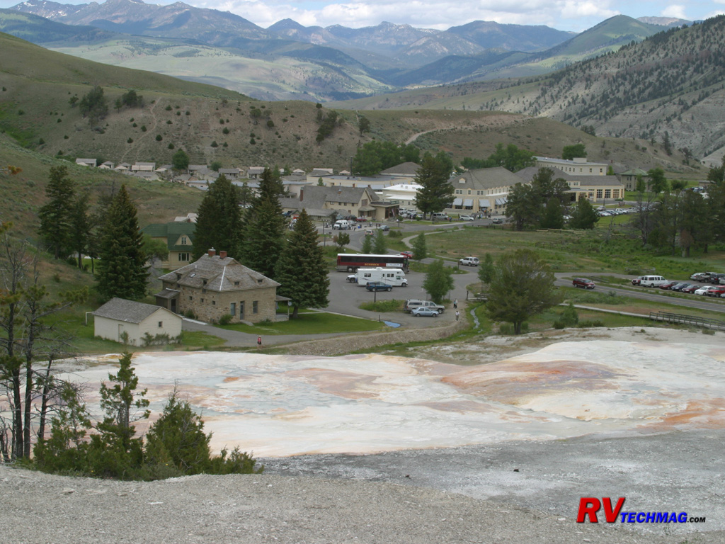
Mammoth Village
This view of Mammoth Village was taken from on top of Main Terrace. It shows the village area as surrounded by the mountains
around it. The historic Mammoth Hotel can be seem in the right-top corner with its cream colored columns. The many other building in the area are all
park service building that were built and formerly occupied by the US army, who managed the park prior to 1918, when the National Park Service
was formed.
Bighorn Sheep
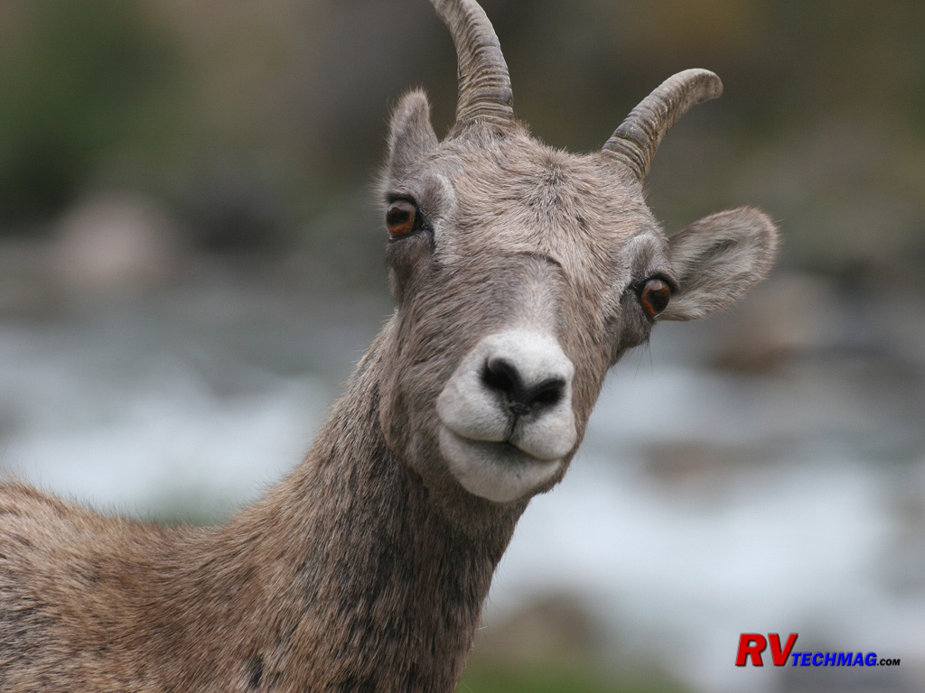
Bighorn Sheep frequent steep rocky slopes where they can easily evade predators. Their
hooves are specially designed for both
traction and durability in the sharp rocks and shale. Bighorn Sheep are frequently seen in Gardiner Canyon just north of Mammoth. They descend the
steep rocky slopes and cross the road on their way to the Yellowstone River to get water.
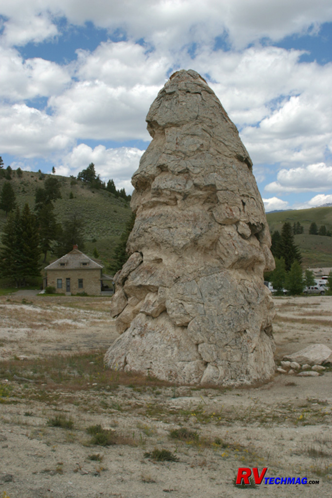
Liberty Cap
In Mammoth Village, near the base of the lower terraces is Liberty Cap. Liberty Cap is a dormant geyser cone. At one time the
cone spewed forth hot water, but as it did the cone grew larger, eventually clogging the orifice. It now stands as a tower of solid geyserite and
derives its name from a style of hat that was popular during the American Revolution.
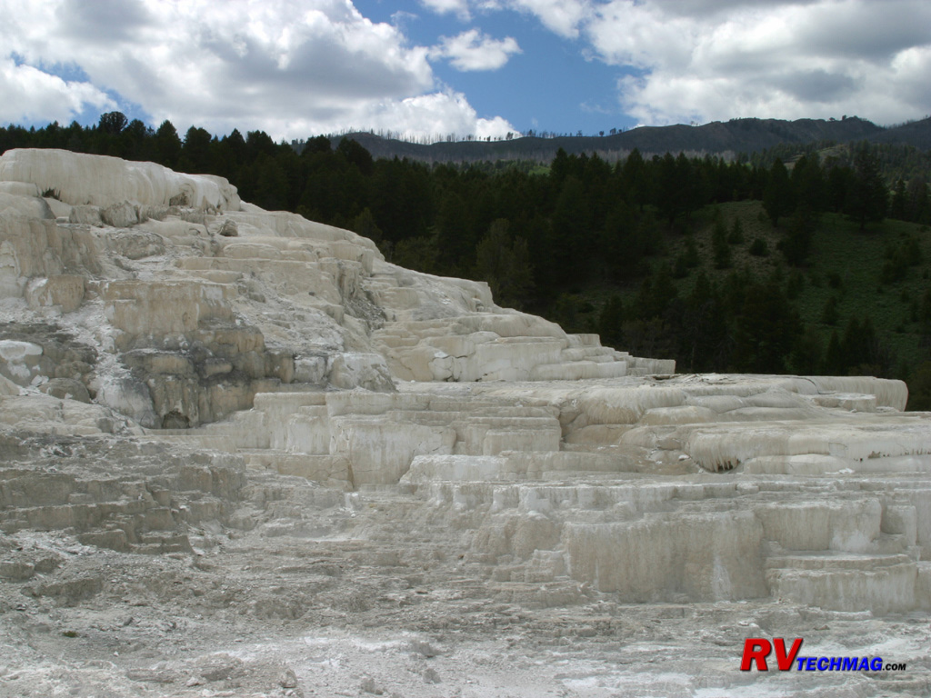
Minerva Terrace
The terraces are constantly in change. In 1991 Minerva Terrace was vibrantly flowing and its colorful mineral water was
cascading down each layer. In 2003 these terraces had all but dried up. Minerva Terrace is found at the base of the cliff where the larger Jupiter
and Main Terraces are found resting up top.
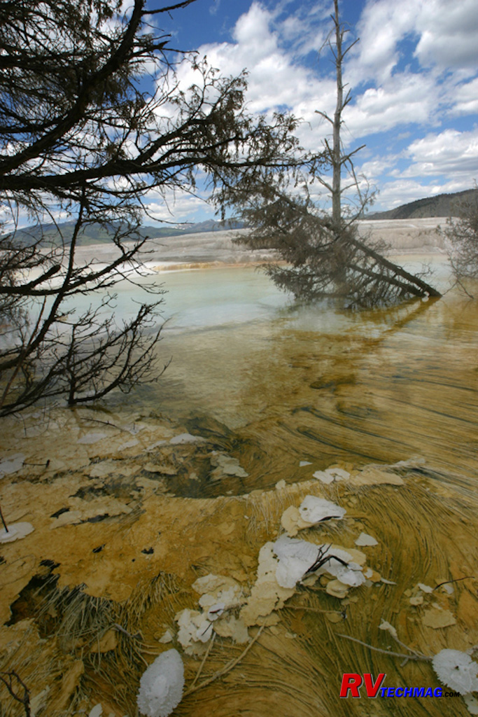
Main Terrace
Main Terrace was the feature event in the early 1900s. Since the 1960s it has pretty much dried up and the water diverted to
other areas. Recently the Main Terrace has begun a resurgence on its southern flank. The steaming pools in this section have overtaken the original
boardwalks and are now host to a variety of algae.
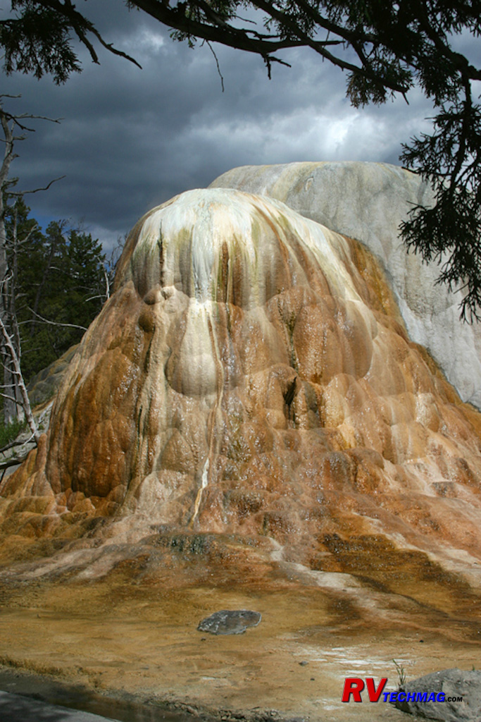
Mound Geyser
Hidden behind Main Terrace is Mound Geyser. While originally a geyser, with cyclic eruptions, it is now a steady flowing spring.
It steaming hot waters flowing steadily down its face reveal the heavy iron content as well as calcium in its waters.
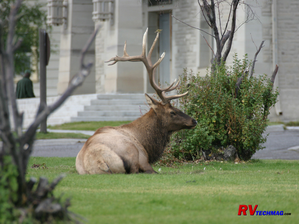
Resting Elk
During the fall rut bull elk expend a great deal of energy gathering their harems. In the Mammoth area many bulls can be seen
resting in the public areas. It's important to give these animals some breathing room because they can get irritated easily and have been known to
charge both people and vehicles with their sharp antlers.
Bull Elk
This bull stands resplendent in the September sun as he keeps watch over his harem. The mountains in the background are the
Madison Range, just west of the Mammoth area.
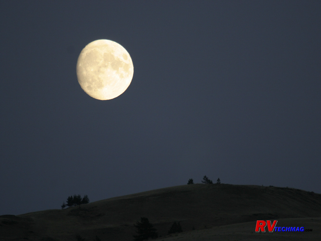
Moon Over Mammoth
This not quite full moon shines over the park in this mid September setting.
Norris
Directly south of Mammoth, about 21 miles on the loop road, lies Norris. Norris is a lesser known geyser basin than the Old
Faithful area but it is the hotbed of the park. This is the area of the park where the hot magma pocket is the closest to the surface. This heat is
responsible for a wide array of thermal features. This is the area of the park where the world's largest geyser, Steamboat Geyser, is found. Norris
has two geyser basins, the back basin is covered with many active geysers, hot springs, and fumaroles while the desolate Porcelain basin best resembles
a scene from a distant planet. This area is filled with the sounds and smells of thermal activity and is the most seismically active portion of the
park. Yellowstone is known for between 1,000 and 3,000 measurable earthquakes every year. While many of these can only be sensed with a seismograph,
there is a bit of rumbling in this area and the topography is in constant change. Every August this area features its "Annual Awakening" when the
underground plumbing has pretty much exhausted the influx of fresh snowmelt and things begin to rearrange themselves. Many new thermal features
appear and several dormant ones reawaken.
Approaching Norris from Mammoth requires a drive through the Golden Gate portion, an area where the road clings to yellow stone
cliff as it winds its way through the canyon. This road was rebuilt after landslides destroyed much of it during the 1959 Hebgen Lake earthquake.
Continuing on south you'll pass through forests with major meadows, such as Gibbon Meadows and Elk Park where numerous bison and elk herds can be seen.
Moose can be found in the marshy areas north of Roaring Mountain and Obsidian Cliff as well as grizzly bear in Spring and early summer. Leaving Norris
you'll pass through the beautiful Gibbon River valley and see Gibbon Falls on your way to Madison.
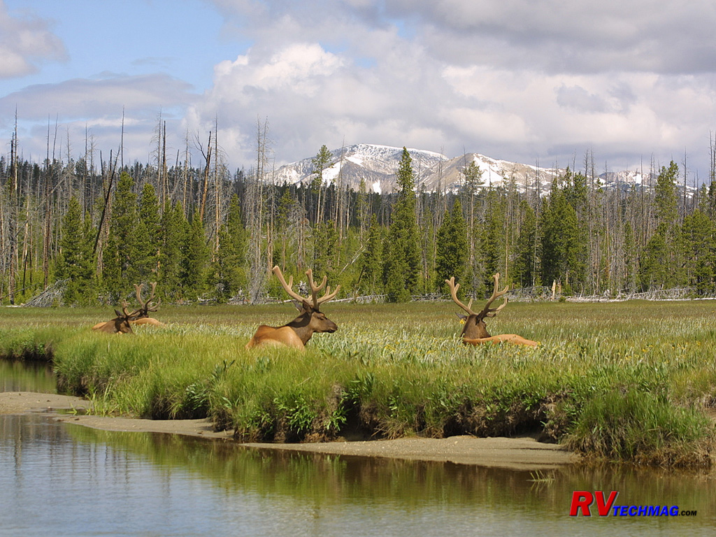
Elk Park
On the road between Mammoth and Norris are two large meadows, Gibbon Meadows and Elk Park. These meadows are frequented by Elk,
Bison, and Sandhill Cranes. This June image shows the bulls as they gather in bachelor groups. At this time of the year their antlers are covered in
velvet, which is shed in the fall. Mount Washburn lies in the distance.
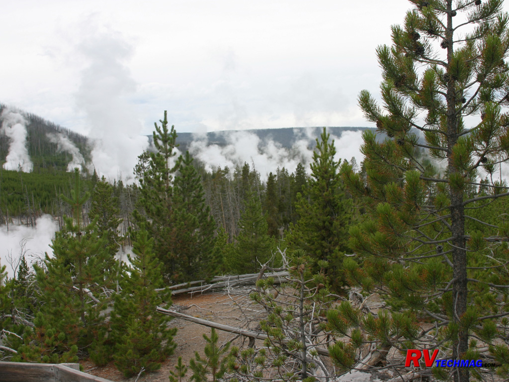
Norris Geyser Basin
Norris is a land of heavy thermal activity. This scene shows the many steam plumes rising from the various thermal features in
this area.
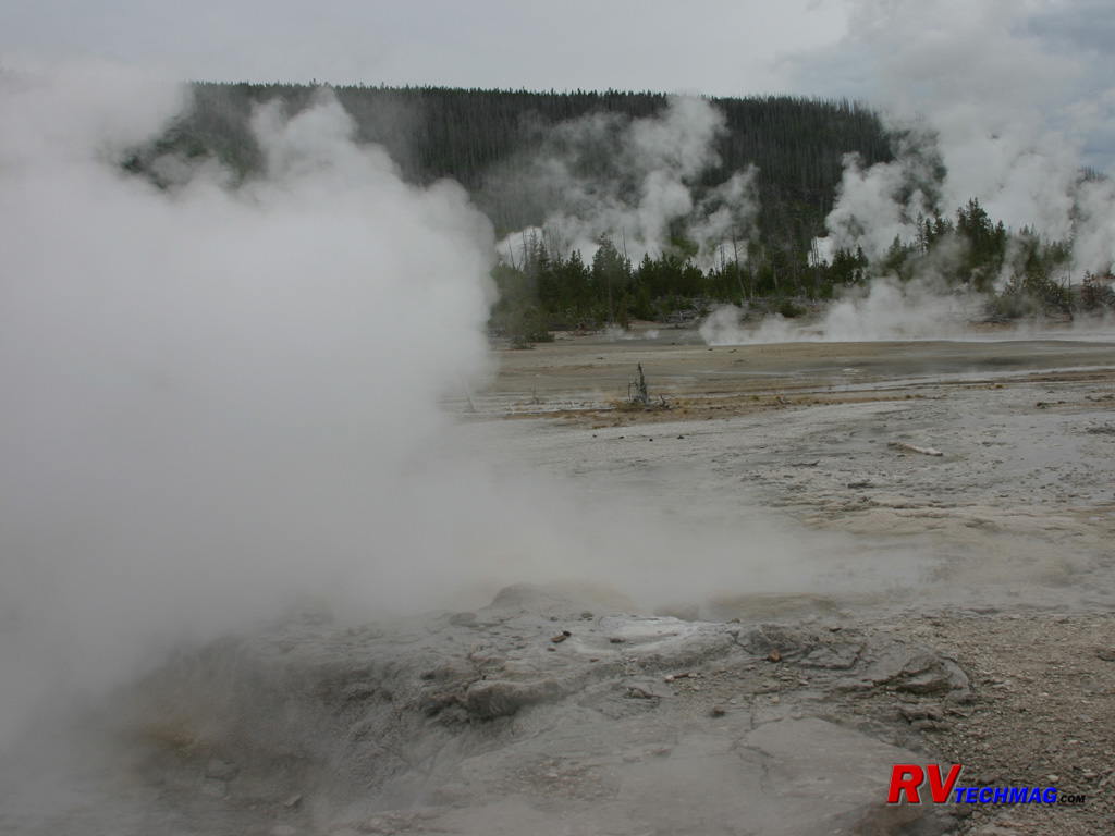
Back Basin
The Back Basin at Norris is the hottest spot in the park. Constant steam and boiling water flows create an extremely hot runoff
that blankets the area. To prevent breaking through the thin earthy crust that covers many pockets of scalding water, all visitors are required to stay
on the boardwalks that are provided for their safety.
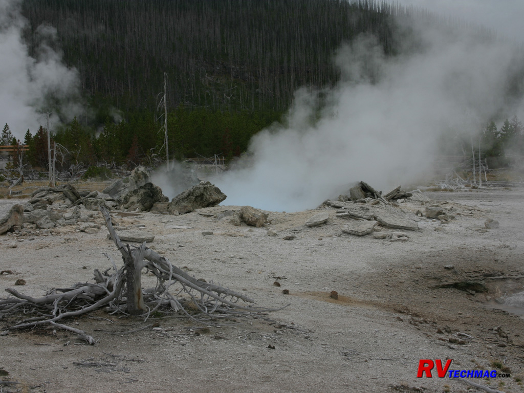
Pork Chop Geyser
Pork Chop Geyser, named for its distinct shape, was an active geyser that used to bubble constantly until 1989 when the geyser's
cone plugged and it blew up, scattering slabs of geyserite over the area. It was then dormant until the fall awakening of 2003 when the entire basin
underwent massive changes, requiring walking paths to be rerouted to prevent visitors from being hit by boiling mud in areas. Since then it has
continued its normal activity, at least for the time being.
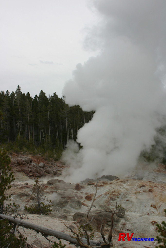
Steamboat Geyser
Steamboat Geyser is the world's largest geyser and is also the most unpredictable. It is the perfect symbol of the
unpredictability of the ever changing Norris area. After resting dormant for over 80 years, Steamboat finally erupted in May of 2000. After a brief
3 year rest it erupted again in March, April, and October 2003, and also May 2005. Steamboat begins with an earth shaking rumble and shoots water
over 350' into the air, showering anything in the immediate area with hot mineral water. After an approximate 45 minute shower, Steamboat settles
into a 3-4 hour steam phase that gives it its name as it roars away like an old sternwheeler.
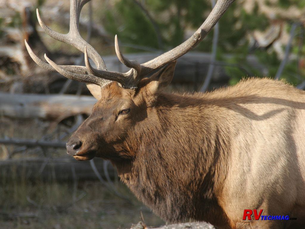
Bull Elk
In the fall, Bull Elk shed the velvet covering from their antlers as they prepare to do battle during the fall rut mating season.
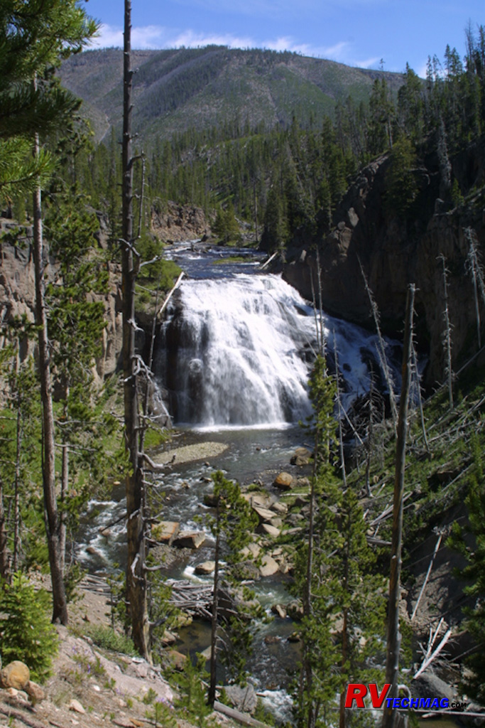
Gibbon Falls
Gibbon Falls is located on the Madison to Norris road. Its location showcases the Gibbon River as it crashes over the falls to
the valley below.

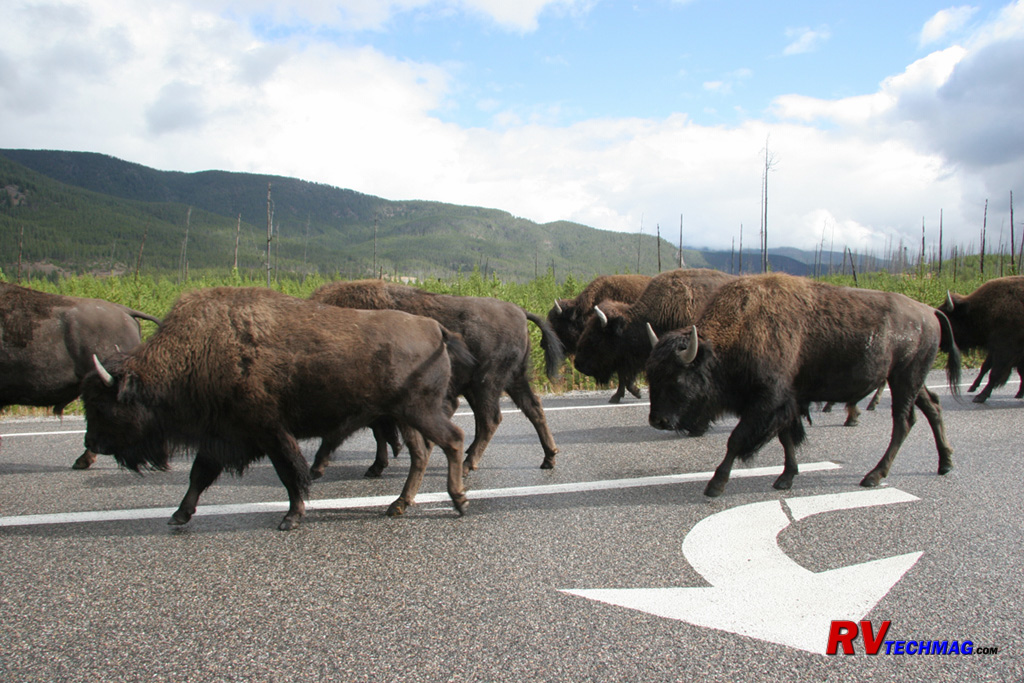
Bison Jam
Yellowstone's traffic is different than any other place. You have to be ready to sit for a while whenever bison herds take to
the road. Approximately 2,000 Bison in the park use the roads to move between grazing areas. If you are in tight surroundings you'll just have to
wait because they aren't in a hurry and you're not well equipped to argue with them.
Madison River Area
Visitors entering Yellowstone from West Yellowstone enter the park via the west entrance. The 14 mile drive to Madison follows
the Madison River as it flows out of the park to the west, eventually emptying into the Missouri River at Three Forks, Montana. This drive runs through
a valley, flanked on either side by mountains. The Madison River meanders through a series of Meadows which are inhabited by Bison and Elk. The river
and its bank support Great Blue Herons, Sandhill Cranes, and the endangered Trumpeter Swans. River Otters may be seen playfully swimming in the river
and many vehicle pullouts allow plenty of room for visitors to park and marvel at the wildlife abundant to this area. The Madison area is where the
Hayden expedition of 1894 camped and the idea was proposed to preserve this land from development. It's also the area where the Gibbon and Firehole
Rivers give up their waters and join the Madison River.
Madison is somewhat of a central hub for transportation. Its location allows you to branch out to explore other areas of the
park. From Madison intersection you have choice of heading north to Mammoth, Norris, or Canyon or south to Old Faithful, Lake, or the south entrance.
You may also meet up with a Bison jam when in the area because Bison frequently move through this area to access other graving areas and tend to
clog the road as it narrows leaving Madison. This is also the area where the Nez Perce passed through when Chief Joseph lead his tribe away from
the pursuing cavalry that wanted to relocate them to a reservation.
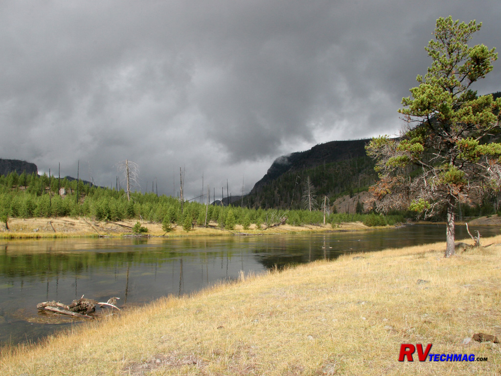
Madison River
Shortly after entering the park, the road from the west entrance, the river meanders through an area of regrowth that was
devastated by the fires of 1988. There are storm clouds brewing in the distance and Yellowstone may be in for a brief September snow storm. Such
storms pop up quickly and disappear just as fast, taking with them all evidence of their visit.
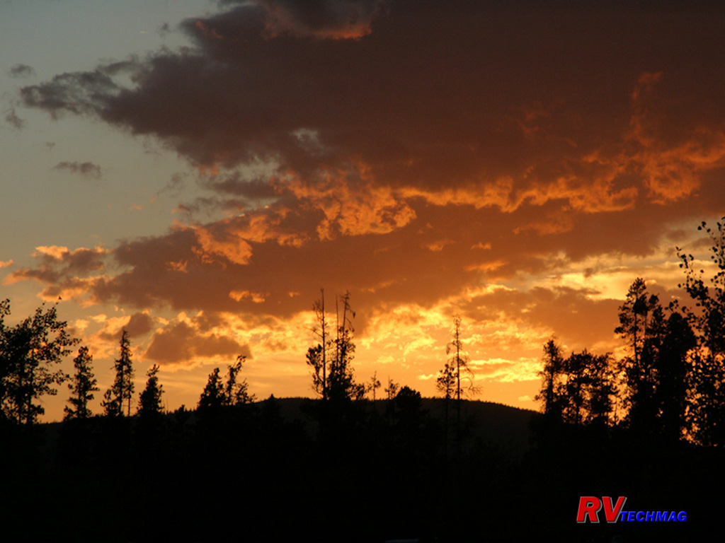
Sunset Over West Entrance
The evening skies can turn bright hues of red and amber as the sun sets to the west of Yellowstone. Evening drives
leaving the park and heading to West Yellowstone can reward one with
spectacular sunsets.
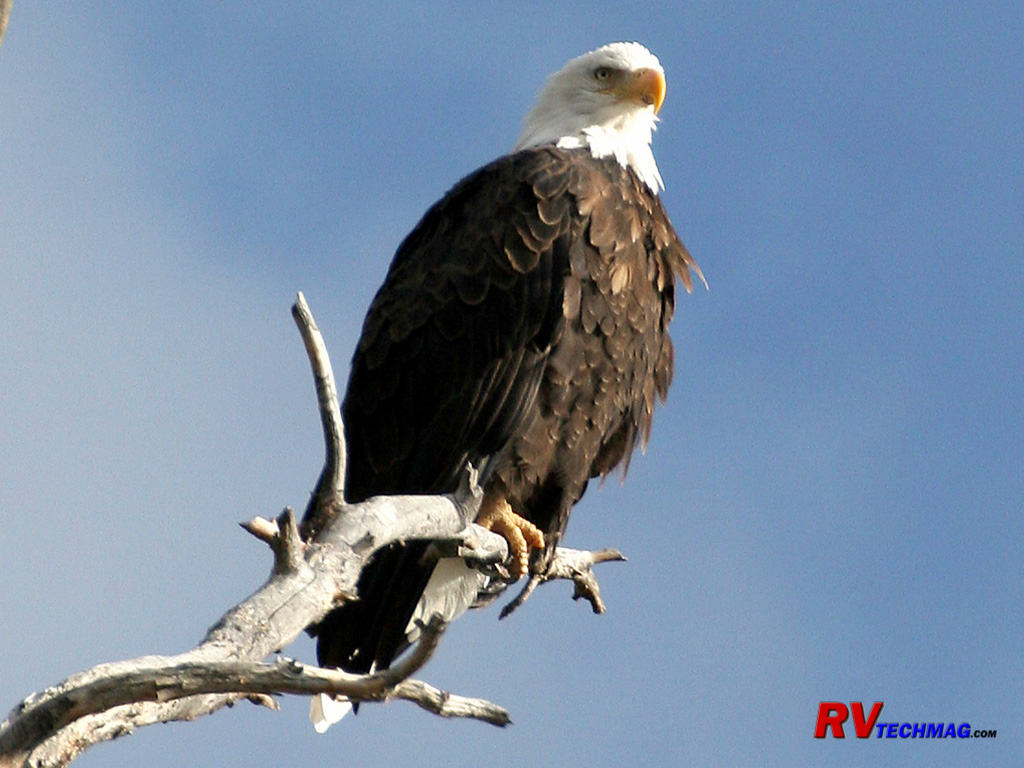
Bald Eagle
Bald eagles stand watch over the Madison River high up on the ridge in snags left standing after the 1988 fires waiting for
the right moment to swoop down and catch a cutthroat trout for a meal.
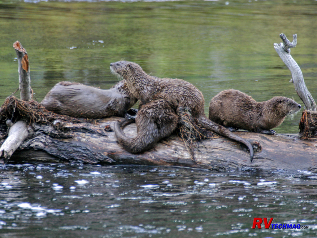
River Otters
River Otters make their homes in the muddy banks of the Madison River. While rarely available for photographs, they can
occasionally be seen gracefully frolicking in the water wherever logs or brush are found.
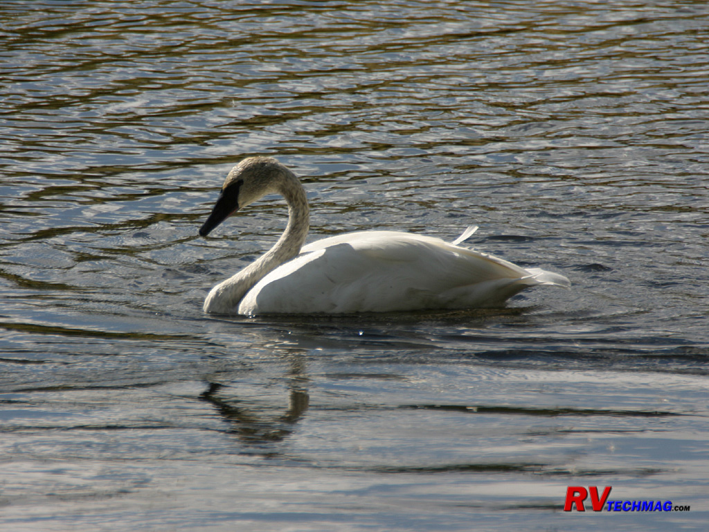
Trumpeter Swan
Trumpeter Swans are a reclusive bird and normally shy away from humans. There is a mating pair of Trumpeters who live on
the Madison River and can be seen floating gracefully on the water. When they do fly their loud honking noise easily identifies these large birds,
who are on the endangered list.
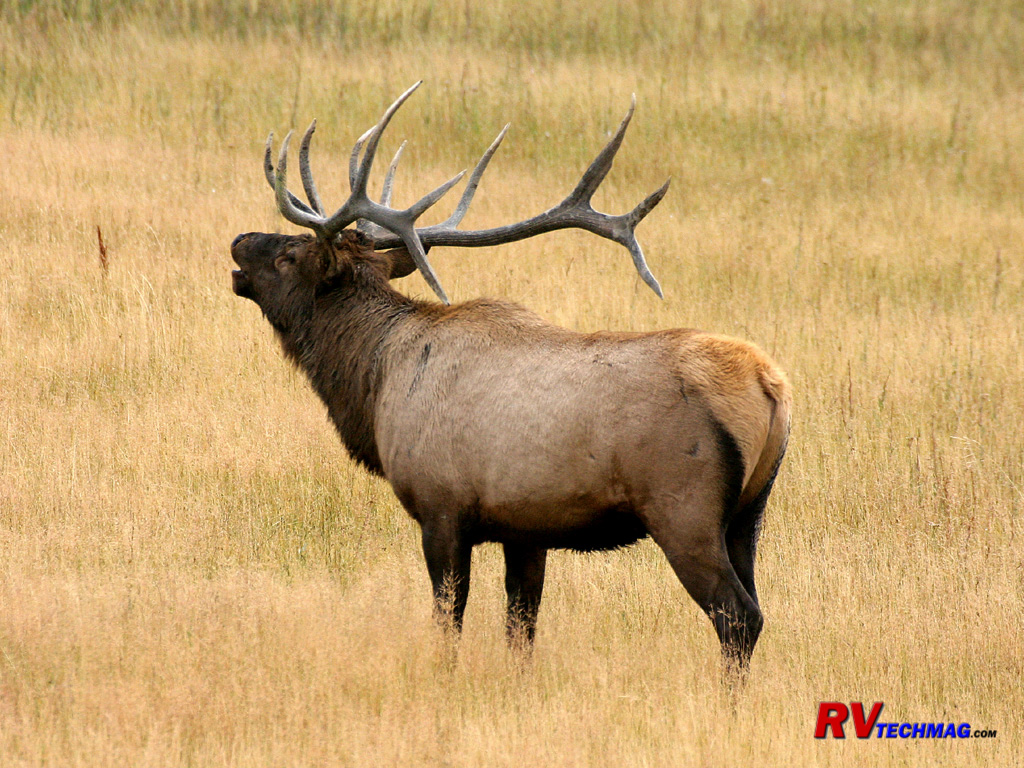
Bull Elk
In the fall the elk rut is in full swing and the bulls are seen bugling to draw their harem together. The Madison River
Valley is a popular place to find bull elk during the rut because it's popular place year round and provides water and good grazing. It's also an
awesome place to hear the bull elk's bugles as they resound and echo through the valley.
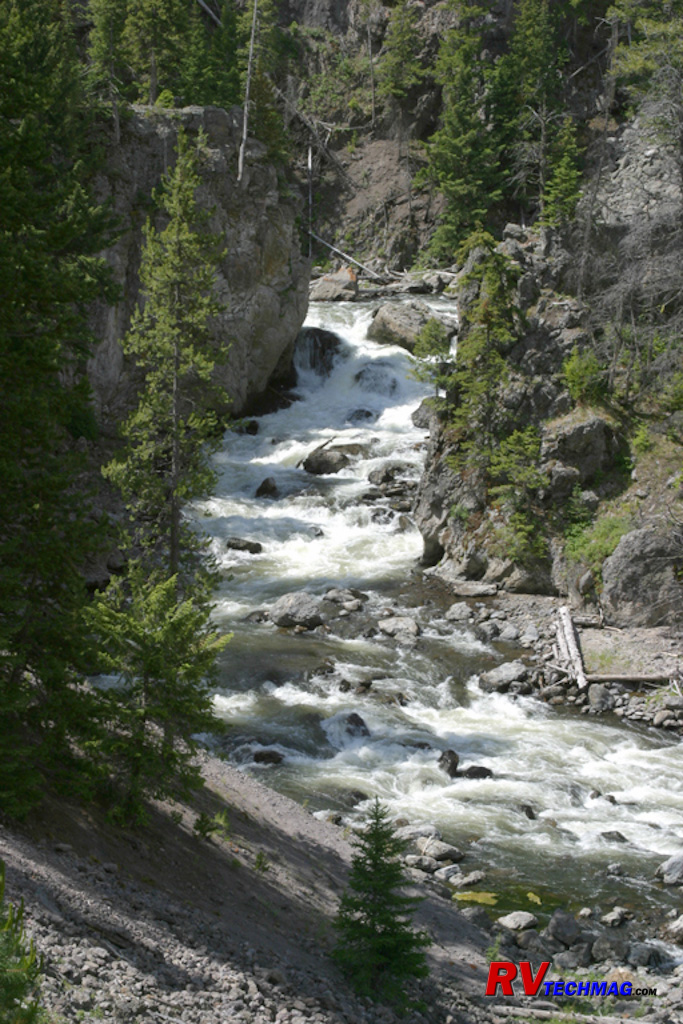
Firehole Canyon
Immediately south of Madison junction is the Firehole Canyon Drive. This one way road winds through Firehole Canyon and
overlooks the Firehole River as it cascades through the canyon.
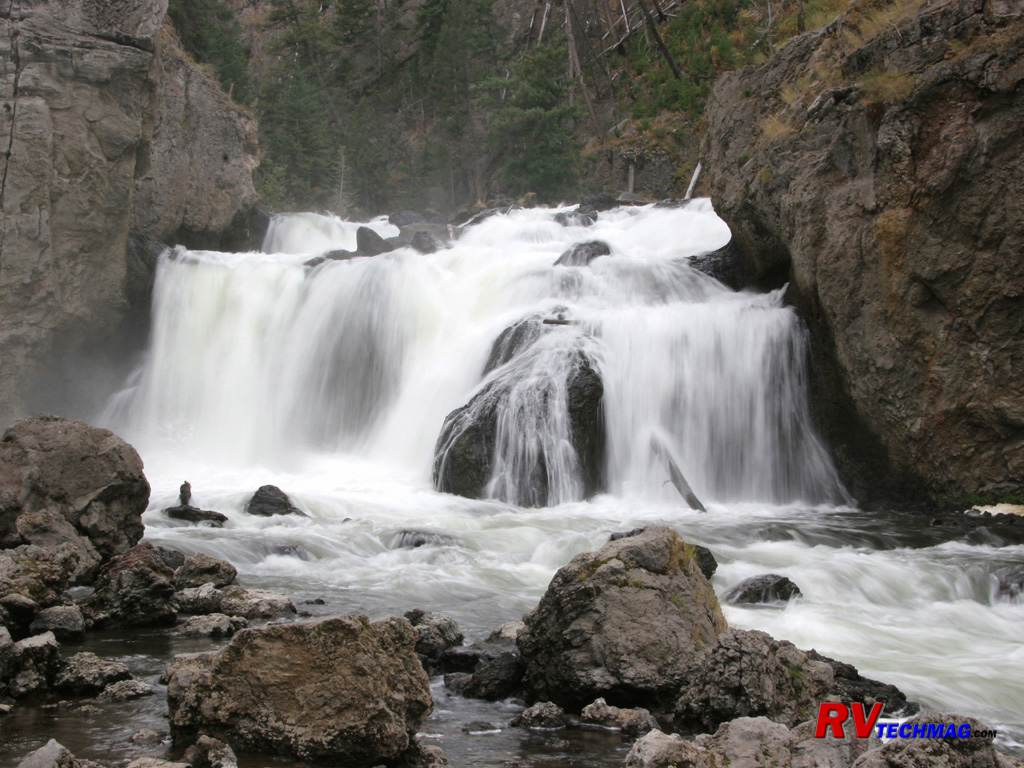
Firehole Falls
Deep inside the Firehole Canyon is Firehole Falls. Upstream is a wide, calm pool where summer tourists are known to take an
occasional dip while downstream is a rock strewn narrow canyon filled with rushing water.
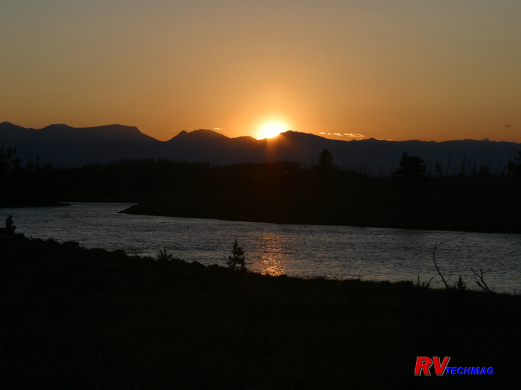
Sunset Over the Madison River
The river calmly makes its way out of the park as the sun sets over the Gallatin Mountains.
Old Faithful Area
The Old Faithful area is the most popular spot with visitors. Everyone wants to see the famous geyser blow and its
predictability makes it a sure bet. But Old Faithful geyser is not the only thing of interest in this area. The entire area is known as the Upper
Basin. Within this huge basin are a number of other thermal features. Indeed, while Old Faithful is the most regular geyser, it is not the tallest.
Many other geysers are just as spectacular and a few are even larger. The many thermal pools and hot springs drain their way across this barren
landscape and drain into the Firehole River, which then heads north to its junction with the Madison River. In the midst of this area sits the
grandest hotel of all, the Old Faithful Inn. Built in 1904 this hotel set the stage for a new style called "parkitecture" and many future resorts
were patterned along the original design ideas of Robert Reimer. The Old Faithful complex also contains a number of
concessionaire facilities and the
Snow Lodge remains open in winter. Although the roads are closed to vehicular travel, Old Faithful can be reached by snowmobile or snow coach and
is the premier destination for winter travelers. In the fall elk herds congregate to graze in this area and bison are full time residents here.
During winter the warm thermal features help provide access to the grass for the Bison, who use their massive neck muscles to plow snow away to
expose this precious food supply.
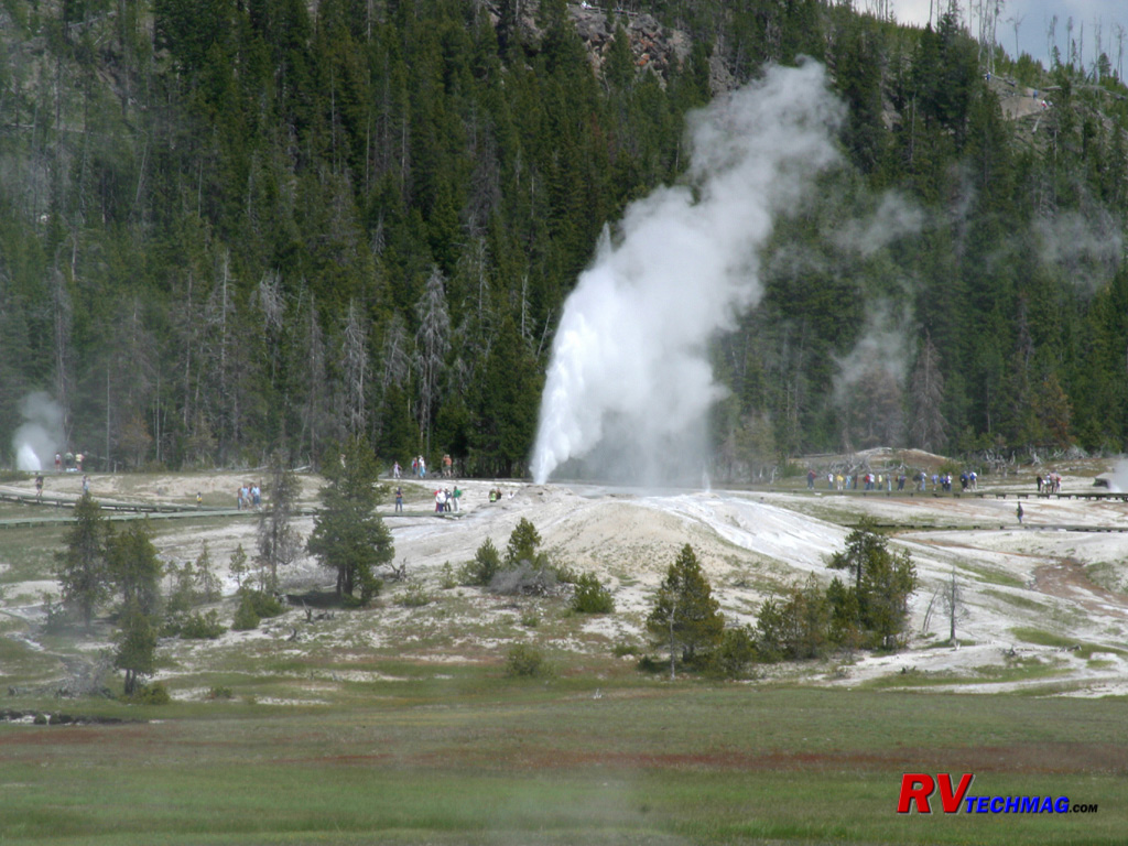
Upper Geyser Basin
The area behind Old Faithful is filled with boardwalks that connect the various geysers and thermal features. The earth is
dangerously thin in these areas and underground rivers and pools of boiling water lie just underneath. These boardwalks allow visitors to safely
explore these areas.
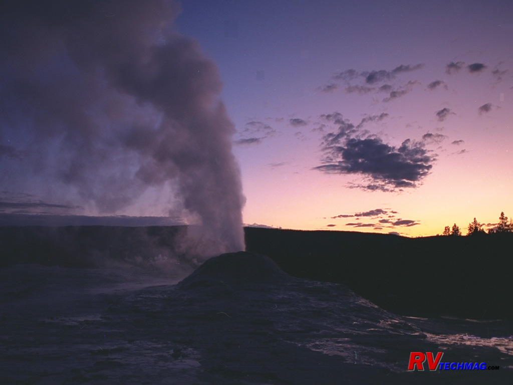
Lion Geyser at Night
Lion Geyser is actually a group of Geysers on a common mound. Big Lion, Lioness, Cub, and Baby Lion are all interconnected.
Late on a summer evening the sun hasn't quite gone down over the Yellowstone caldera. A combination of longitude, latitude, and altitude give it
just the right combination for late evening explorations of this area.
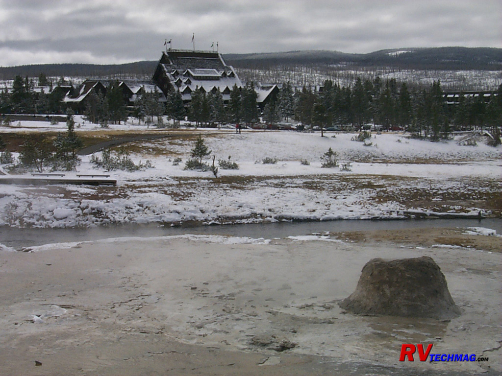
Beehive Geyser in Winter
Beehive Geyser has a mound of geyserite that has built up over the years. Its name comes from the roaring sound that it makes
when it erupts, which sounds like a flurry of angry bees buzzing around their hive. This particular image was captured in mid September when a freak
snowstorm fell upon the park. The roads were ice and the park was actually closed for a full day for safety reasons. Old Faithful Inn is in the
background.
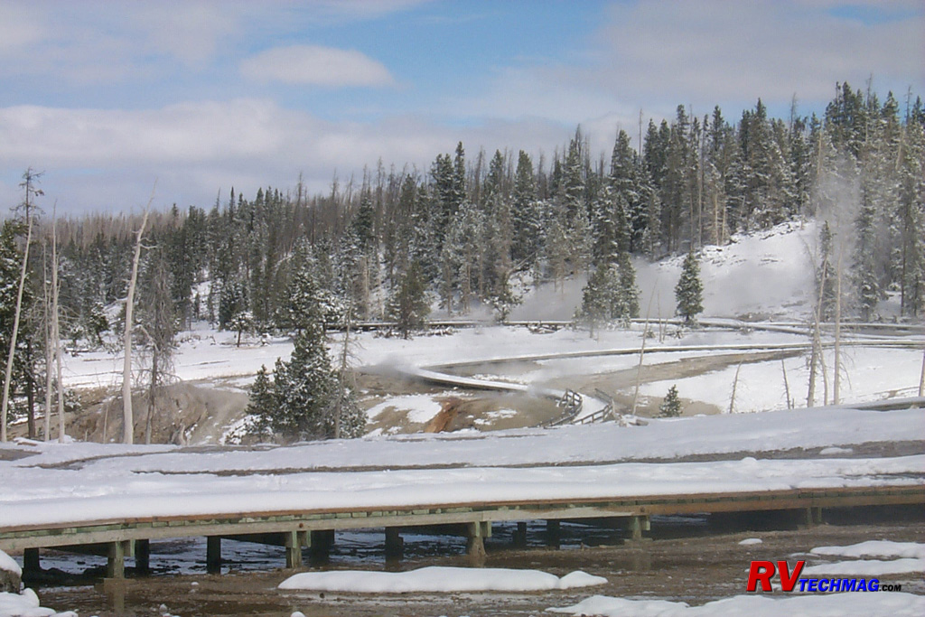
Boardwalks in Winter
These boardwalks are shown during that September storm and give an idea of the majestic beauty of Yellowstone in winter.
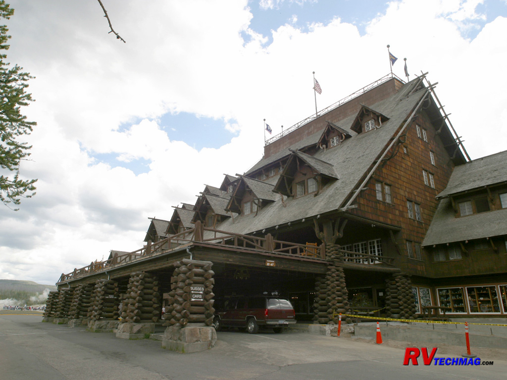
Old Faithful Inn
Built in 1904, the Old Faithful Inn is a classic example of the style of architecture that was applied to the various national
park lodges. It was constructed entirely from materials found nearby and its Lodgepole Pine logs blend with its surroundings. As part of its 100th
anniversary, the Inn began a restoration to restore some areas that were showing their age to their former glory. Its porch overlooks the Old Faithful
Geyser and the Inn is a prominent feature in the Lower Geyser Basin.

Old Faithful Inn Fireplace
Visitors to the Old Faithful Inn are awestruck as they enter the lobby. Standing in the midst of this five story lobby is the
huge stone fireplace surrounded by balconies of hand picked Lodgepole Pine railings from the surrounding area. There are separate fireplaces on each
side of the massive stone structure but three of them were deemed unsafe after the 1959 Hebgen Lake earthquake shifted some stones, blocking the
flues. As part of the Inn's 100th anniversary renovation, these fireplaces are being restored. Originally surrounded by a sunken pit the seating area
is now at floor level but the pit is being restored as part of the current renovation.
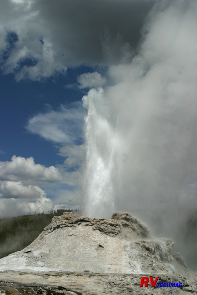
Castle Geyser
Castle Geyser is one of the most popular geysers in the Lower Basin. An easy walk from the Old Faithful Inn, its prominent
cone is castle shaped and gives it its name. Generally erupting three times each day, it sends large plumes of boiling water into the air for several
minutes, followed by long periods of steam.

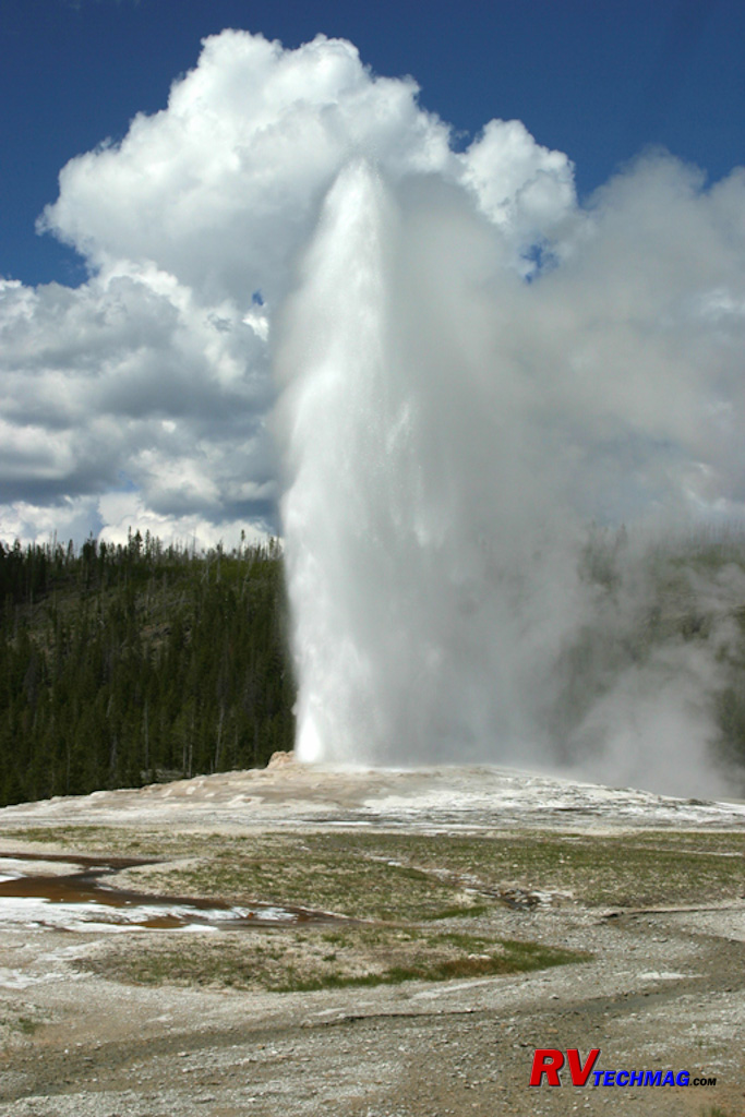
Old Faithful
The number one attraction in the park, Old Faithful Geyser spouts quite regularly. The park service monitors the height and
duration of each eruption and posts a fairly accurate prediction as to the next eruption time. It reaches heights of between 110' to 180' and eruptions
occur on the average every 60-75 minutes.
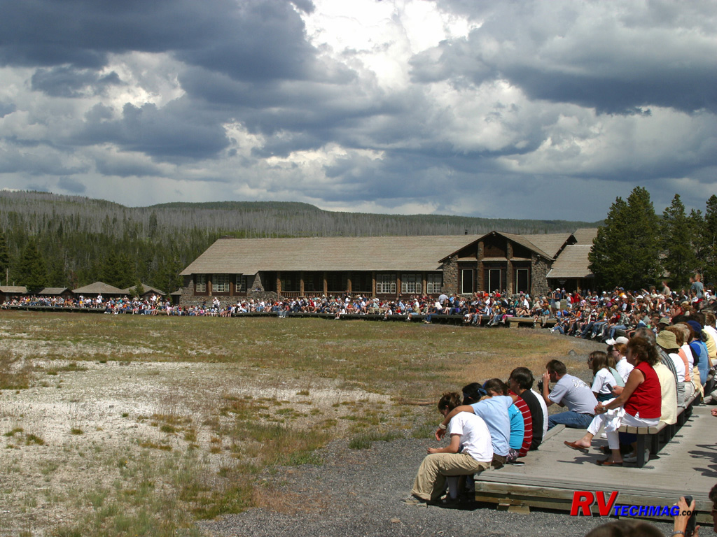
Waiting for the Show
Whenever it gets close to the posted time of Old Faithful's predicted eruption the boardwalk and bleachers fill with expectant
tourists. Summer is a particularly busy time at this popular geyser and its eruption is generally accompanied by a host of oohs and aahs.
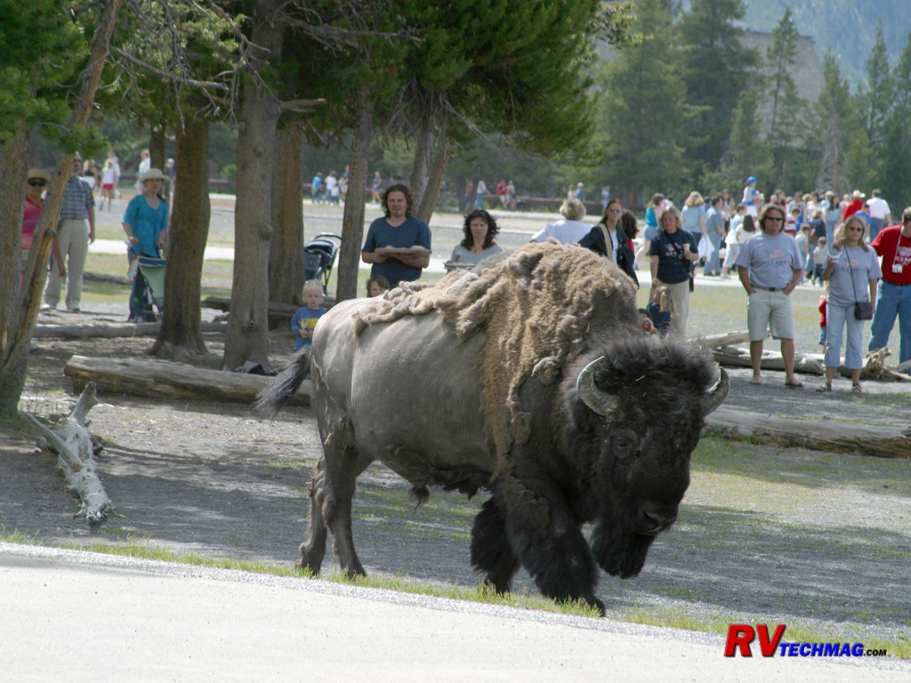
One of the Locals
There are a handful of bison that are regular residents of the Old Faithful area. They typically can be seen walking around on
the pathways and roadways and lounging in parking lots. Always a big hit with tourists, they should never be taken for granted. While these "locals"
are fairly accustomed to tourists, they can get agitated if approached too closely so
always give them a wide berth.
Canyon
Everyone knows about the Grand Canyon in Arizona. But Yellowstone has its own canyon, the Grand Canyon of the Yellowstone. The
Yellowstone River begins at Yellowstone Lake where it flows northward on its northward journey out of the park. It begins flowing through flat bottomed
valleys, but after traveling around 10 miles it takes a 109' plunge over Yellowstone's Upper Falls. From there it takes a short trip to the Lower Falls,
where it plunges another 308' into the bottom of the Grand Canyon of the Yellowstone. Passing through the golden yellow cliffs of the canyon it continues
on its northern trek towards the Mammoth area and eventually empties into the Missouri River far north of the park.
The Canyon area is a popular destination. Canyon Village features food service, lodging, and campgrounds. It's the most heavily
traveled intersection on the east side of the park because you can head south through Hayden Valley on your way to Fishing Bridge and Lake. The road
west takes you up "over the hump" of the park to the west side and you can also drive north, climbing Mount Washburn and traversing Dunraven Pass on
your way to Tower Junction. Canyon is also the beginning of the North Rim Drive, which gives access to the many overlooks of Yellowstone's Grand Canyon
as well as Brink of the Falls trail, which takes you right to the edge of the 308' Lower Falls.
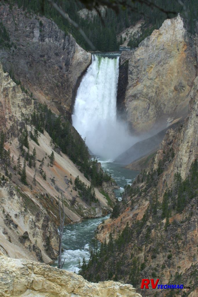
Grand Canyon of the Yellowstone
The Grand Canyon of the Yellowstone is roughly 20 miles long and begins at the Upper Falls and extends to the Tower Falls area.
It ranges between 800 and 1,200' in depth and was formed by the natural cutting action of the Yellowstone River over the ages. This particular view is
of the Lower Falls as it plummets 308' to the canyon floor. While there are a number of overlooks and vantage points that view the canyon, this
particular image was taken from the Inspiration Point overlook. It is noteworthy that the 308' Lower Falls is taller than the 109' Upper Falls. The
Upper Falls is located just upstream of the Lower Falls and is the first drop that the Yellowstone River takes as it leaves Yellowstone Lake, therefore
their names are derived from their geographical locations, not their overall heights.
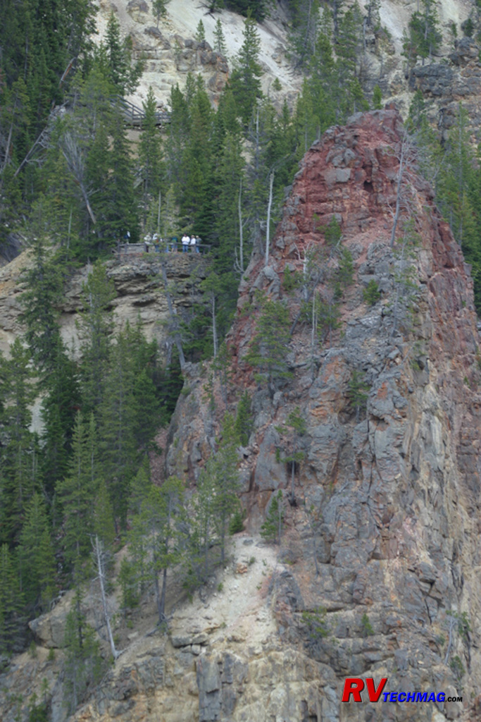
Red Rock Point
A side trail from the Lookout Point overlook takes you to Red Rock Point. This overlook gives you another viewpoint that is
further into the canyon than Lookout Point, which is found on the rim. It is named after the Red Rock formation immediately next to the overlook.
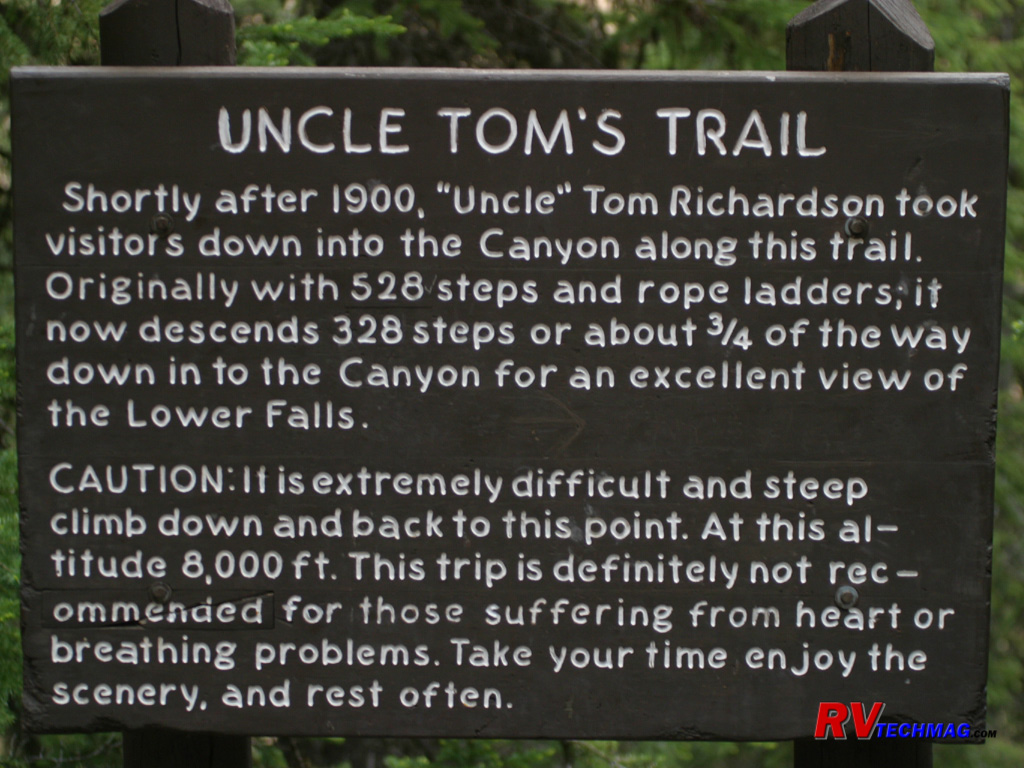
Uncle Tom's Trail
Uncle Tom's Trail is accessible from the Upper Falls Viewpoint, which is located on the South Rim Drive. Originally
constructed in 1898, "Uncle" Tom Richardson took tourists down the trail into the canyon for a "looking up" view of the Lower Falls. He originally
crossed the canyon upstream of the present day Chittenden Bridge and included a picnic lunch for his clients before returning the same way.
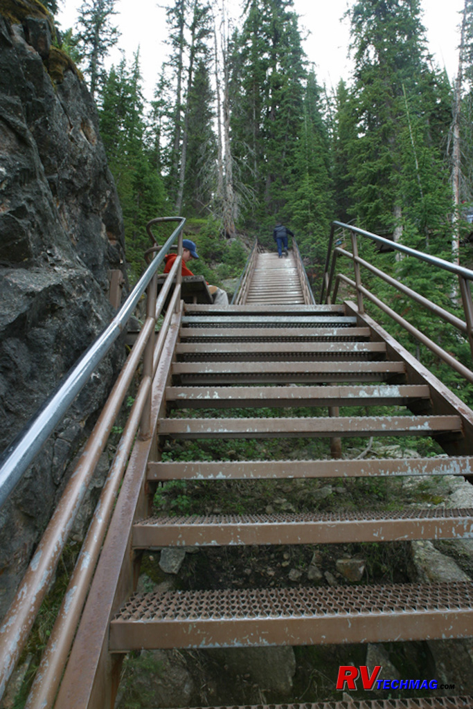
Uncle Tom's Trail
Uncle Tom's original trail has changed over the years. The rope ladders are now replaced by steel steps and the unstable soil
in the canyon walls required a shortening of its depth so that it no longer goes all the way to the bottom but the trek is still a handful for anyone
afraid of heights.
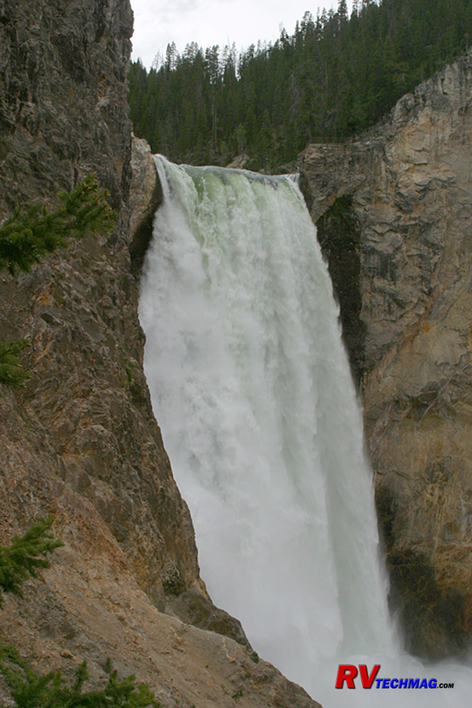
Lower Falls
The view of the Lower Falls was taken from the base of Uncle Tom's Trail. While it no longer runs to the absolute bottom of the
canyon, this vantage point still offers an impressive view of the 308' waterfall and its spray is a welcome feeling on a hot summer day. The Brink of
the Falls viewpoint can be seen at the top of the falls, just to its right. This viewpoint is accessed from the west rim drive by hiking down from
the rim. That trail is not as strenuous as Uncle Tom's Trail and is a paved asphalt walkway that winds its way down to the brink of the Lower Falls.
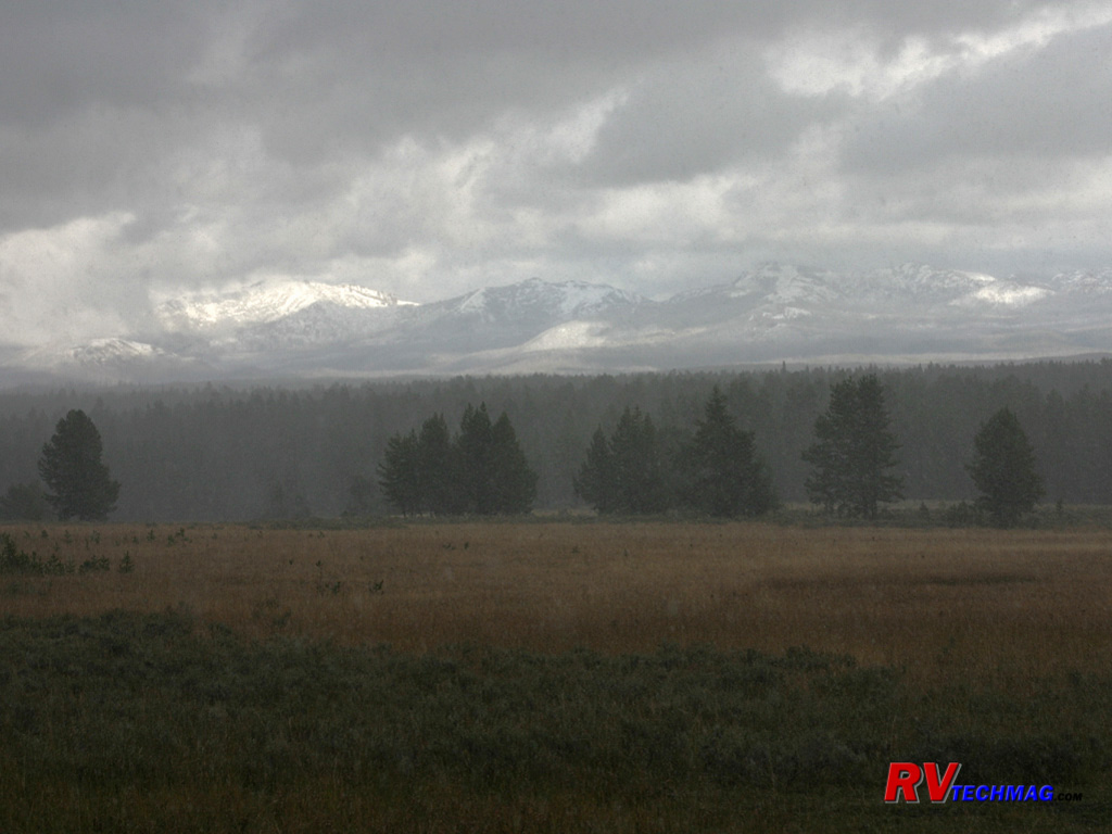
Mount Washburn
Mount Washburn is the tallest peak in the park. It rises 10,243' above the west side of the canyon. It was named after General
Henry Washburn, a member of the 1870 Washburn-Langford-Doane expedition. A gravel spur road takes passenger vehicles up its side to an overlook near the
top. From there, a hike can be taken to reach the summit and the fire tower that overlooks the park. Views from the top take in a vast area. From the
summit it's possible to see the canyon, the far reaching peaks of the Absarokas, and Lake Yellowstone. The park service provides a web camera at
www.nps.gov/yell/photosmultimedia/webcams.htm
but at that altitude it is frequently snowed or fogged in so it's not always available. Mount Washburn's summit is known for both bighorn sheep and mountain
wildflowers in season. Its flanks are popular with grizzly bear and many tourists spot them from this location, although they are generally far off.
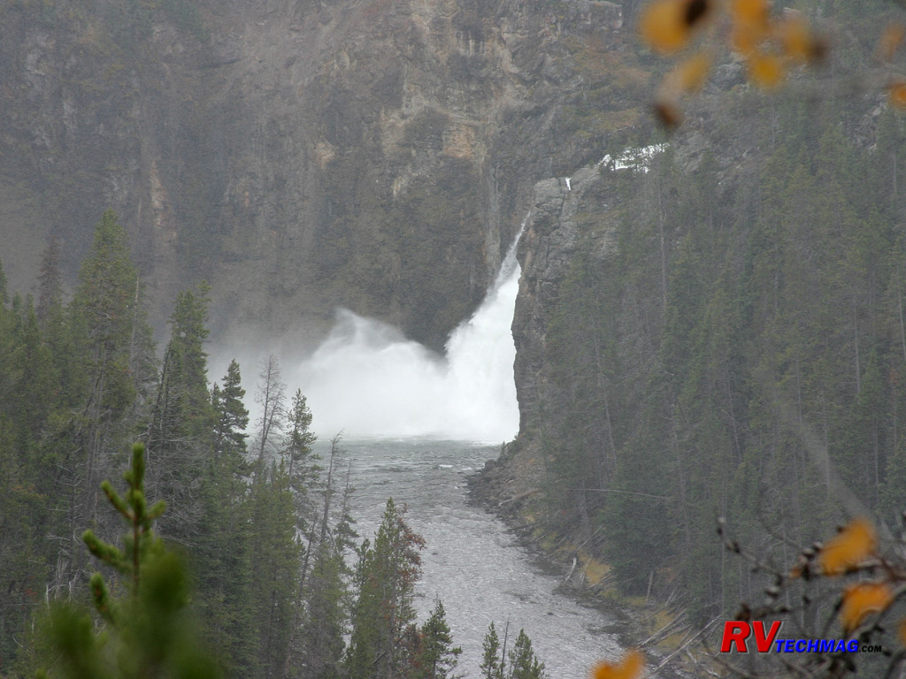
Upper Falls
Upstream of the larger Lower Falls stands the 109' Upper Falls. This is where the Grand Canyon of the Yellowstone begins as the
Yellowstone River leaves that flat plains of Hayden Valley and begins its 20 mile run through the canyon towards Tower Falls. This view of the Upper
Falls was taken from on the trail to the Brink of the Lower Falls.
Lake Yellowstone and Hayden Valley
Yellowstone Lake is very unique. At 132 square miles it's classed as the largest high elevation lake (over 7,000') in North
America. At 7,733' above sea level it remains frozen for nearly half of the year and thaws in late May or early June. If all of the water were drained
out of Yellowstone Lake it would closely mirror what is now found in Yellowstone. The floor of the lake is covered with geysers, hot springs, and
fumaroles. When exploring recently with a submersible robot submarine a 390' deep canyon was found just east of Stevenson Island. Prior to this the
deepest spot was thought to be 320' at West Thumb. The hottest spot was found at Mary Bay where hollow pipes or silica chimneys were found spewing
water at 252 degree Fahrenheit.
The grand Lake Hotel, sits on its shores, looking out across the clear blue waters as the Absaroka Mountains form the perfect
backdrop. Nearby Fishing Bridge is where the Yellowstone River begins its northerly flow, leaving the lake for the waterfalls of the Canyon area.
This headwaters is also the spawning grounds for the Cutthroat Trout that ply these waters and is a popular spot for Pelicans, Moose, and Trumpeter
Swans. From the Fishing Bridge junction one can travel south along the shoreline to West Thumb and Grant Village or a turn to the north will bring
you through the abundant wildlife of Hayden Valley on your way to Canyon. Head east and shortly after Lake Village appears, with the impressive
Lake Hotel, and you'll cross Sylvan Pass on your way out as you climb, then descend over the Absarokas before arriving at the East Entrance.
Hayden Valley is a large area where the Yellowstone River lazily meanders through. This spot is a popular grazing spot for
bison and elk due to the lush grassy meadows. It's also a popular spot for grizzly bear and wolves as they travel along the tree line looking for a
meal amongst the grazing animals upon its slopes. Waterfowl abound in these waters, pelicans, ducks, herons, and trumpeter swans are present. You'll
also see bald eagles soaring overhead searching for cutthroat trout or whatever else is on the menu.
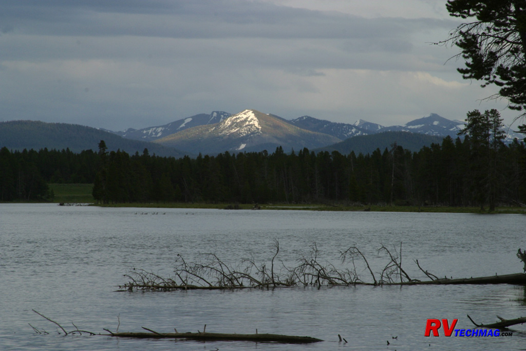
Yellowstone Lake
Yellowstone Lake is the largest high altitude lake in North America and is filled by the runoff from the surrounding mountains.
It is also fed boiling waters from the numerous vents in its base but these tepid waters do little to warm the cold waters that fill the lake. This is
not a lake well suited to swimming because its frigid waters will, and have, claimed lives from exposure to extreme cold temperatures. It is a great
lake for fishing and exploring and its setting easily makes it the crown jewel of alpine lakes. This July image shows how most of the snow has finally
melted from some of the surrounding peaks.
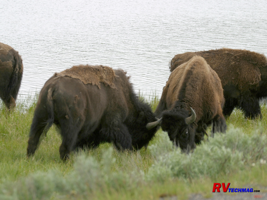
Bison Sparring
Bison practice expressing their dominance by sparring with one another. While bison rarely are injured by this routine their
massive neck muscles and body weight seems like two locomotives on a collision course at times. This sparring serves to establish dominance amongst
competing males for grazing and mating rites but also serves as practice when needed as a defensive maneuver from predators. Bison have been known to
flip a person 30' or more, sometimes landing them in trees so it's important to keep these powerful animals at a safe distance when viewing.
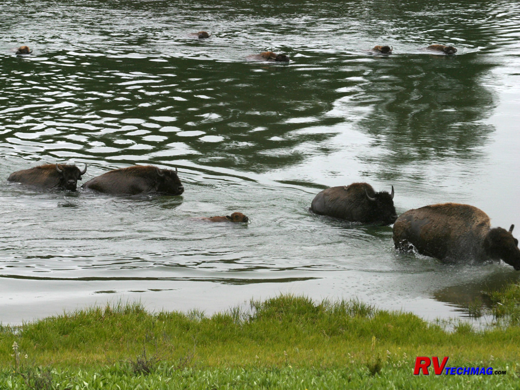
Bison Ford
Bison can swim. Every evening one herd can be found crossing the Yellowstone River at the north end of Hayden Valley as they
return from their grazing areas to bed down for the night in the Alum Creek vicinity. The current is swift but the bison are strong and they help
block the current for the young to cross.
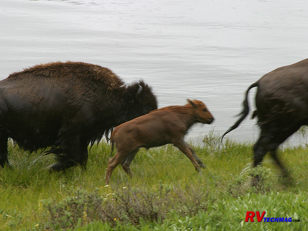
Bison Calf
After fording the cold Yellowstone River, this bison calf was jumping for joy after shaking his wet coat off. He was undoubtedly
glad to be out of the cold water.
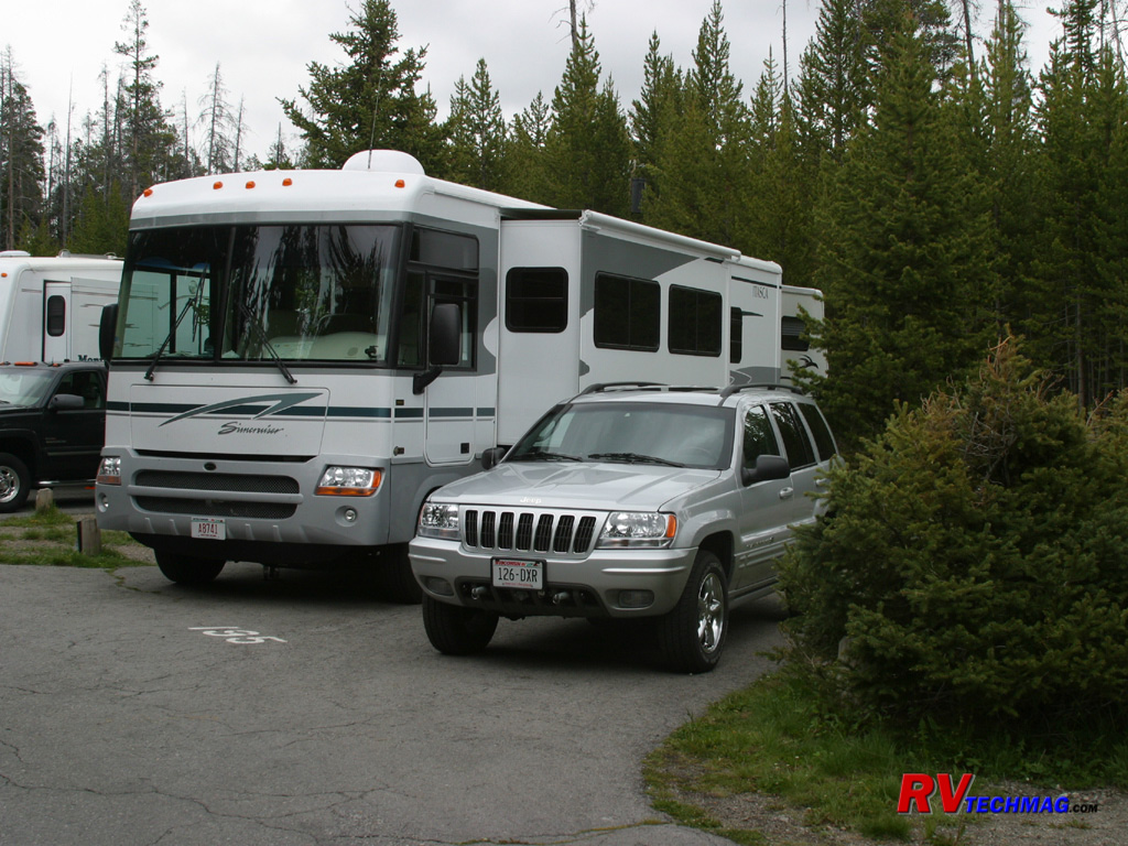
Fishing Bridge RV Park
There are a number of campgrounds in Yellowstone but most are limited in size. The only full service campground inside the park
is the Fishing Bridge campground. Here there are full hookups and they can handle larger RVs. The sites are narrow so it can be a squeeze to fit and the
campground is packed tight, like a large parking lot, so it's not a prime place for rest and relaxation. However, most RVers are off exploring the park
unless sleeping so it's not the worst choice, especially for smaller RVs. Larger RVs will find better accommodations immediately outside the park but
Fishing Bridge does have an excellent central location to base camp from when exploring the park.
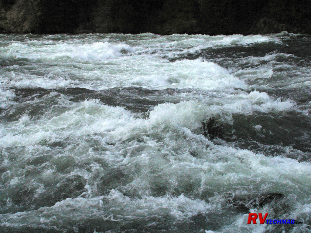
LeHardy Rapids
Located three miles north of Fishing Bridge is LeHardy Rapids. Each spring large numbers of cutthroat trout rest in the pools
there before jumping the rapids to reach their spawning grounds just under Fishing Bridge. These rapids were named for Paul LeHardy, a civilian
topographer with the Jones expedition of 1873. Jones and a partner started off on a raft with the intent of surveying the river, planning to meet the
rest of their party at the Lower Falls. Upon hitting the rapids, the raft capsized, and many of the supplies were lost, including guns, bedding, and
food. LeHardy and his partner saved what they could and continued their journey to the falls on foot.
The rapids became a popular visitor attraction when a boardwalk was built in 1984 providing access to the area. Due to
increased visitation, a group of harlequin ducks, which once frequented this area in spring, have not been seen for several years. The boardwalk has
consequently been closed in early spring to protect this sensitive habitat, but the harlequins have not returned.
Cutthroat Trout
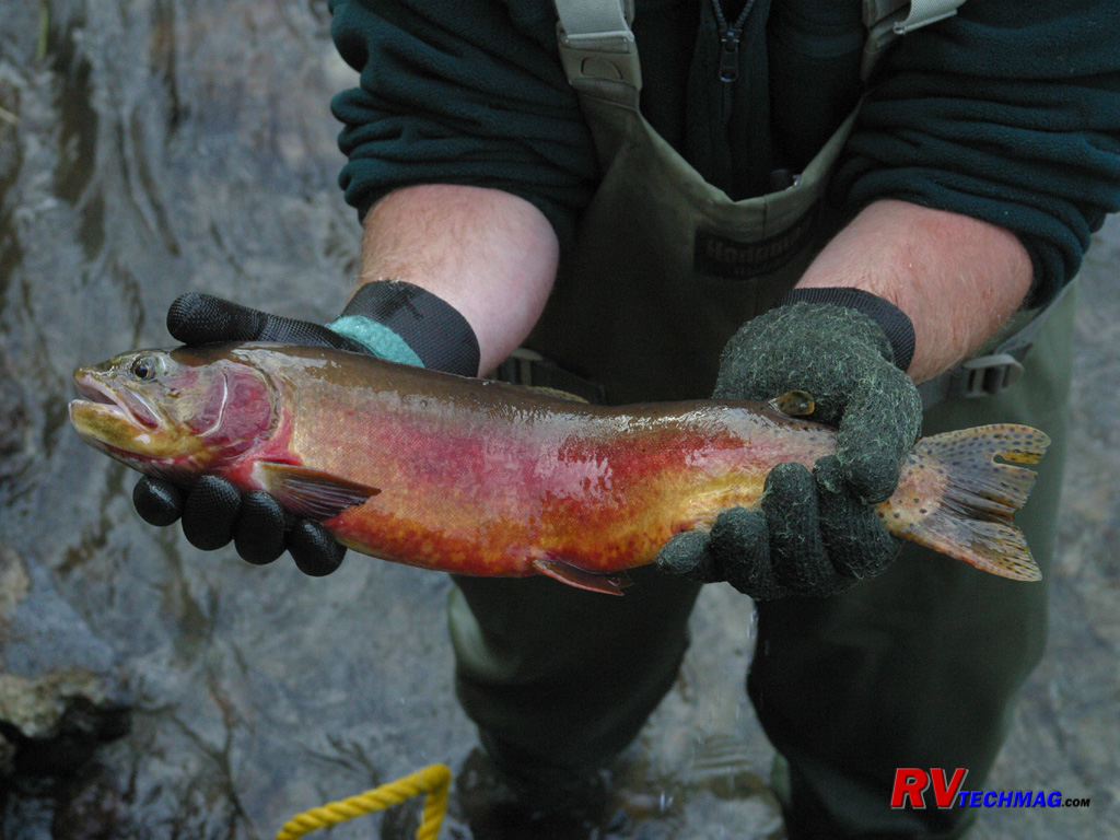
Cutthroat Trout are indigenous to the Yellowstone Lake as well as the many rivers and streams in this area. This trout was one
of many temporarily captured by Wyoming Fish and Game at LeHardy Rapids to collect eggs for use in hatcheries to repopulate areas where the trout are
disappearing. Recently Lake Trout have been dumped into Yellowstone Lake. These larger fish eat the young cutthroat trout, which are much smaller, so
a large scale netting operation is being conducted to remove the Lake Trout from the lake so that the Cutthroat have a better change at survival. This
red female shows the effects of fighting her way through the rocky rapids on the way to her spawning grounds.
Bull Elk in Velvet
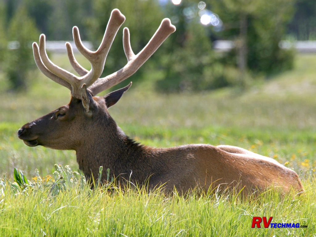
Male, or bull, elk shed their antlers at the beginning of every spring. They then grow new antlers through out the spring and
summer which mature into large impressive racks by the fall rut. As these antlers grow they are covered with blood vessels called velvet that nourish
the antlers as they grow. In the fall, when the antlers are done growing, this velvet dies and falls off as the bull elk rub their racks against trees
and brush. This image of a young bull was taken at West Thumb in the end of June.
Elk Cow at West Thumb
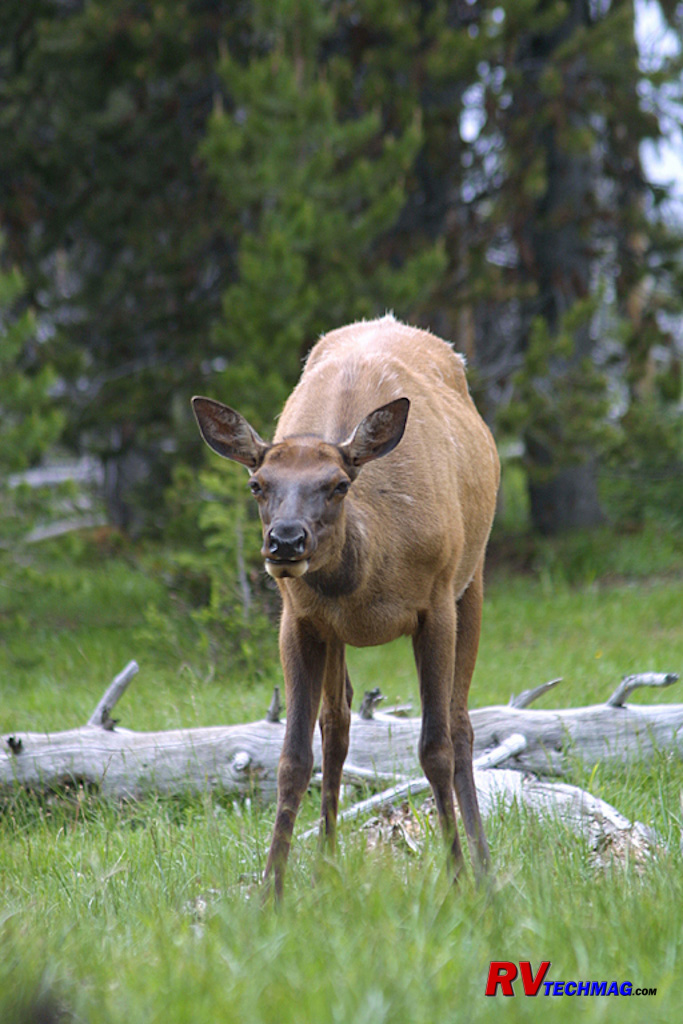
Female, or cow, elk hang around in family groups throughout the majority of the year while the bull elk hang out in bachelor
groups. These groups consist of a number of cow elk as well as their calves, which are born in the spring. This continues until the fall rut, when
the bulls separate from each other to gather their harems. This cow elk was grazing at West Thumb with a number of other cows and calves.
West Thumb Geyser Basin
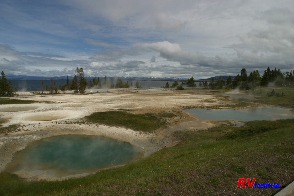
If you look at a map of Yellowstone Lake you'll see that it's not perfectly round. Instead there is a section to the west
called West Thumb. This part of the lake is the deepest and the many thermal vents in its floor make it the hottest part of the lake. The West Thumb
geyser basin is found right on the shore of the lake. The boardwalk wraps around its circumference and follows the shoreline in places, where you can
see submerged geysers, such as Fishing Cone, right off the shore. There are many pools, geysers, and fumaroles in this area and it's also a place
where Trumpeter Swans can be seen from the shoreline.
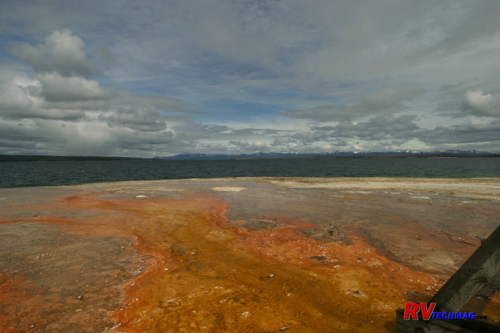
West Thumb Runoff
The continuous flow of hot water from West Thumb's thermal features has to go someplace and downhill is the logical solution.
The West Thumb basin pitches down slope to the shore of Yellowstone Lake and this image shows evidence of the iron and mineral content present in
this runoff.
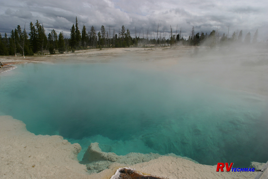
Blue Spring
This blue pool is typical of the hot springs present in Yellowstone. The boiling waters ooze from limestone caverns within the
ground. Unlike the geyser, there is no restriction to build up pressure so hot springs flow steadily rather than cycle. This 200 degree water steams
at it hits the cool fall air and partially hides it's vivid aqua color.
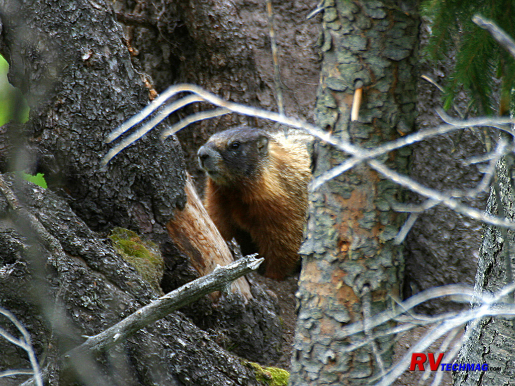
Yellow Bellied Marmot
Yellow bellied marmots are also known as Rock Chucks or Whistle Pigs. A relative of the Woodchuck, Marmots live in rocky
locations. The dig their burrows underground and always stay close to cover so that they can disappear should an eagle or coyote happen by.
Marmots are reclusive and generally pretty wary of people.
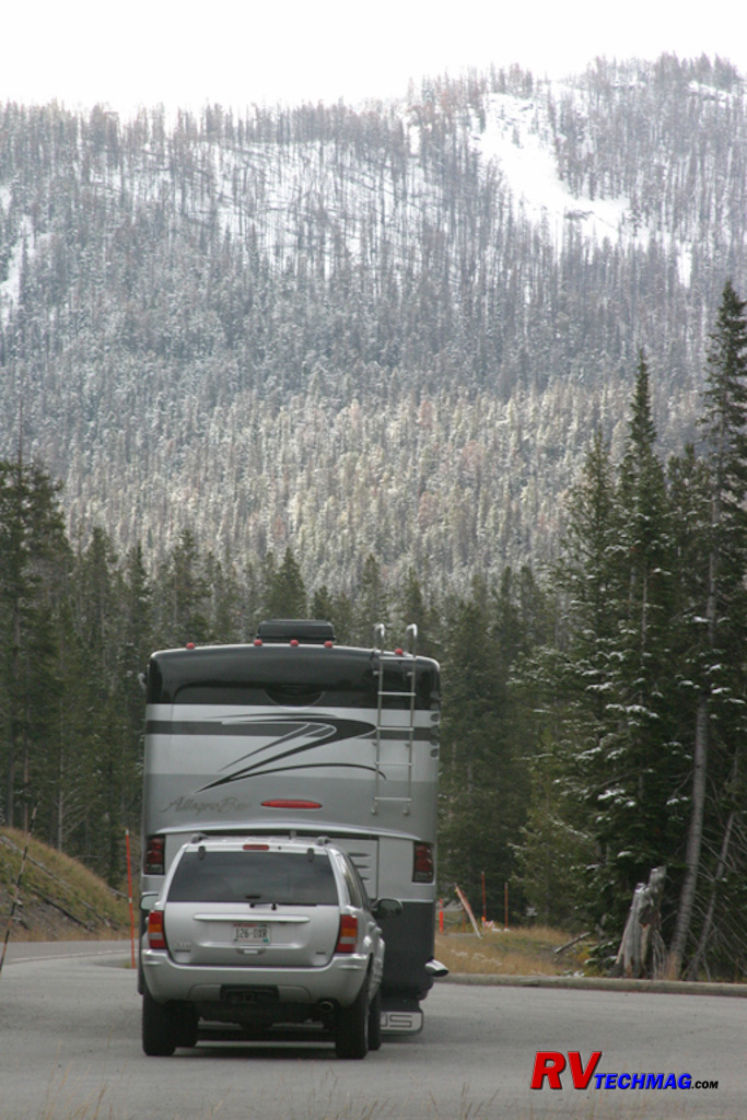
Sylvan Pass
Heading east from Fishing Bridge you'll need to cross the Absaroka mountain range to exit the park. This is done by crossing
Sylvan Pass. This image was taken in late September after a brief snowfall and shows the drive ahead. Sylvan Pass is doable with any vehicle but
there are areas where the view over the edge can be unnerving to someone not comfortable with heights.
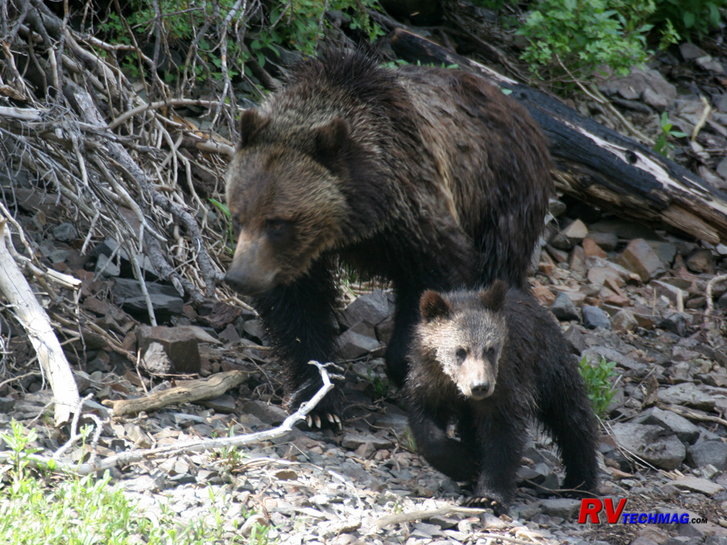
Grizzly Sow and Cub
This grizzly sow and cub were spotted shortly after descending from Sylvan Pass, near the east entrance to the park. The mother
was following the edge of a small lake as the cub followed closely behind. Grizzly cubs typically stay with their mothers for 2, and sometimes even 3
years before setting out on their own.
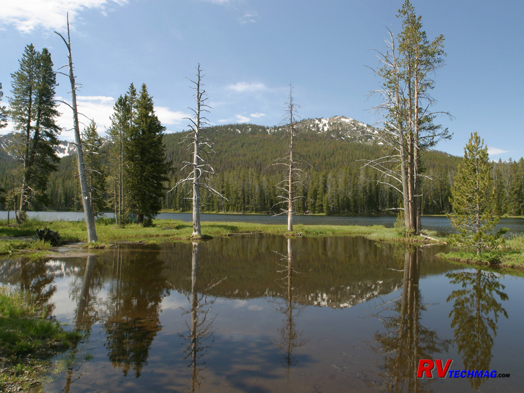
Sylvan Lake
Before beginning the climb out of the park, you'll pass by Sylvan Lake. This July setting shows the surrounding mountains as
well as the effects of forest fire and mineral contamination of trees. The reflection shows the Absaroka range in the distance.
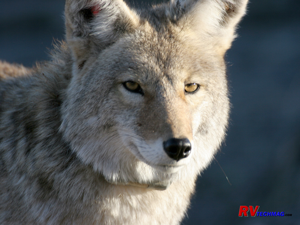
Coyote
This smaller cousin to the Gray Wolf has a tougher time finding food now that the wolves have been reintroduced to Yellowstone.
Still, they are thriving and feed on smaller rodents as well as scarps left from a bear or wolf kill left unattended.
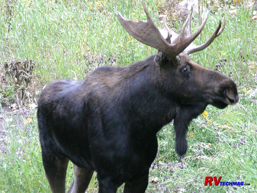
Bull Moose
These gangly looking creatures are found in aquatic settings such as marshes. Their huge snouts are perfect for picking up wet
vegetation from the bottom of marshes and streams and their tall legs and dark coloring keeps their body warm and out of the water. These tame looking
animals can be deceiving though and they don't care much for strangers and express that with strong, powerful hooves. Like elk, these ungulates also
shed their antlers annually.
Return to Home Page
If you enjoyed this article be sure to recommend RVtechMag.com to your friends, like us on Facebook or Twitter
or subscribe to our RSS feed.


|


