Yellowstone National Park
A Photo Journal of America's First and
Best National Park
Article Date: January, 2015
Article and Photography by Mark Quasius
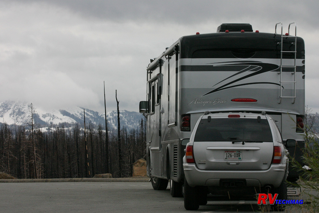
Canyon
Everyone knows about the Grand Canyon in Arizona. But Yellowstone has its own canyon, the Grand Canyon of the Yellowstone. The
Yellowstone River begins at Yellowstone Lake where it flows northward on its northward journey out of the park. It begins flowing through flat bottomed
valleys, but after traveling around 10 miles it takes a 109' plunge over Yellowstone's Upper Falls. From there it takes a short trip to the Lower Falls,
where it plunges another 308' into the bottom of the Grand Canyon of the Yellowstone. Passing through the golden yellow cliffs of the canyon it continues
on its northern trek towards the Mammoth area and eventually empties into the Missouri River far north of the park.
The Canyon area is a popular destination. Canyon Village features food service, lodging, and campgrounds. It's the most heavily
traveled intersection on the east side of the park because you can head south through Hayden Valley on your way to Fishing Bridge and Lake. The road
west takes you up "over the hump" of the park to the west side and you can also drive north, climbing Mount Washburn and traversing Dunraven Pass on
your way to Tower Junction. Canyon is also the beginning of the North Rim Drive, which gives access to the many overlooks of Yellowstone's Grand Canyon
as well as Brink of the Falls trail, which takes you right to the edge of the 308' Lower Falls.
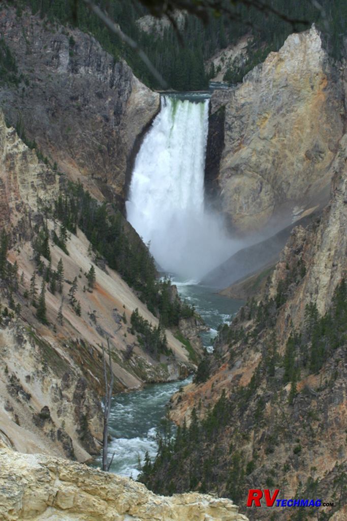
Grand Canyon of the Yellowstone
The Grand Canyon of the Yellowstone is roughly 20 miles long and begins at the Upper Falls and extends to the Tower Falls area.
It ranges between 800 and 1,200' in depth and was formed by the natural cutting action of the Yellowstone River over the ages. This particular view is
of the Lower Falls as it plummets 308' to the canyon floor. While there are a number of overlooks and vantage points that view the canyon, this
particular image was taken from the Inspiration Point overlook. It is noteworthy that the 308' Lower Falls is taller than the 109' Upper Falls. The
Upper Falls is located just upstream of the Lower Falls and is the first drop that the Yellowstone River takes as it leaves Yellowstone Lake, therefore
their names are derived from their geographical locations, not their overall heights.
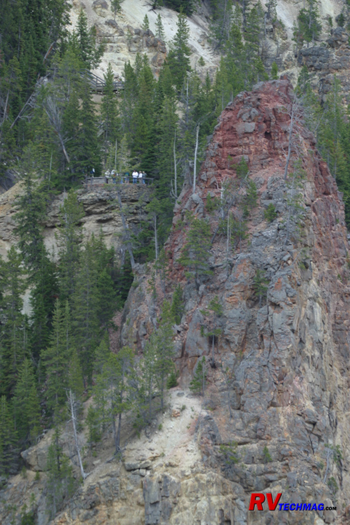
Red Rock Point
A side trail from the Lookout Point overlook takes you to Red Rock Point. This overlook gives you another viewpoint that is
further into the canyon than Lookout Point, which is found on the rim. It is named after the Red Rock formation immediately next to the overlook.
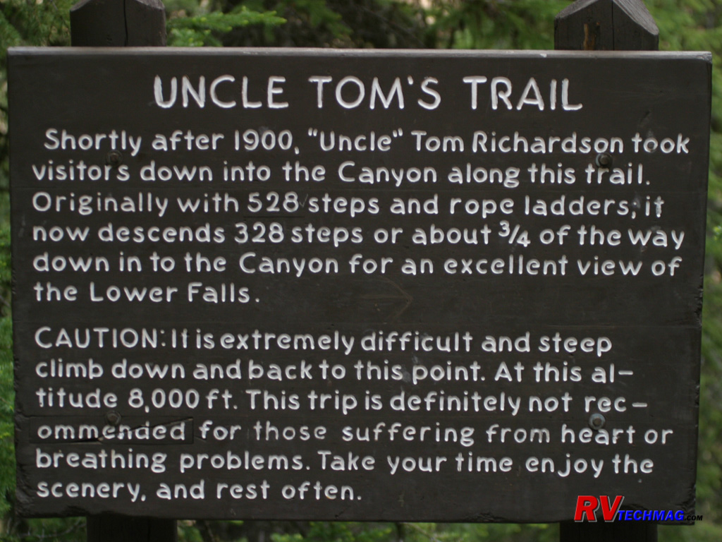
Uncle Tom's Trail
Uncle Tom's Trail is accessible from the Upper Falls Viewpoint, which is located on the South Rim Drive. Originally
constructed in 1898, "Uncle" Tom Richardson took tourists down the trail into the canyon for a "looking up" view of the Lower Falls. He originally
crossed the canyon upstream of the present day Chittenden Bridge and included a picnic lunch for his clients before returning the same way.
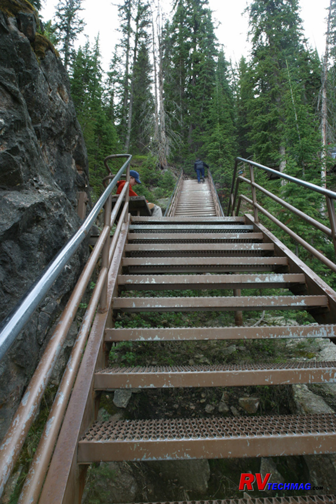
Uncle Tom's Trail
Uncle Tom's original trail has changed over the years. The rope ladders are now replaced by steel steps and the unstable soil
in the canyon walls required a shortening of its depth so that it no longer goes all the way to the bottom but the trek is still a handful for anyone
afraid of heights.
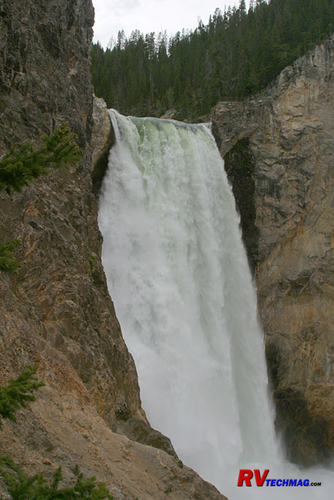
Lower Falls
The view of the Lower Falls was taken from the base of Uncle Tom's Trail. While it no longer runs to the absolute bottom of the
canyon, this vantage point still offers an impressive view of the 308' waterfall and its spray is a welcome feeling on a hot summer day. The Brink of
the Falls viewpoint can be seen at the top of the falls, just to its right. This viewpoint is accessed from the west rim drive by hiking down from
the rim. That trail is not as strenuous as Uncle Tom's Trail and is a paved asphalt walkway that winds its way down to the brink of the Lower Falls.
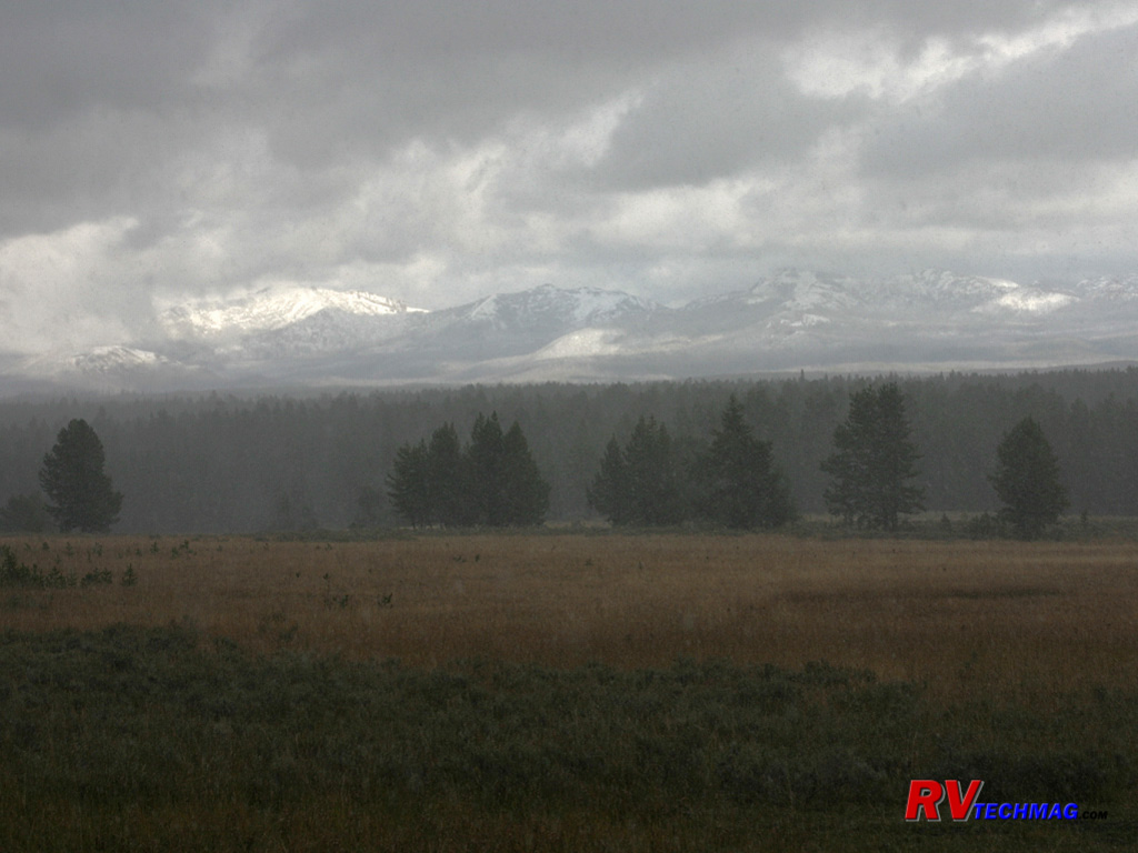
Mount Washburn
Mount Washburn is the tallest peak in the park. It rises 10,243' above the west side of the canyon. It was named after General
Henry Washburn, a member of the 1870 Washburn-Langford-Doane expedition. A gravel spur road takes passenger vehicles up its side to an overlook near the
top. From there, a hike can be taken to reach the summit and the fire tower that overlooks the park. Views from the top take in a vast area. From the
summit it's possible to see the canyon, the far reaching peaks of the Absarokas, and Lake Yellowstone. The park service provides a web camera at
www.nps.gov/yell/photosmultimedia/webcams.htm
but at that altitude it is frequently snowed or fogged in so it's not always available. Mount Washburn's summit is known for both bighorn sheep and mountain
wildflowers in season. Its flanks are popular with grizzly bear and many tourists spot them from this location, although they are generally far off.
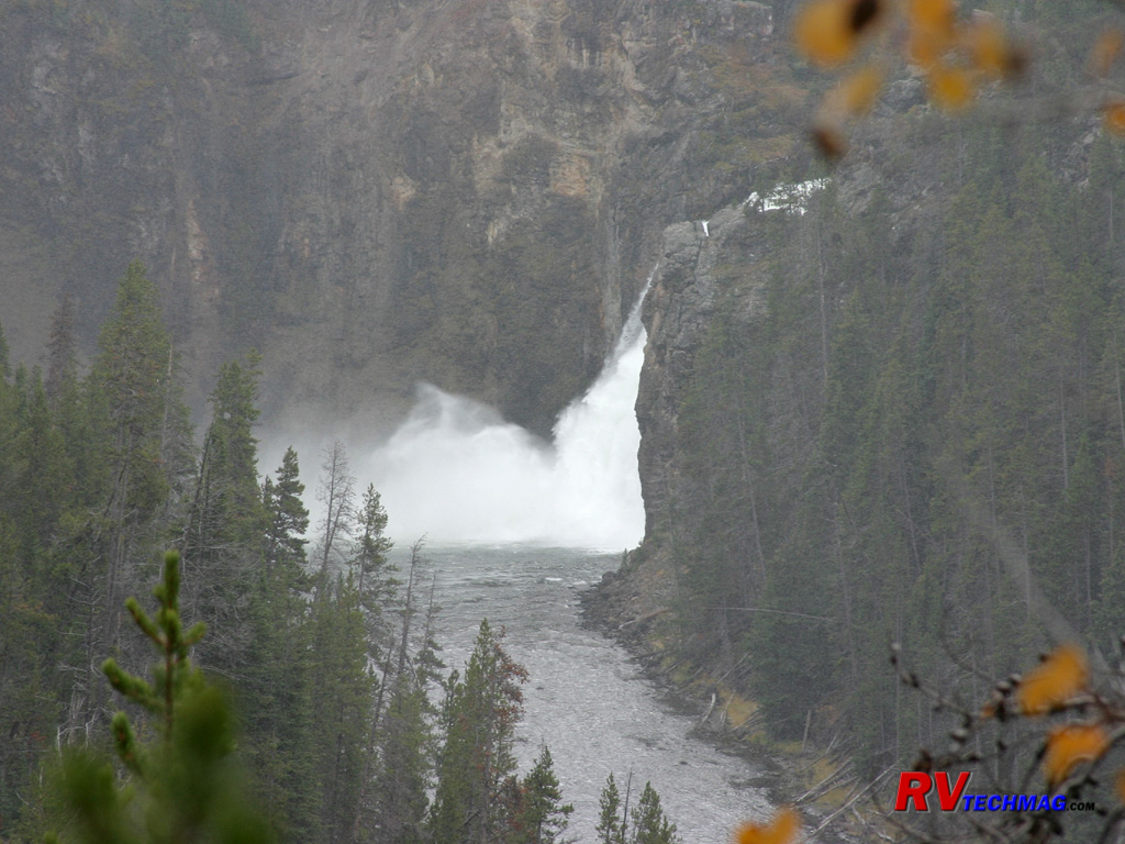
Upper Falls
Upstream of the larger Lower Falls stands the 109' Upper Falls. This is where the Grand Canyon of the Yellowstone begins as the
Yellowstone River leaves that flat plains of Hayden Valley and begins its 20 mile run through the canyon towards Tower Falls. This view of the Upper
Falls was taken from on the trail to the Brink of the Lower Falls.
Return to Home Page
If you enjoyed this article be sure to recommend RVtechMag.com to your friends, like us on Facebook or Twitter
or subscribe to our RSS feed.


|


