Buffalo Wyoming
Gateway to the Bighorns
Article Date: March, 2015
Article and Photography by Mark Quasius
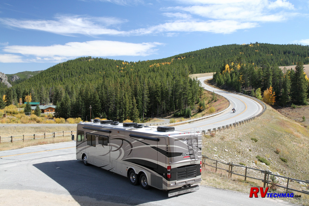
Gateway to the Mountains
Buffalo is a great place to base yourself from when exploring the Bighorn Mountains. The Bighorns are like a massive wall
that runs north to south and there are really only three possible routes that cross them. If you head up I-90 a bit to Sheridan you can take US-14
up into the mountains. US-14 climb a series of switchbacks until it reaches the top, where it continues west to Burgess Junction. These switchbacks
aren't that bad for an RV and there are a number of scenic overlooks where you can rest you vehicle if needed. The portion of US-14 that climbs the
east face of the Bighorns can safely be taken in either directly with a large RV.
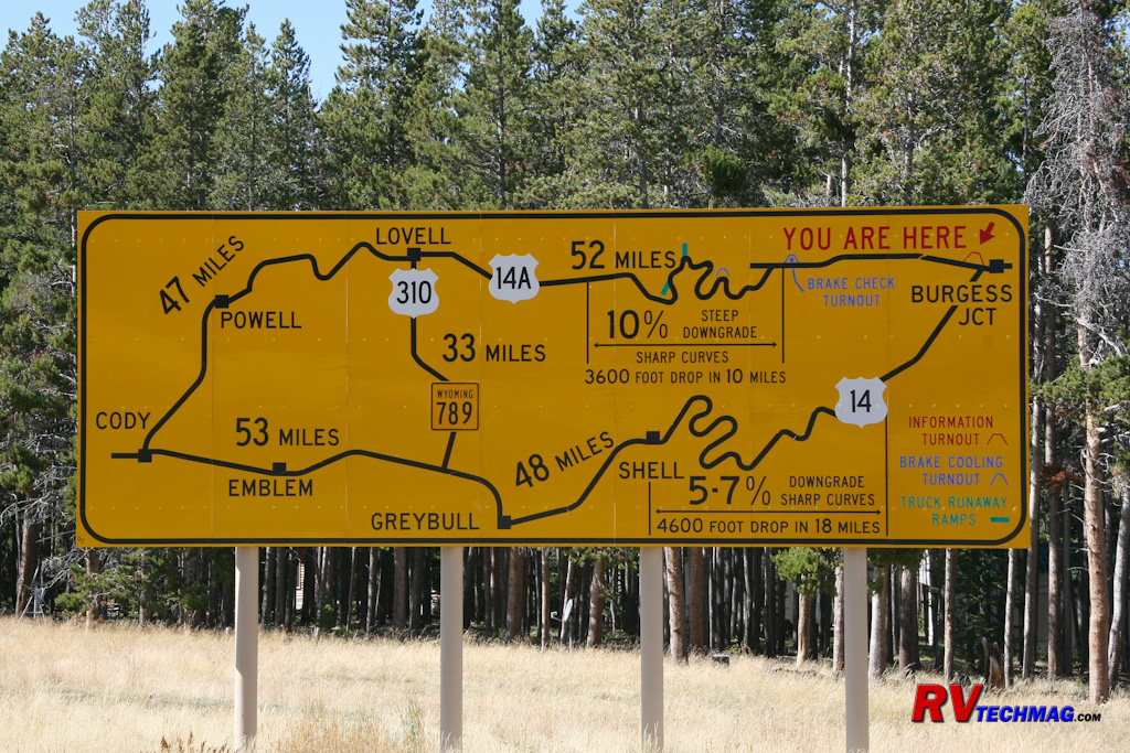
This sign at a pullout near Burgess Junction is a mandatory stop for trucks and illustrates the hazards involved with descending the west face
of the mountains via U.S. Route 14 or U.S. Route 14A.
However, once you leave Burgess Junction to head down the west face of the mountains things get pretty ugly for large vehicles,
such as an RV. There are steep grades that seem to go on forever with no real room to rest your RV. The road splits into US-14, which heads to Greybull,
and US-14A, which heads to Lovell and the wild mustang refuge in Bighorn Canyon's Pryor Mountains. US-14A is particularly deadly with its 10% grades.
I would recommend not taking US-14 or 14A when heading westbound across the mountains because odds are good you'll lose your brakes due to excess fade
and heat and stuffing an RV into the runaway truck ramps isn't a good thing. I have taken both 14 and 14A in an eastbound uphill climb with a powerful
diesel pusher motorhome but it was a slow climb and many smaller RVs or tow vehicles pulling trailers wind up burning up transmissions on that climb.
For anyone traveling by RV taking US-16 is a much better, and safer, choice.
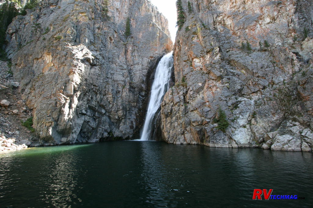
This is Porcupine Falls. Just one of the many areas accessible from one the Bighorns numerous hiking trails.
US-16, also known as the Cloud Peak Scenic Skyway, leaves Buffalo and crosses the southern end of the mountains. What separates
US-16 from 14 is that 14 climbs over the hump of the mountains while 16 travels through valleys and canyons and doesn't have those steep grades. US-16
can safely be taken in either direction by any RV and there's plenty of room to let your vehicle breath rather than subject it to those continuous
climbs on 14 or 14A. It's also the most scenic route. Beginning in the lower ranch land country it begins its eastbound climb gradually, passing through
numerous canyons, including the scenic Ten Sleep Canyon, passing by beautiful streams and a variety of geological features as it works its way up into
the mountains. Once up top you'll cross large valleys, pass streams and lakes, and eventually reach Powder River Pass. Descending down the mountains
towards Buffalo is not a major event nor does it has those sheer cliff drop-offs that can be unsettling to some.
|
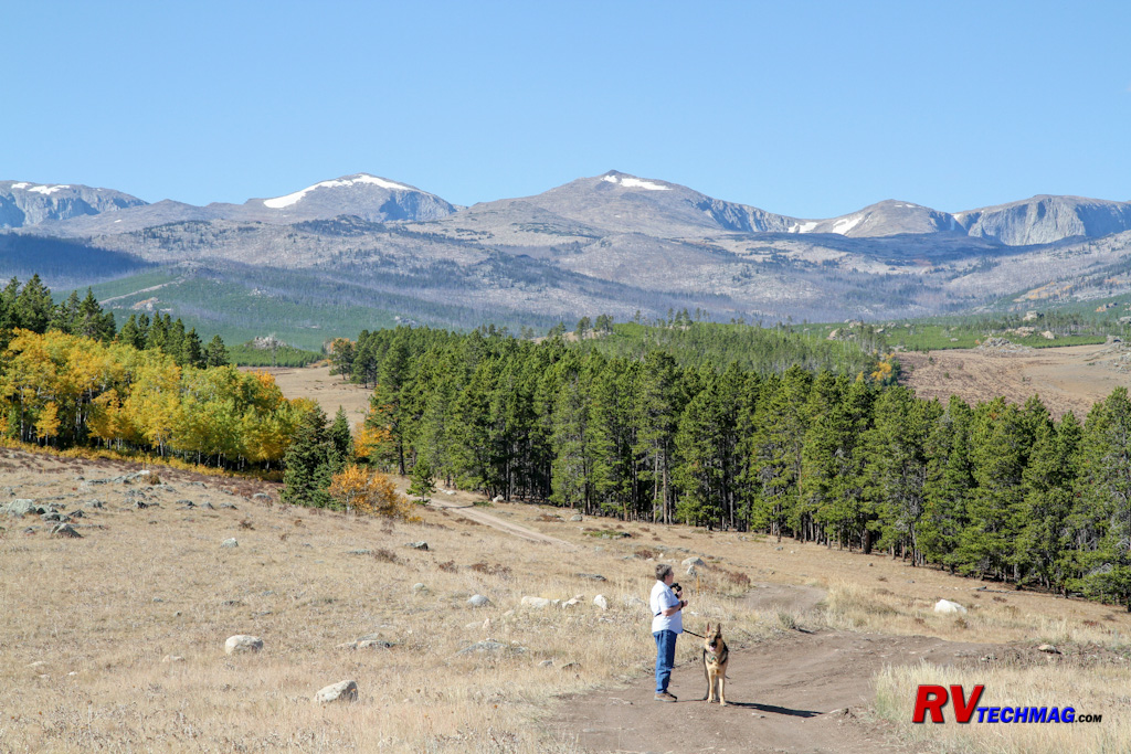
The many side roads found along the Cloud Peak Scenic Highway offer excellent views of the mountains and basins found in the Bighorn Mountains.
|
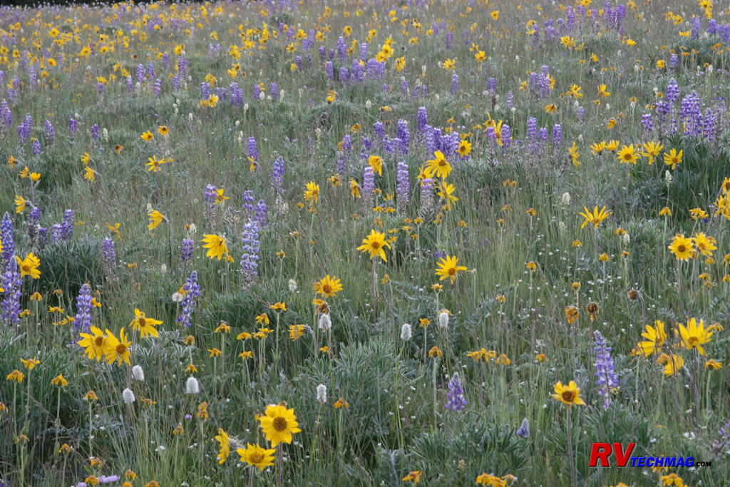
In July wildflowers will be found blanketing the high meadows of the Bighorn Mountains.
|
US-16 also gives you the best access to a number of gravel or dirt side roads that take you to some amazing scenery. Once you
set up camp in Buffalo you can take your tow vehicle and explore the mountains to your heart's content. Be sure to bring your camera because the odds
of seeing Mule Deer, Moose, Elk, and other wildlife are good - especially if it's in the evening or early morning. If you have a four wheel drive
vehicle your opportunities expand even farther. Rocky trails take you into places such as Soldier Park, where a pair of graves from the cavalry days
still exist. A number of ATV trails can also be found in the Cloud Peak Wilderness and permits, maps, and information can all be obtained at the US
Forest Service office in town.
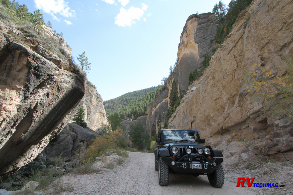
Crazy Woman Canyon is a must-see drive. This road takes you through the canyon and streams as it connects U.S.-16 to the ranch roads just south of
Buffalo.
If you are real adventurous consider a climb up Bomber Mountain. In 1943 a B-17 Flying Fortress lost its way during an evening
flight and crashed into the mountain. The wreckage wasn't found until 1945 when the camouflage paint had finally worn off of the plane, making it
visible to hunters when the sun reflected off of it. The bodies were removed but the wreckage remains and is scattered over a large area. A few parts
of the plane were removed and are now on display in the excellent Jim Gatchell Museum in downtown Buffalo. The bomber rests on both sides of the ridge
on top of the mountain so you'll need to research this further if considering this hike. The hike will require the entire day and you'll need to be in
good physical shape in order to scramble up the 12,840' tall mountain.
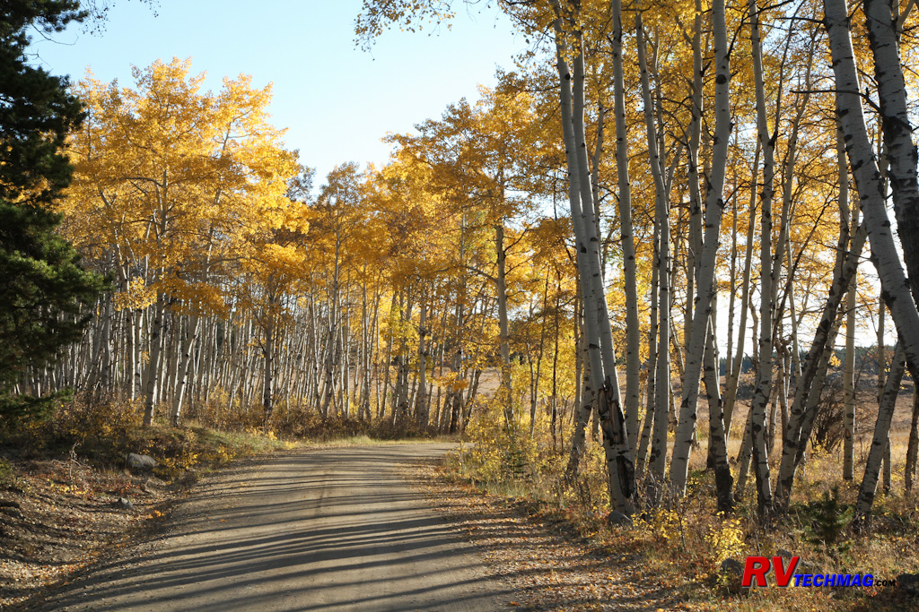
Fall is an excellent time to tour the Bighorns when the Aspens turn shades of yellow and amber as the sun sets lower in the sky.
Return to Home Page
If you enjoyed this article be sure to recommend RVtechMag.com to your friends, like us on Facebook or Twitter
or subscribe to our RSS feed.


|


