Exploring Yellowstone by RV
Navigating Your RV Safely Inside America's Oldest National Park
Article Date: May, 2011
Article and Photography by Mark Quasius

The Bighorn Mountains
The Bighorn Mountains are massive and can be formidable. Plus, if you are accessing Yellowstone from the east, they are
smack in the way. You can take I-90, which skirts around the Bighorns and goes through Montana, then drop down into Yellowstone from the north.
This is the easiest way and you stick to interstate highways until you get close to Yellowstone. However, it's also the longer way and not as
scenic as crossing Wyoming. There's pros and cons to both routes so I'll explain the Bighorns to you so that you can better understand them and
make your own decision.

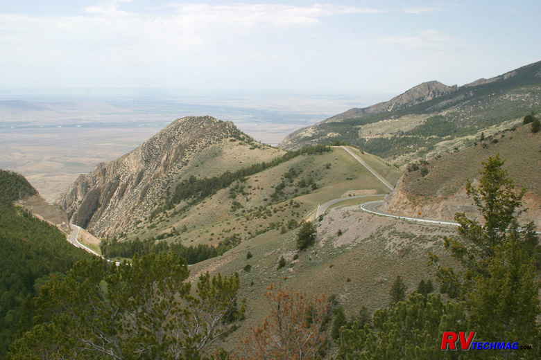
US 14A as it climbs the west flank of the Bighorn Mountains.
First of all, the Bighorns are a long range of mountains that runs north and south that sit smack in the middle of the way
of I-90 it heads west from the Black Hills and Gillette, WY. So I-90 chooses to go way to the north through Montana to skirt them. There are two
routes that do cross the Bighorns from the east, US-14 and US-16. US-16 leaves Buffalo, WY and goes over the southern end of the Bighorns while
US-14 leaves Ranchester, WY and goes over the northern end of the Bighorns. No roads do or could go over the massive center section of the Bighorns
and this area is designated as the Cloud Peak Wilderness area. US-14 further splits into two up top at Burgess Junction and descends the western
flank as either US-14 or US-14A, depending on which fork you take. To the west of the Bighorns is flat ranch lands. To the east of the Bighorns is
the Bozeman Trail valley that gradually climbs it's way to the north where I-90 enters Montana. The only issues with driving an RV in this area
is the actual crossing of the Bighorn Mountains themselves.
The southern crossing is the easiest. US-16 runs between Buffalo and Worland. If heading eastbound you leave Worland and
enter Ten Sleep Canyon shortly thereafter. This is a gradual climb that carries you alongside the Powder River as you ascend through the canyon.
It's a very scenic drive and eventually it reaches Powder River Pass. The climb up Powder River Pass is steep, topping out at 9,666 feet of altitude.
But, there are slow vehicle lanes and lots of turnouts and we've never had a problem here. You will be driving in some nice scenic high country for
a while before descending into Buffalo at 4,665 feet. The roads are wide, offer plenty of easy stretches to allow your RV to keep it's cool and
breath a bit, plus no terrorizing drop-offs. This road is a safe passage route for any RV traveling in either a westbound or eastbound direction.

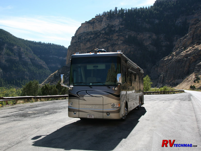
A scenic overlook in Ten Sleep Canyon on US-16 in the Bighorns.
The northern crossing is much different, however. Approaching the mountains from the east you'll enter a series of tight
switchbacks that sweep back and forth as they climb the grades on the east face. The difference between US-16 to the south and US-14 is that US-16
gradually builds it's altitude over time whereas US-14 runs up to the face of the mountains and then begins it's climb. Compare it to the difference
between a ramp and a ladder and you'll get the idea. Still, this is manageable for an RV. There are a number of pulloff areas and scenic turnouts
that you can use if needed. Once you have climbed the eastern flanks you'll be up top and driving across the Bighorns in the high country which
is a much easier drive.
The real problem with the northern crossing arrives once you get to Burgess Junction up top and have to deal with the west
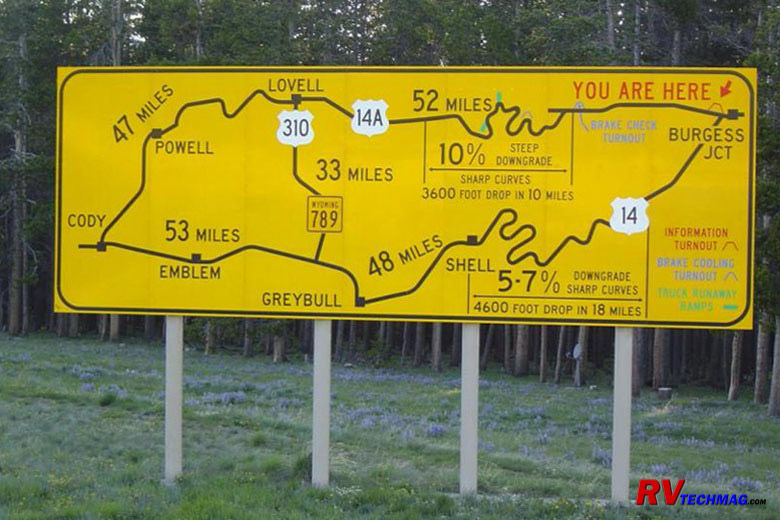
face of the mountains. Once you get to Burgess Junction there is a sign directing all trucks and large vehicles to pull over and that they must
read the large sign posted there. following is an image of that sign:

The warning sign at Burgess Junbction at the top of the Bighorns, where US-14 and USD-14A merge.
Descending to the west the road splits. US-14 heads down to Greybull while US-14A takes a more northerly route through Lovell.
Eventually both meet up at Cody, WY. The problem here is that the grades are steep, long, and there is no place to get a break on them. No flat areas
to let your coach breathe nor any pulloff areas to let them rest. This means that your brakes will become overheated, fade, and you won't be able to
retard your descent speed. You'll probably wind up doing a swan dive over a switchback's cliff. For this reason I recommend that you NEVER take an
RV in a westbound direction via US-14 or US-14A. If you are heading west, either take I-90 and skirt them to the north or take the more scenic US-16
to the south.
If you are heading eastbound, the situation changes. We've taken heavy RVs over all three of these routes in an eastbound
direction. While the northern routes aren't a whole lot of fun, they are doable.
Normally we'll prefer to take US-16 because it's scenic and it winds up in Buffalo rather than Sheridan. If you climb US-14
from Greybull to Burgess Junction it's a stiff climb. First you drive through a real desert-like waste land, which is scenic in it's own right, then
you approach Shell, WY. From Shell, the steep climb begins and you'll be pedal to the metal for a long time as you gradually climb those 15 miles
at 25-35 MPH. If your cooling system is in good order this is doable. We've done it with 33' gasoline , 40' diesel, and 42' diesel motorhomes
without any problems. We do unhook the toad for this climb and drive in tandem to help relieve some of the weight. Once up top you can rehook and
rest the RV while you look back at the flat valley below, which unfortunately is usually a bit hazy as far as good photographs go. Once up top
it's an easy drive to the east face, where you then have to descend the switchbacks as you make your way down to Ranchester. Heading down the east
face isn't as bad as the west face. The east face has plenty of scenic turnouts where you can rest your RV and cool off your brakes. Therefore,
crossing the Bighorns via US-14 is okay if you head in an easterly direction but not in a westerly direction.
US-14A is the same as US-14 except it's even worse. It's even steeper than US-14 and they've added two runaway truck ramps
to help prevent total wipeouts on that road. We've climbed that road as well but it's the most extreme climb we've ever made and there is literally
no place to catch a break until you get to the top. The only reason I see for taking this route is if you wanted to see the Pryor Mountain wild
mustang herds in the Bighorn Canyon, just north of Lovell. If that's not on your itinerary scratch this route of your list. If it is, be sure to
make this another "eastbound only" route.
Return to Home Page
If you enjoyed this article be sure to recommend RVtechMag.com to your friends, like us on Facebook or Twitter
or subscribe to our RSS feed.


|


