Exploring the Pacific Northwest by RV
Helpful Tips on Traveling the Pacific Coast from California's Redwoods Through Washington's Olympic Peninsula
Article Date: August, 2008
Article and Photography by Mark Quasius
Introduction
The Pacific Northwest has much to offer to anyone traveling by RV. We've traveled this area numerous times with our motorhomes
and it has always been one of our most popular trips. Coming from Wisconsin we've traveled this route in multiple directions. Sometimes we will come
over the North Cascades and arrive at Anacortes, Washington and begin out trip south. Other times we may come up from the California coast and begin
our northbound trip at Brookings, Oregon. Either direction is fantastic so just choose which direction works out best for you. Like any trip, the
hardest part is making it all fit because there's never enough time to do it all. Other RVers ask me numerous questions regarding this area so I've
put together this overview of what we've found during our travels. Hopefully it will help others in planning their trips in this area. I've put this
travel guide together as if traveling from the southern end up through the northern end. You can easily reverse this route if that better suits your
needs. It's designed from an RVer's point of view so there will be links to RV parks as well as other areas of interest that we have found. I've
segmented it into chapters so that you can go directly to a specific area to review that information. I've also included a couple of popular side
trips that really are not on the coastline but are popular spots, nonetheless.
The Oregon Coast
The Oregon coastline is undoubtedly the most spectacular coastline in the lower 48. It features a number of sea mounts that come
in every size and shape and mixes in lush green slopes in some places, rugged cliffs in others, and white sandy beaches in still other locations. The
variation in scenery, as well as the spectacle of it, makes for a very non-boring trip. I'll attempt to take you through these areas as we begin at
Oregon's southern border with California. We'll head north along the coast on US-101 and cover the highlights of this scenic coastline as we proceed
up to the Washington coast.
I guess before we continue a brief overview of two geographical features common to the Oregon coast is in order.
Sea mounts are rocks that are thrust up from the earth's crust by a process called subduction. When the Pacific Plate, which
is slowly but constantly creeping to the east, meets the North American Continental Plate it is pushed beneath the North American Plate. When it
cracked molten rock rose up through the off-shore waters and solidified, forming the sea mounts so prevalent to the Oregon coastline. This happened a
long time ago in geographic times so you're not going to see anything volcanic rising out of the ocean but you will see plenty seamounts, giving
evidence to what did happen at one time.
Tidal pools are formed when the tide is low and the water recedes from the shoreline. At high tide the beach will be very
narrow and may not even exist. But, at low tide the water recedes and the wide sandy beach appears. Many of the rock structures previously surrounded
by water are now accessible by beachcombers. Around these rocks you will find tidal pools. A small amount of water will remain in these pools and any
sea life left behind by the receding waters will remain in the pool. In addition to the pools you'll find starfish, clams, and other mollusks attached
to the lower walls of these rock formations. When viewing sea life it's important to time your visit to coincide with low tides or else the pools will
not be accessible. When visiting these areas be sure to watch for rising tides. In some cases you can get trapped in an area as the tide rises when
the beach disappears into the surf. Tidal charts are available or you can find them by searching the Internet.
Brookings
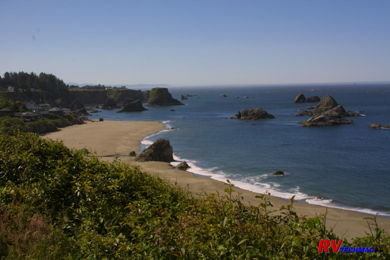
Harris Beach - Brookings, Oregon
Brookings anchors the Oregon coastline at its southern end. Like most coastal cities, US-101 runs right through the center of
town and is very RV friendly. there are a few campgrounds in Brookings. Most are fairly compact with tighter spaces. We skipped them with our 40'
motorhome and stayed at Harris Beach State Park once but it was very tight wooded park. We reserved the longest site in advance. When we arrived it
wasn't quite as large as they stated. We did manage to fit but it was a real squeeze. The park is a nice wooded park and very well suited for smaller
RVs but a large class A will have issues navigating the narrow roads and sites. We chose to skip staying at Brookings for future trips. We generally
will stay just south of Brookings in Crescent City, California or to the north in another coastal city. If you want to stay at Brookings I would
suggest checking out the various campground reviews at www.rvcampreviews.com or
www.rvparkreviews.com for more information.
Harris Beach State Park is much more than a campground though. There is an excellent visitors center on the east side of US-101
that's a must to stop at for anyone new to traveling the Oregon coast. The helpful staff will give you information and brochures to help you make the
most of your trip. After stopping at the visitor center, drive across the highway to the parking area on the west side. This is on a high bluff
overlooking the ocean and a paved walking trail will take you right down to the beach. The beach is wide and features tidal pools and sea mounts and
is an excellent place to explore at low tide. for more information on Harris Beach State Park visit their link at
www.oregonparks.org/park_79.php.
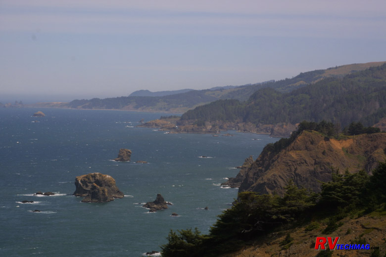
Samuel H. Boardman State Park
Immediately upon leaving Brooking you'll come upon the Samuel H. Boardman State Park. Unlike the typical state park, the
Boardman is a 12 mile stretch of rugged coastline interrupted by small sandy beaches. Various overlooks and parking areas along US-101 break the
constant groves of Sitka Spruce that line the coastline and offer views of the rock formations and other scenic areas. There are 27 miles worth
of coastal hiking trails for those who want to venture farther on foot but the easy access pull-offs make for excellent views for those with
less time on their hands.
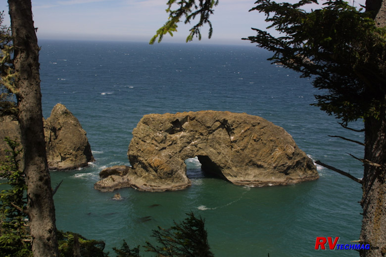
Arch Rock in Samuel H. Boardman State Park
Arch Rock and Natural Bridges are popular features in Sam Boardman. Many rock formations can be seen dotting the coastline
in this area. Cormorants and other shore birds make their nests on these sea mounts.
Gold Beach
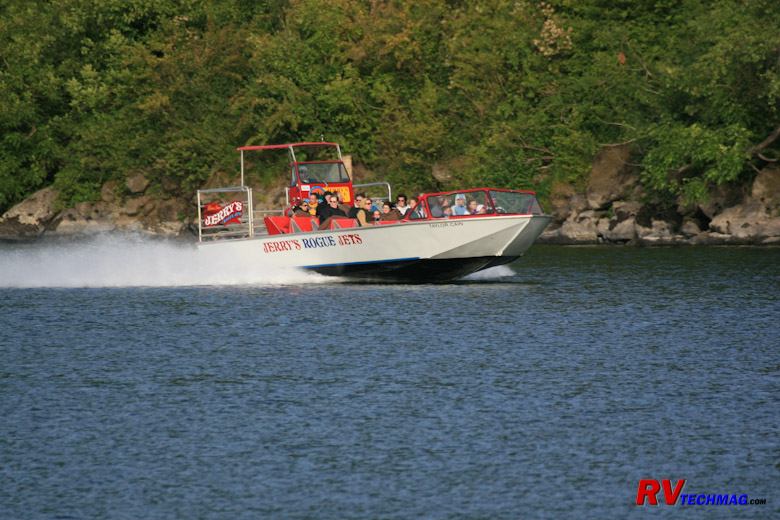
Rogue River Jet Boats
Gold Beach is located about 29 miles north of Brookings. Gold Beach is located where the Rogue River enters the Pacific Ocean.
The Rogue is a wild untamed river and jet boat tours leave this area to go upstream through the canyons, rocks, and rapids. If you are looking for
scenic adventure without having to paddle this trip would be ideal for you. We stayed in Gold Beach at the Four Seasons RV Resort which overlooked
the Rogue River.
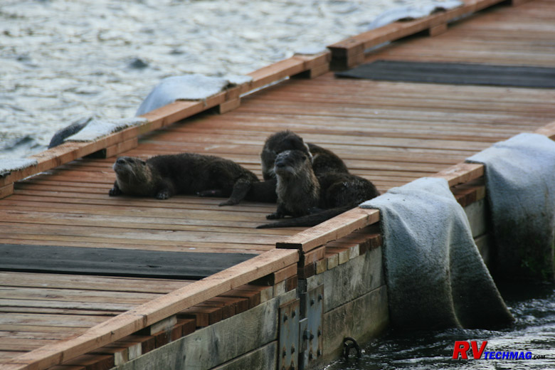
River Otters on the Pier at Four Seasons Campground
Four Seasons is tucked back along the river and 6.5 miles away from town. The drive from Gold Beach along the river is very
twisty. I recommend to go farther up US-101 and take the Edson Creek Road, which is much better for a large RV. There was a family of River Otters
living on the banks by the RV resort that were casually sunning themselves on the RV park's piers. You can get access to the jet boat tours right
from the RV park. Check out the park's website at www.fourseasonsrv.com for more details. Other parks of interest in the area are Oceanside RV Park
and Turtle Rock Resort. As always, check out reviews on any Gold Beach RV park at
www.rvparkreviews.com or any other campground reviews website.
When leaving Gold Beach you'll encounter Humbug Mountain to the north. The highway runs straight up to the cliffs of the
mountain and then winds it's way around the mountain before breaking out onto the clear coastline to the north. Farther on you'll past through
Port Orford and then Cap Blanco before arriving at Bandon.
Bandon
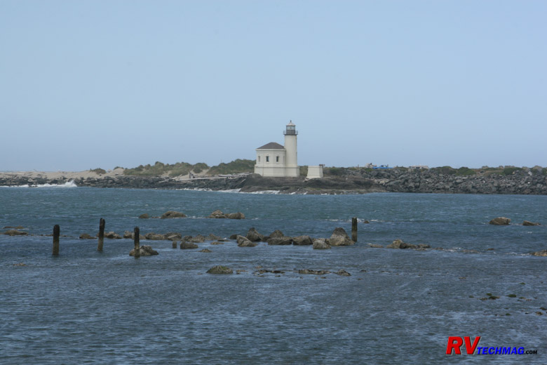
Bandon Lighthouse
Bandon is just 48 miles north of Gold Beach and is where the Coquille River meets the Pacific Ocean. Bandon has some great
beach areas, tidal pools, and rock formations. I find that it's easiest to park on 11th Street SW near the high school, then unhook the toad and drive
to the South Jetty State Park at the mouth of the Coquille River directly across from the lighthouse. A drive to the downtown visitor's center will
give you armloads full of literature and you can follow 1st street along the Coquille River and past the fish markets to the South Jetty State Park.
This park has great beach access as well as full facilities.
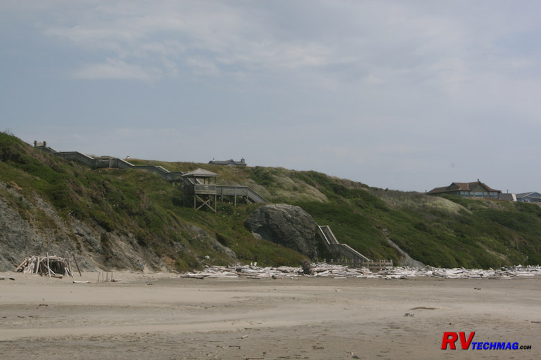
Viewing Platform and Stairs to the Beach
At the west end of 11th Street is a viewing platform and steps down to the beach allow access to tidal pools and rock
formations. It's directly west of where you parked the RV but take the toad. While there is adequate parking at the viewing platform it's not very
navigable for a large Motorhome.
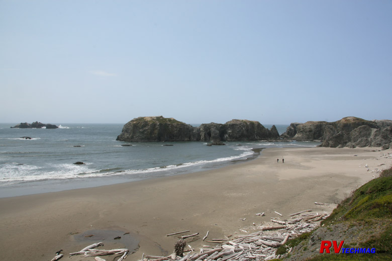
Beach Area Below the Viewing Platform
Various tidal pools can be accessed by descending the steps at the viewing platform. This is another area best visited at low
tide. Bandon has always been a mid-day stop for us so I can't comment on any RV parks that may be in the areae.
Florence
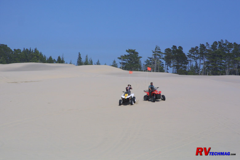
Dune Buggies Near Florence
Heading north from Bandon will take you to Coos Bay which is a large lumber shipping port. Here you'll see lots of spruce
logs stacked up in the many yards next to the Coos River as they are being prepared for shipment via sea. Coos Bay is also the start of the Oregon
Dunes National Recreation Area. The Oregon Dunes are roughly a 50 mile stretch of white sand dunes that line the coast and reach to the sea. The
majority of these are reserved for non-motorized recreational use but a section between Reedsport and Florence, near Dunes City, is dotted with
places where you can rent dune buggies and ATVs to go play in the sand. The sand is very white so on sunny days you do have to watch carefully or
you can get snow blind and not see what's in front of you. Still it's a blast to go play in the sand.
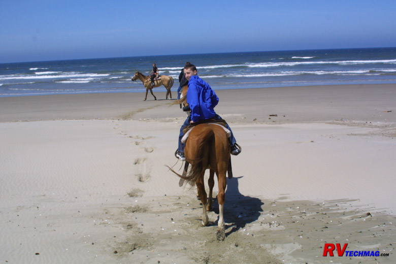
Trail Rides on Beach
On the northern outskirts of Florence is C&M stables where you can take a trail ride through the wind sands and beach grass
and ride on the beach. This is a popular early morning ride with many tourists. The website for C&M is
www.oregonhorsebackriding.com.
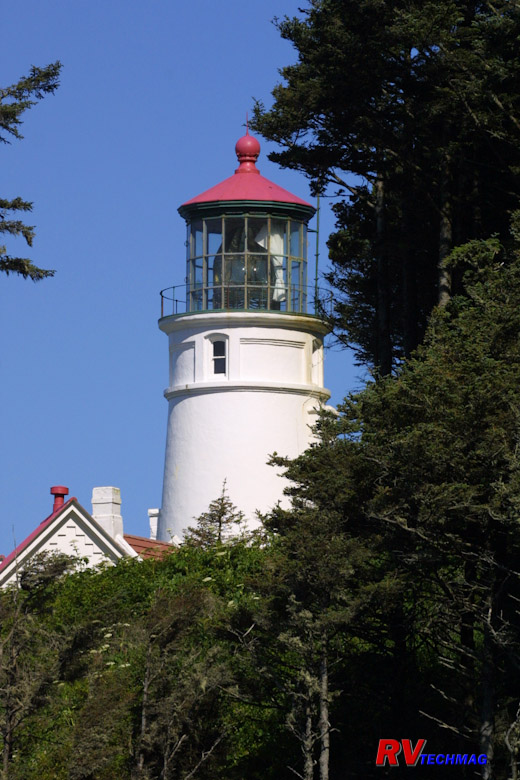
Heceta Head Lighthouse
13 miles north of Florence you'll find the Heceta Head lighthouse. This is one of the most photographed lighthouses in the
country. It's actually a state park (see www.oregonstateparks.org/park_124.php
for details). Satellite GPS navigation has eliminated the need for lighthouses but Heceta Head still shines it's light every night. The lighthouse
keeper's house is now a bed and breakfast. The coastal highway between Florence and Heceta Head follows the shoreline and also passes by Sea Lion Caves.
This is commercial property where you pay admission and they take you down in an elevator to see the caves. However, not many sea lions are in the
caves in summer. Most are out on the rocks along the shore. Their website is
www.sealioncaves.com for more information. Nice overlooks in the area afford good views of the lighthouse from the north.
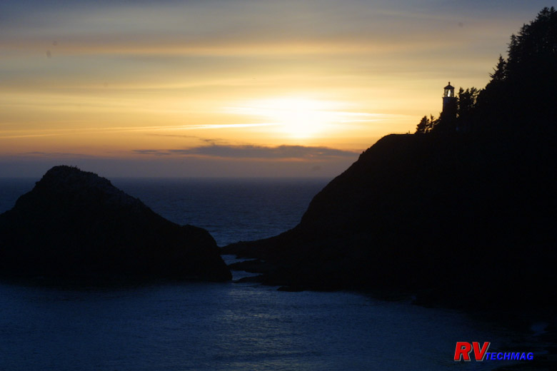
Sunset at Heceta Head
Heceta Head is located at the mouth of Cave Creek. US-101 crosses the creek via a bridge. A trail leads from the bridge down
to the beach below. If you want a great evening sunset shot park your vehicle ion either end of the bridge. Then walk with your camera and tripod to
the center of the bridge and set up there. There is a walking area so it's safe. When the sun sets over the ocean you can use it to silhouette the
lighthouse and if you time your shot just right you can capture the burst of light as it passes by.
27 miles farther north you'll come to Newport. Newport is where the Elk River dumps into Yaquina Bay. The Yaquina Head
Lighthouse is another popular site here. At 93' it's the tallest in Oregon. Newport has a shopping area and Aquarium Village, which is a tourist
centered shopping center. After passing through Lincoln City, you'll arrive at Tillamook, which is another 70 miles from Newport. Many of these
seaside villages will feature seafood eateries. Oysters, in particular, are popular along this stretch of coast.
Tillamook
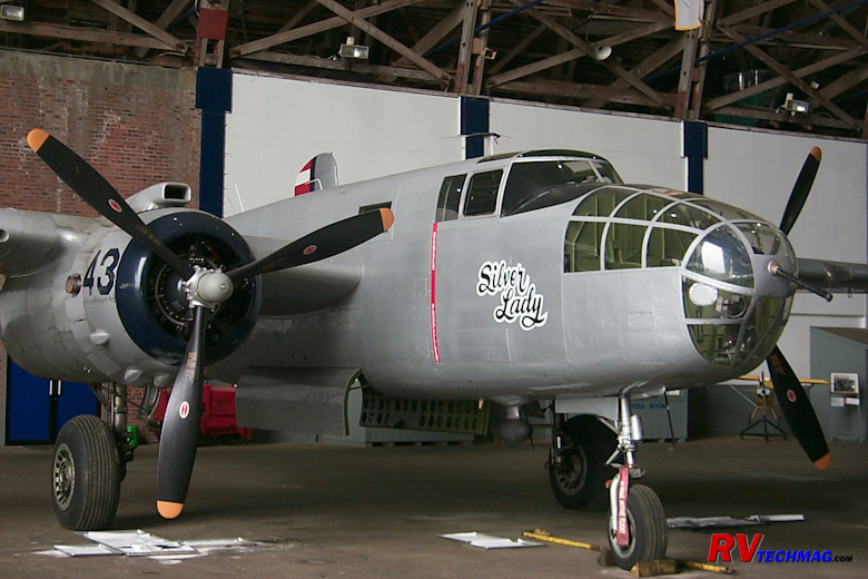
B-25 in Blimp Hangar Museum
Tillamook is known for two things - the Tillamook Cheese Factory and the Blimp Hangar. The Blimp Hangar is the largest w
ooden structure still standing. The Navy used it to house 6 blimps during World War II for anti-submarine patrol. This huge building can easily
be seen when passing by on US-101 and you can tour the hangar. There is room for RV parking and a lunch counter as well. In addition to the
display and story behind the hangar itself, the hangar contains a large selection of aircraft - mostly naval related. You can view an F-14
Tomcat, approximately 30 WW-II aircraft, and other exhibits. There was a second hangar but it was used to store hay and one night it started
on fire so you can pretty much guess why there's only one left now. Details can be found on their website at
www.tillamookair.com.
The Tillamook Cheese factory is another popular stop. It's a very popular attraction and it has a huge parking area where it's
easy to park an RV. The factory tour is free, and you'll be able to sample free cheese. However, you'll probably get hooked and want to buy cheese
or their excellent ice cream in their store, which also handles almost any gift, souvenir, or snack that you'll ever need. Their website is
www.tillamookcheese.com for more information. It's located on the north end of town
right on US-101. In addition to the small blacktop lot next to the building there is a large gravel lot where RVs and semis can easily park. At the
edge of this lot is a small visitor's center. Be sure to stop there to pick up informational pamphlets on the area. While there pick up a map to
Oceanside, which is a small community right on the ocean with excellent beach access. Leave the RV in the parking lot at Tillamook Cheese and take
the toad there and do some beachcombing.
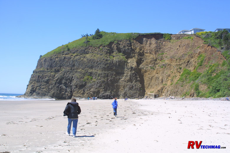
Oceanside Bluff and Tunnel
When you go to Oceanside it will be helpful (although not mandatory) if you bring a flashlight. There are two large beaches
at Oceanside that are separated by a large bluff that reaches to the ocean. You can't go around the bluff but they made a walking tunnel through it
to connect the two beaches. It's dark in the tunnel but if you follow the person ahead of you and look to the light at the end of the tunnel you'll
make it. However, if you are tall you need to watch out because there is one area where a 6' person will need to duck a little bit. That's where the
flashlight comes in handy.
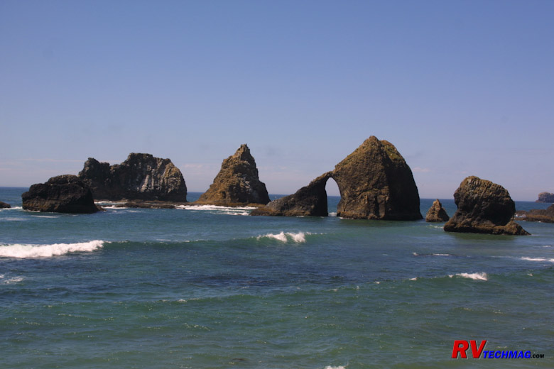
Oceanside Seamounts
There are tidal pools on both sides of the bluff but the best ones are on the north side so you do need to cross over via the
tunnel to get to them. Various rock formations will be found just off shore and you'll probably see plenty of shore birds in the area.
Cannon Beach
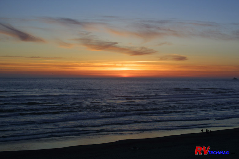
Sunset at Cannon Beach
Cannon Beach is 40 miles north of Tillamook. It's an interesting drive as you cruise north along the shoreline on US-101,
passing through Rockaway Beach, Manzanita, and many oyster beds and seafood opportunities. Cannon Beach is a very large and wide beach and while there
are always people combing the beach, it's so massive that it's never crowded. Dogs are allowed on the beach as well and there's plenty of room to let
them run.
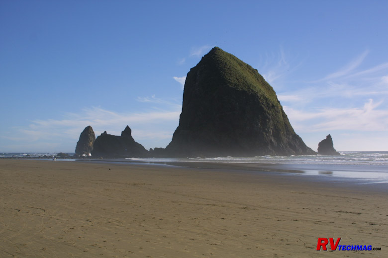
Haystack Rock
The main attraction at Cannon Beach is Haystack Rock, which is a 265' tall monolith jutting out of the ocean's floor. At
high tide it's impossible to reach it but during low tide you can walk out to the rock and view the various tidal pools that surround it on
the east side.
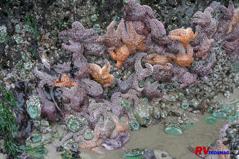
Haystack Rock Tidal Pool
There are a number of tidal pools around Haystack Rock. The area is a protected nesting area for Puffins, Cormorants, and
other shore birds so climbing is not allowed. But the tidal pools showcase a plethora of mariner life, such as starfish, anemones, razor clams,
and other mollusks.
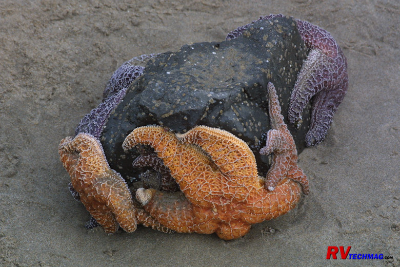
Starfish at Haystack Rock
The rocks surrounding Haystack are generally covered with large starfish, sometimes reaching as 18" in spread and coming in
many colors. The entire area is great for exploring. For more information, check out www.cannonbeach.org/ to see what the area offers and check out
the various schedules of events. Cannon Beach is known as sort of an artist's colony and one popular event is the annual sand castle contest, which
features some world class sand castles. You can also access tide tables on this site to plan the best times to explore the beach.
We stay at the Cannon Beach RV Resort when in town. It is a nice RV
park and has easy access to downtown toad parking. Cannon Beach's main drag through town is Hemlock Street. Walking along Hemlock Street will allow
you access to many shops as well as beach access. Two good places to eat are
Pizza a' fetta and Morris' Fireside Restaurant. Each has excellent food!
In addition to it's own beach, Cannon Beach is near to Ecola State Park, and Hug Point. If you want to walk up and grab a seafood snack, or some seafood
to go, Ecola Seafoods has a great little shop right on Spruce Street. I'm always good for a
Dungeness crab cocktail when there at the bare minimum.
Where to go Next
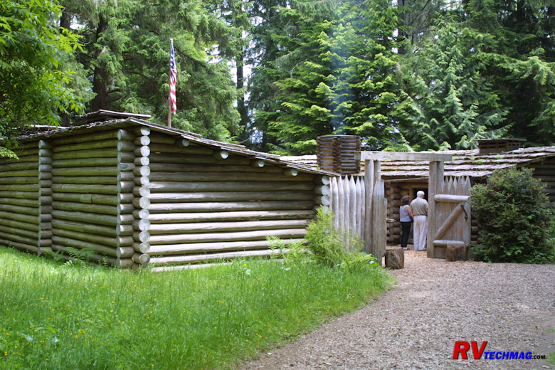
Fort Clatsop
Okay, now that we've traveled up the coastline to Cannon Beach we have some options as to where to go next. If you want to continue
on and travel the Washington coastline you can stay on US-101. That will take you north to Astoria, which is at the mouth of the Columbia River. This can
also be a popular day trip from Cannon Beach to visit Fort Clatsop,
which is the site where Lewis and Clark spent the winter of 1805-1806. Traveling north on US-101 will take you over the long bridge that spans the
Columbia River and you'll wind up in Washington on the other side. From here you can head north on US-101 and skirt the Olympic Peninsula. Keep in mind
that the Washington coastline is very much different than the Oregon coast. Whereas Oregon has great beaches and sea mounts, they quickly disappear on
the Washington coast. However the Olympic peninsula is spectacular in it's own right and we'll cover that in another chapter.
Another option is to take US-30 east from Astoria. That will take you alongside the Oregon side of the Columbia River. This is
recommended over the Washington side because it's much easier to navigate in a large motorhome. When you get to Longview, you can cross over the bridge
to Kelso and connect with I-5. I-5 can run you back south towards Portland or north to Seattle. If you want to see Mount Saint Helens, which is one of
the highlights of any pacific northwest trip, then this is a good route to take. If you are planning on doing a loop of the Olympic Peninsula then I'd
suggest heading north on US-101 first and then picking up Mount Saint Helens on the way back down on I-5.
If you are not interested in Mount Saint Helens or the Olympic Peninsula at this time but want to see the Columbia River Gorge,
I would suggest taking US-26 from just north of Cannon Beach. That will take you through Portland and then into the Columbia River Gorge. However, if
you have the time I would recommend heading up US-101 to see the Olympic Peninsula, then work your way back down I-5, picking up Mount Saint Helens on
the way, and then heading east through the Columbia River Gorge. Naturally this all depends on which direction you are coming from. There's so many
possibilities that one route won't fit everyone. Plus this is always a good excuse to go back and revisit this area in the future.
A Quick Side Trip

Crater Lake
Before we go one I think we need to side track a little bit. If you began this trip at Brookings the southern end or traveled up
through the California redwoods, you may have decided to take a detour up to Crater Lake National Park. If so you can get there via US-199 from Crescent
City, California or cross over at Coos Bay via Oregon 42 and 138. If you do this in a loop you'll miss lots of great Oregon coastline between Brookings
and Coos Bay though, so you may want to consider returning the same way you go out. we'll have more details on Crater Lake on the next page. If you
aren't interested, and want to skip Crater Lake, just return to the index and then select the Washington Coast page.
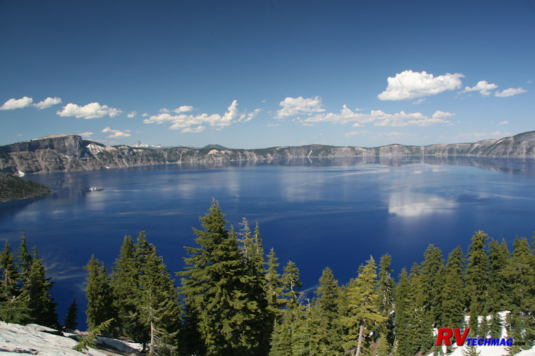
Crater Lake
Crater Lake is one of the unique jewels in the National Park system. Crater Lake is located high up in the Cascades. It's
basically a dormant volcano that blew its mountain top off, creating a large crater. Because of its unique location it receives an amazing amount of
snowfall every winter. Because of its cool high altitude the snow on the rim melts very slowly. In fact the rim roads around Crater Lake are generally
not completely plowed until well into July, although access roads to the rim and facilities are open much earlier. 10 to 15 feet of snow is typical
and the annual snowfall averages 533 inches, although the one year we went they had 655 inches that winter. The rim is filled with water. Each winter's
new snowfall adds to the water level but each summer's evaporation equals that amount so the water level stays very constant from year to year. It's
also constantly cold because at 1,943 feet in depth it's the ninth deepest lake in the world so the water temperature remains fairly constant and it's
always cold. Later in July you can take a boat launch over to Wizard Island, which is a small volcanic island rising from the lake. More information
on Crater Lake can be obtained from the National Park service website at www.nps.gov/crla.
Crater Lake is accessible from the south end via I-5. If coming up I-5 you can exit at Medford and take Oregon 62 north to
Crater Lake. If you are approaching from the California redwoods on US-199 then you'll connect with I-5 at Grants Pass. From there you can head south
a few miles to Gold Hill and take Oregon 234 over to Oregon 62 and then head north to the lake. Crater Lake has a campground but it's really not
designed for a large class A motorhome. We chose to stay at Diamond Lake RV Park, which
is just north of Crater Lake. It's very big rig friendly and nearby other great scenic areas as well.
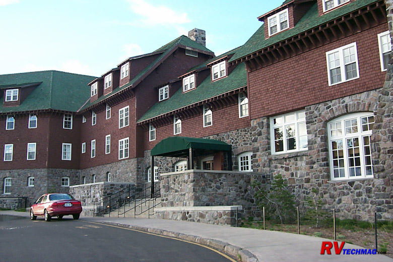
Crater Lake Lodge
The Crater Lake Lodge offers dining and accommodations. It is built right inside the rim so the view is spectacular. It's
nearby the NPS visitor's center and concessions and also close to the park campground, which features laundry facilities and a general store and
snack bar. It is located on the south end of the lake and the roads are open to this area from the south earlier in the year. The loop road around
the lake won't be open until later July but if the last winter's snowfall wasn't too severe the west half road will be open around July 1st. If
that road is open you can easily travel between the north and south ends of the park without taking the long detour. This will be helpful if you
are staying at Diamond Lake to the north. Keep in mind that the boat launch will not be open until later in July though because the road to the
launch is to the east of Crater Lake Village so if you are planning on taking the boat trip to Wizard Island plan your trip accordingly.

Union Creek, Next to Beckie's
As mentioned earlier, Diamond Lake RV Resort has more to offer than just Crater Lake. It's right next to Diamond Lake but
it's located on Oregon 138. Oregon 138 is strewn with US Forest Service sites. While Crater Lake is an awesome spectacle to see, there's actually
more to see and do along the many USFS sites along highway 138. The office at Diamond Lake RV Resort gave us plenty of great information. There
were lots of great hiking trails and waterfalls along 138 and the highlight was Toketee Falls. They also turned us on
Beckie's Restaurant, which served excellent home made pies, which
is always one of my biggest weaknesses. After having supper there and plowing down a few pieces of pie I was forced to take some extra back to the
RV. The restaurant is located in a nice scenic location, right alongside Union Creek, just south of the junction between OR-230 and OR-62. A nature
walk trail is provided along with viewing platforms over the rapids and cascades.
Our entrances to Crater Lake have always been from the redwoods. There are a ton of grades as you approach Crater Lake and
you won't be setting any speed records climbing them with a large RV. When we left Diamond Lake we headed west on Oregon 138. It turned out that
138 was a much easier drive without the huge roller coaster grades that we experienced coming up 62 and 230. It was also more scenic as it gently
wound through the Umpqua National Forest until we arrived at I-5 at Roseburg, Oregon. From there we chose to continue west to Coos Bay on Oregon 42.
That part was fine but we wanted to go to Bandon so we exited 42 at Coquille and took 42S to Bandon. That was a mistake. The road was very narrow
and had a constant ditch along our right side all of the way. Meeting oncoming traffic meant you had to be very careful. I don't think we'll take
that way again. Next time we'll head to Coos Bay via Oregon 42 and fit Bandon into out schedule some place else. Ideally we would probably head up
the coast to Coos Bay, then head over to Diamond Lake, return the same way, and then continue on northward up the coast.
The Washington Coast
The Washington Coastline is different than the Oregon coastline. While the Oregon coastline is noted for its wide beaches and
sea mounts, the Washington coastline changes rapidly as you head north. The road generally does not follow right along the coastline as in Oregon.
The area is heavily used for logging so vast forests of Douglas Fir cover the area. The Olympic Mountains act as a barrier in the northern portion
and trap the moisture coming off the Pacific Ocean. This climate is excellent for growing dense forests full of large trees. In fact there is a
rain forest in Olympic National Park just for that reason. Because the Olympic Mountains form the center of the Olympic Peninsula, there are no
roads through the interior. Therefore most coastal trips will head east at the northern end of the peninsula and head to Port Angeles and points
farther east.
Kalaloch
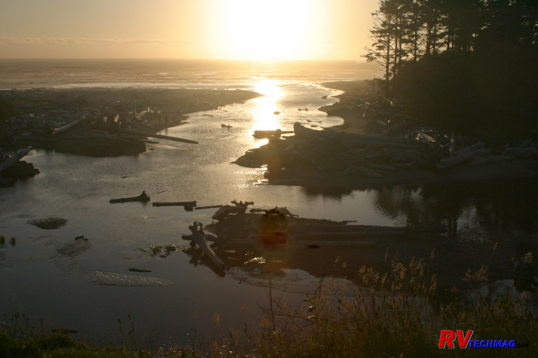
Kalaloch Sunset
Immediately after crossing the bridge at Astoria you'll be given a choice. US-101 heads left to Seaview before doubling back
around the Wallapa National Wildlife Refuge to continue heading north. That's the long way around. Instead, take the 401 shortcut to Naselle and
then head north, saving some time and mileage. Farther up you will reach Aberdeen and Hoquiam, which are located along Gray's Harbor. As you continue
north you'll pass by many forests of Douglas Fir. This area is used heavily for logging and forestry.
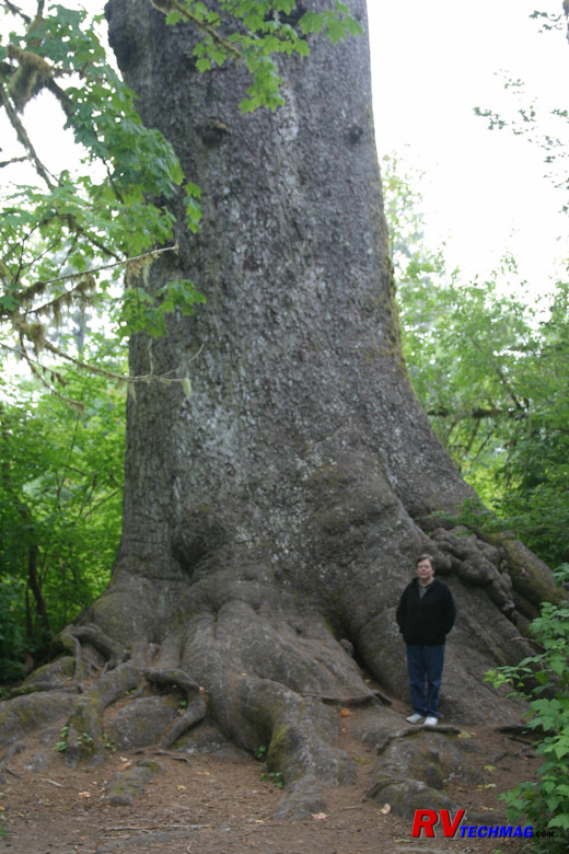
World's Largest Spruce Tree
Another 42 miles will bring you to Quinault, Lake Quinault is part of Olympic National Park. There is a campground there that
is located next to the world's largest spruce tree. This tree is 191' tall, has a 96' spread, and the trunk is 58' around. It's about 1,000 years old.
The campground is part of the
Lake Quinault Lodge and is within the park. While it's a nice campground, we opted for one closer to the coast.
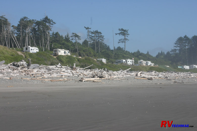
South Beach Campground
Immediately south of Queets is Kalaloch. There is a nice little lodge there but camping is limited to tents and the very smallest
RVs. A few miles south of Kalaloch is a US Forest Service campground called South Beach. It's nothing more than a series of terraced overlooks that look
out over the Pacific Ocean. You parallel park so you have an excellent view out the side of your coach. Fire pits and picnic tables are provided and a
waterless rest room is provided. It's boondocking but the view is worth it.
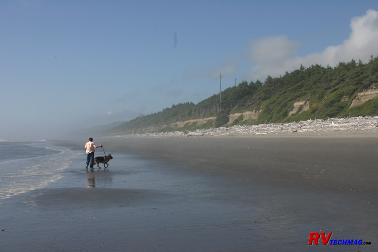
South Beach
The beach extends for many miles. You can take strolls along the beach with the ocean on one side and forested bluffs on the
other side. Chances are you'll see bald eagles perched on snags. Many small streams run down from the bluffs and beachcombing at low tide can be
rewarding. High tide is another situation however. The stacks of logs that are piled up between the beach and the bluffs show you just how far the
surf can come crashing in.
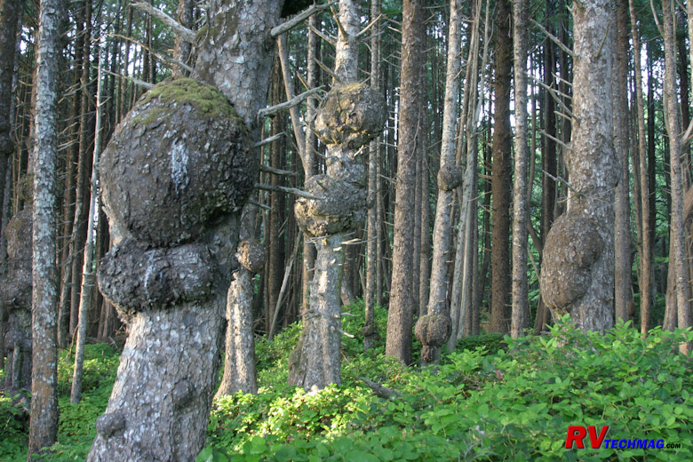
Spruce Burls
If you take the toad north from South Beach along US-101 you'll find four beach access roads that are spread out over the next
few miles. These roads will access parking areas with trails that will take you down to the beach at key areas of interest. As these trails pass
through the dense forests you'll see a number of spruce and fir trees with large burls on them. The moist environment encourages this growth and
rivals the redwood burls seen in California's dense redwood forests.
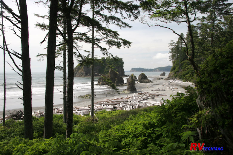
Ruby Beach
One such beach is Ruby Beach. The northernmost of this series, Ruby Beach has a stream that drains into the ocean, forested
approaches, and seamounts. The bleached driftwood logs are typical of this area. If a tree topples and is washed out to sea, the waves will return
it to the shore. The sun and weather contribute to a bleached appearance after time.
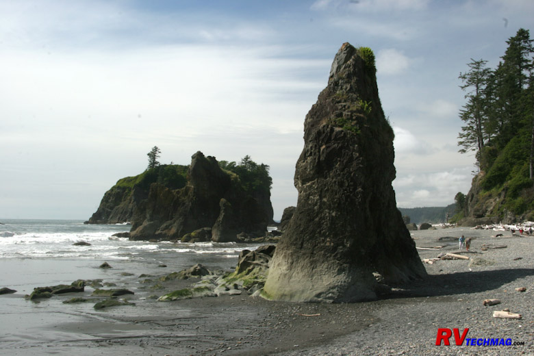
Seamounts at Ruby Beach
The seamounts at Ruby Beach guard tidal pools where marine life can be seen at periods of low tide. The largest one has a
small forest growing on its top where shore bird colonies exist.
Hoh Rain Forest
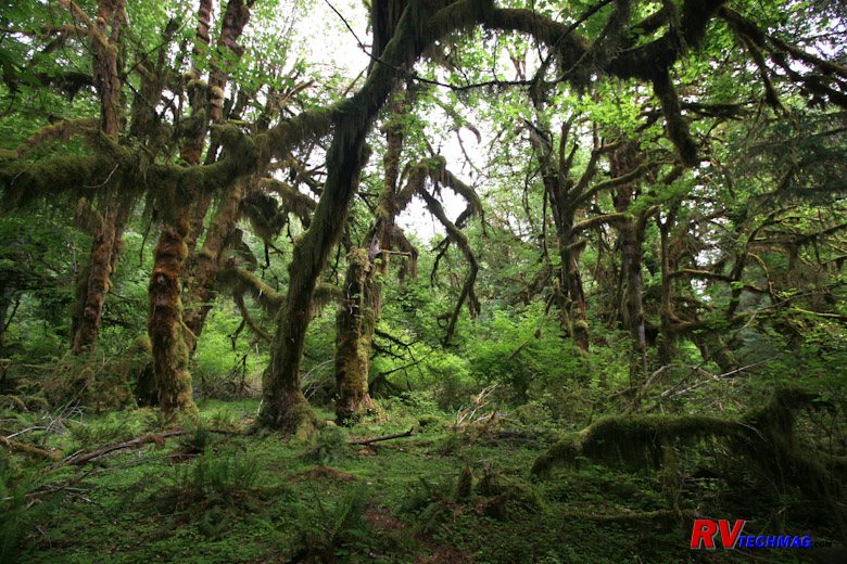
Hoh Rain Forest
Heading north up the coast from Kalaloch, you'll meet up with the Hoh River. Following this road into Olympic National Park
will take you to the Hoh Rain Forest portion of the park. Olympic National Park is a large area where there are no interior roads. The Olympic
Mountains and their wildlife are basically unreachable for the most part unless you are a hardy adventurer. There are three key areas though where
the park service has established visitor centers for the average tourist. One of these is the
Hoh Rain Forest.
The Hoh Rain Forest unit of Olympic National Park receives between 140 to 170 inches of rain every year. Naturally, things
tend to grow when that kind of moisture is present. Unlike a Tropical Rain Forest, which is found in hot climates, this is a Temperate Rain Forest
because it doesn't get that hot on the Olympic Peninsula. Most visitors didn't even know that such a place existed let alone finding it in Washington
so this can be a very interesting visit.
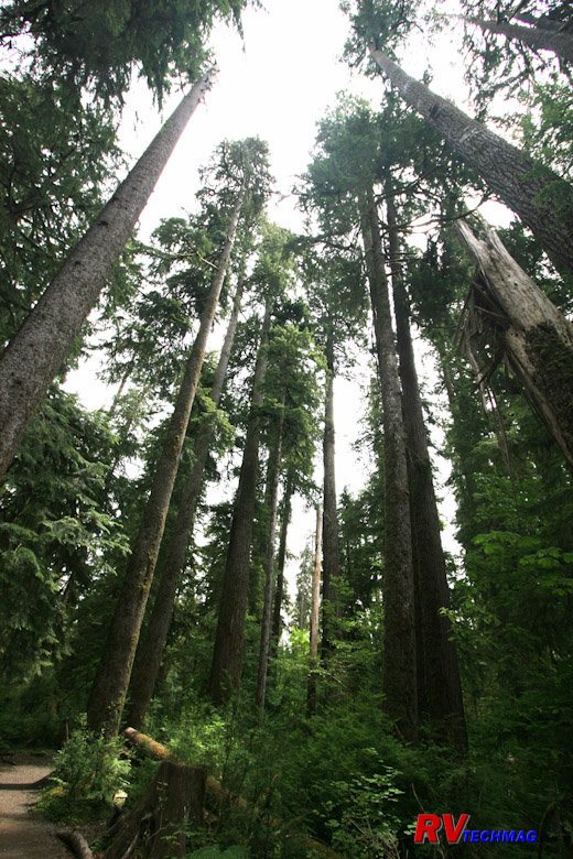
Tall Sentinels
We took our motorhome down the road to the visitor center for the Hoh Rain Forest. It was tight parking and a long winding
road through the forest but it was worth it. After parking we found two trail loops. The long loop would have taken too much time but the shorter
Hall of Mosses trail was just right. So we ate lunch in the RV and then took off for a short hike.
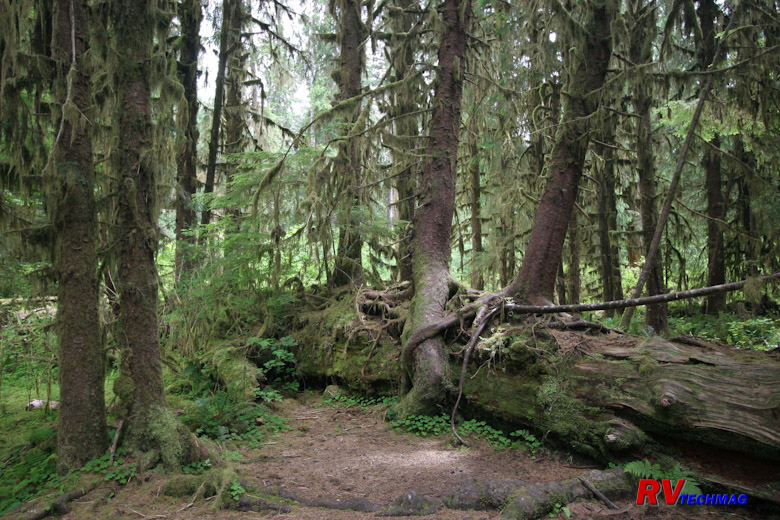
Collonades
The Hall of Mosses Trail is a short 0.8 mile loop through old growth temperate forest with only a 100' gain in elevation. It
winds its way through moss covered trees and colonnades. Colonnades are trees that have fallen. The moist conditions allow them to rot and hold moisture.
Seeds from neighboring trees fall on them and the new trees actually take root in trunk of the fallen tree and begin to grow without ever touching the
ground.
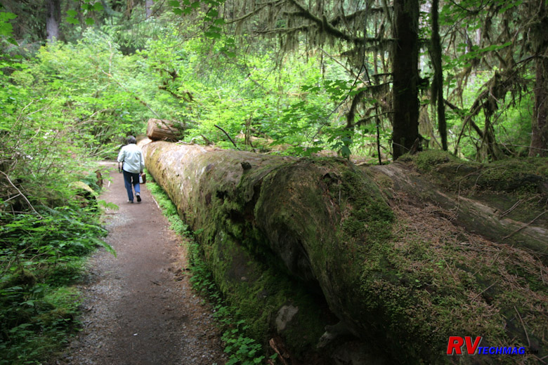
Hall of the Mosses Trail
The trail passes through many unique areas. Fallen trees line the path and you will find wildlife in this area. Woodpeckers,
banana slugs, and deer and elk frequent the area.
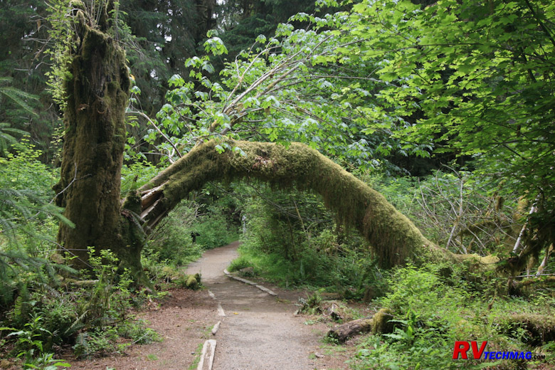
Arched Tree
Heading back to the visitor center you'll notice many different shapes of trees. Various arches and other shapes are formed as
these trees twist and turn to change with their environment.
Moving On
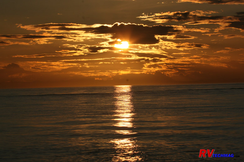
Straits of San Juan
US-101 continues north after exiting the Hoh Rain Forest. It passes through Forks along the way. There is an RV park in Forks
called Forks 101 RV Park that is handy to the Hoh Rain forest as well as Rialto Beach
and Cape Flattery but it appeared a bit on the tight side and they have a very strict policy regarding dogs so we passed on it. At this point US-101
ends its northerly trek and takes a turn to the east along the north coast of the Olympic Peninsula. If you want to drive out to Cape Flattery you can
do it at this point. There is a campground at Neah Bay on the Makah Reservation but I am not familiar with that area (until next trip ) so can't comment
on them. Check the various campground reviews before committing to stay there. Otherwise you can just follow US-101 to the east towards Port Angeles and
Port Townsend.
Port Townsend and the North Coast
US-101 takes a turn to the east once it reaches the end of the Olympic Peninsula as it skirts around the Olympic Mountains.
After passing through dense forests you will reach Crescent Lake and re-enter the boundaries of Olympic National Park. A very scenic drive eventually
gets you to Port Angeles, which is a gateway and jumping off point if you want to boat over
to Vancouver Island and see Sidney or Victoria. We haven't stayed here but the Salt Creek Recreation Area appears to have had favorable reviews by
others. Instead, our personal choice is to stay at Fort Worden in Port Townsend.
Sol Duc and Crescent Lake
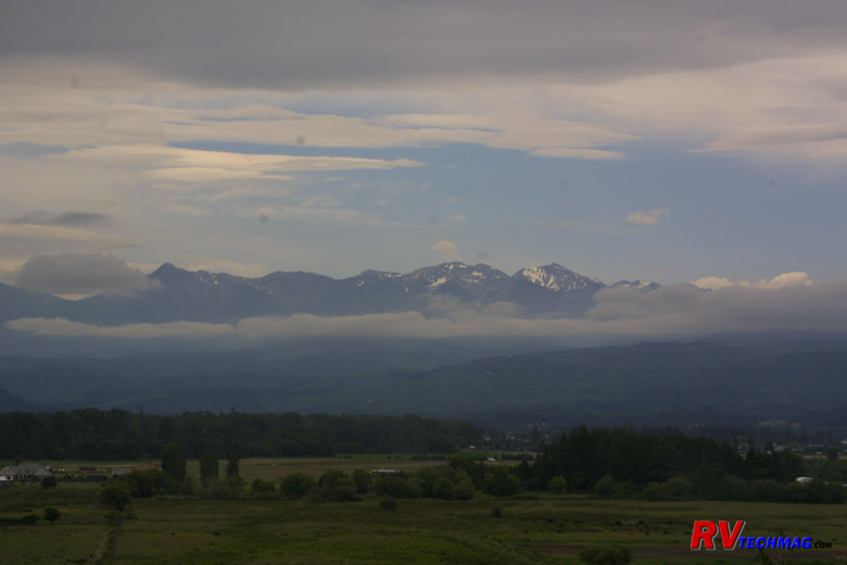
Sol Duc Falls
Just west of Crescent Lake is Sol Duc. Sol Duc is an area with hot springs and the
Sol Duc Hot Springs Resort features
hot spring pools as well as lodging and food service. Just up the road is the entrance to
Sol Duc Falls. There is a small parking lot where
you can park the toad and take a short hike will take you deep into the forest to Sol Duc Falls. You may find blacktail deer as well as other forest
wildlife during this walk.
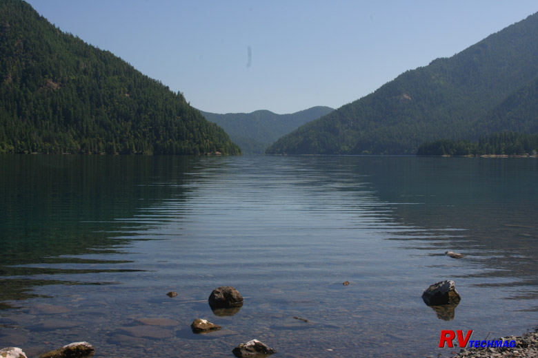
Lake Crescent
Lake Crescent is located between the Olympic Mountains and Mount Storm King. It's 12 mile long crescent shape was carved by
glaciers and runs east to west as US-101 winds along it's southern shore. This area is a twisty 35 MPH road but just fine for a large motorhome.
Just enjoy the view! The historic
Lake Crescent Lodge was built in 1916 and was the place where Franklin Delano Roosevelt stayed and inspired him to preserve this land as a
national park.
Hurricane Ridge

Hurricane Ridge Wildflowers
Hurricane Ridge is the third (after Hoh Rain Forest and Sol Duc Hot Springs) visitor center in Olympic National Park. It
accessed via Hurricane Ridge Road from Port Angeles. This road does a long steady climb up the mountain and back down again. It is not recommended
for large Vehicles. In fact one tourist lost his life when his motorhome's brakes faded coming back down. It's best to park the motorhome and take
the toad up. It's a 45 minute drive to the top and visitors will find a visitor center, a snack bar and rest rooms and awesome views of the
surrounding mountains. If you are traveling in late July you'll be there during the when the mountain wildflowers are blooming. The fields and
slopes will be colored with vivid hues of wildflowers.
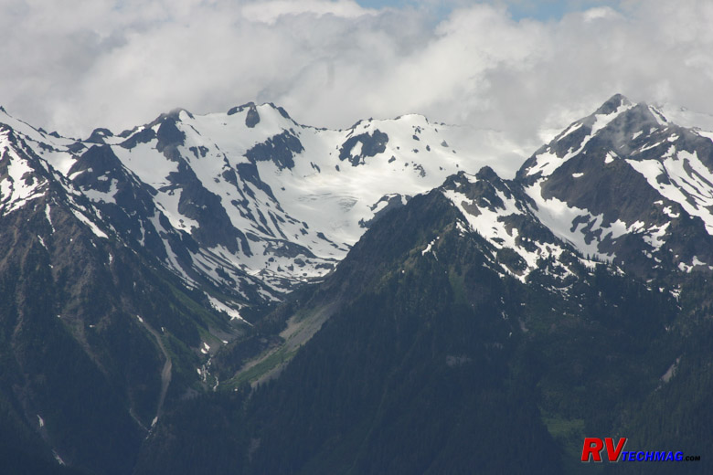
Carrie Glacier From Hurrican Ridge
At the top you'll be at 5,200 feet of altitude surrounded by peaks and exposed glaciers. Many hiking trails are in this area
but you do need to be prepared. Hurricane Ridge is named for its high winds and any kind of weather can blow in at a moment's notice. Just because
it's July doesn't mean it can't snow at that altitude.
Sequim
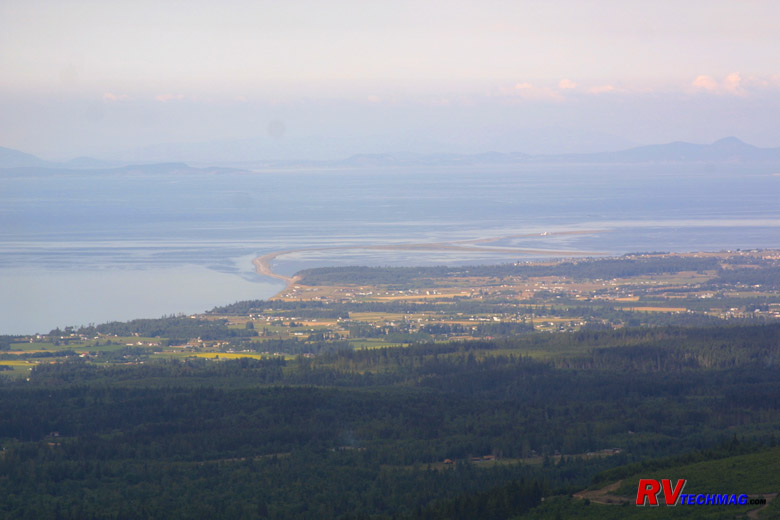
Sequim and the Dungeness Spit
Sequim (pronounced "Skwim") is located where the Dungeness River empties into the straits of San Juan de Fuca. At this point
all of the sand that washes down from the Olympic Mountains forms a finger of land called the Dungeness spit that extends into the water. This forms
the Dungeness Bay, which is a wildlife refuge for seals as well as birds. You can take the hike out onto the spit to observe the various wildlife
but the side of the spit that faces to the bay is off limits because it's a seal pup nesting area. It begins at the
Sequim Bay State Park and culminates at the lighthouse at the end of the
two mile hike.

Olympic Mountains from Sequim
Sequim is a native American word for "quiet waters." It's also know by pilots as "The hole in the clouds." Sequim lies in the
rain shade of the Olympic Mountains. While the coastal area gets tons of rain every year Sequim gets as much sunshine as Phoenix, Arizona although
the temperatures are more moderate. In fact, a cactus grows right outside city hall to help illustrate that point. The farmland surrounding Sequim is
known for growing lavender. An annual lavender festival occurs every June when the fields are bright violet in color. For more information on
Sequim, check out www.visitsun.com for more information. It's an easy drive from Port Townsend.
Olympic Game Farm
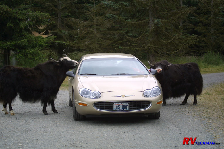
Yak
We've seen so much natural beauty and wildlife in our travels that zoos and game farms just don't appeal to us any more. There
is one exception though and that is the Olympic Game Farm, which is located on the outskirts
of Sequim. This was started by Lloyd Beebe. Lloyd was renowned animal trainer who just plain understood how to communicate with wild animals. When Walt
Disney had problems getting a cougar to act properly for one of his films he called upon Lloyd, who got Walt the shots he needed. That began a long
relationship between Walt and Lloyd and many of the animal films were shot at "The Beebe Ranch" as Walt used to call it. Lloyd had a way to recreate any
situation that would make an animal respond in the desired manner. So, rather than train the animal, he set the circumstance and the animal responded
exactly they way he wanted it to.
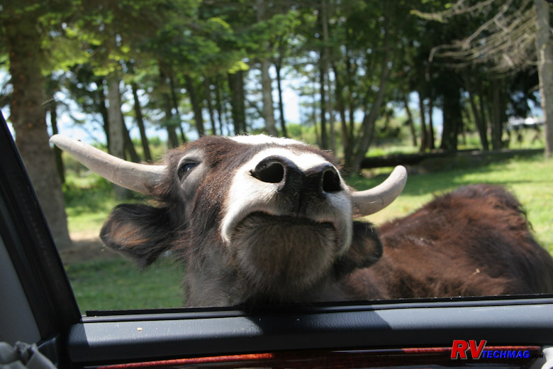
Feeding the Yak
Walt insisted that the ranch be closed to the public because he didn't want everyone recognizing the locations from his movies.
Eventually Walt died and the relationship with the new Disney regime faded so Lloyd opened his ranch to the public and established Olympic Game Farm.
You can tour the film area and see some of the sets. The television series Gentle Ben was filmed here as well but Ben passed away in the late 1990s so
he is no longer there. A drive through area is the greatest part of this adventure. You can drive amongst the wildlife and they actually encourage
feeding them. They sell loafs of bread at the front gate and we find that 4 loaves barely makes it. However, you can always go back and redrive the loop
as often as you want during the day.

Grizzly Bear
In most cases the animals will be free to roam right up to your vehicle. However, the bears are kept behind a short electrified
fence. You can get within 10' of them if they come up to the fence, which is common. These bears are former actors so they know how to perform tricks
for you in hopes of getting a slice of bread tossed their way. It's amazing how comical these guys can be.
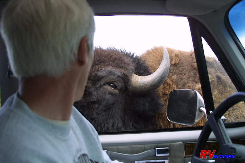
Feeding the Bison
Don't do this in Yellowstone. But it's okay at the Olympic Game Farm. The one warning they give you is that if you stop in this
area your car make get a "Bison Buff." Bison like to roll in the dirt and dust themselves to keep bugs off of them so their fur isn't exactly the
cleanest around. If they rub alongside your car they are not responsible for any scratches left. In that case you just slowly drive on through and
don't stop. You might want to leave the Ferrari home for this trip.
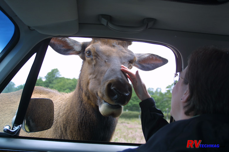
Feeding the Elk
Elk are awesome. When the last time you got to pet one? When you look out the sunroof and see that huge rack of antlers hanging
over your vehicle and then they stick that large muzzle in through your window it is impressive. Give them some bread and pet them on the nose and
they'll be your buddies for life. Needless to say, by the time you are done with this tour you'll want to vacuum all of the bread crumbs out of your
vehicle and wipe the dried bison and elk drool off of your interior door panels. But, it's worth it.
Port Townsend
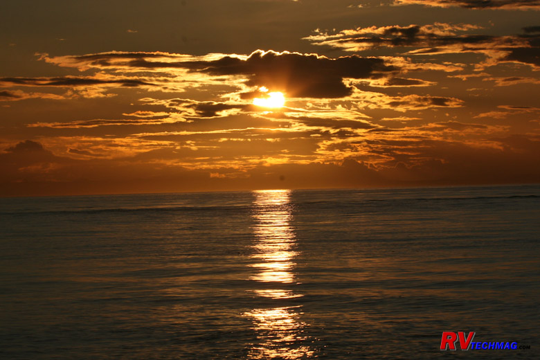
Sunset From Fort Worden
As US-101 continues it's easterly direction it eventually comes to the end and now heads south towards Olympia, completely
skirting the Olympic Peninsula like a giant J shaped hook. When it gets to the end you can take Washington-20 onto the Discovery Peninsula. It will
end at Port Townsend, which was once considered to be the capital of Washington until Olympia lobbied to have the customs port moved to them. Located
at the very end of the peninsula it's loaded with Victorian architecture and has a nice seaside village atmosphere to it.
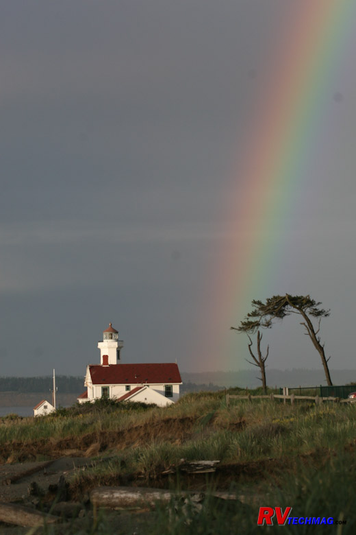
Rainbow Over Point Hudson
Port Townsend overlooks the Straits of San Juan de Fuca. Major shipping traffic passes by here and makes a right turn as it
heads south down the Puget Sound to ports in Seattle or the naval base on Bainbridge Island. The lighthouse on Point Hudson marks that spot. One
key feature at this area is Fort Worden.
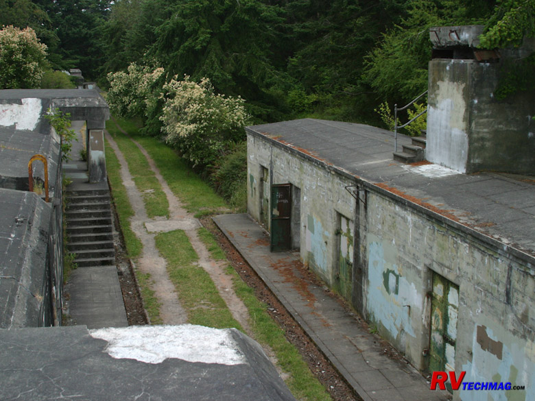
Bunkers at Fort Worden
Fort Worden was constructed after World War I and served as a coastal artillery defense fort to protect Seattle and the
Puget Sound from any invading naval force. The fort is constructed high on the bluffs overlooking the straits as well as down below on the lower
flats near Point Hudson. The fort was equipped with massive disappearing guns and mortars cable of knocking out any ships passing by.
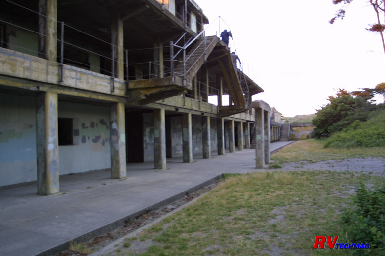
Entrance to Kinzie Battery
With the advent of the airplane as the preferred weapon, Fort Worden was no longer needed and eventually was closed. The
land reverted to the state and was made into a state park. You may remember the fort if you have seen the movie "An Officer and a Gentlemen", which
was filmed at the fort and various places in town. Fort Worden State Park has
two campgrounds. One is located up on the bluffs while the second is down on the flats. We prefer the lower campground because it's roomy and located
right next to the Kinsey Battery, which can be freely explored.
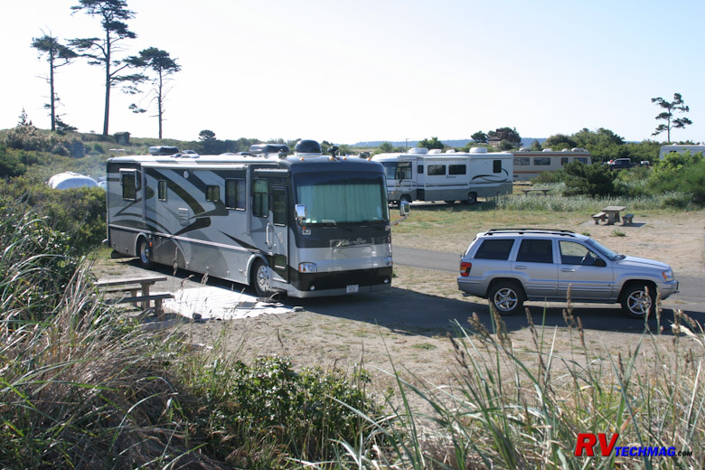
Campsite at Fort Worden
The lower campground has a number of sites near to the beach. They are all pull-through sites parallel to the access roads and
most have full hook-ups. There are steps cut into the side of the bluffs so that you can walk to the top and hike around that area to explore those
batteries and magazines. A tall grass covered berm separate the sites from the winds coming off the beach.
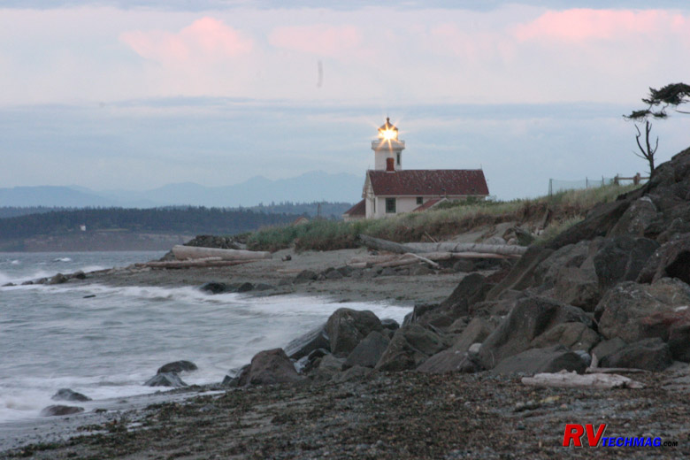
The Beach at Fort Worden Campground
Once you walk out over the berm you can explore the beach. You'll get awesome sunsets from here and you can walk down to the
Point Hudson lighthouse to the east or alongside the bluffs to the west (if it is low tide). Fort Worden can be easily accessed from downtown Port
Townsend, which has some great restaurants and shopping possibilities. Be sure to stop and eat at the
Elevated Ice Cream Company. The Elevated is right downtown on the main street (Water Street) and is rated as one of the top 10 ice cream parlors
in the country.
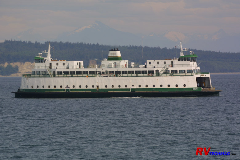
The Port Townsend - Coupeville Ferry
Washington 20 really doesn't end at Port Townsend. The road itself ends but not the highway number. The
Washington State Ferries provide access across the various bodies of water so that road
going travelers don't have to drive all the way down to Olympia and then back up the other side. One such ferry is the Port Townsend to Coupeville ferry.
This ferry crosses the Puget Sound, arriving at Coupeville on Whidbey Island, where Washington-20 continues as it drives up Whidbey Island to the north.
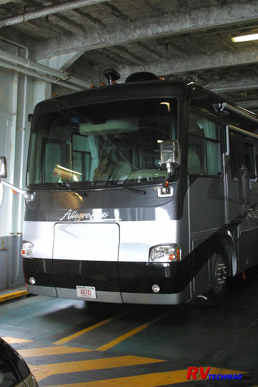
Allegro Bus on the Ferry
We were fortunate to have been able to take the old Steel Electric class ferries between Port Townsend and Coupeville. These ferries
were built in the 1930s and were found to have no longer met safety requirements so they were taken off line recently. New ferries have now replaced them.
In order to take your RV across you will need to make an advance reservation. Be sure to check out
Washington State Ferries for details before you go. There is plenty to see and do in Port
Townsend though. Be sure to check out www.enjoypt.com and
www.ptguide.com for more information.
Moving On
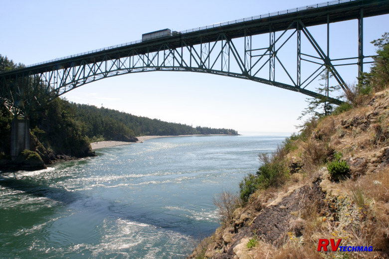
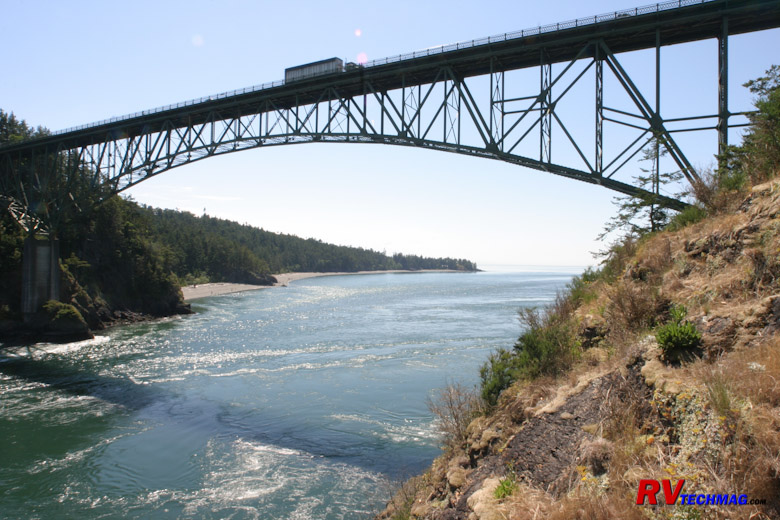
Deception Pass Bridge
When leaving Port Townsend it is possible to drive south and take US-101 alongside the Hood Canal. However, we've done that and
it wasn't that spectacular. I would recommend taking the ferry to Keystone and driving up Whidbey Island. When you get to the end of Whidbey Island a
bridge takes you over Deception Pass and connects you to Fidalgo Island. continue on Washington 20 and head into Anacortes, which is our next stop.
Anacortes and the Islands
Heading north from Keystone on Washington 20 you pass through Whidbey Island, cross the bridge at Deception Pass, and drive up
through Fidalgo Island into Anacortes. Anacortes is the northernmost point on the Whidbey-Fidalgo Island chain that borders the main coast of Washington.
You can take 20 east across another bridge to the mainland where you can either head south on I-5 or head east on Washington 20 and cross the Cascades.
Yet Anacortes is known as the gateway to the San Juan Islands. The San Juans consists of San Juan Island, Orcas Island, Lopez Island
and a number of smaller islands. San Juan, Orcas, and Lopez are all served by the Washington
State Ferry System via the Anacortes terminal. In addition it's a popular spot from which to take whale watching trips to view the resident Orca pods
in this area. More information on Anacortes can be obtained on the www.anacortes.org website.
Anacortes
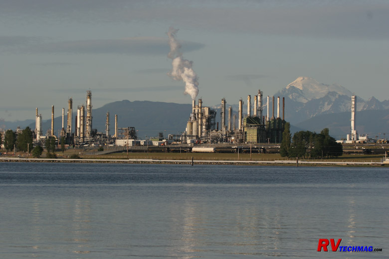
Mount Baker From Our Campsite
When staying in Anacortes we stay at Fidalgo Bay RV Resort. They have
sites right on the shore of the bay that are designed for motorhomes. You drive right up to the edge of the beach and view it all right out your windshield.
You'll see eagles flying and sea lions frolicking in the water. There is another upper campground as well but there are no views from there. If anything
you may get a view of the mud flats at low tide, which isn't that great. The Tesoro Oil Refinery is across the bay but it's not a bad view, doesn't smell
or make any noise, and it frames Mount Baker in the background. It's also nicely illuminated in the evening.
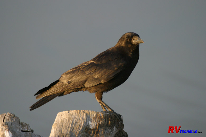
Raven on Piling
Anacortes has a number of nice restaurants and of course you can find anything seafood related when here. The Anacortes Chocolate
Factory is located at 23rd Street and Commercial Avenue (the main drag in Anacortes) and has great pies, ice cream, chocolate, and even deli sandwiches
to go. The Rockfish Grill is a popular microbrewery and restaurant, Randy's Pier 61 is a
nice dining establishment with a view overlooking the water, and Gere-a-Deli is a great spot
to pick up a deli sandwich to take along on the boat or when exploring.
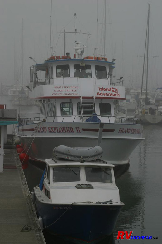
The Island Explorer II
Anacortes is also a great spot to base a whale watching cruise out of. You can go to the islands and take a tour out of Friday
Harbor but that requires getting to the island, staying there, and dealing with the ferry traffic in both directions. If you base your trip out of
Anacortes it will be more convenient. We use Island Adventures for our whale watching
cruises. They have a pretty good record regarding sightings and the Island Explorer II is fast so it can get out there and have the most time to spend
with the whales.
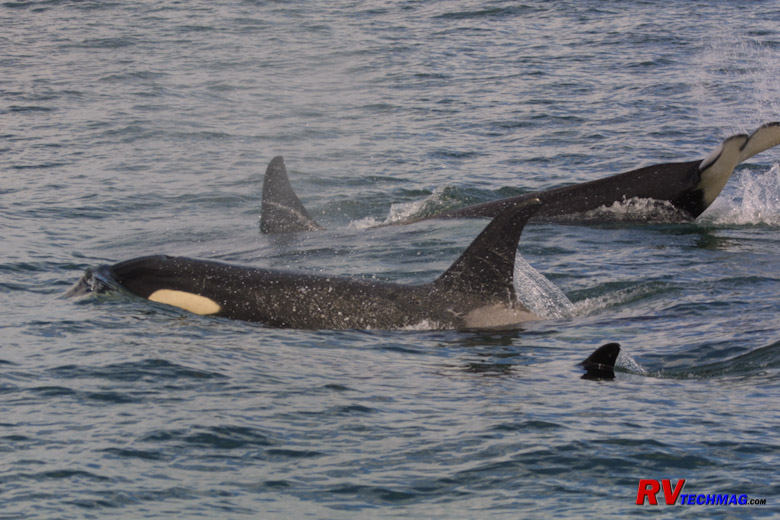
Orcas Off The Boat
There are three resident Orca pods in the San Juans. Each pod is considered a family group and may have 20 whales in the pod.
Orcas are also known as Killer Whales because they have teeth and are known to attack sea lions. However, that occurs in other areas where food is less
prevalent. Salmon are constantly running in this area so these three pods simply feast themselves on the salmon in the area.
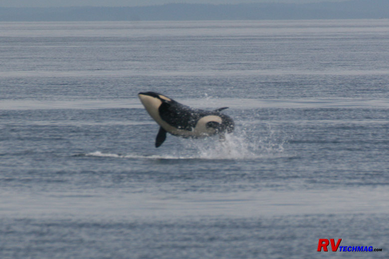
Orca Breach
While the pods normally roam by themselves, occasionally two pods will get together. When this happens they tend to get more
active and playful, almost as if they are greeting long lost friends or relatives. In rare circumstances all three pods will get together, forming a
super pod. Super pods are extremely active and that's what the photographer dreams off. Whales will be breaching and spy hopping and very active.
Most whale tours have underwater microphones ands will be able to play the Orca sounds over a loudspeaker.
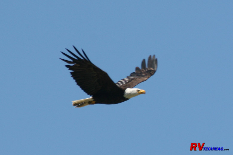
Bald Eagle
Bald Eagles frequent this area. After all, they like salmon too. They can be spotted from the boat as well as land. Your
skipper will pilot the boat past known populations and the guide will direct you to locations of eagles, sea lions, and other marine life, such as
dolphins, Minke whales, and Dall's Porpoise. Actually, this particular photo was taken from out campground at Fidalgo Bay RV Resort so you can find
them in many places.
San Juan Islands
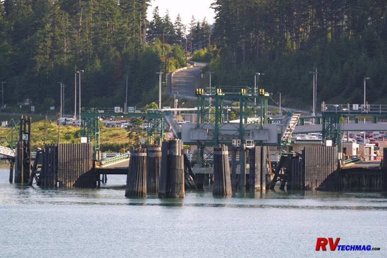
Anacortes Ferry Dock
Washington 20 Spur heads right down the main drag in Anacortes, it then heads left on 12th Street and ends at the Anacortes
Ferry Terminal. This is the jumping off point for traffic between Anacortes and San Juan Island, Orcas Island, Lopez Island, and Victoria, British
Columbia. These are the large Super Ferries that handle plenty of vehicles and passengers. Traffic to the San Juans is heavy during summer and
especially on weekends. Wait times for vehicles can be as long as two hours so it really takes a chunk out of your day. You could fit a large RV
on the ferry but it's not recommended. It would cost an arm and a leg, the wait time would be unreal, and the narrow roads of Friday Harbor and
San Juan Island really aren't great for any large vehicle. Most semi-truck deliveries are accomplished with shorty trailers to handle the tight
turns. This was also the area where "Free Willy" was filmed so you may recognize some of the buildings in Friday Harbor from that movie.
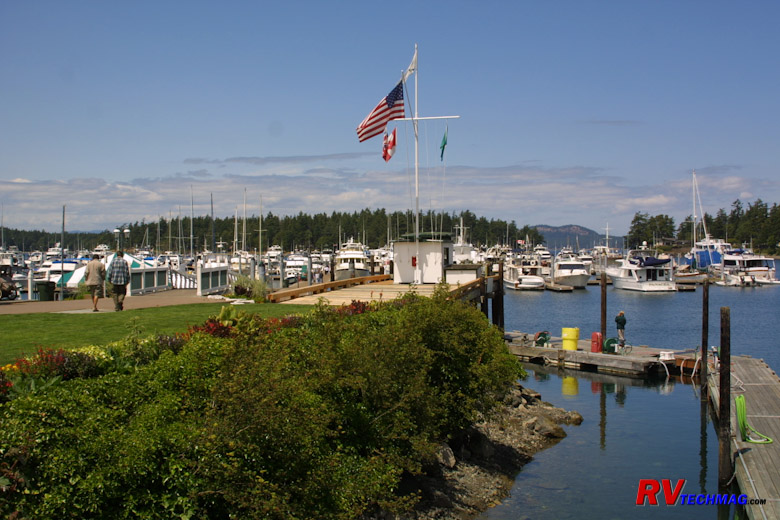
Friday Harbor
When visiting San Juan Island we prefer to take the toad to the Anacortes Ferry terminal and park it in the day lot, then
walk onto the ferry. We do this early in the morning when it's not crowded and we get to Friday Harbor early in the morning to make the most of
our day. I then walk about a mile up Spring Street to
M&W Auto Rentals and pick up a vehicle to rent for the day. Another option is to rent a moped from
Susie's Mopeds if you are into that kind of transportation. San Juan Island is home to the San Juan Island National Park. Two sections are American
Camp and English Camp. It was actually based upon the Pig War of 1859, where America and the United States both sent troops and were close to going to
war over a farmer's dead pig. It's an interesting and humorous story and the camps of both parties are preserved. More information can be had at
www.nps.gov/sajh. Friday Harbor also hosts the
Whale Museum, which is right downtown and features exhibits and information on Orca whales. Be sure to check out
www.fridayharbor.com for more information. We've found that a long day trip is generally enough
to see San Juan Island.
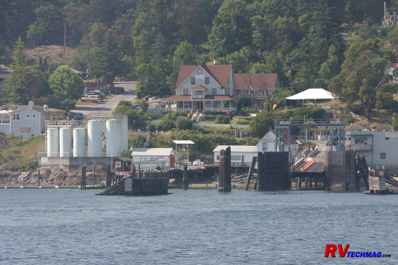
Orcas Island Landing
San Juan Island is the most popular island of the chain and has the most facilities. Orcas Island is more of a quieter place and
tends to feature natural beauty rather than man-made features. Eastsound Village is small but has everything you really need. If you want excellent
pizza, Portofino Pizzeria is renowned and a must stop. We ate lunch there and arranged to have
some extra pizzas boxed and ready so that we could pick them up when leaving on the ferry back to Anacortes so that we could heat them up in the RV for
the next day's lunch. You can also rent vehicles right at the ferry landing by calling M&W Rentals and making those arrangements so the walk-on ferry idea
still works if you don't want to stay on the island overnight.
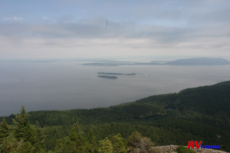
Obstruction Pass From Mount Constitution
Leaving east sound we drove to Moran State Park. This beautiful state
park includes a number of scenic lakes as well as Mount Constitution, which rises about 2,000' above sea level. A stone tower at the top looks out over
Rosario Strait and a short hiking trail leads from the parking area to the tower. Views from this tower extend to hundreds of miles on a clear day. For
more information on Orcas Island check out www.orcasislandchamber.com .
Seattle
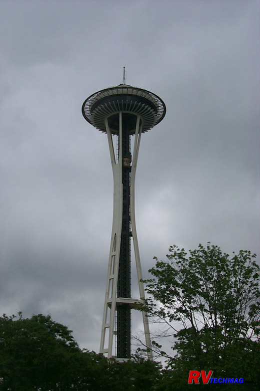
Seattle Space Needle
Seattle is a big city with the typical traffic and parking issues as well as lack of nearby campgrounds. We choose to day trip
Seattle from Anacortes. Washington 20 heads over the bridge to I-5, which takes us south into Seattle. We've seen the
Space Needle. It's expensive to access the observation tower but if you are into high views
you can't beat it. It's surrounded by a carnival type atmosphere as well as the Seattle Aquarium. You can take the monorail to downtown from here. From
there it's an easy 1/2 mile walk down to Pike Place.
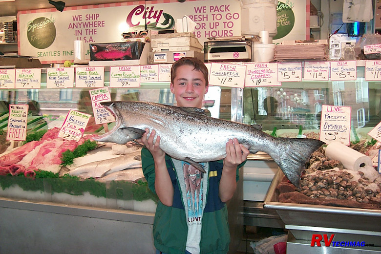
Pike Place Market
Pike Place Market is really amazing. It's way above and beyond what
any farmers market could ever be. The multi-story building houses a large number of vendors. Three large seafood markets are hear as well as excellent
fruits, vegetables, and anything else you would ever need to make dinner. In addition to the main building, Pike Street is lined with similar businesses
that offer ethnic foods, bakeries, cooking supply stores, etc. We always make sure to bring a large cooler and ice packs when heading down here. For
this reason we no longer drive to the Space Needle and take the monorail to downtown. Hauling all of that food that distance would be prohibitive.
Instead, we park in the Pike Place parking structure behind the market. That minimizes the distance we have to travel when toting all that food. Our
RV's freezers and fridge are definitely well stocked when we leave.
Another popular attraction is the Underground Tour. It's a 1 mile
walk from Pike Place market so be sure to see that first, then return to the market and load up on food. In Seattle's early day's the area known as
Pioneer Square was actually below sea level. When they finally figured out that this wasn't working they just built up higher and left the old levels
abandoned beneath the new levels. The roads rose as well and the underground area became a seedy area before being eventually abandoned totally. The
tour is very interesting as you walk beneath the sidewalks of the city and explore the old buildings. The guides are excellent story tellers and make
the tour very humorous. You will need to call ahead to reserve a spot though or you may have to wait a few hours before you can get in.
Moving On
Deception Pass
Leaving Anacortes you have a few choices, depending on where you want to go next. You can head back down Washington 20 through
Fidalgo Island, Deception Pass, and Whidbey Island. From there you can take the Keystone Ferry back to the Olympic Peninsula at Port Townsend. At that
point you can take US-101 back around the Olympic Peninsula and down the coast or you can head south along the Hood Canal, see the naval base at
Bainbridge Island, and wind up in Olympia. Or you can take the Mukilteo Ferry to the mainland and pick up I-5 there, although taking the Fidalgo Island
bridge east to Mount Vernon would be easier, faster, and less expensive. Either way gets you to I-5 to head south.
Heading south on I-5 will eventually get you to Mount St. Helens although you'll have to deal with Seattle traffic, which is
notorious. If that's the case be sure to time your passage for off-peak hours. If you are heading east consider staying on Washington-20 and seeing the
North Cascades. Normally if we want to see the North Cascades we'll enter Washington this way and exit via the coastline to the south, either continuing
on through Oregon to the California Redwoods and back out I-80 or else heading east through the Columbia River Gorge via I-84. However, it can be done
in either direction, depending on what works best for you.
Mount St. Helens
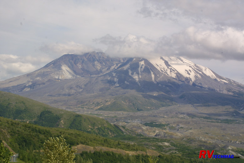
Mount St Helens was known as the Mount Fuji of North America, this beautiful snow covered peak was a popular destination for
outdoors people. Lodges dotted the shores of Spirit Lake, which lied at the feet of the mountain. In addition logging operations were prevalent in the
timber laden forests on and around the mountain. That all changed on May 18th, 1980 when Mount St. Helens erupted. The mountain was an active volcano,
with eruptions occurring every 100 years or so. In the weeks previous the mountain began a series of shudders and quakes so volcanologists were present
studying the mountain. A large bulge had formed on the north face of the mountain and the area was being evacuated and a "red zone" was created where
no one was allowed to enter. However, volcanoes being unpredictable, the volcano didn't always stick to the anticipated red zone and a number of events
unfolded that created some amazing stories of survival. Fortunately the area was basically barricaded off for the most part and resident were just about
ready to re-enter the area to remove more of their belongings when the volcano erupted at 8:32 AM.
Most people seem to think that volcanoes have craters that fill with hot molten lava when they erupt, which then flows down the
sides of the volcano. However, Mount St. Helens wasn't one of these. Mount St. Helens' crater had filled up over the last 100 years as lava slowly flowed
into the crater, building it back up into a mountain again. Eventually the weight of the new now hardened lava stopped up the flow and it became a scenic
snow capped mountain once again and forests surrounded the mountain and climbed its lower flanks. However, as the pressure built up it eventually got to
where it could no longer be contained. A weakness was found on the north face and the bulge formed after a series of quakes a few months prior to the
eruption. When the mountain finally blew, the bulge was the weak spot and superheated air blasted to the north at supersonic speeds. This lateral blast
caused the most damage and the massive blast was heard as far away as Canada. Like a massive shotgun, the lateral blast carried rocks and debris from
the mountainside and mowed down anything standing in a path some 20 miles wide. With a huger gaping hole in the side of the mountain, the top now fell
down into the blast hole and further fueled the shock wave. When the top was removed a vertical blast followed and ash darkened the sky for many miles
around. Heat and shock waves roared through the forests, previously thought to be safe and not in the red zone. The superheated air melted the snow and
frozen soil and large mudflows from the north face careened down the Toutle River, reaching as high as 65' over normal water level. New ridges were
formed, streams were diverted, and the landscape was changed forever.
Today, Mount St. Helens is once again accessible to travelers. What once was a laid back scenic area is now a national monument
and many visitor centers provide some great interpretive experiences that make this a very interesting sightseeing stop. The mountain is basically accessible
from two sides. The west side is the most popular access point and features the most opportunities for seeing the mountain and understanding what happened
with the least amount of time and effort. It's also very RV friendly. The east side requires more time. The roads twist and turn as they skirt around the
mountain, then climb to vantage points overlooking Spirit Lake. It also features a number of interesting side trips, such as Ape Cave, Lava Canyon, etc.
This trip is better taken with the toad, rather than the RV. If you only have one day in the area skip the east side and just do the west side. If you
have 2 or more days use 1 day for the west side and the others day or days for the east side.
Since the eruption, the area has shifted gears because tourism is now a huge part of the local economy. Many services have begun,
and this includes RV parks. RV parks for the most part are smaller and packed into trees. We liked the location of some of them, especially on the east
side, but didn't want to try to fit into them. Still, things change so be sure to check out the various campground reviews and keep in mind how large
of an RV the RVer who submitted the review had. Our choice was to stay in Woodland, Washington at
Columbia River RV Resort although their new restrictive policy of no dogs over 40 pounds will cause us to look elsehere next time - most likely in Kelso.
Woodland is a good place to set up base camp. It's just down I-5 from the west entrance to Mount St. Helens and it's also easy to get to the east side via Yale
and Cougar from there. There is a diesel fuel stop with easy access truck pumps just up the interstate and Woodland has a Safeway Store as well as other services
that you may need. Columbia River RV Resort is located right on the shores of the Columbia River. It's a quiet and scenic area and you may see large ships gliding
through the waters from the windshield of your RV.
Mount St. Helens is somewhat unique in it's management. It's a national monument so the National Park Service is involved. Much of
the land, and visitor centers are on US Forest Service land, and private enterprises are involved. So, to get information you'll have to check a number
of resources. The following links should be of some help:
The West Side Approach
Mount St. Helens Blast Crater
The west side of Mount St. Helens can easily be accessed from I-5 exit # 49 at Castle Rock. Washington 504 is a nice blacktop road
that heads east through the Toutle River Valley until it terminates at Johnson Ridge Visitor Center about 52 miles later. There are a number of visitor
centers along the way and parking a large RV is not a problem at any of them. The very first Visitor Center is the US Forest Service visitor center at
Silver Lake, which is about 5 miles from the Castle Rock exit. This is a must see. When you enter the visitor center you will be shown exhibits of the
timeline of the eruption and the results of the eruption. It is very interesting and will help immensely in understanding everything else that you see.
Moving on down the road will get you to the Mount St. Helens
Forest Learning Center, which is put on by Weyerhaeuser. This free exhibit will show you the role that forestry has played in this area. After the
eruption, Weyerhaeuser hand planted over 18 million seedlings in this area to restore growth to the devastated hillsides.
Pumice and Ash in the Touttle River Basin
About 18 miles from I-5 is the 18 Mile Diner. A small house has been made into a restaurant, serving burgers, shakes, and other
good stuff for a lunch or light supper. The balcony overlooks the Toutle River and is nearby where a large depot of logging equipment was destroyed by
the mudflows. This is outside the National Monument boundaries and there are logging roads nearby that will give you access to the Toutle River. The
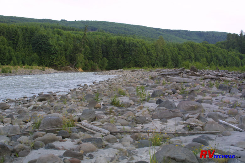
river is now choked by debris from the blast and ash fallout is still evident throughout the area although it gets thinner and thinner every year as
the elements wash it downstream. They have a small museum as well that holds various vehicles and artifacts that were damaged by the eruption.
Hofstadt Bluffs Visitor Center
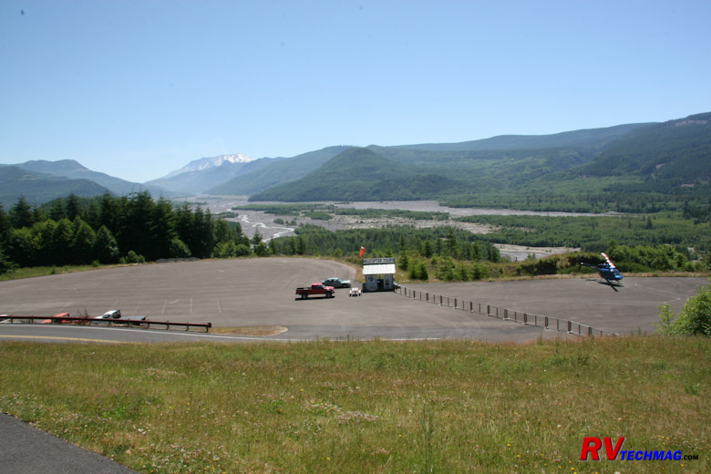
About 30 miles from I-5 is the Hoffstadt Bluffs Visitor Center.
This is a private concessionaire. It's the first real open view of the decimated Toutle River Valley and spotting scopes are provided to view the herds
of elk that have now returned to the valley. You can also take a helicopter tour down the valley that will take you to the edge of the lateral blast
crater. Flights are not permitted inside the crater but the bird's eye views you will get from this helicopter are spectacular.
Touttle River Mudflows
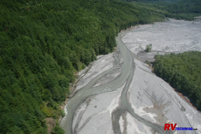
When the lateral blast occurred large the extreme heat pretty much dissolved the mountainside. The melted snow combined with
dirt to create huge mudflows that roared down the Toutle River, carrying with it rocks, trees, and anything else in it's path. After the eruption
subsided and the ash fallout had ended, the landscape was vastly changed. The once clear Toutle River was now a meandering river that twisted and
turned around new soil deposits as it worked it's way out towards the Columbia River. Trees eventually were restored to the region but the mudflows
are slow to heal and cover the central part of the valley. The helicopter tour provides excellent views of this.
Wildflowers at Coldwater Lake
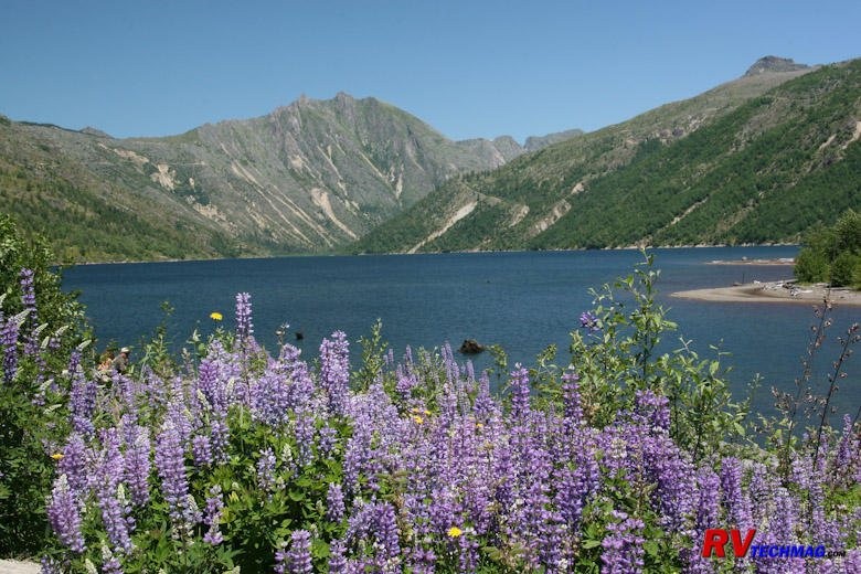
A visitor Center on Coldwater Ridge, 46 miles from I-5, has recently been closed due to lack of funding. However, across the
road is Coldwater Lake, which was formed when the debris from the lateral blast dammed up Coldwater Creek. A parking area and nature trail take you
along the edge of the lake and if you look across to the other side you will see heavy logging equipment that was damaged and left stranded from
the eruption. A hiking trail will take you to that ridge if you are want to see that up close.
Crater View From Johnson Ridge
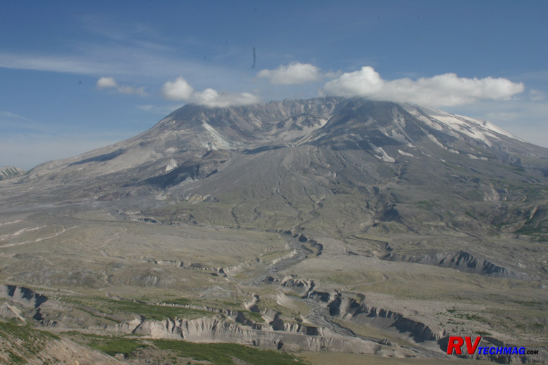
At 52 miles, the road ends at Johnson Ridge Visitor Center. This was named after the volcanologist who was here observing the
volcano when it erupted in May of 1980. He is buried somewhere beneath hundreds of feet of mountain that now cover this ridge. This visitor center
provides an up close view of the open blast crater. It seems so close, but in fact the mountain is 6 miles away but the crater is massive in size
so it just appears close. A very good movie is shown inside the theatre which is highly recommended. A number of hiking trails lead from this area
if you are so inclined.
Lava Dome View From Johnson Ridge
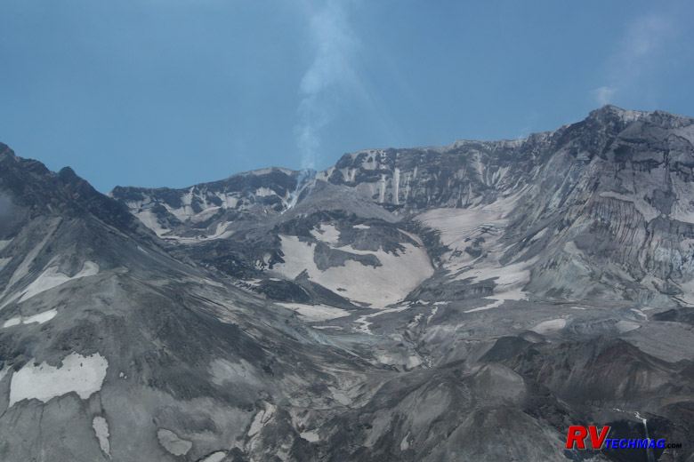
After the blast first occurred, things settled down a bit and the volcano appeared to be resting. In the fall of 2004 the
volcano began making minor seismic rumblings and a steam vent appeared inside the crater. This constant venting allowed lava to slowly flow into
the crater, establishing a lava dome in the process. This is typical for Mount St. Helens as it now begins it cycle of mountain rebuilding. The
magma is poor in gas concentration so there is no danger from its slow steady flow. The explosive pressures won't return until after the mountain
rebuilds itself and corks itself up again. By that time I will no longer be around because this cycle repeats itself approximately every 100 years.
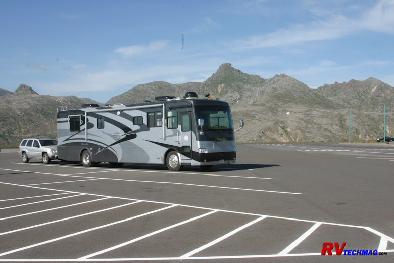
Johnson Ridge Visitor Center Parking
Generally, our itinerary puts us southbound on I-5. If we can reach I-5 exit 49 by mid morning we will take the motorhome and
toad combination and drive the above route. There's plenty of room to park the large RV at the various visitor centers and we generally eat lunch in
our RV after seeing the Silver Lake Visitor Center before heading east to see the other stops. That gives us enough time to see things and return
from Johnson Ridge in time to arrive at a campground in Woodland or Kelso in time to set up camp and have supper. We then take the toad to see the east
side the next few days. If your drive day is longer you may want to go to your RV park first and take the west side tour the next day in the toad.
The west side tour can easily be a day trip and does not require any extra days but it will take 1-1/2 hours just to get to Johnson Ridge from I-5
so the drive alone will take 3 hours out of your day with no stops. If you have enough time and plan on doing both sides of the mountain then be
sure to do the west side first. The east side is awesome but the sites are more spread out and remote so you won't be getting the interpretive
information on that side. If you do the west side first you'll have a much better understanding of what you are seeing on the east side when you do
travel there later.
The East Side
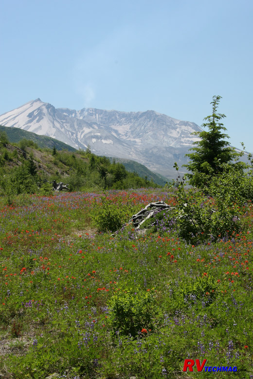
Mount St. Helens
To get to the east side you take I-5 exit #21 at Woodland, which is 28 miles south of the west side entrance. From here you
head east on Washington-503. It's a very scenic drive around this end of the mountain but it winds through the mountains and forests so it's best to
leave the motorhome behind and do this trip with the toad. After 21 miles you'll arrive in Yale. The Climber's Registry used to be at Jack's Store
until it burned down in December 2007 but now has been moved to the Lone Fir Resort, 6 miles to the east in Cougar.
Ape Cave isn't far from here. Ape Cave
is a lava tube formed by a previous eruption of Mount St. Helens. When the hot lava flowed through it left a shell of solidified lava behind. Ape
Cave is more of a tunnel than a cave and was discovered by boy scouts in 1950. This area is known for many Bigfoot sightings and if you talk to the
locals and read some of the local publications you may change your mind regarding Sasquatch. Tours of the cave are self-led and you can rent lanterns
at the USFS visitor center or bring your own lighting along. It's cool in the cave so bring a light jacket.
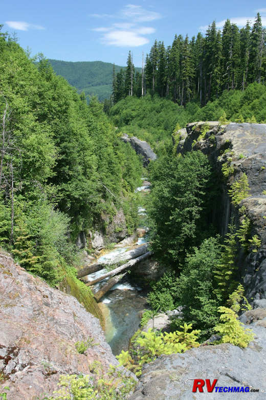
Lava Canyon
As you circumnavigate the south end of Mount St. Helens you'll pass by Lava Canyon. Lava Canyon was not discovered until after
the 1980 eruption. That eruption decimated any trees in the area, exposing Lava Canyon. Any trees now present have been new growth since the 1980
eruption. It's an interesting hike that you can take down one side of the canyon, then cross over on a
Suspension Bridge (click to see) and return down the other side.
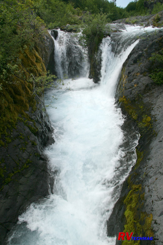
Lava Canyon Waterfalls
Much of the snow melt from Mount St. Helens runs to this area and falls into Lava Canyon, where it is carried downstream. The
waterfalls are beautiful and easy to see from the viewing platform but visitors are warned not to climb out on the rocks because they get very
slippery and others have fallen to their deaths by attempting this.
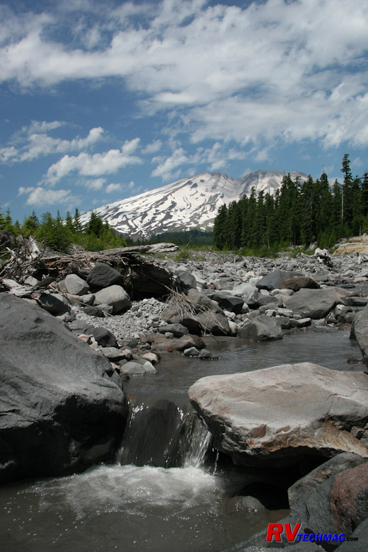
Ape Canyon
Ape Canyon used to be quite a bit deeper but the mudflows from the 1980 eruption filled in much of it. Much of the runoff
from the mountain's south face flows down this canyon. It was so named because of numerous Bigfoot sightings in this area. Prior to the 1980
eruption, when the canyon was still deep, a hunter shot one who fell into this canyon. That night as the hunters were gathered inside their cabin
a large racket began as a number of Bigfoots began throwing rocks and such at their cabin. Stories like these abound in the area. Whether or not
you believe them or not is immaterial. They are entertaining to say the least.
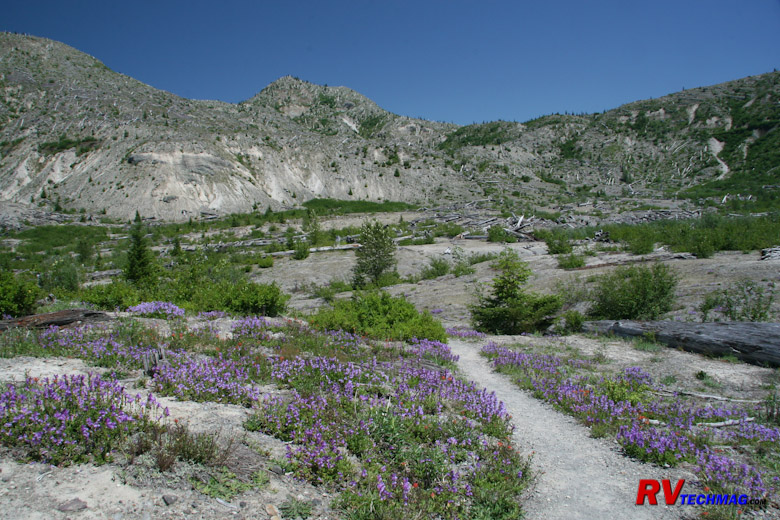
Harmony Basin Trail
After seeing Lava Canyon and Ape Canyon continue east on Forest Road 90 until Forest Road 25, which is about 52 miles from I-5,
and take it north. Note that these are excellent blacktop roads so don't let the term "Forest Road" scare you into thinking it's a rough dirt or gravel
road. When you get to the east end of the mountain, which is another 25 miles, turn left onto Forest Road 99. after another 14 miles you should be at
the Harmony Basin overlook. You can take the Harmony Basin trail down into the basin if you like.
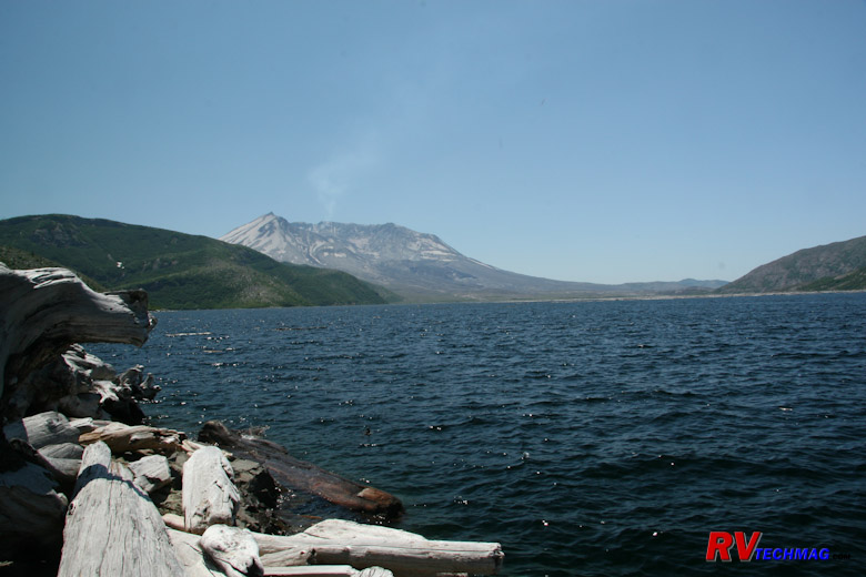
Spirit Lake
If you take the trail down into Harmony Basin you will wind up at the shores of Spirit Lake. When the mountain erupted a huge
landslide roared down Mount St. Helens towards Spirit Lake, burying Harry Truman and his resort home under hundreds of feet of mountain. The landslide
created a massive tidal wave that raced up the opposite shore of Spirit Lake at Harmony Basin, which at that time was heavily covered with forests.
The water, like a giant pendulum, then slammed back down towards the lake, stripped every tree from Harmony Basin and creating a floating log jam
that covered most of Spirit Lake. Eventually the trees filled with mineral in the water and settled to the bottom but a large number still remain
at the other end of the lake. Because the lake no longer had an outflow it was in danger of overfilling from snowmelt and flooding the Toutle River
valley and Castle Rock downstream so the Corps of Engineers built a tunnel and spillway to prevent this from happening.
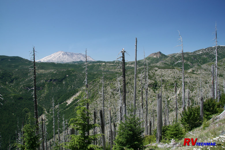
Windy Ridge
Just 3 more miles up the road will take you to Windy Ridge, a 94 mile drive from I-5 via Yale and Cougar. There is a visitors
center here as well as a snack shop, restrooms, and general store. There are many trails that wind through this lateral blast zone. Trees that were
partially protected by ridges may still have the bottom half remaining while others have totally disappeared. This can be a great place to explore
if you are an avid hiker.
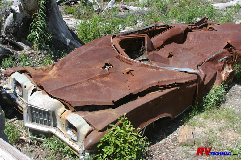
Flattened Car
On the road up to Windy Ridge you'll see this car that was flattened by the eruption. It belonged to a couple who were living
and mining in the area. The mine that they were in was all covered up by the blast and buried beneath a new hillside. Their car was ripped from the
hillside, tumbled down the ridge, and came to rest in this location.
Climbing The Mountain
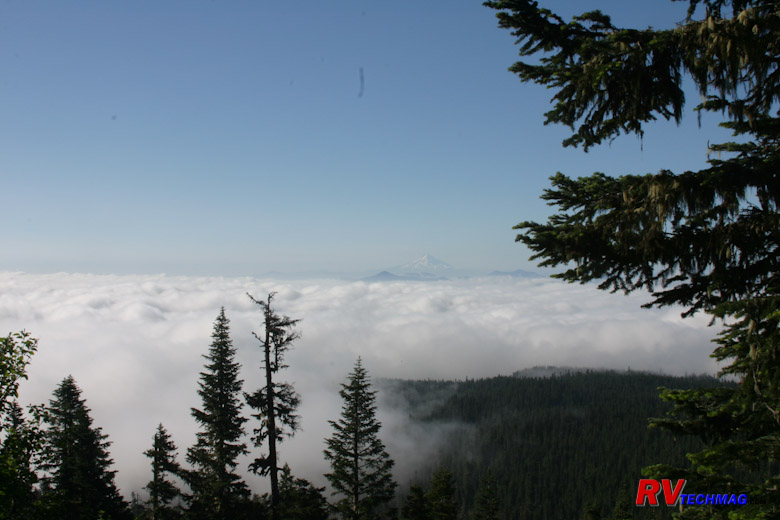
Mount Adams Poking Through The Clouds
If you want the ultimate view of Mount St. Helens, you need to climb it. I have to admit that this was one of the highlights of
my life. The mountain changes as you climb and peering down into the crater from the rim is just an amazing feeling. To learn more about climbing
the mountain be sure to check out the US Forest Service website. It will have much of the information that you need to know. The trek begins with a
pre-dawn drive from Woodland to the Climber's Bivouac, which is accessed via Forest Road 830 and is right off the road to Ape Cave on the south end
of the mountain, near Yale. You'll climb the south flank of the mountain and will begin with a steep 40 degree uphill trail through the wooded forest.
Pit toilets near the end of tree line are available. Hopefully it's not an overcast day, because as the tree line begins to break you'll be exposed
to views of Mount Hood to the south in Oregon and Mount Adams to the east as they poke through the cloud cover below you. Ideally you want to begin
this hike early in the morning, as soon as there is enough light to make your way through the wooded forest. This gives you plenty of time to take
this all day trip and helps keep the afternoon sun for the downhill portion of the trip.
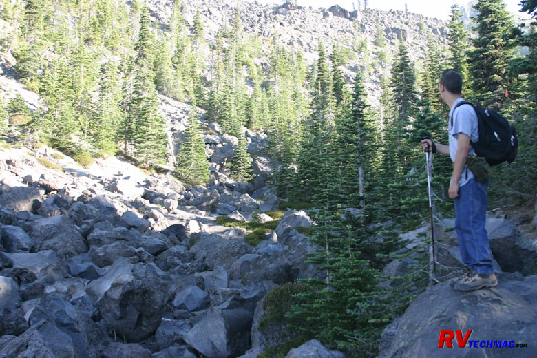
End of the Tree Line
When the tree line breaks you'll see a gulley that you have to cross. After this point you will need a climbing permit. The
wooded forest trail that brought you this far now gives way to a rocky trail where gloves can be just as useful as a hiking pole.
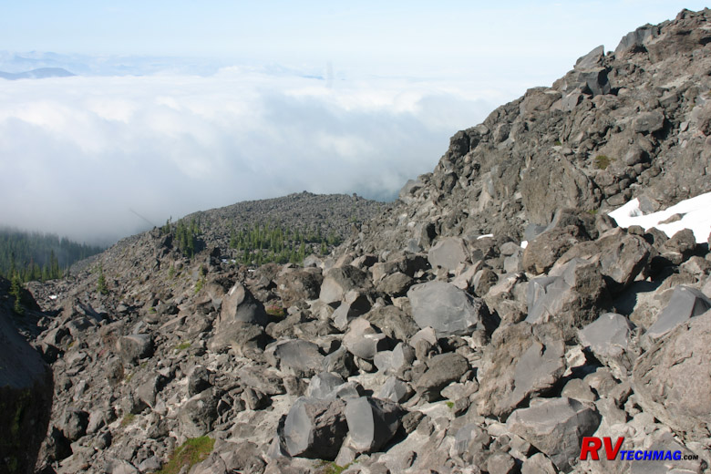
Hummocks
When the tree line ends the trail will be harder to find. The best route up follows Monitor Ridge which is covered with
Hummocks. At this point the hiking pole will get as much use as a pair of leather gloves to navigate over and around the various rocks.
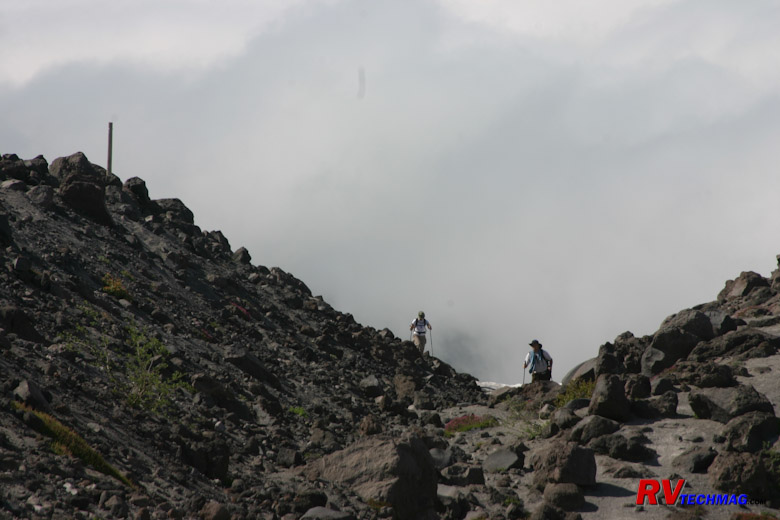
Trail Guide Posts
The terrain tends to look the same up there so there are wooden posts put into the ground every now and then to sort
of mark where the trail is. In actuality there are many trails that go all over the place but the posts will help to keep you from getting too
far off course. They won't always be visible but if you look fopr them whenever you reach the top of a ridge you'll be able to tell if you
are on course or not.
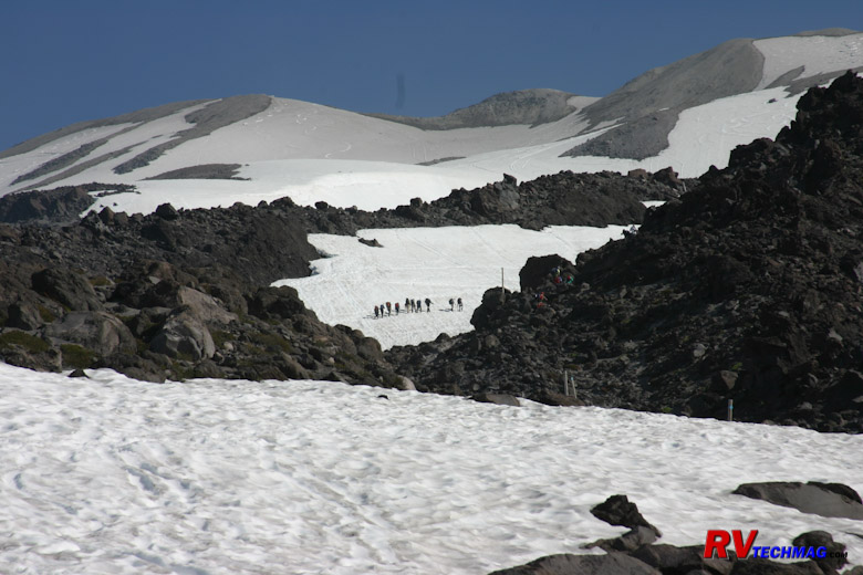
Glaciers and Snowfields
Surrounding Monitor Ridge are snowfields and glaciers. If you have crampons and poles you can save some time when
climbing by traveling across them rather than climbing through the hummocks. A slip and slide down the glaciers could be fatal if you hit
your head on the rocks below so helmets and ropes to tie in to other members of your party are good safety ideas.
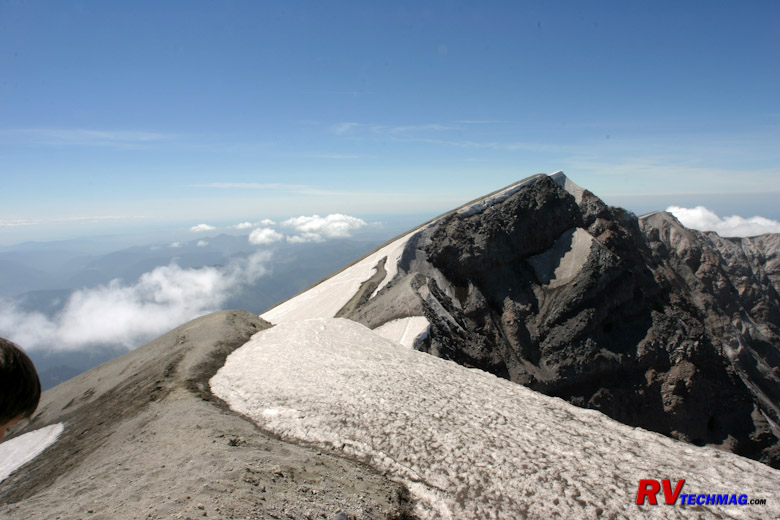
Crater Rim
Just prior to arriving at the rim you'll encounter the toughest part of the climb. While picking your way through
hummocks can be time consuming and laborious, the last 1,800' of the climb is the worst. At this point the hummocks give way to a slope of
pumice. This 40 degree slope is like walking on a tilted slab of ball bearings. You take three steps forward and slide back two. This was
the most physically draining portion of the climb and of course it happens at the highest altitudes where there is less oxygen to breathe.
However, once at the rim that is all forgotten. When you stand at the rim and look down into the crater, see the now tiny Johnson Ridge
Visitors Center 6 miles away you'll forget about all that. To the north you will see Mount Rainier. To the east is Mount Adams. To the
south in Oregon is Mount Hood. If the weather is not overcast at the coast you can see the Pacific Ocean and coastline - all at the same
time. This photo was taken on July 1st. The snow cornice is still fair sized this early in the summer. You don't want to step out on it
or it could give way and you would fall into the crater. If you climb later in July the cornice will be gone and it will be much easier
to get great views of the base of the crater without having to hunt for gaps in the snow cornice.
Heading downhill is much faster a climb that began at 6 AM got us to the rim at 2 PM and we would be able to return
to Woodland by 6 PM. Part of the speed gained when descending is found by taking the snowfields. Bringing crampons along will save you time
and energy on both the uphill and downhill legs. Some climbers try to glissade down the snowfields. The pumice laden snow can be very abrasive
on snow suits and tear them up unless you have something to use as a shield. You also need to wear helmets when glissading to protect your head
when you wipe out (and you will) should you hit a rock. Glissading is the fastest way down the mountain but remember that you also have to carry
that stuff up the mountain too.
Columbia River Gorge
The Columbia River separates Washington from Oregon. As it begins its westwardly flow to the Pacific Ocean gradually carves
itself deeper and deeper into the earth. The Oregon Trail meets up with the river at The Dalles at the eastern slope of the Cascade Mountain Range.
Early pioneers had to make a choice whether to take the steep rocky Barlow Road over the mountains or to float their wagons down the Columbia River
on rafts on their way to the Willamette Valley. The gorge begins at the Dalles and as the mountains rise, the gorge gets deeper as it approaches
Portland. Many waterfalls descend the flanks of the gorge as they drain into the Columbia River.
Traveling the gorge is best down from the Oregon side where continuous roads flank the southern shore of the river. The
old Columbia River Gorge Road is now a scenic highway but it's very narrow and parking is limited so this is not a great place to take any large
RV. It's best to leave the RV at the campground and take the toad to the many scenic points of interest along the old road. I-84 also runs through
the gorge if you are looking for a scenic drive but don't want to stop you can take the RV through on I-84. However, there is one place that you
can stop with a large RV and that is at Multnomah Falls where an I-84 exit takes you to a parking area that is easy walking distance to the visitors
center. We've seen the various points of interest via a toad and we've done the drive through with the RV, including the pit stop at Multnomah Falls.
If the Columbia River Gorge is part of our route we generally take it from west to east but it really makes no difference so it will depend on your
particular route. The best course is to head north and south along the coast and just spend the day with the toad to see the gorge. That way you
can see the various viewpoints, which you would miss in the RV.
The following links should be of some help:
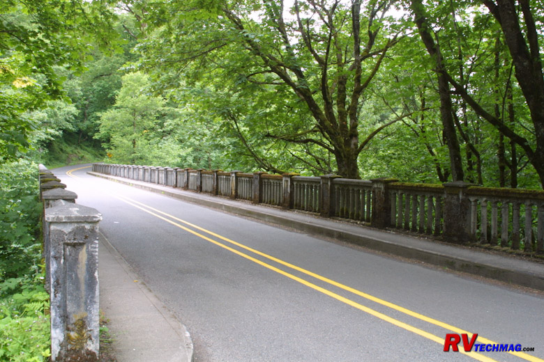
Historic Columbia River Highway
The great views of the gorge begin at Troutdale when you leave I-84 at exit # 22. At this point you can take the Historic
Columbia River Highway (HCRH) to see all of the scenic wonders this area has to offer. The highway began construction in 1913 and was completed in
1922. It was designed to be unobtrusive upon the scenic landscape while also routing to all of the best scenic viewpoints within the gorge. The
road winds among forested slopes on the south bank of the river and was built to 1920s standards so wide, tall, or large vehicles will have
difficulty navigating this road. The many bridges that cross the various creeks and outflows in the area were done with the typical classy stone
mason work popular to that era. The road begins at Troutdale and ends at the Dalles but various access points midway will connect you to I-84 so
it's not necessary to drive the full length of the HCRH.
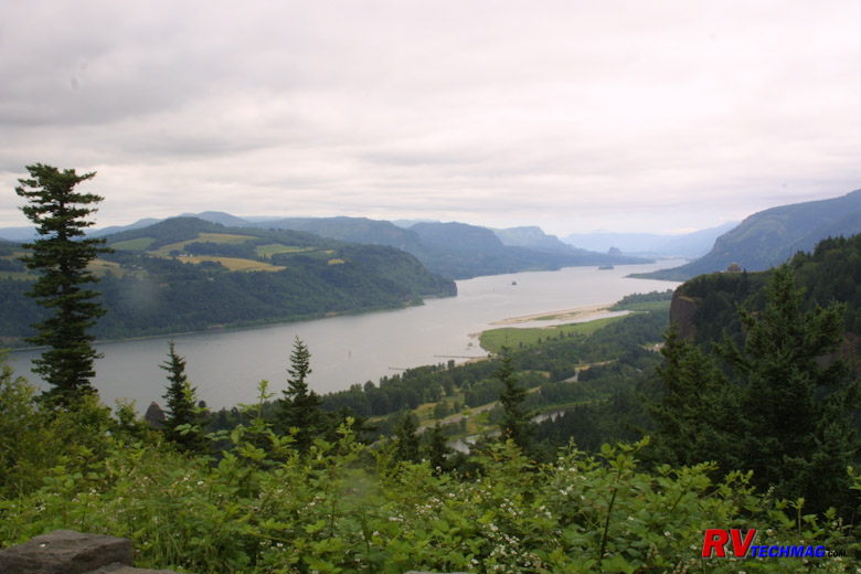
Columbia River Gorge
Beginning at Troutdale, the first stop is about 2 miles later at the Women's Forum Overlook. From here you can look eastward
into the gorge. Crown Point Overlook can also be seen on a ridge about 1 mile to the east.
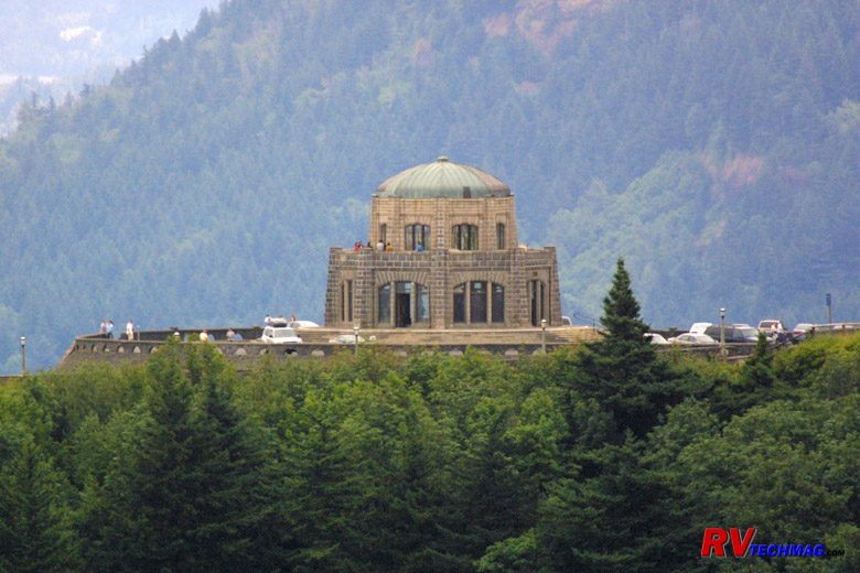
Crown Point Overlook Vista House
The Vista House is a stone structure built on Crown Point, which is a promontory overlooking the gorge. Many plaques and
interpretive maps and placards describe the valley below. After leaving Vista House a series of waterfalls will unfold during your easterly drive.
Latourell Falls is about 2.5 miles east of Vista House.
Sheppard's Dell is another mile down the road, the ever
popular Bridal Veil Falls is another 1.5 miles, while
Wahkeena Falls is another 3 miles. All of these falls are
worthy side trips so be sure to bring your camera.
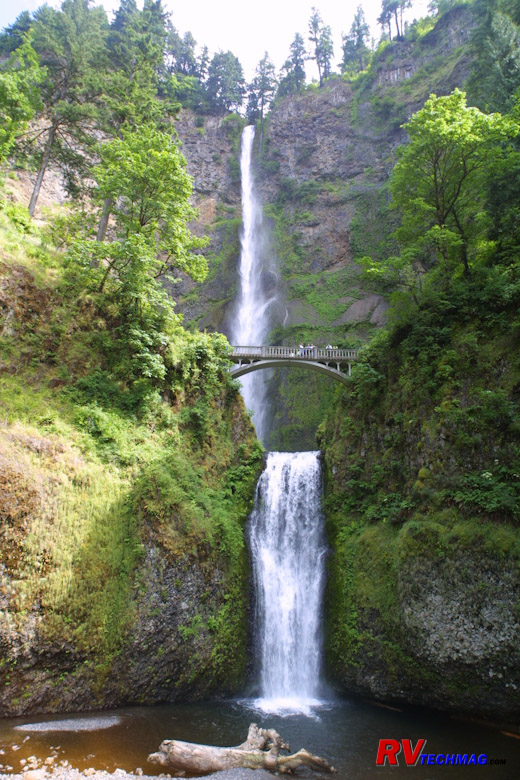
Multnomah Falls
Multnomah Falls lies another 0.5 miles after Wahkeena Falls, or about 12 miles from Troutdale via the HCRH. It can also be
accessed via I-84 at exit #31 where the eastbound and westbound lanes spread around a parking area that can be accessed in either direction. A
short walking path tunnels beneath the interstate to get to the falls and visitor center. Large RV parking spaces are provided so this is the one
spot you can take a large motorhome to access a waterfall on the HCRH. This spectacular waterfall is claimed to be Oregon's largest tourist
attraction. A large stone home was built by the falls. This land was originally owned by a lumber magnate who could see the falls out the back
windows of his home. Eventually the land was donated to the state of Oregon and the home is now a lodge, restaurant, and gift shop. On a
beautiful summer day you can dine outside on the patio in view of the falls. A hiking trail will take you to the bridge midway up the 611' tall
falls and other viewpoints are just as magnificent. For more information be sure to visit
www.multnomahfallslodge.com.
If you continue driving to the east you will encounter more waterfalls. If you want to preview them check out the
www.waterfallsnorthwest.com website for more details. After a while they all
start to look alike, plus their height diminishes as you head eastward so you may want to allocate your time better, unless you are really into
waterfalls. The Bonneville Dam is about 9 miles from Multnomah Falls and the Hood River is 33 miles. Near exit # 69 is a pair of twin tunnels
that used to be on the HCRH but that section is now closed to vehicles and is a hiking trail. You can get to the tunnels from the parking areas
at either exit # 64 or exit # 69. At Hood River a scenic drive loop can take you around Mount Hood. By exit # 82 you will have reached The Dalles
and the gorge is now over.
North Cascades
One popular way for us to get to the Pacific Northwest from Wisconsin is via I-90 for the most part, then swing north to drive
the through the North Cascades. This gets you away from the interstate driving and lets you get into the back roads to see the scenery and less hectic
life in this area. Our trip through the North Cascades begins with the Grand Coulee Dam, winds through the scenic Okanogan National Forest, passes
through the North Cascades National Park complex, and brings us to the Pacific Coast at Anacortes.
The run from Spokane to Anacortes is around 350 miles. That's doable in a day trip but won't give you time to see anything so
that leg of the trip should be split into two days. We found that Spokane doesn't have any decent RV parks so we stay just across the border in Post Falls,
Idaho at the Coeur d' Alene RV Resort, which is an excellent RV park and only 20 miles from
Spokane. We'll leave Post Falls, stop to see the Grand Coulee Dam along the way, and spend the night at
Riverbend RV Park, which is located between Twisp and Winthrop. It's an excellent park situated alongside the Methow River that has full hookups and a
nice quiet setting. It's an easy drive into Winthrop to check out the shops and restaurants in town. There are a number of Jeep trails in the area so if
you want to spend more time here this is a great place to stay and set up a base camp. It's located right on Washington 20, which is the scenic drive that
takes you from the Methow Valley all the way across the Cascades and down into Anacortes until it ends at the ferry terminal.
Grand Coulee Dam
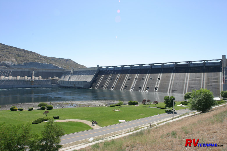
Grand Coulee Dam
Our westward journey from Post Falls has leave exit I-90 at exit # 277 in Spokane, where we head west on US-2. We stay on US-2
until Wilbur, where Washington 174 takes us to Grand Coulee and the Grand Coulee Dam. There are parking areas just before the dam where you can park
the RV if the lot isn't too crowded) and take the tour of the dam. If not you can always park on the street in town, which we usually do while
restocking at the Safeway Store. You could unhook the toad and drive to the visitors center at the dam if you couldn't get into the parking lot. In
the evening a laser light show is presented on the dam. When it's time to leave you'll need to cross the river upstream of the dam via very narrow
bridge. You'll then travel on Washington 155 to Omak, where you will pick up Washington 20 for the rest of the trip.
North Cascades
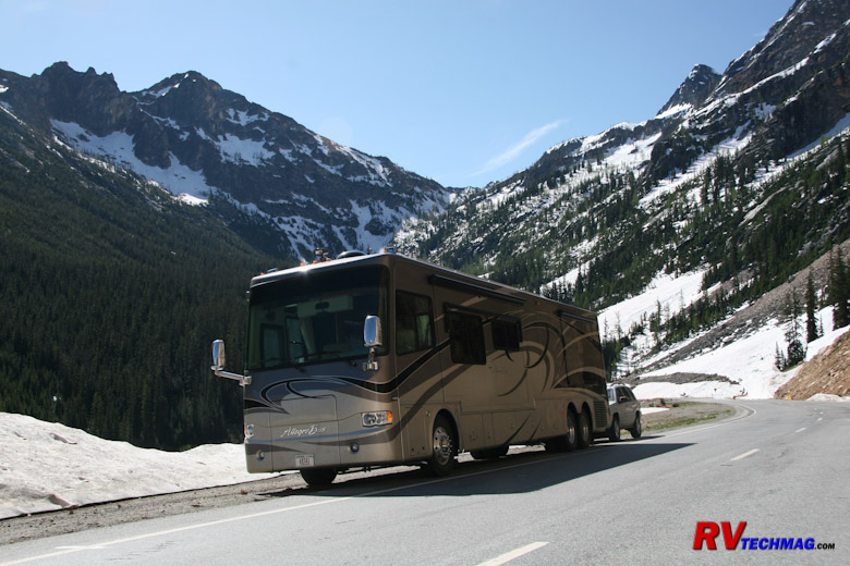
Washington Pass
After continuing on and spending the night at Riverbend RV Park, near Winthrop, you are ready to begin the trip over the North
Cascades National Park. Just prior to entering the park boundaries you will encounter Washington Pass and Rainy Pass. This is not a troublesome climb
for a motorhome and the pass tops out at 5,477' so it's nothing to be avoided by an RVer.
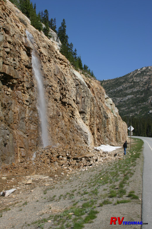
Washington Pass Snowmelt
As you climb Washington Pass you'll have many opportunities to get out and enjoy the scenery. In June the snowmelt streams off
the sides of the mountain and numerous small waterfalls are prevalent.
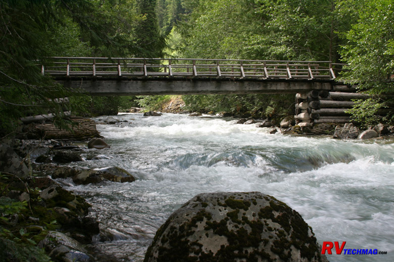
Washington Pass Hiking Trails
As you descend Washington Pass you'll see many streams alongside the road. In some areas there will be hiking trails where
you can park the RV and take a brief walk through the forest.
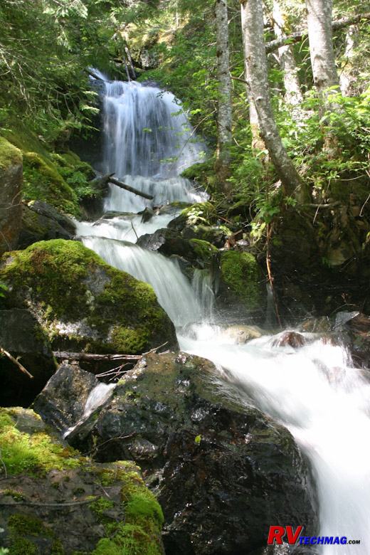
Small Waterfall Near Washington Pass
These stream will provide you with an endless array of scenic opportunities. Many waterfalls are present as the runoff cascades
down to the streams below.
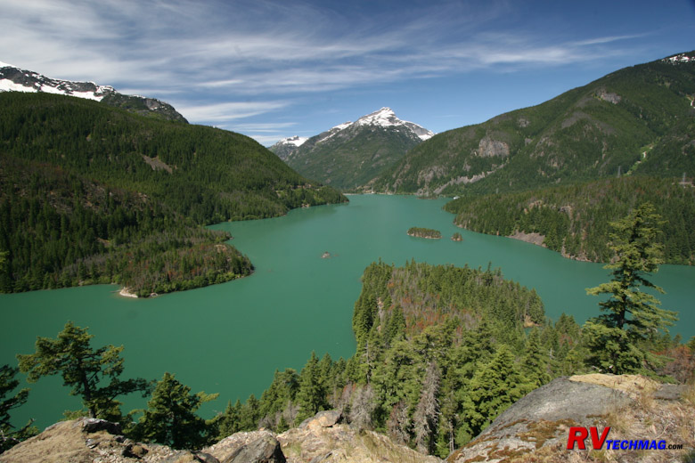
Ross Lake
As Washington 20 continues bisecting North Cascades National Park you will arrive at Ross Lake. A large RV friendly parking lot
is found at an overlook. Ross Lake derives it color from the mineral that washes into it from the nearby mountains. The drive from Ross Lake westward
drops in altitude as it passes Diablo Lake and follows the Skagit River. When you descend to
Marblemount the Buffalo Run Restaurant is always a good place to eat. There's
room to park the motorhome on the side of the road by the restaurant and the outside dining is a nice setting.
Moving On
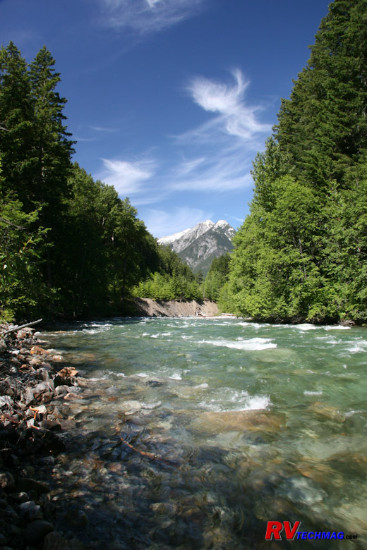
Stream in the Cascades
Continuing on, Washington 20 will travel through the Skagit Valley until it reaches I-5 at Burlington. There's a bit of traffic
there but once you get to I-5 you can either head south on I-5 or continue on Washington 20 and cross the bridge to Fidalgo Island and stay
at Anacortes.
Return to Home Page
If you enjoyed this article be sure to recommend RVtechMag.com to your friends, like us on Facebook or Twitter
or subscribe to our RSS feed.


|


