Exploring the Pacific Northwest by RV
Helpful Tips on Traveling the Pacific Coast from California's Redwoods Through Washington's Olympic Peninsula
Article Date: August, 2008
Article and Photography by Mark Quasius
Columbia River Gorge
The Columbia River separates Washington from Oregon. As it begins its westwardly flow to the Pacific Ocean gradually carves
itself deeper and deeper into the earth. The Oregon Trail meets up with the river at The Dalles at the eastern slope of the Cascade Mountain Range.
Early pioneers had to make a choice whether to take the steep rocky Barlow Road over the mountains or to float their wagons down the Columbia River
on rafts on their way to the Willamette Valley. The gorge begins at the Dalles and as the mountains rise, the gorge gets deeper as it approaches
Portland. Many waterfalls descend the flanks of the gorge as they drain into the Columbia River.
Traveling the gorge is best down from the Oregon side where continuous roads flank the southern shore of the river. The
old Columbia River Gorge Road is now a scenic highway but it's very narrow and parking is limited so this is not a great place to take any large
RV. It's best to leave the RV at the campground and take the toad to the many scenic points of interest along the old road. I-84 also runs through
the gorge if you are looking for a scenic drive but don't want to stop you can take the RV through on I-84. However, there is one place that you
can stop with a large RV and that is at Multnomah Falls where an I-84 exit takes you to a parking area that is easy walking distance to the visitors
center. We've seen the various points of interest via a toad and we've done the drive through with the RV, including the pit stop at Multnomah Falls.
If the Columbia River Gorge is part of our route we generally take it from west to east but it really makes no difference so it will depend on your
particular route. The best course is to head north and south along the coast and just spend the day with the toad to see the gorge. That way you
can see the various viewpoints, which you would miss in the RV.
The following links should be of some help:
Historic Columbia River Highway
The great views of the gorge begin at Troutdale when you leave I-84 at exit # 22. At this point you can take the Historic
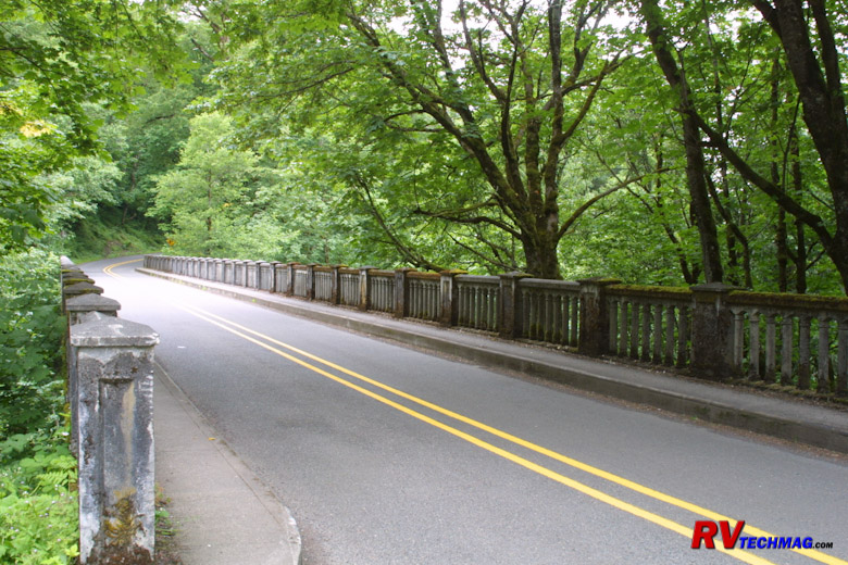
Columbia River Highway (HCRH) to see all of the scenic wonders this area has to offer. The highway began construction in 1913 and was completed in
1922. It was designed to be unobtrusive upon the scenic landscape while also routing to all of the best scenic viewpoints within the gorge. The
road winds among forested slopes on the south bank of the river and was built to 1920s standards so wide, tall, or large vehicles will have
difficulty navigating this road. The many bridges that cross the various creeks and outflows in the area were done with the typical classy stone
mason work popular to that era. The road begins at Troutdale and ends at the Dalles but various access points midway will connect you to I-84 so
it's not necessary to drive the full length of the HCRH.
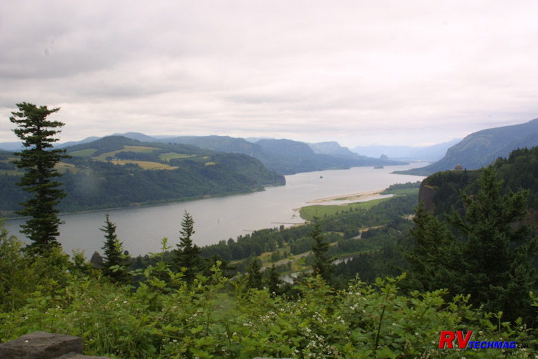
Columbia River Gorge
Beginning at Troutdale, the first stop is about 2 miles later at the Women's Forum Overlook. From here you can look eastward
into the gorge. Crown Point Overlook can also be seen on a ridge about 1 mile to the east.
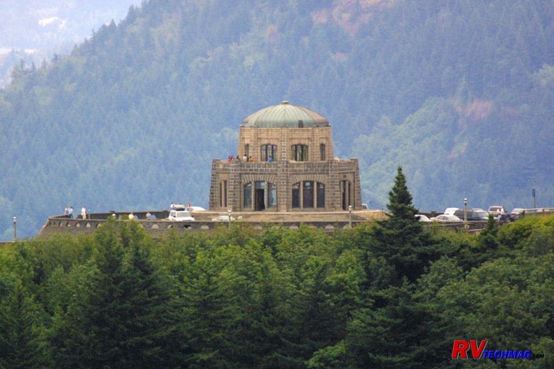
Crown Point Overlook Vista House
The Vista House is a stone structure built on Crown Point, which is a promontory overlooking the gorge. Many plaques and
interpretive maps and placards describe the valley below. After leaving Vista House a series of waterfalls will unfold during your easterly drive.
Latourell Falls is about 2.5 miles east of Vista House.
Sheppard's Dell is another mile down the road, the ever
popular Bridal Veil Falls is another 1.5 miles, while
Wahkeena Falls is another 3 miles. All of these falls are
worthy side trips so be sure to bring your camera.
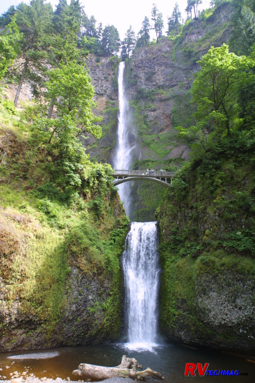
Multnomah Falls
Multnomah Falls lies another 0.5 miles after Wahkeena Falls, or about 12 miles from Troutdale via the HCRH. It can also be
accessed via I-84 at exit #31 where the eastbound and westbound lanes spread around a parking area that can be accessed in either direction. A
short walking path tunnels beneath the interstate to get to the falls and visitor center. Large RV parking spaces are provided so this is the one
spot you can take a large motorhome to access a waterfall on the HCRH. This spectacular waterfall is claimed to be Oregon's largest tourist
attraction. A large stone home was built by the falls. This land was originally owned by a lumber magnate who could see the falls out the back
windows of his home. Eventually the land was donated to the state of Oregon and the home is now a lodge, restaurant, and gift shop. On a
beautiful summer day you can dine outside on the patio in view of the falls. A hiking trail will take you to the bridge midway up the 611' tall
falls and other viewpoints are just as magnificent. For more information be sure to visit
www.multnomahfallslodge.com.
If you continue driving to the east you will encounter more waterfalls. If you want to preview them check out the
www.waterfallsnorthwest.com website for more details. After a while they all
start to look alike, plus their height diminishes as you head eastward so you may want to allocate your time better, unless you are really into
waterfalls. The Bonneville Dam is about 9 miles from Multnomah Falls and the Hood River is 33 miles. Near exit # 69 is a pair of twin tunnels
that used to be on the HCRH but that section is now closed to vehicles and is a hiking trail. You can get to the tunnels from the parking areas
at either exit # 64 or exit # 69. At Hood River a scenic drive loop can take you around Mount Hood. By exit # 82 you will have reached The Dalles
and the gorge is now over.
Return to Home Page
If you enjoyed this article be sure to recommend RVtechMag.com to your friends, like us on Facebook or Twitter
or subscribe to our RSS feed.


|


