Exploring the Pacific Northwest by RV
Helpful Tips on Traveling the Pacific Coast from California's Redwoods Through Washington's Olympic Peninsula
Article Date: August, 2008
Article and Photography by Mark Quasius

The Oregon Coast
The Oregon coastline is undoubtedly the most spectacular coastline in the lower 48. It features a number of sea mounts that come
in every size and shape and mixes in lush green slopes in some places, rugged cliffs in others, and white sandy beaches in still other locations. The
variation in scenery, as well as the spectacle of it, makes for a very non-boring trip. I'll attempt to take you through these areas as we begin at
Oregon's southern border with California. We'll head north along the coast on US-101 and cover the highlights of this scenic coastline as we proceed
up to the Washington coast.
I guess before we continue a brief overview of two geographical features common to the Oregon coast is in order.
Sea mounts are rocks that are thrust up from the earth's crust by a process called subduction. When the Pacific Plate, which
is slowly but constantly creeping to the east, meets the North American Continental Plate it is pushed beneath the North American Plate. When it
cracked molten rock rose up through the off-shore waters and solidified, forming the sea mounts so prevalent to the Oregon coastline. This happened a
long time ago in geographic times so you're not going to see anything volcanic rising out of the ocean but you will see plenty seamounts, giving
evidence to what did happen at one time.
Tidal pools are formed when the tide is low and the water recedes from the shoreline. At high tide the beach will be very
narrow and may not even exist. But, at low tide the water recedes and the wide sandy beach appears. Many of the rock structures previously surrounded
by water are now accessible by beachcombers. Around these rocks you will find tidal pools. A small amount of water will remain in these pools and any
sea life left behind by the receding waters will remain in the pool. In addition to the pools you'll find starfish, clams, and other mollusks attached
to the lower walls of these rock formations. When viewing sea life it's important to time your visit to coincide with low tides or else the pools will
not be accessible. When visiting these areas be sure to watch for rising tides. In some cases you can get trapped in an area as the tide rises when
the beach disappears into the surf. Tidal charts are available or you can find them by searching the Internet.
Brookings

Harris Beach - Brookings, Oregon
Brookings anchors the Oregon coastline at its southern end. Like most coastal cities, US-101 runs right through the center of
town and is very RV friendly. there are a few campgrounds in Brookings. Most are fairly compact with tighter spaces. We skipped them with our 40'
motorhome and stayed at Harris Beach State Park once but it was very tight wooded park. We reserved the longest site in advance. When we arrived it
wasn't quite as large as they stated. We did manage to fit but it was a real squeeze. The park is a nice wooded park and very well suited for smaller
RVs but a large class A will have issues navigating the narrow roads and sites. We chose to skip staying at Brookings for future trips. We generally
will stay just south of Brookings in Crescent City, California or to the north in another coastal city. If you want to stay at Brookings I would
suggest checking out the various campground reviews at www.rvcampreviews.com or
www.rvparkreviews.com for more information.
Harris Beach State Park is much more than a campground though. There is an excellent visitors center on the east side of US-101
that's a must to stop at for anyone new to traveling the Oregon coast. The helpful staff will give you information and brochures to help you make the
most of your trip. After stopping at the visitor center, drive across the highway to the parking area on the west side. This is on a high bluff
overlooking the ocean and a paved walking trail will take you right down to the beach. The beach is wide and features tidal pools and sea mounts and
is an excellent place to explore at low tide. for more information on Harris Beach State Park visit their link at
www.oregonparks.org/park_79.php.

Samuel H. Boardman State Park
Immediately upon leaving Brooking you'll come upon the Samuel H. Boardman State Park. Unlike the typical state park, the
Boardman is a 12 mile stretch of rugged coastline interrupted by small sandy beaches. Various overlooks and parking areas along US-101 break the
constant groves of Sitka Spruce that line the coastline and offer views of the rock formations and other scenic areas. There are 27 miles worth
of coastal hiking trails for those who want to venture farther on foot but the easy access pull-offs make for excellent views for those with
less time on their hands.

Arch Rock in Samuel H. Boardman State Park
Arch Rock and Natural Bridges are popular features in Sam Boardman. Many rock formations can be seen dotting the coastline
in this area. Cormorants and other shore birds make their nests on these sea mounts.
Gold Beach

Rogue River Jet Boats
Gold Beach is located about 29 miles north of Brookings. Gold Beach is located where the Rogue River enters the Pacific Ocean.
The Rogue is a wild untamed river and jet boat tours leave this area to go upstream through the canyons, rocks, and rapids. If you are looking for
scenic adventure without having to paddle this trip would be ideal for you. We stayed in Gold Beach at the Four Seasons RV Resort which overlooked
the Rogue River.

River Otters on the Pier at Four Seasons Campground
Four Seasons is tucked back along the river and 6.5 miles away from town. The drive from Gold Beach along the river is very
twisty. I recommend to go farther up US-101 and take the Edson Creek Road, which is much better for a large RV. There was a family of River Otters
living on the banks by the RV resort that were casually sunning themselves on the RV park's piers. You can get access to the jet boat tours right
from the RV park. Check out the park's website at www.fourseasonsrv.com for more details. Other parks of interest in the area are Oceanside RV Park
and Turtle Rock Resort. As always, check out reviews on any Gold Beach RV park at
www.rvparkreviews.com or any other campground reviews website.
When leaving Gold Beach you'll encounter Humbug Mountain to the north. The highway runs straight up to the cliffs of the
mountain and then winds it's way around the mountain before breaking out onto the clear coastline to the north. Farther on you'll past through
Port Orford and then Cap Blanco before arriving at Bandon.
Bandon

Bandon Lighthouse
Bandon is just 48 miles north of Gold Beach and is where the Coquille River meets the Pacific Ocean. Bandon has some great
beach areas, tidal pools, and rock formations. I find that it's easiest to park on 11th Street SW near the high school, then unhook the toad and drive
to the South Jetty State Park at the mouth of the Coquille River directly across from the lighthouse. A drive to the downtown visitor's center will
give you armloads full of literature and you can follow 1st street along the Coquille River and past the fish markets to the South Jetty State Park.
This park has great beach access as well as full facilities.

Viewing Platform and Stairs to the Beach
At the west end of 11th Street is a viewing platform and steps down to the beach allow access to tidal pools and rock
formations. It's directly west of where you parked the RV but take the toad. While there is adequate parking at the viewing platform it's not very
navigable for a large Motorhome.

Beach Area Below the Viewing Platform
Various tidal pools can be accessed by descending the steps at the viewing platform. This is another area best visited at low
tide. Bandon has always been a mid-day stop for us so I can't comment on any RV parks that may be in the areae.
Florence

Dune Buggies Near Florence
Heading north from Bandon will take you to Coos Bay which is a large lumber shipping port. Here you'll see lots of spruce
logs stacked up in the many yards next to the Coos River as they are being prepared for shipment via sea. Coos Bay is also the start of the Oregon
Dunes National Recreation Area. The Oregon Dunes are roughly a 50 mile stretch of white sand dunes that line the coast and reach to the sea. The
majority of these are reserved for non-motorized recreational use but a section between Reedsport and Florence, near Dunes City, is dotted with
places where you can rent dune buggies and ATVs to go play in the sand. The sand is very white so on sunny days you do have to watch carefully or
you can get snow blind and not see what's in front of you. Still it's a blast to go play in the sand.

Trail Rides on Beach
On the northern outskirts of Florence is C&M stables where you can take a trail ride through the wind sands and beach grass
and ride on the beach. This is a popular early morning ride with many tourists. The website for C&M is
www.oregonhorsebackriding.com.

Heceta Head Lighthouse
13 miles north of Florence you'll find the Heceta Head lighthouse. This is one of the most photographed lighthouses in the
country. It's actually a state park (see www.oregonstateparks.org/park_124.php
for details). Satellite GPS navigation has eliminated the need for lighthouses but Heceta Head still shines it's light every night. The lighthouse
keeper's house is now a bed and breakfast. The coastal highway between Florence and Heceta Head follows the shoreline and also passes by Sea Lion Caves.
This is commercial property where you pay admission and they take you down in an elevator to see the caves. However, not many sea lions are in the
caves in summer. Most are out on the rocks along the shore. Their website is
www.sealioncaves.com for more information. Nice overlooks in the area afford good views of the lighthouse from the north.

Sunset at Heceta Head
Heceta Head is located at the mouth of Cave Creek. US-101 crosses the creek via a bridge. A trail leads from the bridge down
to the beach below. If you want a great evening sunset shot park your vehicle ion either end of the bridge. Then walk with your camera and tripod to
the center of the bridge and set up there. There is a walking area so it's safe. When the sun sets over the ocean you can use it to silhouette the
lighthouse and if you time your shot just right you can capture the burst of light as it passes by.
27 miles farther north you'll come to Newport. Newport is where the Elk River dumps into Yaquina Bay. The Yaquina Head
Lighthouse is another popular site here. At 93' it's the tallest in Oregon. Newport has a shopping area and Aquarium Village, which is a tourist
centered shopping center. After passing through Lincoln City, you'll arrive at Tillamook, which is another 70 miles from Newport. Many of these
seaside villages will feature seafood eateries. Oysters, in particular, are popular along this stretch of coast.
Tillamook

B-25 in Blimp Hangar Museum
Tillamook is known for two things - the Tillamook Cheese Factory and the Blimp Hangar. The Blimp Hangar is the largest w
ooden structure still standing. The Navy used it to house 6 blimps during World War II for anti-submarine patrol. This huge building can easily
be seen when passing by on US-101 and you can tour the hangar. There is room for RV parking and a lunch counter as well. In addition to the
display and story behind the hangar itself, the hangar contains a large selection of aircraft - mostly naval related. You can view an F-14
Tomcat, approximately 30 WW-II aircraft, and other exhibits. There was a second hangar but it was used to store hay and one night it started
on fire so you can pretty much guess why there's only one left now. Details can be found on their website at
www.tillamookair.com.
The Tillamook Cheese factory is another popular stop. It's a very popular attraction and it has a huge parking area where it's
easy to park an RV. The factory tour is free, and you'll be able to sample free cheese. However, you'll probably get hooked and want to buy cheese
or their excellent ice cream in their store, which also handles almost any gift, souvenir, or snack that you'll ever need. Their website is
www.tillamookcheese.com for more information. It's located on the north end of town
right on US-101. In addition to the small blacktop lot next to the building there is a large gravel lot where RVs and semis can easily park. At the
edge of this lot is a small visitor's center. Be sure to stop there to pick up informational pamphlets on the area. While there pick up a map to
Oceanside, which is a small community right on the ocean with excellent beach access. Leave the RV in the parking lot at Tillamook Cheese and take
the toad there and do some beachcombing.

Oceanside Bluff and Tunnel
When you go to Oceanside it will be helpful (although not mandatory) if you bring a flashlight. There are two large beaches
at Oceanside that are separated by a large bluff that reaches to the ocean. You can't go around the bluff but they made a walking tunnel through it
to connect the two beaches. It's dark in the tunnel but if you follow the person ahead of you and look to the light at the end of the tunnel you'll
make it. However, if you are tall you need to watch out because there is one area where a 6' person will need to duck a little bit. That's where the
flashlight comes in handy.

Oceanside Seamounts
There are tidal pools on both sides of the bluff but the best ones are on the north side so you do need to cross over via the
tunnel to get to them. Various rock formations will be found just off shore and you'll probably see plenty of shore birds in the area.
Cannon Beach

Sunset at Cannon Beach
Cannon Beach is 40 miles north of Tillamook. It's an interesting drive as you cruise north along the shoreline on US-101,
passing through Rockaway Beach, Manzanita, and many oyster beds and seafood opportunities. Cannon Beach is a very large and wide beach and while there
are always people combing the beach, it's so massive that it's never crowded. Dogs are allowed on the beach as well and there's plenty of room to let
them run.

Haystack Rock
The main attraction at Cannon Beach is Haystack Rock, which is a 265' tall monolith jutting out of the ocean's floor. At
high tide it's impossible to reach it but during low tide you can walk out to the rock and view the various tidal pools that surround it on
the east side.

Haystack Rock Tidal Pool
There are a number of tidal pools around Haystack Rock. The area is a protected nesting area for Puffins, Cormorants, and
other shore birds so climbing is not allowed. But the tidal pools showcase a plethora of mariner life, such as starfish, anemones, razor clams,
and other mollusks.

Starfish at Haystack Rock
The rocks surrounding Haystack are generally covered with large starfish, sometimes reaching as 18" in spread and coming in
many colors. The entire area is great for exploring. For more information, check out www.cannonbeach.org/ to see what the area offers and check out
the various schedules of events. Cannon Beach is known as sort of an artist's colony and one popular event is the annual sand castle contest, which
features some world class sand castles. You can also access tide tables on this site to plan the best times to explore the beach.
We stay at the Cannon Beach RV Resort when in town. It is a nice RV
park and has easy access to downtown toad parking. Cannon Beach's main drag through town is Hemlock Street. Walking along Hemlock Street will allow
you access to many shops as well as beach access. Two good places to eat are
Pizza a' fetta and Morris' Fireside Restaurant. Each has excellent food!
In addition to it's own beach, Cannon Beach is near to Ecola State Park, and Hug Point. If you want to walk up and grab a seafood snack, or some seafood
to go, Ecola Seafoods has a great little shop right on Spruce Street. I'm always good for a
Dungeness crab cocktail when there at the bare minimum.
Where to go Next

Fort Clatsop
Okay, now that we've traveled up the coastline to Cannon Beach we have some options as to where to go next. If you want to continue
on and travel the Washington coastline you can stay on US-101. That will take you north to Astoria, which is at the mouth of the Columbia River. This can
also be a popular day trip from Cannon Beach to visit Fort Clatsop,
which is the site where Lewis and Clark spent the winter of 1805-1806. Traveling north on US-101 will take you over the long bridge that spans the
Columbia River and you'll wind up in Washington on the other side. From here you can head north on US-101 and skirt the Olympic Peninsula. Keep in mind
that the Washington coastline is very much different than the Oregon coast. Whereas Oregon has great beaches and sea mounts, they quickly disappear on
the Washington coast. However the Olympic peninsula is spectacular in it's own right and we'll cover that in another chapter.
Another option is to take US-30 east from Astoria. That will take you alongside the Oregon side of the Columbia River. This is
recommended over the Washington side because it's much easier to navigate in a large motorhome. When you get to Longview, you can cross over the bridge
to Kelso and connect with I-5. I-5 can run you back south towards Portland or north to Seattle. If you want to see Mount Saint Helens, which is one of
the highlights of any pacific northwest trip, then this is a good route to take. If you are planning on doing a loop of the Olympic Peninsula then I'd
suggest heading north on US-101 first and then picking up Mount Saint Helens on the way back down on I-5.
If you are not interested in Mount Saint Helens or the Olympic Peninsula at this time but want to see the Columbia River Gorge,
I would suggest taking US-26 from just north of Cannon Beach. That will take you through Portland and then into the Columbia River Gorge. However, if
you have the time I would recommend heading up US-101 to see the Olympic Peninsula, then work your way back down I-5, picking up Mount Saint Helens on
the way, and then heading east through the Columbia River Gorge. Naturally this all depends on which direction you are coming from. There's so many
possibilities that one route won't fit everyone. Plus this is always a good excuse to go back and revisit this area in the future.
A Quick Side Trip
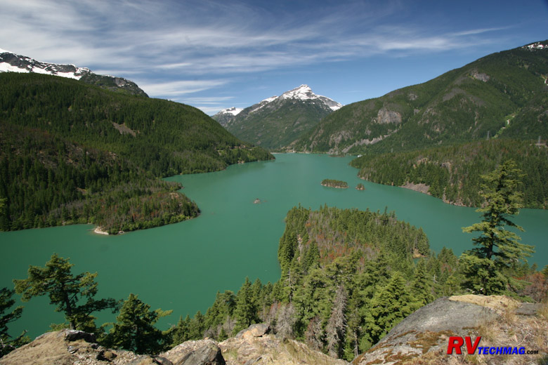
Crater Lake
Before we go one I think we need to side track a little bit. If you began this trip at Brookings the southern end or traveled up
through the California redwoods, you may have decided to take a detour up to Crater Lake National Park. If so you can get there via US-199 from Crescent
City, California or cross over at Coos Bay via Oregon 42 and 138. If you do this in a loop you'll miss lots of great Oregon coastline between Brookings
and Coos Bay though, so you may want to consider returning the same way you go out. we'll have more details on Crater Lake on the next page. If you
aren't interested, and want to skip Crater Lake, just return to the index and then select the Washington Coast page.
Return to Home Page
If you enjoyed this article be sure to recommend RVtechMag.com to your friends, like us on Facebook or Twitter
or subscribe to our RSS feed.


|