Colorado
A Photo Journal of America's Rocky Mountain State
Article Date: January, 2015
Article and Photography by Mark Quasius
Colorado is a land of high places. There are 53 mountains in this state that rise over 14,000' in altitude. Excellent skiing
is abundant from Vail to Denver's front range. The Colorado River begins its journey in the headwaters at Rocky Mountain National Park and winds its
way through the Colorado Rockies on the way to the Gulf of Baja California. Colorado's history is flavored with many tales from the mining area when
gold was taken out of these hills in large quantities. When the mines played out the towns that sprung up around them overnight faded away just as
fast as their occupants moved on to greener pastures. The ore from these mines was hauled out over some extremely rugged terrain by wagons. These
trails, which precariously cling to the sides of mountain sides have now been taken over by Jeeps and are popular tourist attractions for those who
are looking to explore these mines and ghost towns. But not all mountain roads are wagon trails. A paved road to the top of Mount Evans is the highest
paved road in North America, climbing to the summit of Mount Evans at 14,260'.
The eastern portion of the state is flat ranch land, similar to Kansas. Once you get to Denver, the mile high city, the
westbound traveler will be faced with a wall of mountains. The road follows the valley along with the Colorado River and heads westbound, climbing
the steep passes at Vail before descending into a desert-like environment as you continue west to Utah's canyonlands. In the southwest corner of the
state the San Juan Mountains are found. Among these steep mountains are where Telluride, Silverton, and Ouray are located. A great deal of mining was
done in this area and it's one of the Meccas for Jeep owners in this country.
Rocky Mountain National Park is located right outside Estes Park, Colorado. An easy 1 hour drive north of Denver, this park
is filled with scenic mountain vistas and wildlife. Elk herds are abundant in this area and also filter down into Estes Park's fringe areas. The
clang of Bighorn Sheep can be heard echoing through the valleys and if you're lucky, Beaver will be out and about rather than sleeping in their dens.
This photo journal only deals with a portion of Colorado. There is much more than shown here but hopefully these images may give
you a feel for what it's like.
Ouray
Ouray is nestled in the San Juan mountains in the southwest corner of Colorado. Of the many mining towns in this region,
Ouray is unique. When mining in Colorado was booming, many towns popped up overnight and flourished as the mines, and the miners, prospered.
However, mining isn't forever and once the mines played out most of these towns disappeared almost as fast as they were born. But Ouray wasn't
your typical mining town filled with saloons and brothels. Ouray had those too, but a large emphasis was placed on family life here and schools
and churches were built. Once the mines started to dry up the townsfolk stayed put to raise their families here and find other sources of income.
Today, tourism has caused Ouray to flourish more than ever. The old mining trails that the ore wagons were hauled over no longer remain silent.
Theses trails are popular with Jeep enthusiasts and has earned it the reputation of the Jeep Capital of the World. Modern visitors flock to
Ouray for its beauty and recreation. It offers the scenic vistas of the Million Dollar Highway, winter sports such as the Ouray Ice Park and
hot springs. A number of waterfalls are found in the area and one is even accessible a short walk from the downtown area.
The San Juan mountains are beautiful but they can be treacherous. The steep cliffs give this area the title of Avalanche
Capital of the United States. The highway marker to the south on US-212 bears witness to the deaths caused by this swift thundering danger. Yet,
this same topography makes for some prime winter recreation. Telluride is just over the ridge and offers excellent skiing while Ouray's famous
Box Canyon is home of the annual ice climbing championship. Nestled in a small valley with the mountains as a backdrop give Ouray the name
"Switzerland of America". Heading north the drive takes you to Grand Junction, Colorado but the drive to the south is spectacular. US-550 leaves
Ouray by climbing a series of switchbacks and proceeds south to Silverton and then Durango over what is known as the "Million Dollar Highway". If
you're the kind of traveler who doesn't mind mountain roads that get narrow at some spots you'll be rewarded with some of the most spectacular
views you've ever seen. It's definitely a must see trip.
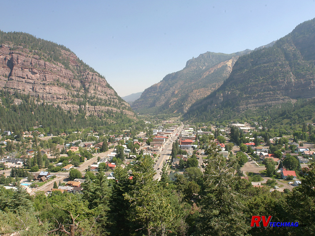
Ouray
When approaching Ouray from the south the Million Dollar Highway drops down through a series of switchbacks. This view of
Ouray was taken from a pull off spot near the base of the switchbacks. The main road can be seen as it passes through town and out the valley to
the north. This amphitheatre like setting earns the town its nickname, "Switzerland of America".
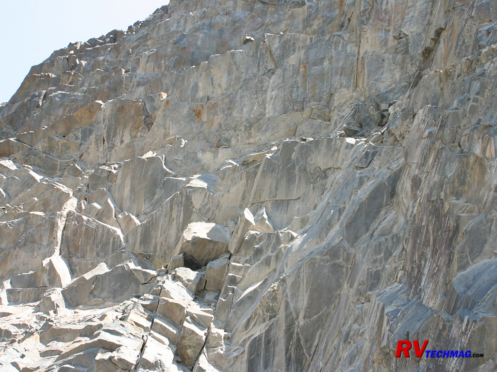
Grizzly Falls
Just south of Ouray on the Million Dollar Highway Grizzly Creek passes by craggy cliffs after tumbling over Grizzly Falls.
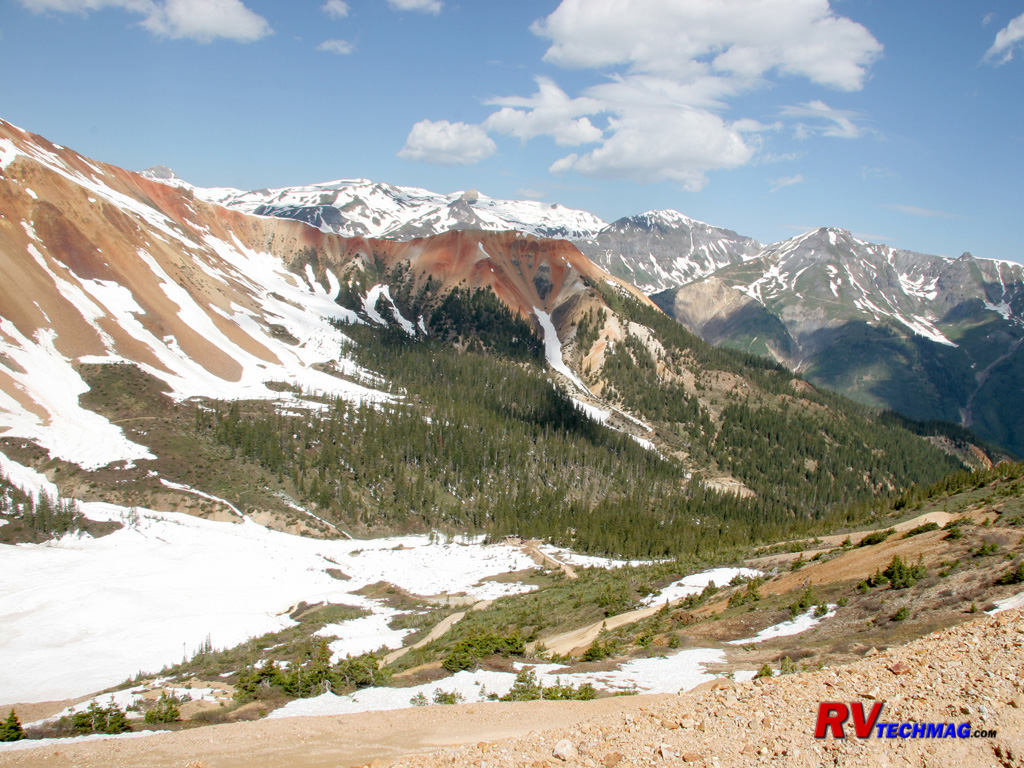
Red Mountain
Red Mountain is the largest and the most visible from the Ouray area. Situated alongside the Million Dollar Highway it's easily
seen from the highway down below. This shot was taken from a high country Jeep trail on its flanks.
Mine Shaft
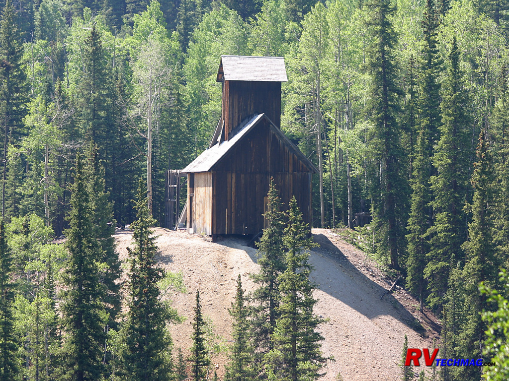
The area surrounding Ouray is dotted with many abandoned mines. Many of these shafts were built upon piles of tailings as this
shaft south of Ouray shows.

Mine
Just south of Ouray, beginning in the old town of Ironton (barely a trace still remains) a number of trails climb their way
through the San Juans, passing by mining sites such as this.
Corkscrew Gulch
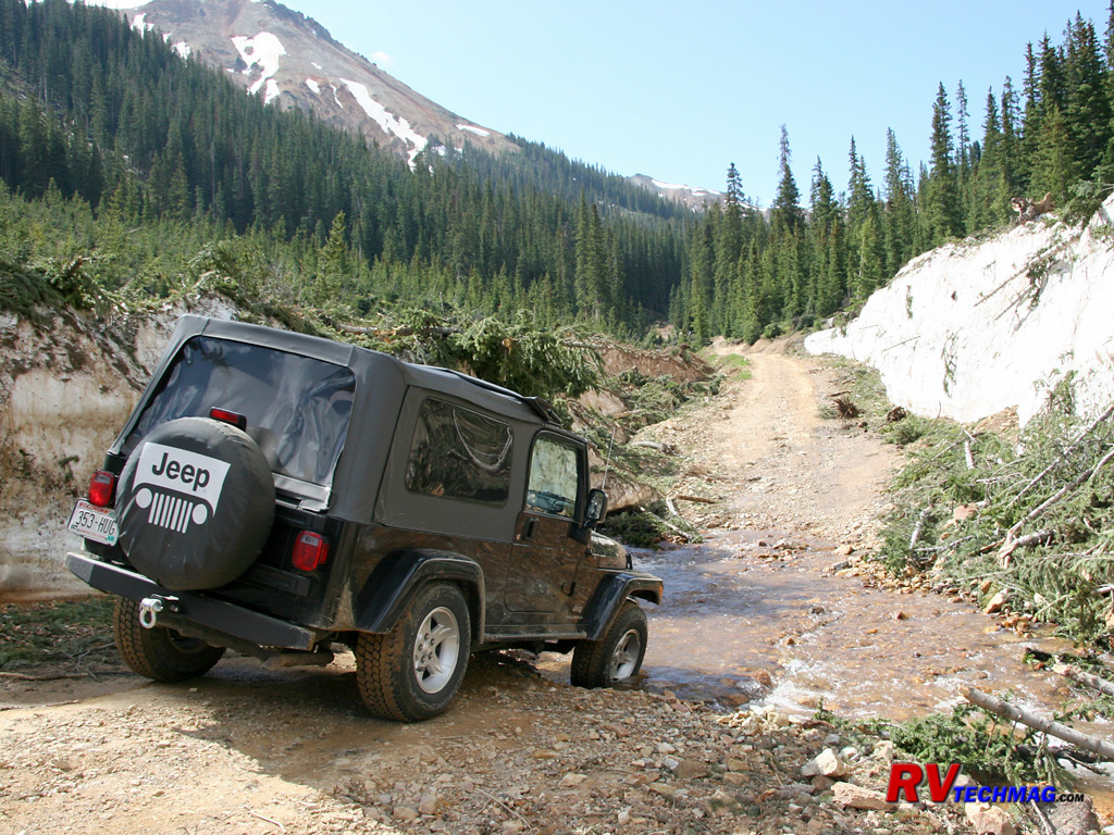
One of the popular Jeep trails is the Corkscrew Gulch trail. Beginning south of Ouray this trail connects with others and
climbs high up into the mountains.
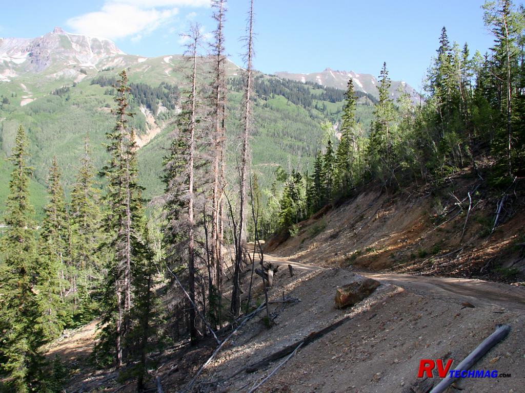
Corkscrew Gulch
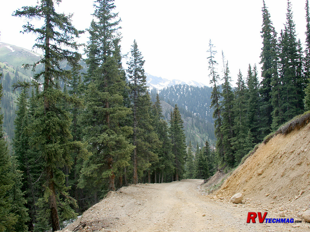
As you climb the Corkscrew Gulch trail you'll traverse many slopes. Each corner offers a different view of the scenic wonders
that are not obtainable from the roads below.
View of the San Juans
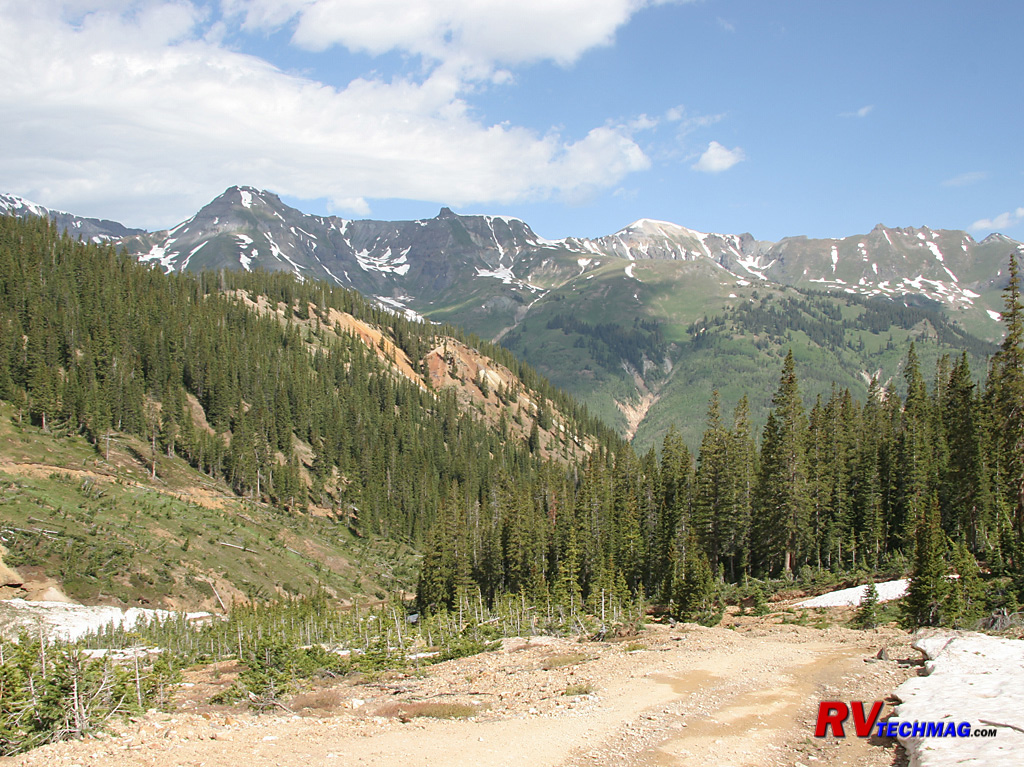
When climbing these mining trails a number of views of the San Juans appear. On most summer days the clouds will be clear
and you'll have unencumbered views of these majestic peaks.
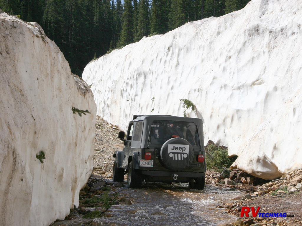
Heavy Snow
Many trails are not open until July. This late June run through Corkscrew Gulch showed plenty of snow left over. The snow melts
fast and the streams are rushing with snowmelt but when you have this much snow, it stays around a while. This snow bank was in the lower areas and a
pathway had been cleared by a bulldozer earlier.
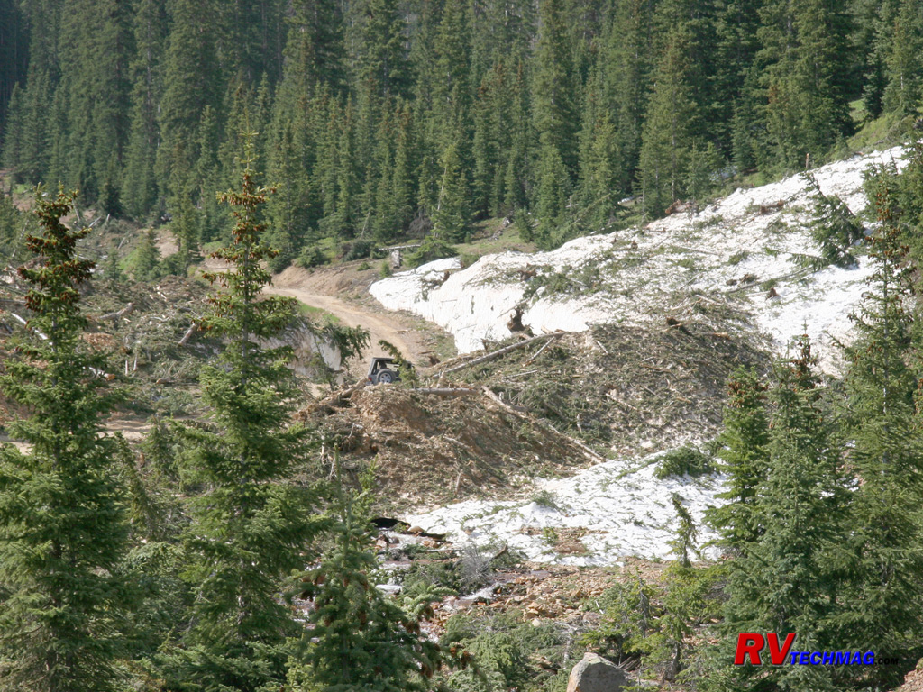
Avalanche Zone
Avalanches are common in the San Juans. This particular area suffers every winter and heavy equipment is used to remove
trees and brush carried by the snow on its deadly path down slope.
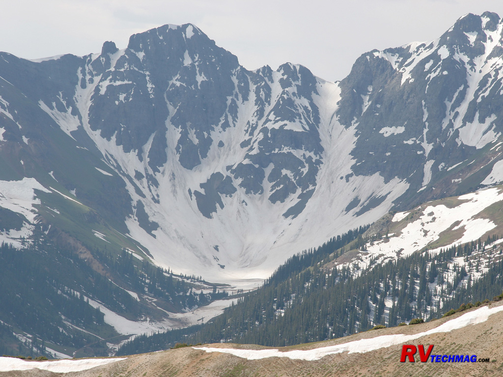
Silverton Glacier
From high up on Red Mountain this glacier was seen in the Silverton area. Glaciers aren't as common in the San Juans because
their mountainsides are fairly steep but a few do exist.
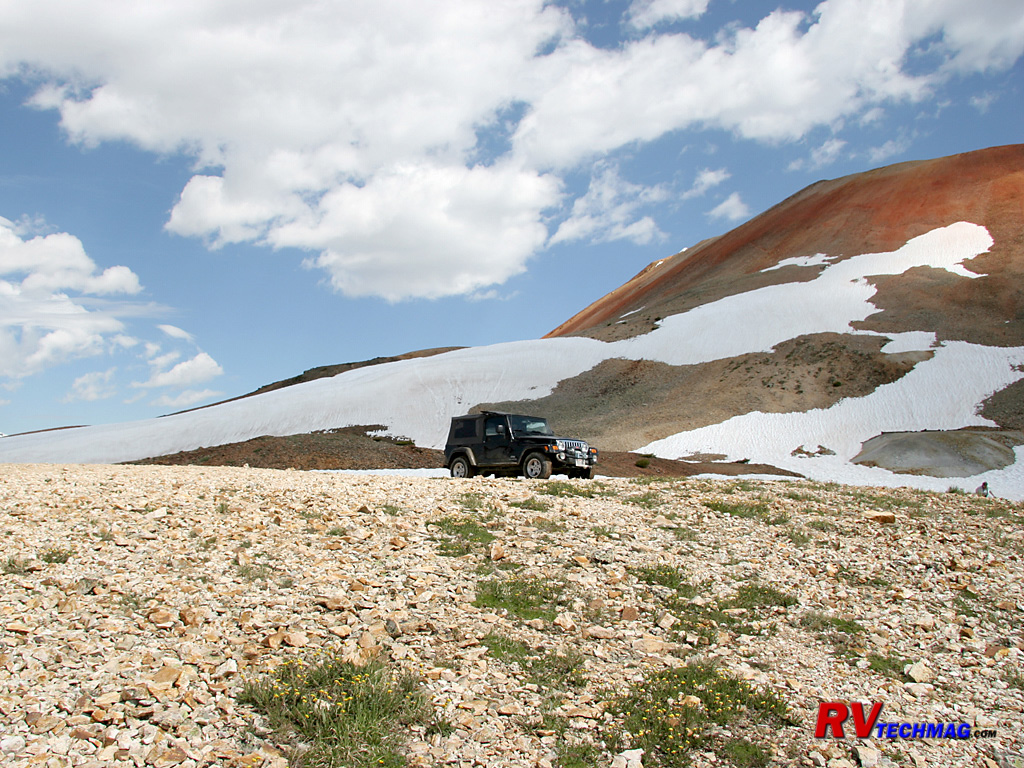
At the Top of Red Mountain
A trek to the top is rewarded by unparalleled views. Also some pretty cold temperatures for June.
Silverton and Animas Forks
Located south of Ouray, Silverton sits in the middle of the Million Dollar Highway, which begins to the south in Durango.
Nestled high in a mountain valley at 9,318', Silverton is another mining town that was famous for its silver mines but it also was connected to
Durango to the south via the Silverton-Durango Railroad. This narrow gauge line gave the miners a cost effective way to transport goods in and ore
out of the mountains. This railroad winds its way through the tight valleys and clings to the sides of the San Juans. Today this railroad has been
restored and now transports passengers on a one hour trip through some amazing scenery.
Silverton was founded in 1875 but the original 100 inhabitants grew to 500 in 1876. Life wasn't easy for them and the
statistics from Silverton's cemetery indicate that 117 died from snowslides, 143 from miner's consumption, 161 from pneumonia, 138 from influenza
(most in the 1918 epidemic), and 202 from mine accidents. At first they came by foot and with mules but in 1879 the wagon road over Stony Pass
opened and in 1887 the railroad from Durango reached Silverton. Railroads also reached Ouray from the north but there was no connection between
Ouray and Silverton due to the rugged terrain in the Uncompahgre canyon. Mining reached its peak between 1900 and 1912 and Silverton flourished
and most building were built at that time. After that the mining industry went through booms and busts and Silverton rode them out but when Lake Emma
flooded the Sunnyside Mine in 1978 that was pretty much the end of Silverton's mining era. Silverton is also known for its winters. Silverton is not
an agricultural area and the growing season is only 14 days long. Tucked in the San Juan mountains, it receives an average of 200 inches of snow
per year. In 1932 Silverton was snowed in for 32 days at one time but modern snow removal equipment has changed that and it's now rare to be isolated
for more than one day at a time.
Today Silverton has much to offer. Nearby mines are easily accessed via Jeep trails and the scenic setting is another draw
for tourism. Animas Forks, a nearby ghost town is in remarkable shape after all these years and a popular spot for 4WD vehicles. Molas Pass, jut
south of Silverton, has the distinction of having the cleanest and clearest high quality air, as shown by government research. 95% of the lands in
this area are public lands so there is much to see and do. Leaving Silverton to the north, you'll finish your drive on the Million Dollar Highway by
passing through the spectacular Uncompahgre River canyon and emptying in Ouray's amphitheatre setting. Driving south you'll climb Molas Pass and
eventually the road descends as the valley widens on its way to Durango.
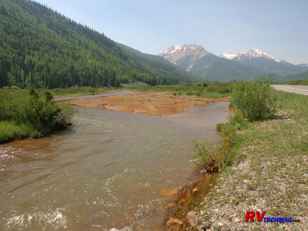
Mineral Creek
North of Silverton, Mineral Creek flows alongside the Million Dollar Highway. As snowmelt and rain water runs downhill from the
mines it picks up traces of the minerals from the tailing piles that are abundant in this area.
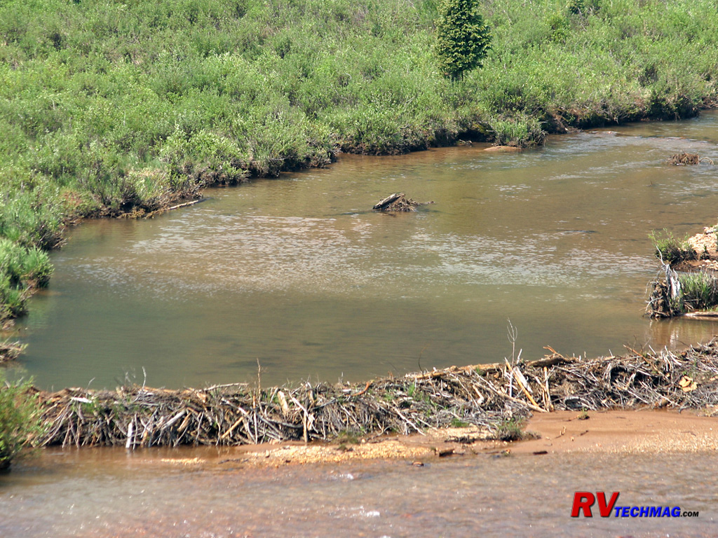
Beaver Dam
Beaver locate their dens anywhere there are Aspen nearby. By creating a dam they control the water level near their lodge.
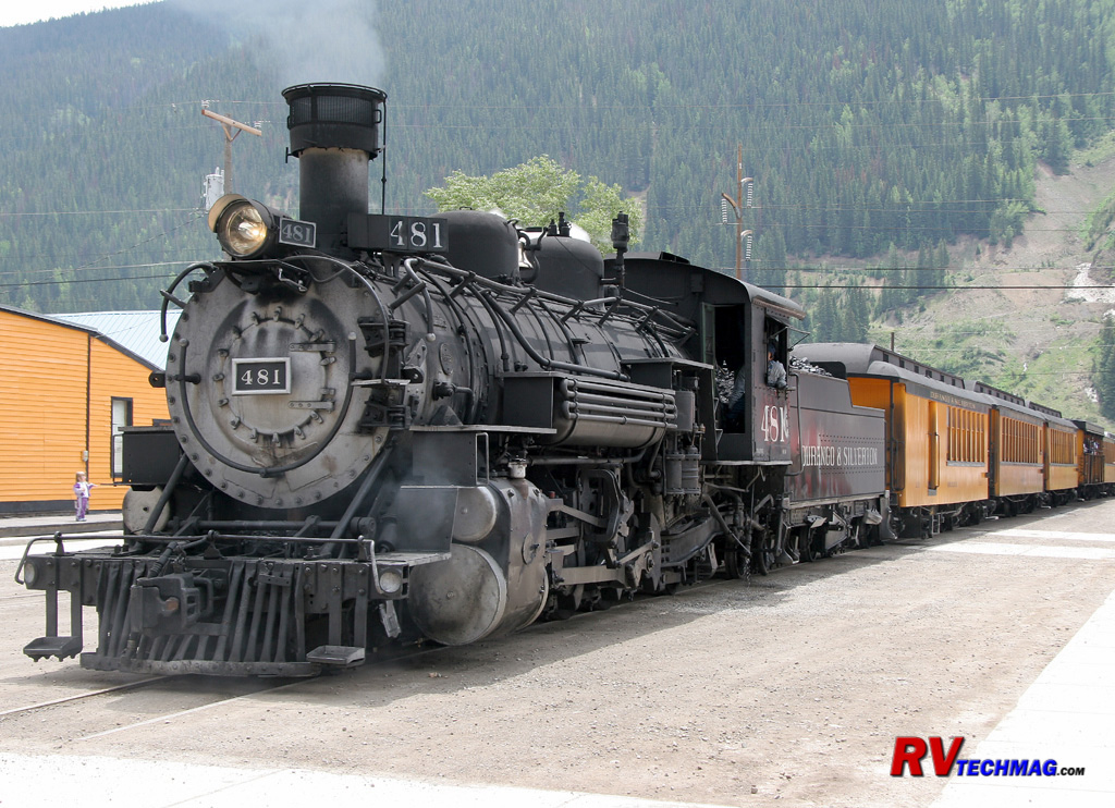
The Silverton
The restored Durango and Silverton narrow gauge railroad now hauls tourists rather than mining supplies through the twisting
valleys and over the mountain passes between Durango and Silverton, docking right in downtown Silverton.
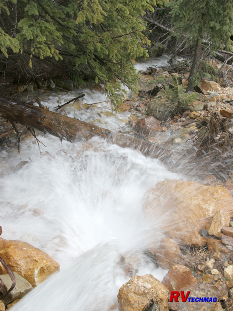
Snow Melt
The heavy snow cover takes time to melt and the numerous streams in the area are filled with rushing water thought most of the
summer.
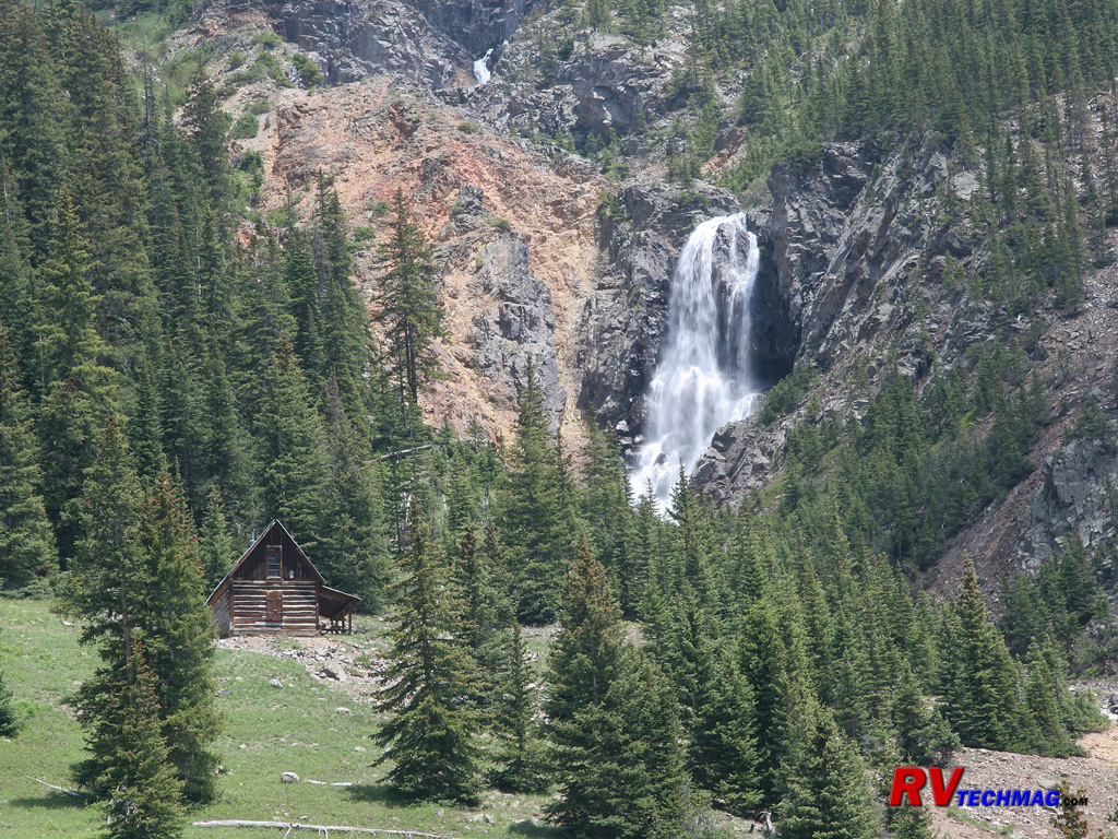
Cabin and Waterfall
Tucked against a slope, this miner's cabin has found the perfect scenic setting next to a waterfall.
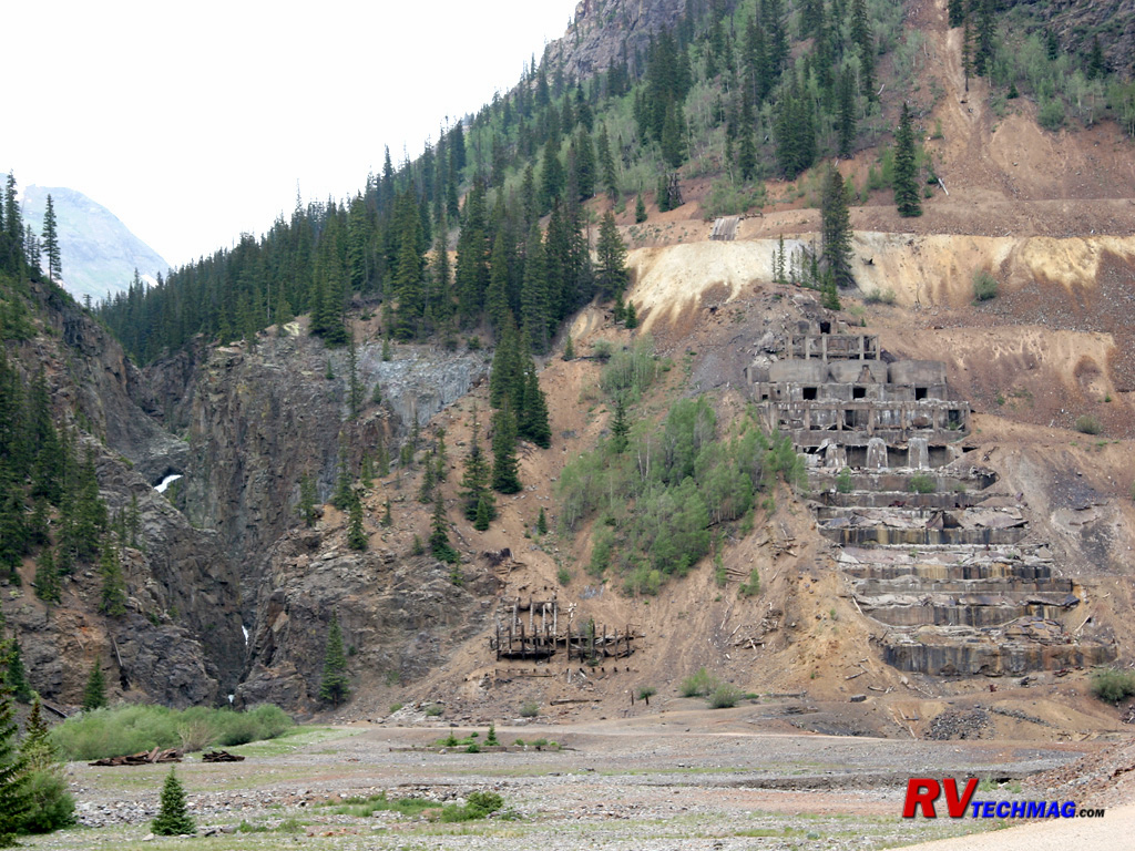
Eureka Mill Ruins
Where there are mines, there are mills. Mills are used to process the ore and remove the precious metals from the ore. This
mill at the Eureka townsite was built in steps upon the mountain. The heavy machinery required large concrete foundations to support the weight and
stress of their operation. After the years have taken their toll, all that remains is the concrete footings as the wood was either removed or
destroyed in avalanches.
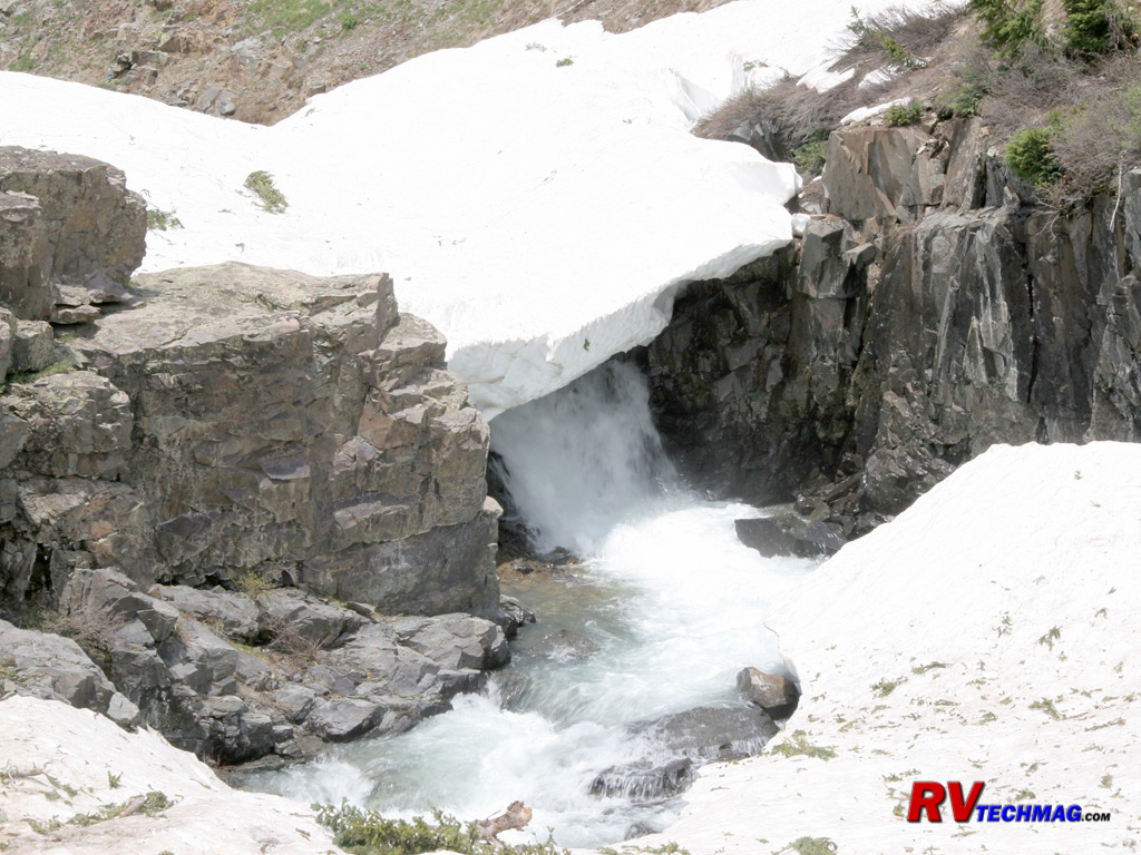
June Runoff
In the end of June, many ditches and gullies are still snow covered as the water flows beneath them.
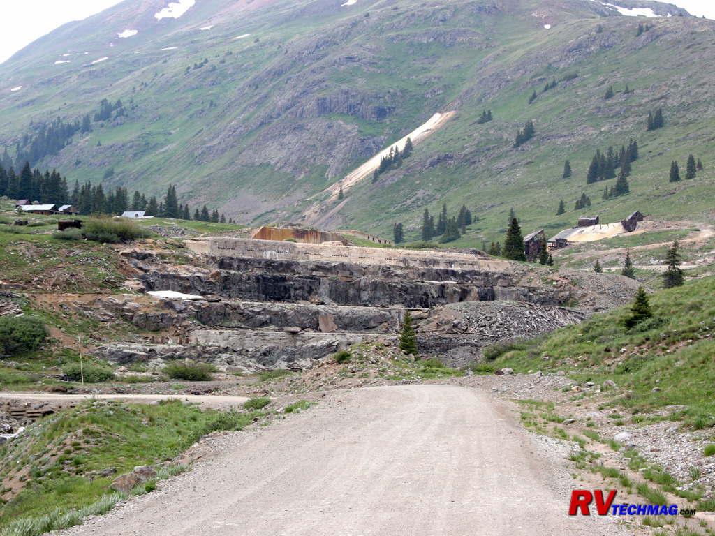
Entering Animas Forks
As you enter Animas Forks, the foundations of the old mill are found at the entrance to town. This pile of concrete and
large steel anchor bolts is all that remains.
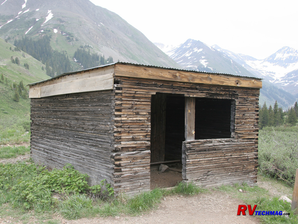
Miner's Hut
Mining wasn't easy and conditions at this altitude, especially during winter, wasn't overly hospitable. This miner's hut
was the home for two miners.
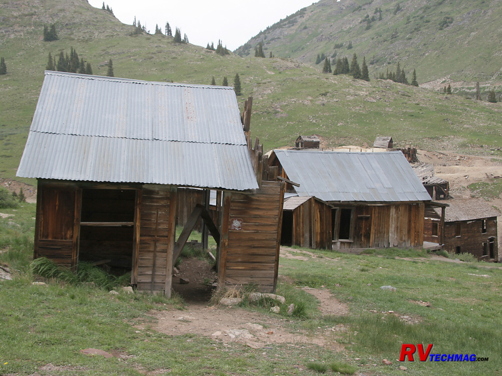
Residential Area
Animas Forks began in 1875. Its sign advertised it as the "largest town in the world" and then, in small print "at this altitude"
which was 11,300' above sea level. It was a short lived community and the mining lasted for maybe 20 years. Its biggest enemy was the constant
avalanches that occurred in this valley, some of which would road down one side and up the other because the valley was so narrow. This section of
Animas Forks was a residential section and a few houses remain.
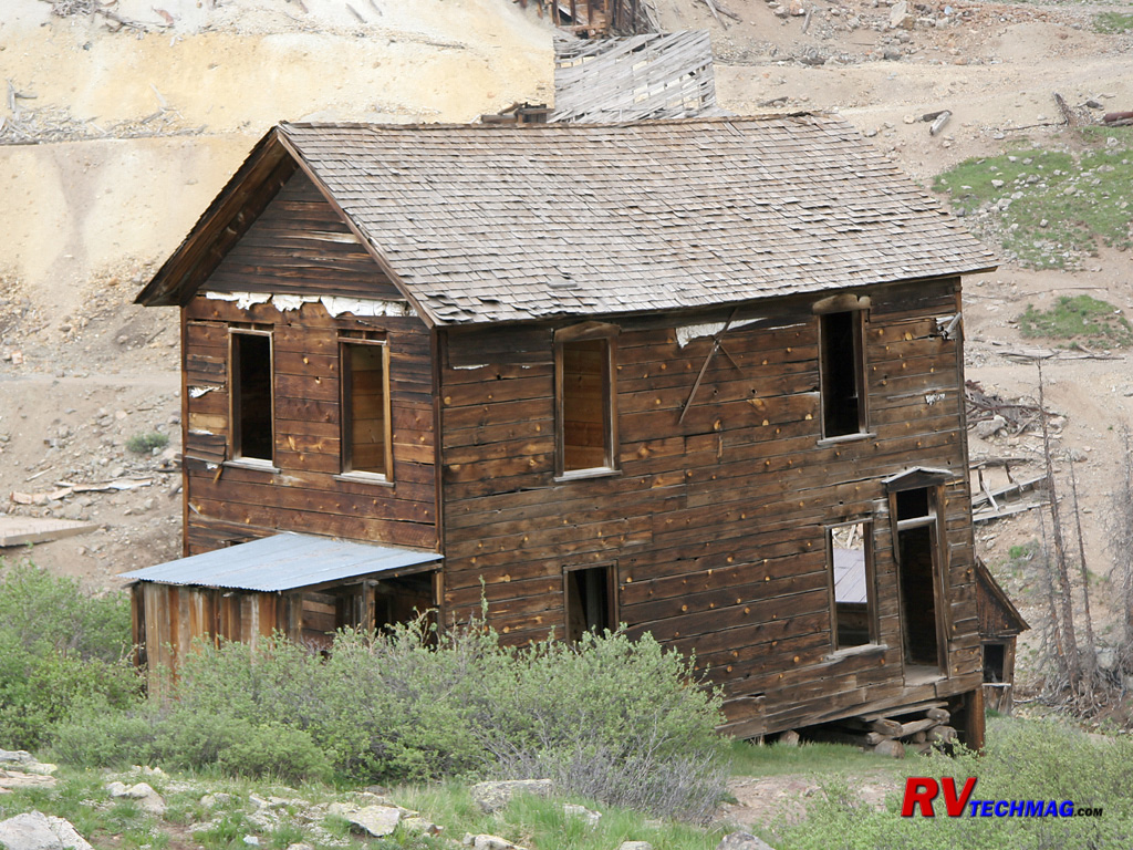
Walsh House
This rear view of the Walsh House shows some of the newer interior lumber. Some of the structures in Animas Forks are being
reinforced to prevent further decay.
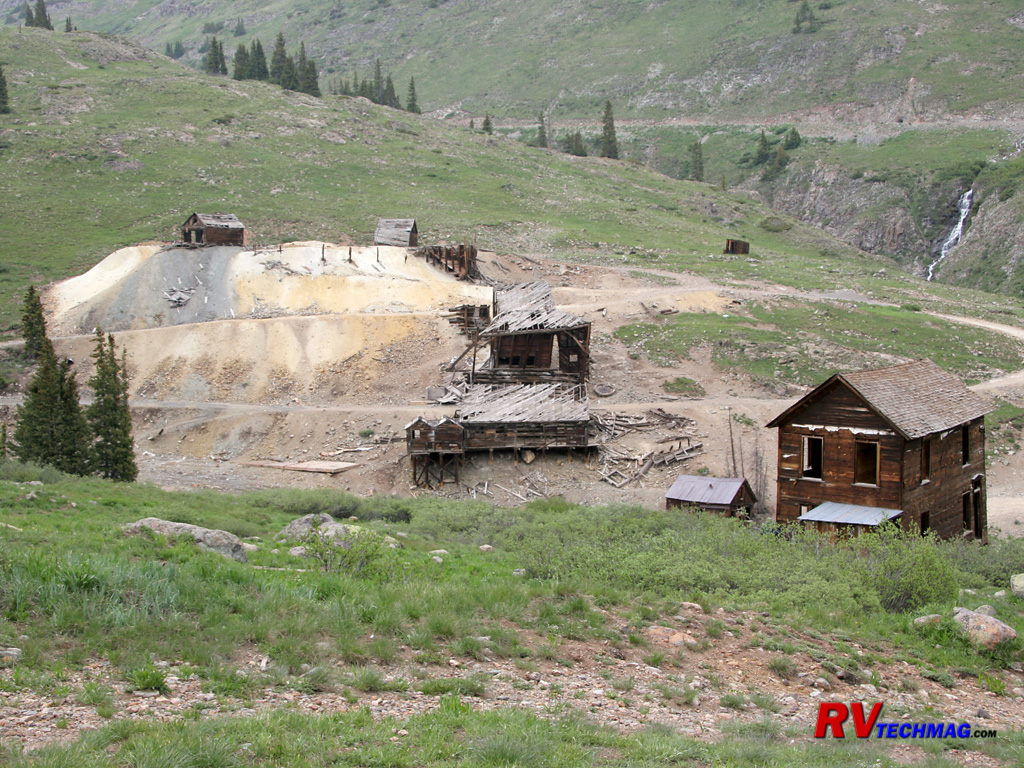
Bunkhouse RuinsForks
This view shows the remains of the Columbus Mine, as well as the bunkhouse or boarding house, which also served "other needs"
for lonely miners. Many bunkhouses were built right on the mine site and surrounded by piles of tailings from the mining operation. Being situated on
slopes these were prime targets for destruction by avalanches. Most miners would retreat in the fall and return again in spring because to remain in
Animas Forks over winter meant dealing with the threat of avalanches as well as total isolation.
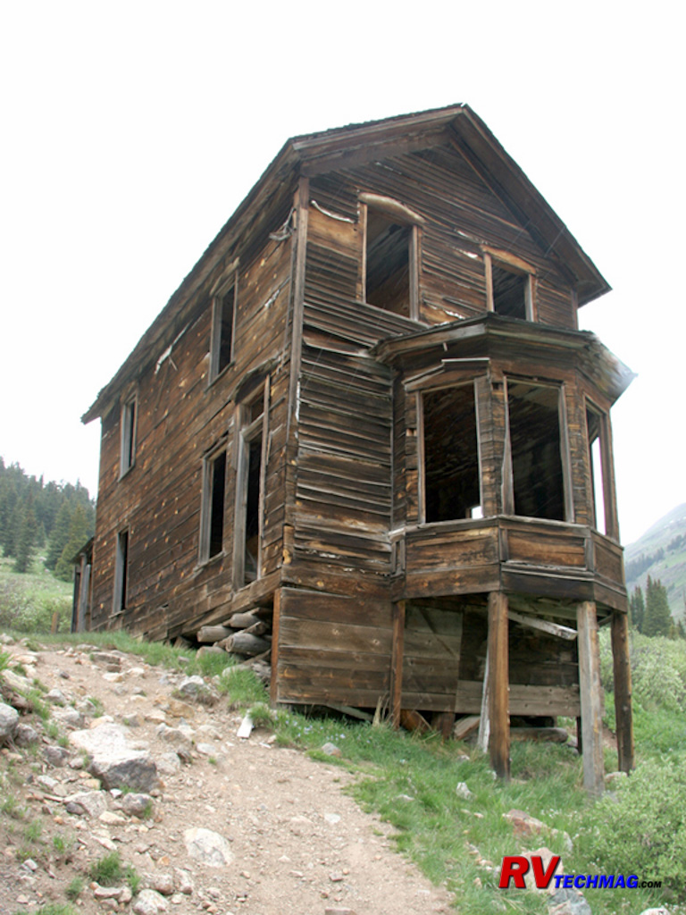
Bay Window House
The Walsh House, also know as the Bay Window House, was the home of Evelyn Walsh McLean, the daughter of Tom Walsh, who
discovered the famous Camp Bird Mine and owned the Hope Diamond.
Leadville
At 10,350' above sea level, Leadville holds the distinction of being the highest incorporated city in the United States. Its
story begins in 1879 when the Slater Party made the $8 million gold discover in California Gulch. The area exploded as prospectors converged upon the
scene but by the mid 1860's all of the gold reserves were mined out. But the "black stuff" that they tried to separate from the gold in their pans
was actually silver bearing lead ore. A number of years later, a pair of miners recognized its value and began buying up old "worked out" gold claims.
By 1880 the silver boom had begun and Leadville was the second largest city in the state. Millionaires were made overnight and many mines produced
hundreds of thousands of dollars in income every day. By 1893 the Silver Crash of 93 brought the price of silver to zero and many of these
rags-to-riches stories turned to riches-to-rags.
Leadville, sitting in a beautiful setting in the Rocky Mountains was a place of scenic color. But, the people who lived and
visited here were also colorful. Doc Holliday held his last shootout in Leadville and then spent 54 days in jail, penniless to post bail. Big Nosed
Kate eventually took him to Glenwood Spring where he died of consumption. Many visitors stayed in the community. Names such as Wyatt Earp, Bat Masterson
and the Cole-Younger Gang to name a few. The unsinkable Molly Brown, later known for her role in the Titanic disaster, found instant wealth in the mines
here with her husband JJ Brown.
Leadville continued on, even after the silver bust of 1893. During World War II nearby Camp Hale was the training spot for the
Army's 10th Mountain Division. It became a popular visit for soldiers but only after the city acted to curb prostitution. Prior to that the city was
declared off limits by the army to all US soldiers. From then on the incresed demand for molybdenum helped the Climax mine, which at one time produced
75% of the world's molybdenum. The closing of the mine in the 1980s was a major blow. The years of mining left behind contaminated soil and water so
that the EPA declared many mines Superfund cleanup sites. Today's Leadville relies on tourism for its income but is unique in that its history remains
in place for all to see. A visit to Leadville is more like a step back in time.
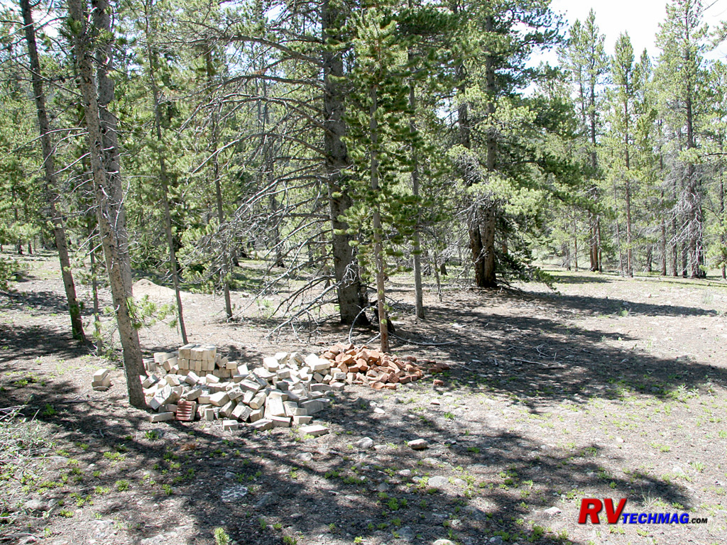
Evansville
The townsite of Evansville was once a bustling town with over 1,000 inhabitants. When the mining boom turned to bust the
occupants left and their homes were dismantled to use as lumber for other structures as well as timber for mine shoring. Eventually the trees grew up
in its place and the townsite is now hidden from view. A hike amongst this location reveals that all that remains is stacks of bricks, rusty metal
hardware, and broken bottles.
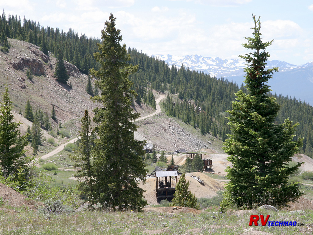
Mining District
East of Leadville a climb up into the mining district reveals a large spread of mines clinging to the hillsides of California
Gulch. Mount Elbert and Mount Massive can be seen to the west.
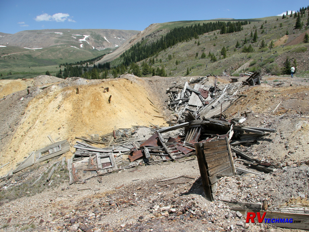
Mine Remains
Many mine shafts were filed in with dozers in recent years to prevent anyone from falling into these long vertical shafts. If
you find an open shaft and drop a rock into it you'll be surprised at how long it takes to hear the splash as it hits the water below. Those shafts are
extremely deep.
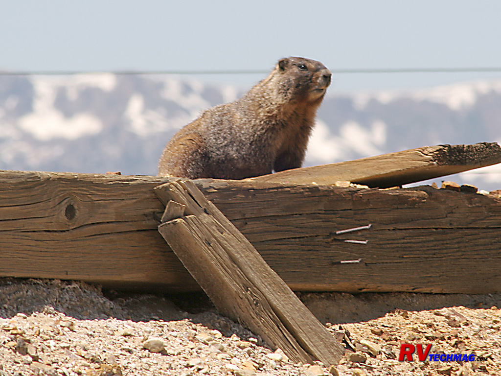
Marmot
This Yellow Bellied Marmot was found on old mining timbers wondering who this human visitor was.
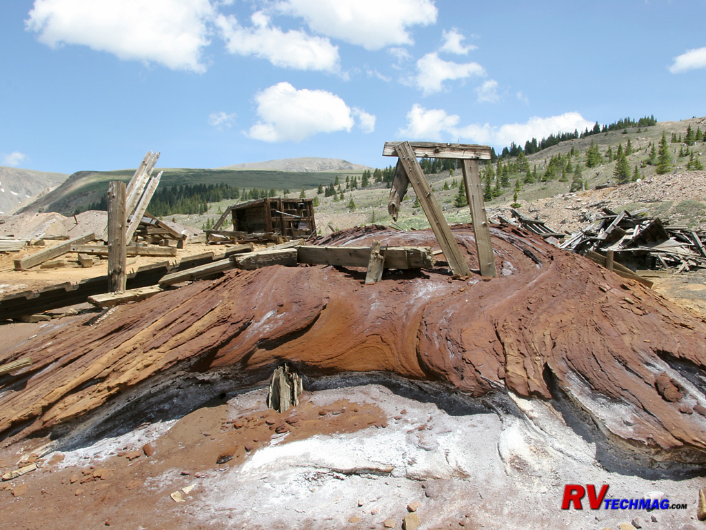
Mine Tailings
When removing the ore from the mines, acids and chemicals are used to leach the mineral from the ore. This tends to leave a
discolored mess in the area and the chemicals also get into neighboring water supplies but these were the days before "environmentally friendly"
became a buzzword. These tailings were found at the top of one of the mines in Leadville's east gulch.
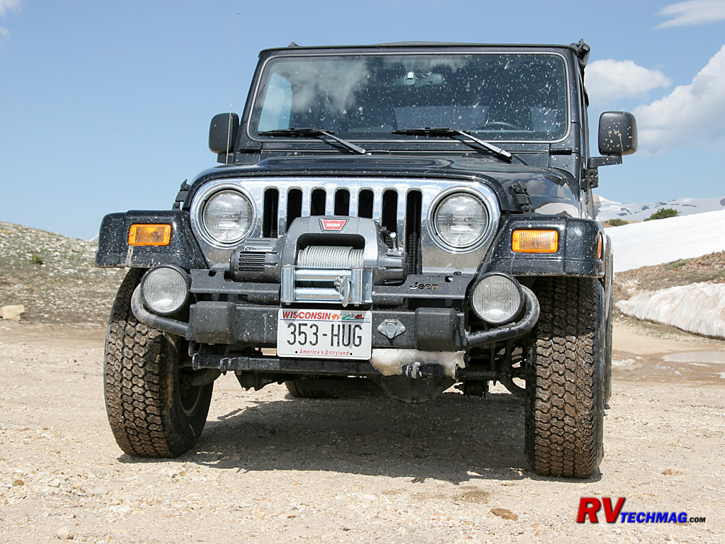
Jeep
When exploring these mines the Jeep is the best method of transportation. Its ability to climb grades, traverse rocky terrain,
and maneuver in tight quarters is unparalleled and makes it a prime candidate for this terrain.
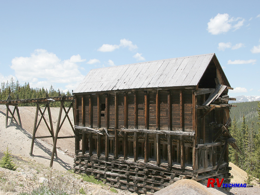
Mill
Mills were used to process the mineral from the ore. The ore entered the mill at the top via carts and was dumped into the
machine works to be ground and processed. The tailings were dumped in the surrounding area and the mineral was loaded into wagons via chutes at the
bottom of the far side of the building.
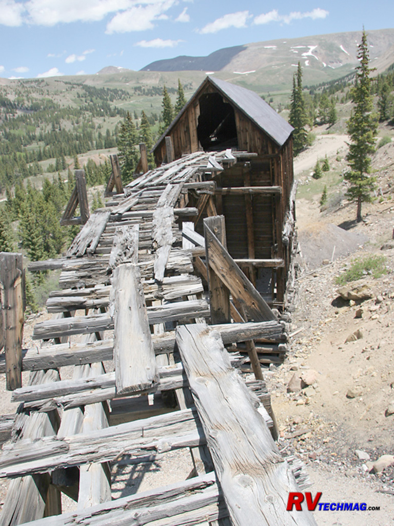
Mill Track
The ore was brought into the mill via carts that passed along this track, which connected the top of the mill to the slope
nearby. Presumably it was in better shape back then.
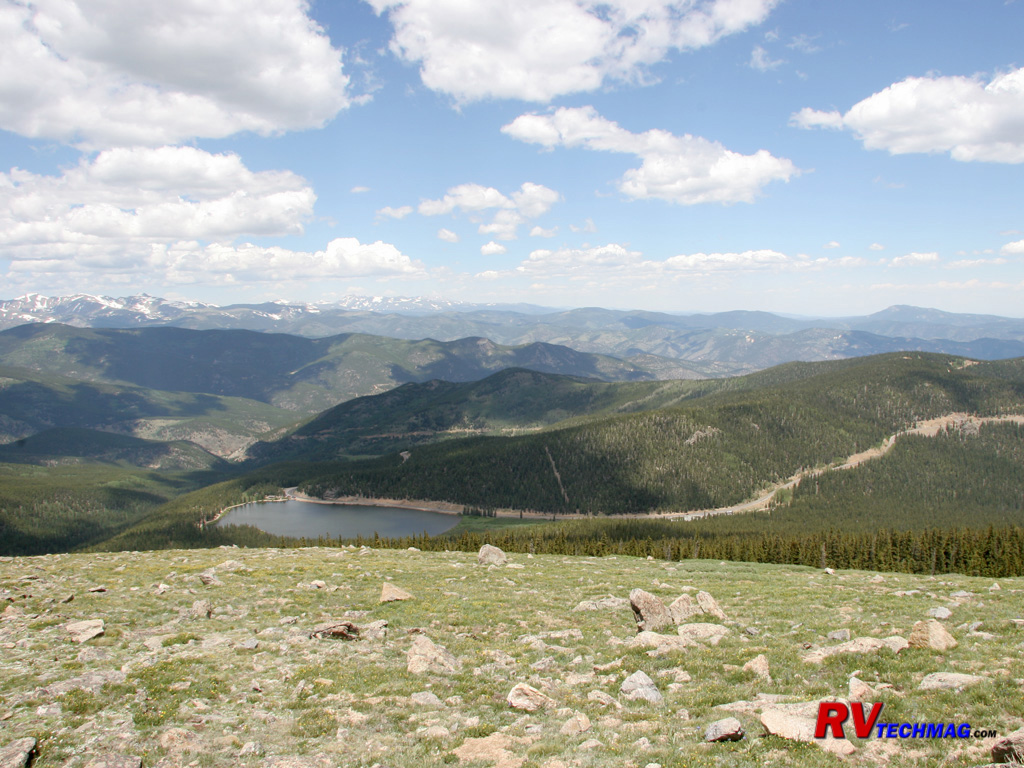
Turquoise Lake
Immediately west of Leadville lies Turquoise Lake. This image was taken from high up in the California Gulch mine district.

Mount Elbert
Mount Elbert is the highest peak in Colorado. At 14,433' it towers over the town of Leadville.
Mesa Verde
Mesa Verde (Spanish for Green Table) is located near Cortez, in the southwest corner of Colorado where Colorado, Arizona,
New Mexico and Utah all converge at one point in the four corners region. Mesas abound in this region but Mesa Verde is a huge mesa, which is a
flat topped mountain that stretches for many miles. Within the flat topped reaches of this Mesa are a number of ravines and deep canyons that taper
out and widen at the south, much like a Norwegian Fjord. Within these canyon walls are found a number of cliff dwellings that were constructed by
the Anasazai Indians.
The Anasazai appeared on the scene around 550 AD, at first they lived in pithouses on the top of the Mesa before evolving to
cliff dwellings. The Anasazai were farmers so they constructed irrigation canals to move water around their fields. The early Anasazai lived this way
for about 200 years, from 550 AD to 750AD. This era was referred to as the Basketmaker era. The Basketmakers eventually built houses above ground,
using poles and mud. These early dwelling more closely resembled a motel than a house and many were clustered together. The Modified Basketmaker era
extended to around 1050 AD. At this time the Classic Era began. The Anasazai now were skillful builders with adobe brick and the population reached
several thousand. These pueblo builders now built many of their dwellings into the sides of cliffs and created the massive cliff dwellings that we
see today. Around 1300 AD the Anasazai mysteriously left Mesa Verde. Historians don't know why they left. Was it lack of food? Were they driven out
by an enemy? Was the soil depleted after centuries of farming? Traces of the ancestral pueblo builders are found in today's Hopi society but no
history is brought forth to chronicle why they left. Fortunately the Anasazai weren't neat and they dumped their trash nearby. This has helped
archeologists to piece together clues as to how they lived.
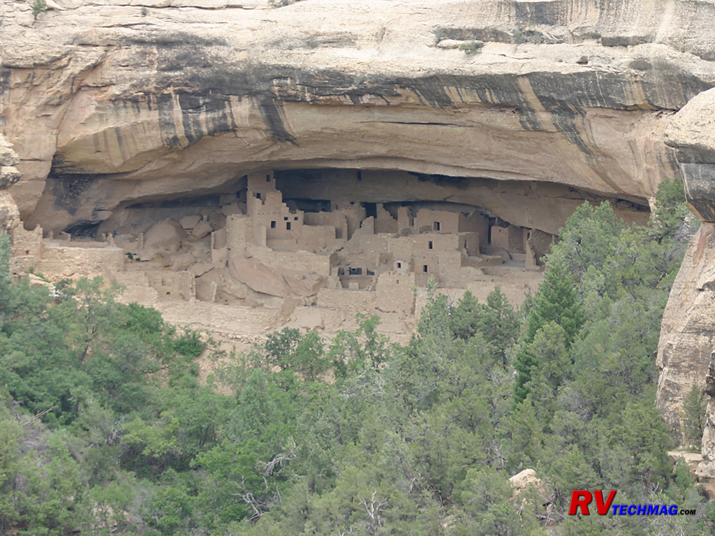
Balcony House
One of the largest and best preserved pueblos is the Balcony House complex. The National Park Service conducts interpretive
tours from the top of the rim down into Balcony House. Balcony House offered excellent protection from enemies as well as from nature.
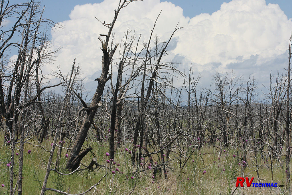
Fire Damage
In recent years Mesa Verde was engulfed by wide spread forest fires that swept across the Mesa during a drought. The ash from
these trees now fertilizes new meadows and wildflowers and begins a new season of regrowth.
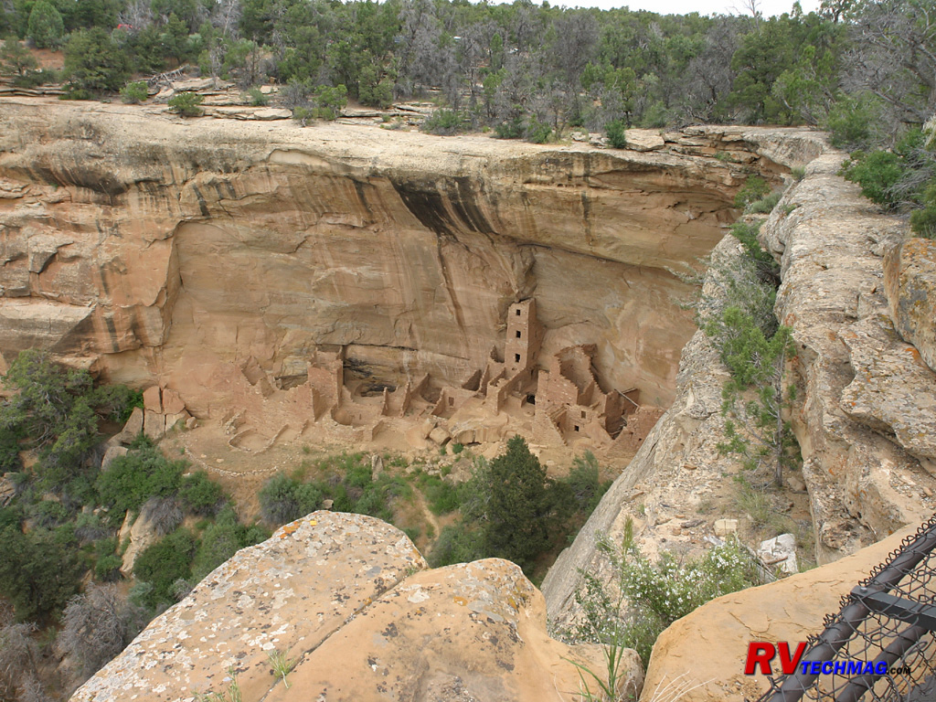
Square Tower
Tucked underneath a ledge is Square Tower. This pueblo is noted for its tall tower that still remains. The elements have taken
a toll on this pueblo over the years and much of the pueblo has been damaged by the falling overhang and the elements.
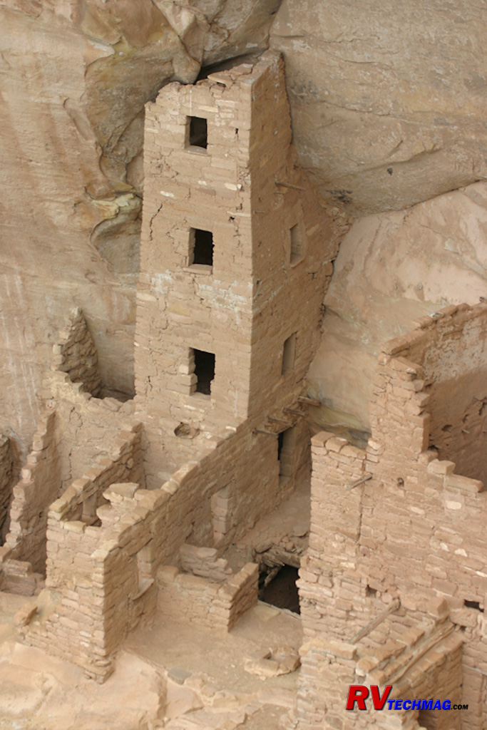
Square Tower
This close-up view of Square Tower pueblo reveals the details of its construction. Adobe bricks were made to form the walls
and many wooden poles were used to support floors and tie the walls together as well as for ladders.
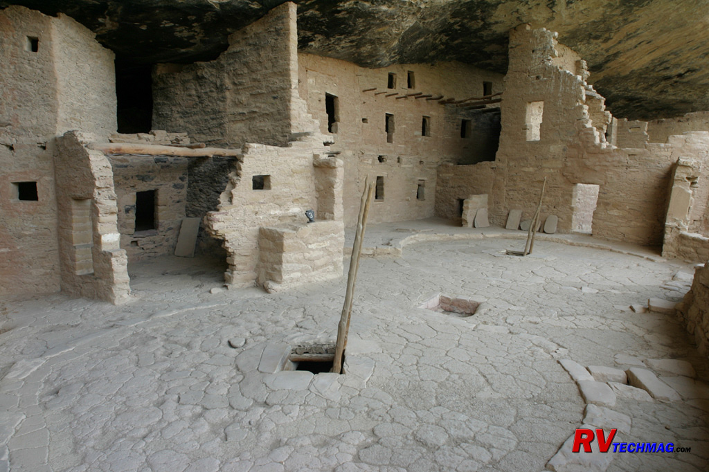
Spruce House
This shot of part of the Spruce House complex shows a pair of Kivas as viewed from the surface. Kivas were underground
ceremonial gathering places and were an integral part of every pueblo. The rooms above represent living quarters for the pueblo's occupants.
Artifacts recovered indicate that much of the day to day work was performed in the open areas of the pueblo and that the rooms behind were mainly
for sleeping.
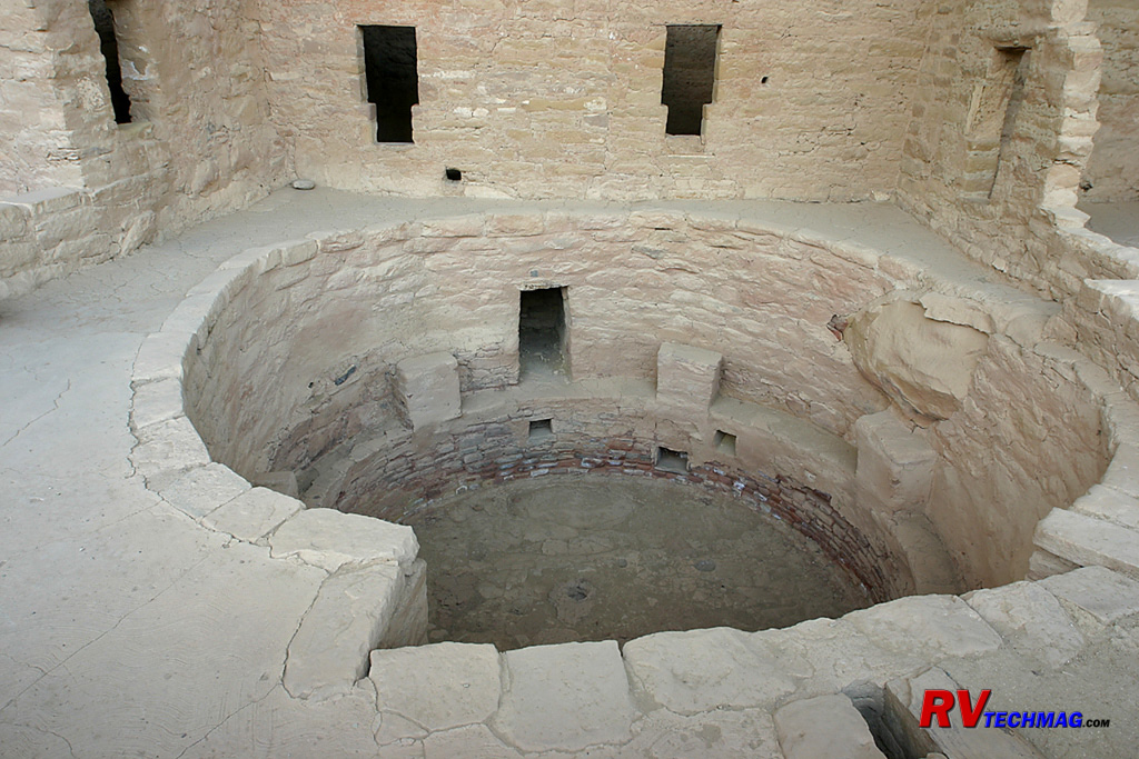
Kiva
Kivas were the central gathering place for each pueblo community. This exposed view of a Kiva shows the how they were
constructed. The occupants sat around the perimeter on the stone benches. The center of the roof structure was supported by a ladder, which
also gave access to the Kiva. At each end chimney vents were located to provide fresh air for the fire and allow the fire's exhaust to escape
out the center. Little is known about the Anasazai but it is presumed that these Kivas served some sort of religious or ceremonial service.
Mount Evans
Mount Evans is found west of Denver on the Front Range of the Rockies. Easily accessed from Idaho Spring, a paved road takes
you to it's summit. At 14,270' this is the highest paved road in America and offers panoramic views of Denver's front range and the plains below. At
the turn of the last century, Denver and Colorado Springs were competing for tourist dollars from eastern travelers. In 1888 the Cascade and Pikes Peak
Toll Road Company completed a 16 mile road up the north side of Pikes Peak. This was an instant hit with tourist so Denver's mayor lobbied for a road
up Mount Evans to keep tourist dollars from getting away. In 1917 Denver was able to secure state funding to complete a road to the top of Mount Evans
and the road was completed in 1927.
The drive begins in Idaho Springs, just west of Denver. A 2 lane blacktop road winds its way through the forests and climbs up
to Echo Lake. Echo Lake is located at 11,000' and features the Echo Lake Lodge as well as a park maintained by Denver Mountain Parks. Continuing on
past Echo Lake there is a gate that closes the road above 11,000' during the winter season, which generally runs the end of September through Memorial
Day. Continuing on to Summit Lake there is a rest area and pit toilets that are maintained by Denver Mountain Parks. Once you reach the summit there
is a parking lot. The remains of the Summit House, which was built during the summers of 1941 and 1942, are still here. Summit House had a restaurant
and gift shop and offered great views of Denver and the eastern plains. Unfortunately, it burned in 1979 and was never rebuilt.
In addition to scenic vistas, Mount Evans is brimming with wildlife. Elk are found in the lower sections while Rocky Mountain
Bighorn Sheep are abundant at all elevations. Mountain Goats can be seen traveling over impossibly rocky terrain with ease while Pika hideout amongst
the rocks at higher elevations. Mount Evans has more Marmots per mile than any other mountain in Colorado and can be seen at varying elevations as
they dart in and out amongst the rocks.
Mount Evans is a true recreational spot. The wilderness area is administered by the US Forest Service and is popular with
hikers and bicyclists as well as passenger car tourists. At 14,270' the air is thin so recreation needs to be limited to those who have adapted to
this higher altitude but the mountain does offer something for everyone.
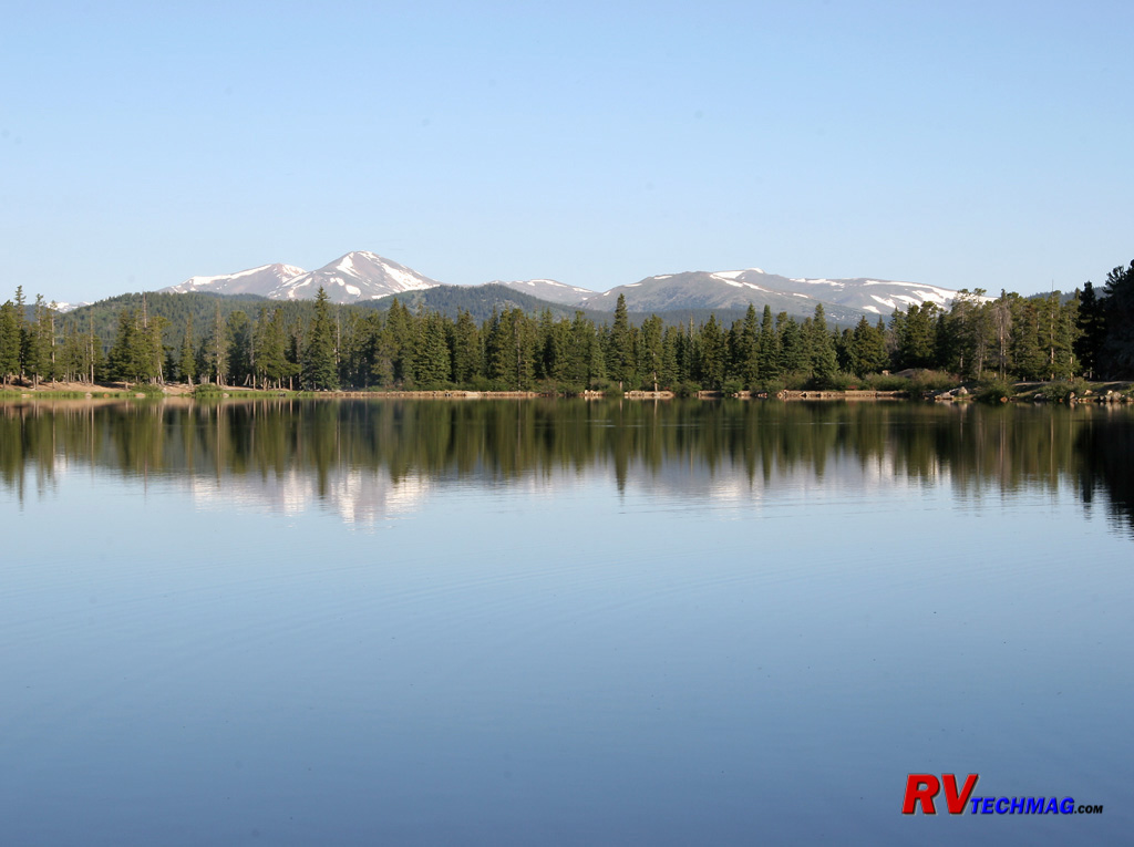
Echo Lake
Situated at 11,000' this jewel reflects the beauty of the sky and the Gore Range to the north.
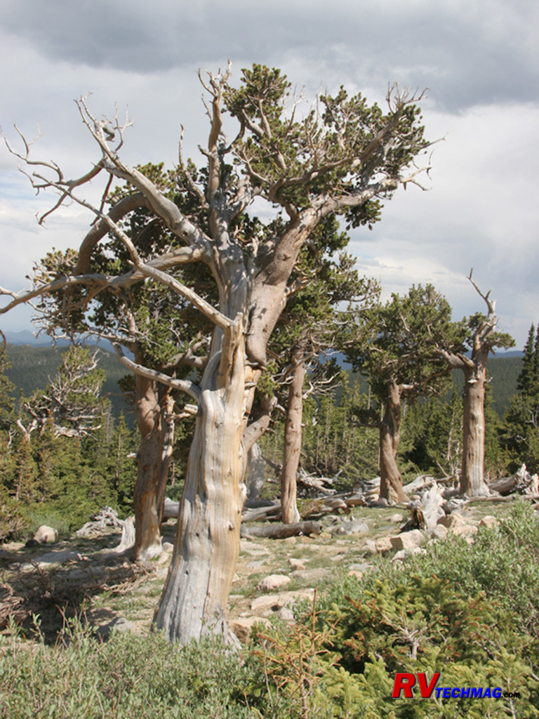
Bristlecone Pine
Bristlecone Pine grow at high elevations, generally above 12,000'. These trees are well adapted to the harsh environment they
live in. Battered and twi8sted by the strong winds at these elevations they take what little moisture and nutrients they can from the soil. Mature
trees such as these will be over 1,000 years old and their growth is measured microscopically compared to other trees. Their hardy nature makes it
easy for them to tough out the long harsh winter that seems to last forever at this altitude.
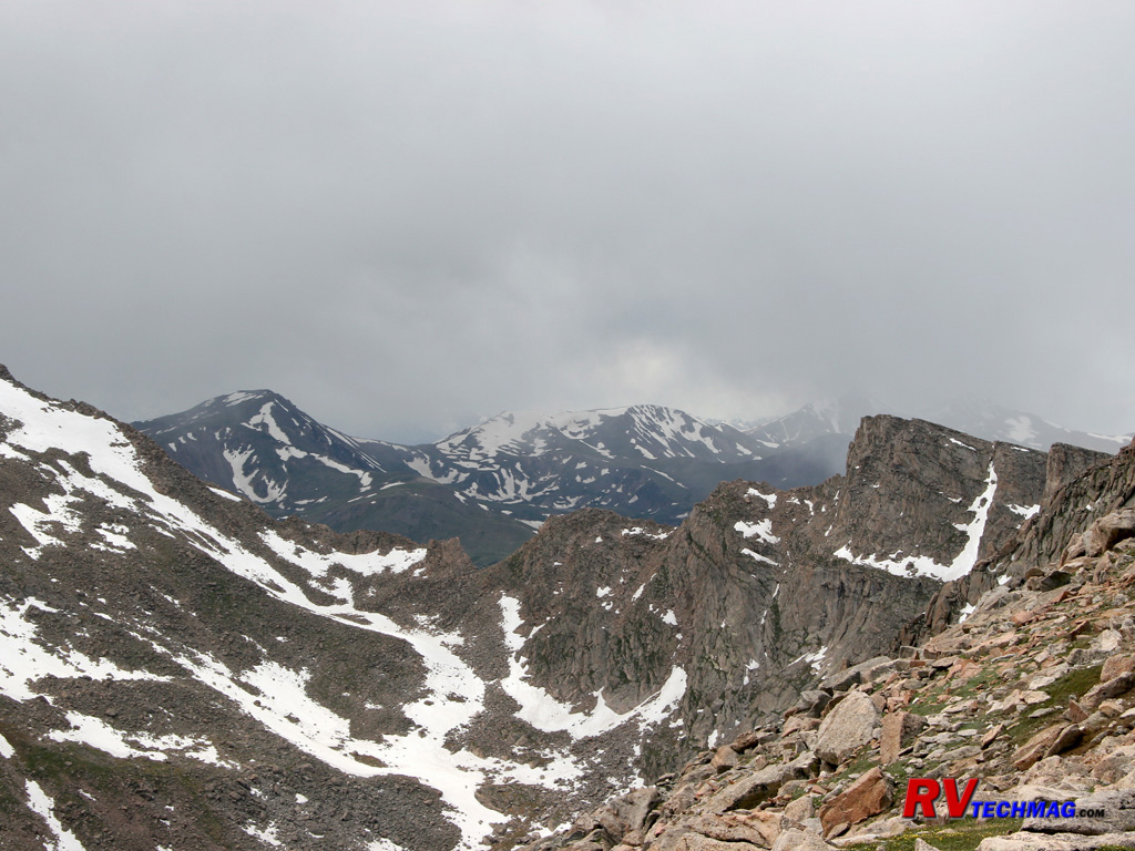
Approaching Storm
An early July storm approaches Mount Evans as seen from its summit. Shortly after this image was taken the snow began to
fall. Mountain weather can be very unpredictable at any time of the year.
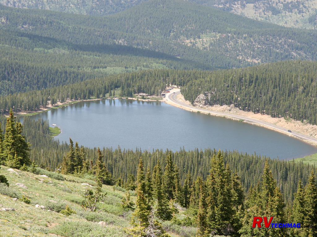
Echo Lake
This view of Echo Lake was taken from the switchback roads above it that wind their way up the mountain's flanks. Echo Lake
Park, maintained by the City of Denver, can be seen at the top of the lake in this northward view.
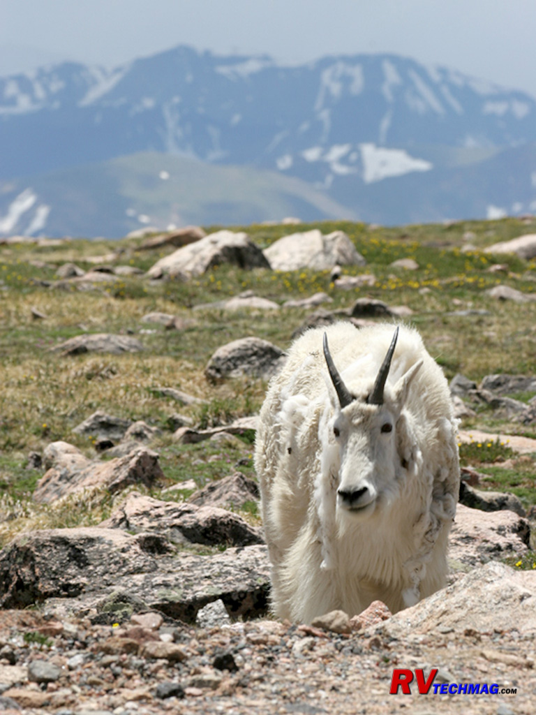
Mountain Goat
Mountain Goats are accomplished climbers. They can be seen scrambling up cliff sides that would require technical climbing
gear for a person. They are normally seen early in the morning or later in the afternoon grazing amongst any green grass that they can find.
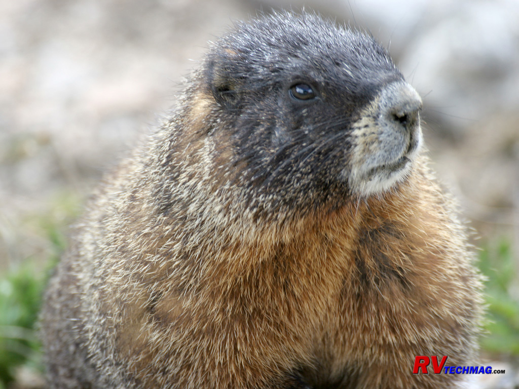
Yellow Bellied Marmot
Marmots, are abundant on Mount Evans, more so than any other mountain in the state of Colorado. Also referred to as Whistle Pigs
or Rock chucks, these relatives of the Woodchuck are found in high elevations and they make their burrows in rocky terrain, which provides them cover
and escape from predators such as Coyotes, hawks, or eagles. They hibernate during the winter and emit a whistling sound to warn others if they feel
they are in danger. During mid-day they are generally sleeping in their dens.
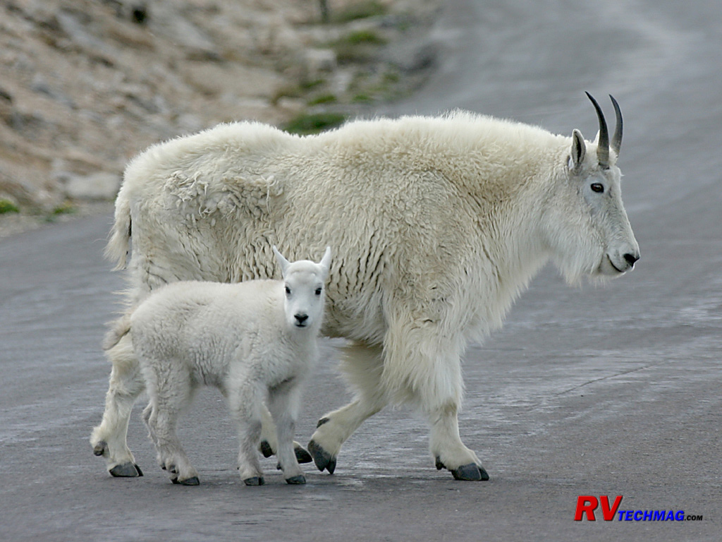
Mountain Goats
This mother and inquisitive baby Mountain Goat were seen crossing the Mount Evans Scenic Byway near the summit.
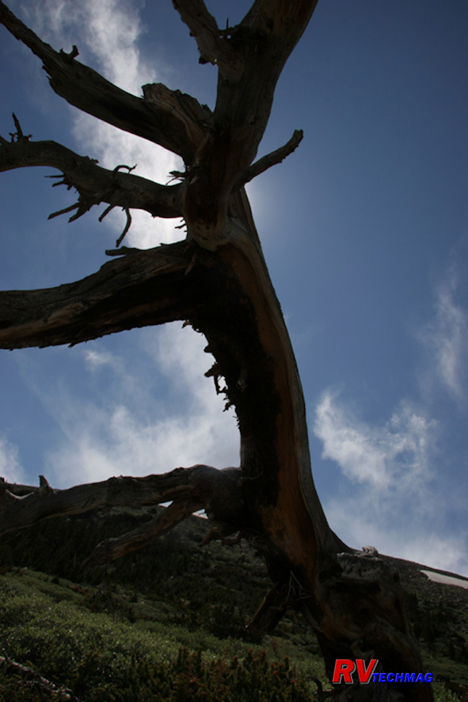
Bristlecone Pine
This Bristlecone Pine stands silhouetted against the sky.
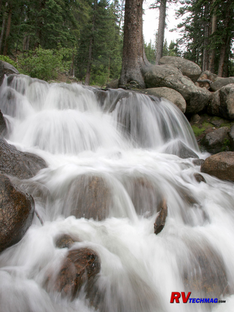
Waterfall
There are a number of streams flowing down Mount Evans. This stream was found in the lower elevations, below Echo Lake.
Rocky Mountain National Park
Rocky Mountain National Park is situated just west of Estes Park, which is about a 1 hour drive north of Denver. This large
area was set aside for the protection of its natural features in 1915 it's 416 square miles begin in the low wet grassy valleys and extend upwards as
at least 60 mountains exceed 12,000'. The highest is the football field sized summit of Longs Peak at 14,259' but the entire park is filled with rocky
wilderness that reaches to the sky. The old Fall River Road that used to be the way into the park is now a one way gravel road that first opens around
July 4th after the snow has been cleared. Instead, most visitors take Trail Ridge Road, a winding alpine scenic highway that begins in the glacial
moraine valleys below and passes through subalpine forests and then alpine tundra before topping out at over 12,000' near the Alpine Visitor's Center.
From here the tourist has the option of passing down the other side to Granby or returning via Trail Ridge Road to Estes Park. Near the Continental
Divide you'll be able to see the Gore Range as well as the Never Summer Mountains. The headwaters of the Colorado River begin in this area.
Rocky Mountain National Park is known for its elk population. Indeed, many of these elk flow out of the park itself and are
seen wandering around the town of Estes Park, particularly in the fall. Bighorn Sheep are generally seen at Sheep Lakes from May through August as
they travel for water and Moose can be found on the parks far west side along the Colorado River in the Kawuneeche Valley. Marmots and Pikas favor
the rocky areas while Golden Eagles, Steller's Jays, and Clark's Nutcrackers can be seen almost anywhere along Trail Ridge Road.
There is a wide number of recreational activities in the park. From automobile sightseeing, bicycling, hiking, and mountain
climbing, to horseback riding there's bound to be something for everyone. A shuttle service is available to transport visitors to the crowded Bear
Lake parking area in the busy summer months for those who want to hike the trails in that area.
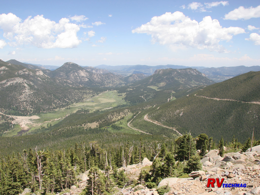
Moraine Park
From up on the Fall River Road, this view looks back down into Moraine Park, carved out by glacial activity many years ago.
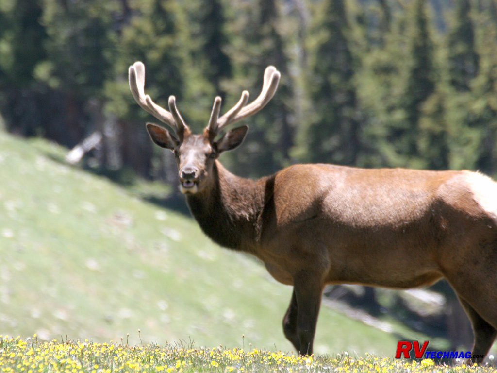
Elk in Velvet
This image of a young bull elk was taken in late June. Elk shed their antlers every spring and begin to grow new ones which are
covered in velvet, which is a the series of small blood vessels that nourish their growth. When fall arrives this velvet dies and the antlers are sharp
and sturdy. Elk are seen rubbing the velvet off on nearby trees to prepare for the fall rut.
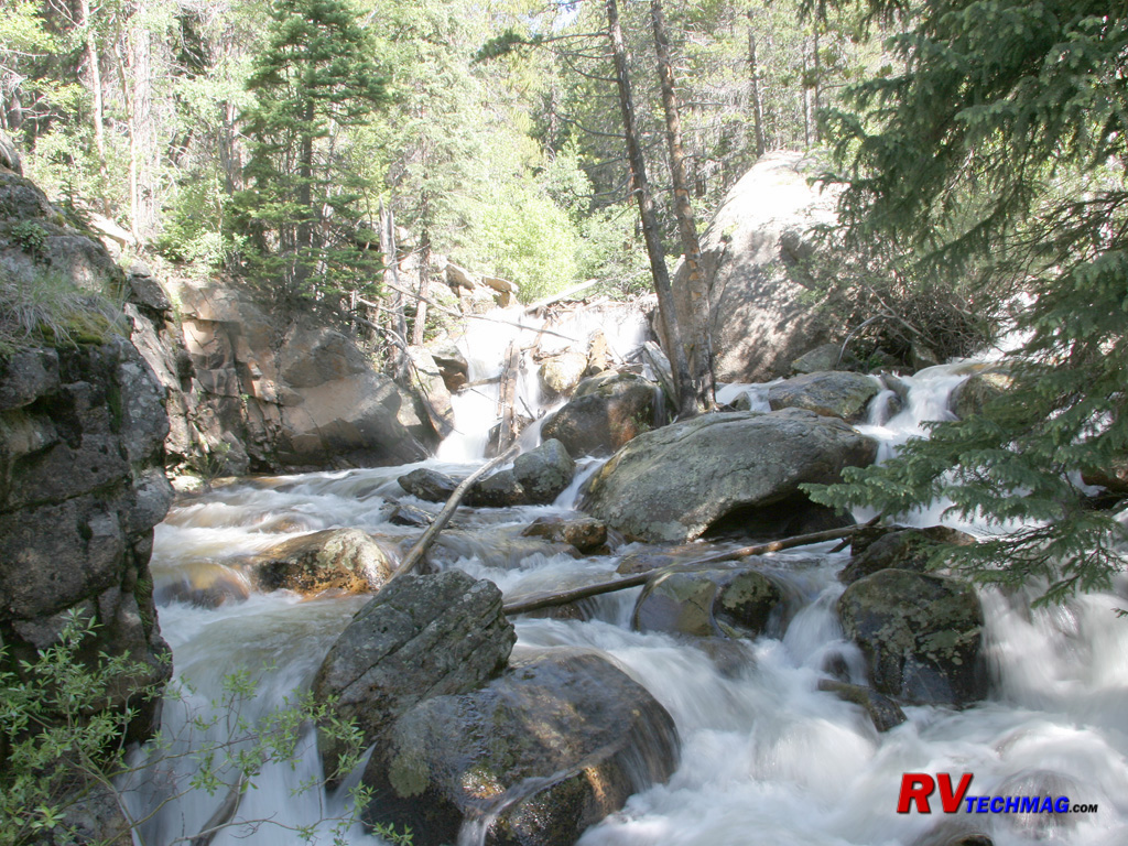
Fall River
The Fall River begins its run high in the peaks of Rocky Mountain Park. It flows down through the Fall River Canyon on its way
to the meadows in Moraine Park.
Avalanche Zone
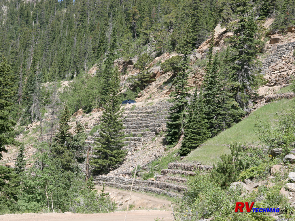
The Fall River Road passes through the canyon and steep slopes tower over it which is why it takes until the beginning of July
for the snow to be cleared. The heavy snows that hang on these cliffs cause avalanches in a number of areas that strip the slope of all trees and washes
the soil away, blocking the road. This particular slope was terraced and filled with stone. Then a protective steel mesh was anchored over it to keep
the stone in place in order to prevent future avalanches from washing the slopes away.
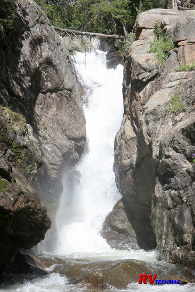
Fall River Waterfall
This waterfall was seen in Fall River Canyon, where the Fall River cascades down to the valley below.
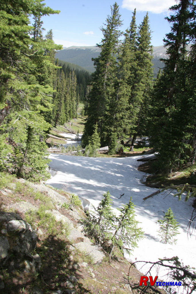
Trapper's Trail
This trappers trail was a popular method of traversing the park in the 1840s when trapping for Beaver was in full swing. The
trappers would cache their supplies along this route for future retrieval. This early July picture shows the amount of snow still present at
this altitude.
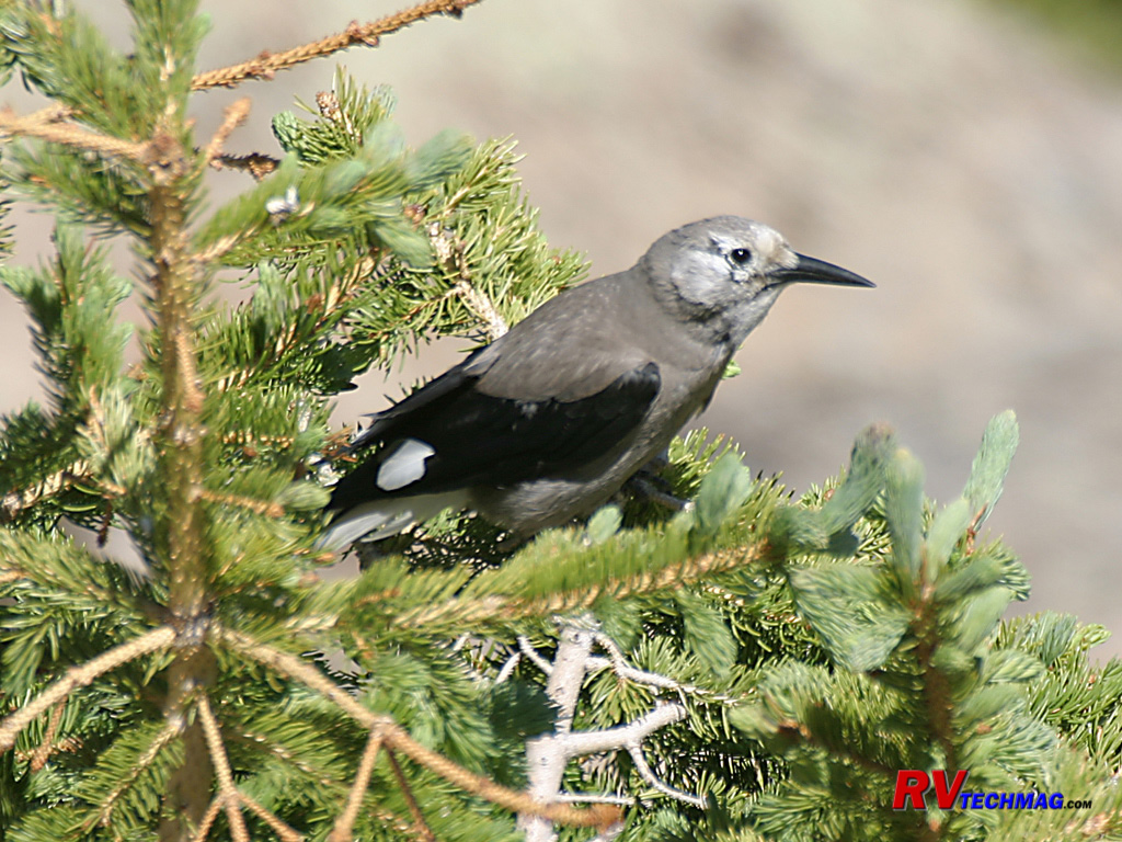
Clark's Nutcracker
The Clark's Nutcracker is very prevalent in the high country. It feeds on pine seeds and stores its surplus seed in caches for
retrieval during the winter months. It has been known to cache more than their actual needs, up to 100,000 seeds, in order to protect against theft
by other animals. it has the uncanny ability to remember where each and every seed is stored and has been known to unerringly find seeds 6 months later
when the seeds have been buried under 3' of snow cover.
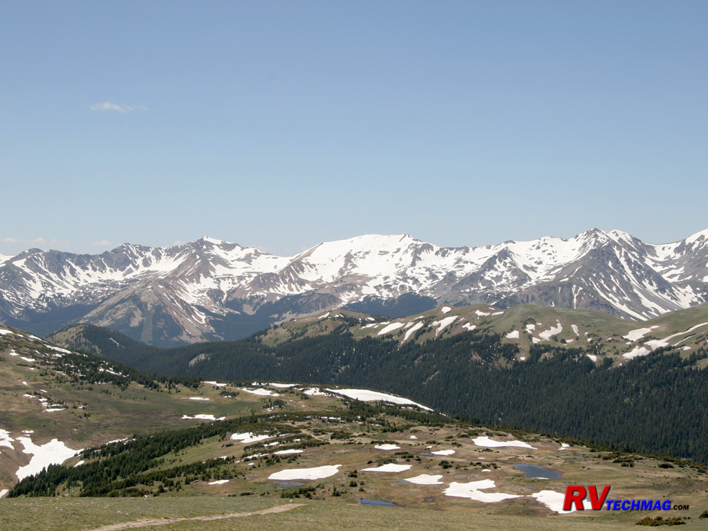
Never Summer Mountains
On the west side of the park, this snow covered mountain range (hence the name) is about 10 miles long and consists of 10 peaks
rising over 12,000'. It straddles the Continental Divide and separates the waters of the Colorado River to the east from the upper basin of the North
Platte River to the west.
Return to Home Page
If you enjoyed this article be sure to recommend RVtechMag.com to your friends, like us on Facebook or Twitter
or subscribe to our RSS feed.


|


