Colorado
A Photo Journal of America's Rocky Mountain State
Article Date: January, 2015
Article and Photography by Mark Quasius
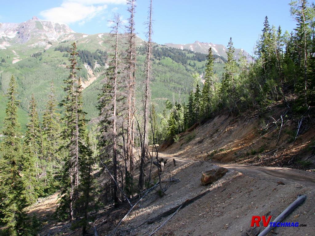
Leadville
At 10,350' above sea level, Leadville holds the distinction of being the highest incorporated city in the United States. Its
story begins in 1879 when the Slater Party made the $8 million gold discover in California Gulch. The area exploded as prospectors converged upon the
scene but by the mid 1860's all of the gold reserves were mined out. But the "black stuff" that they tried to separate from the gold in their pans
was actually silver bearing lead ore. A number of years later, a pair of miners recognized its value and began buying up old "worked out" gold claims.
By 1880 the silver boom had begun and Leadville was the second largest city in the state. Millionaires were made overnight and many mines produced
hundreds of thousands of dollars in income every day. By 1893 the Silver Crash of 93 brought the price of silver to zero and many of these
rags-to-riches stories turned to riches-to-rags.
Leadville, sitting in a beautiful setting in the Rocky Mountains was a place of scenic color. But, the people who lived and
visited here were also colorful. Doc Holliday held his last shootout in Leadville and then spent 54 days in jail, penniless to post bail. Big Nosed
Kate eventually took him to Glenwood Spring where he died of consumption. Many visitors stayed in the community. Names such as Wyatt Earp, Bat Masterson
and the Cole-Younger Gang to name a few. The unsinkable Molly Brown, later known for her role in the Titanic disaster, found instant wealth in the mines
here with her husband JJ Brown.
Leadville continued on, even after the silver bust of 1893. During World War II nearby Camp Hale was the training spot for the
Army's 10th Mountain Division. It became a popular visit for soldiers but only after the city acted to curb prostitution. Prior to that the city was
declared off limits by the army to all US soldiers. From then on the incresed demand for molybdenum helped the Climax mine, which at one time produced
75% of the world's molybdenum. The closing of the mine in the 1980s was a major blow. The years of mining left behind contaminated soil and water so
that the EPA declared many mines Superfund cleanup sites. Today's Leadville relies on tourism for its income but is unique in that its history remains
in place for all to see. A visit to Leadville is more like a step back in time.
Evansville
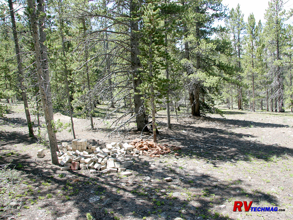
The townsite of Evansville was once a bustling town with over 1,000 inhabitants. When the mining boom turned to bust the
occupants left and their homes were dismantled to use as lumber for other structures as well as timber for mine shoring. Eventually the trees grew up
in its place and the townsite is now hidden from view. A hike amongst this location reveals that all that remains is stacks of bricks, rusty metal
hardware, and broken bottles.
Mining District
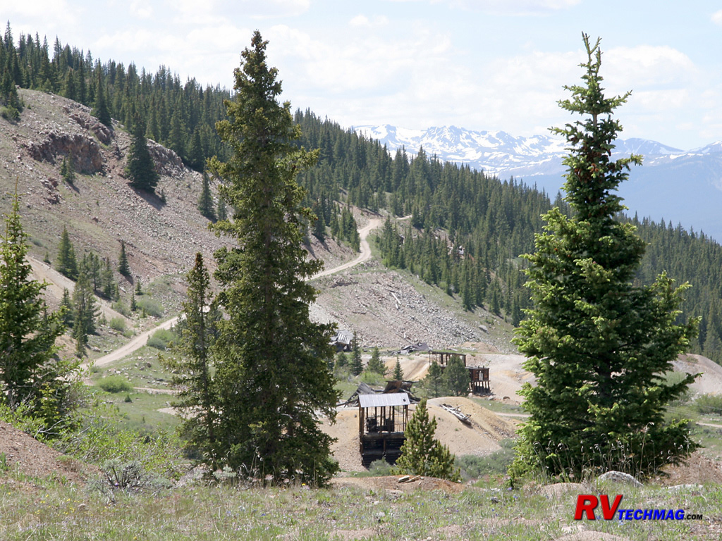
East of Leadville a climb up into the mining district reveals a large spread of mines clinging to the hillsides of California
Gulch. Mount Elbert and Mount Massive can be seen to the west.
Mine Remains
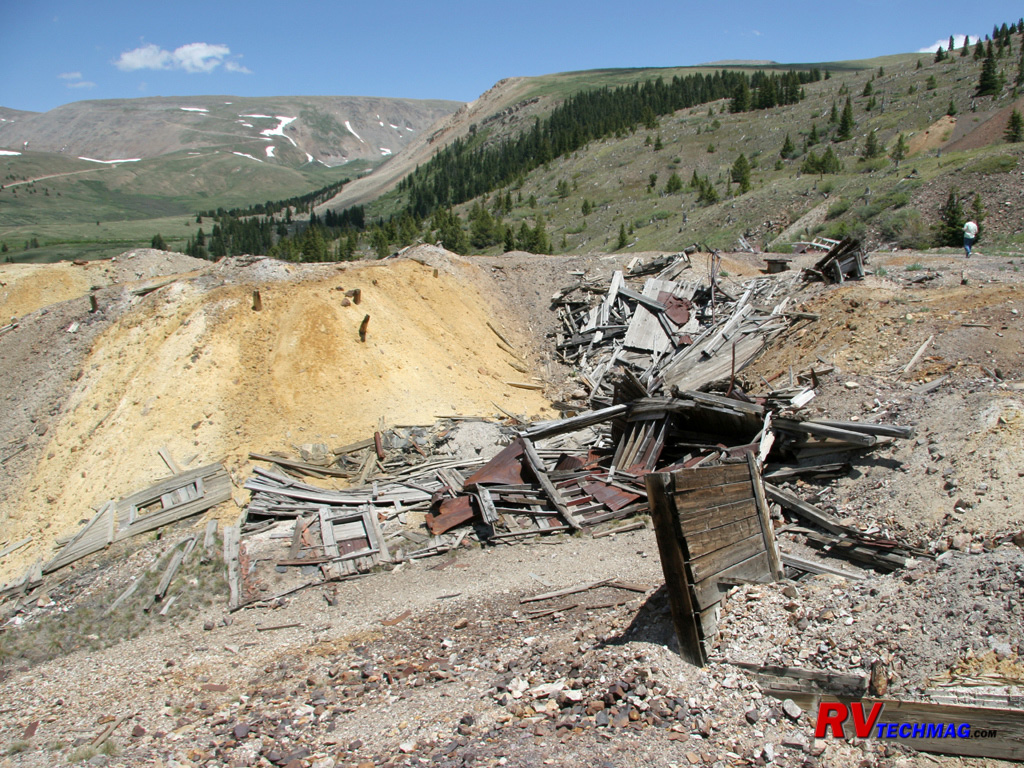
Many mine shafts were filed in with dozers in recent years to prevent anyone from falling into these long vertical shafts. If
you find an open shaft and drop a rock into it you'll be surprised at how long it takes to hear the splash as it hits the water below. Those shafts are
extremely deep.
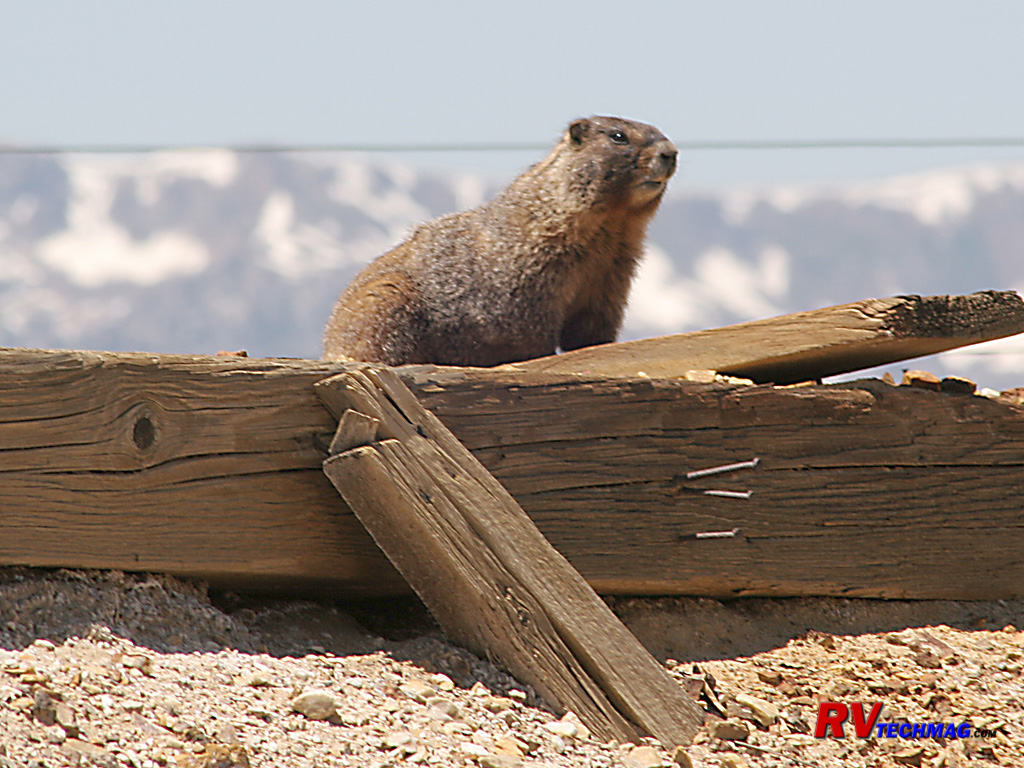
Marmot
This Yellow Bellied Marmot was found on old mining timbers wondering who this human visitor was.
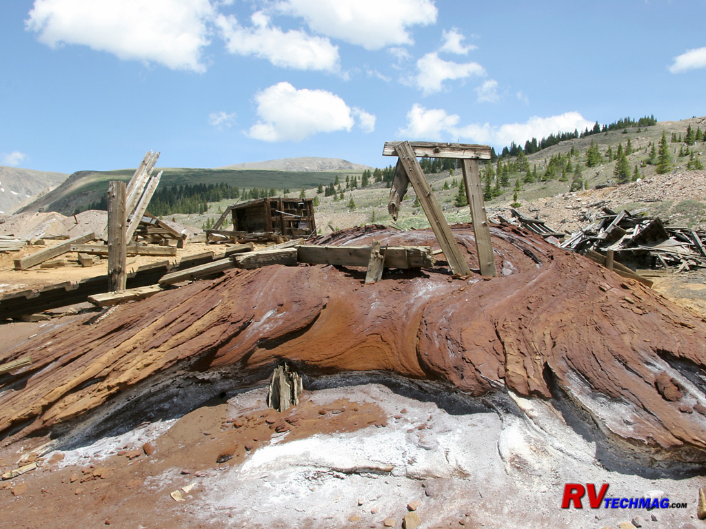
Mine Tailings
When removing the ore from the mines, acids and chemicals are used to leach the mineral from the ore. This tends to leave a
discolored mess in the area and the chemicals also get into neighboring water supplies but these were the days before "environmentally friendly"
became a buzzword. These tailings were found at the top of one of the mines in Leadville's east gulch.

Jeep
When exploring these mines the Jeep is the best method of transportation. Its ability to climb grades, traverse rocky terrain,
and maneuver in tight quarters is unparalleled and makes it a prime candidate for this terrain.
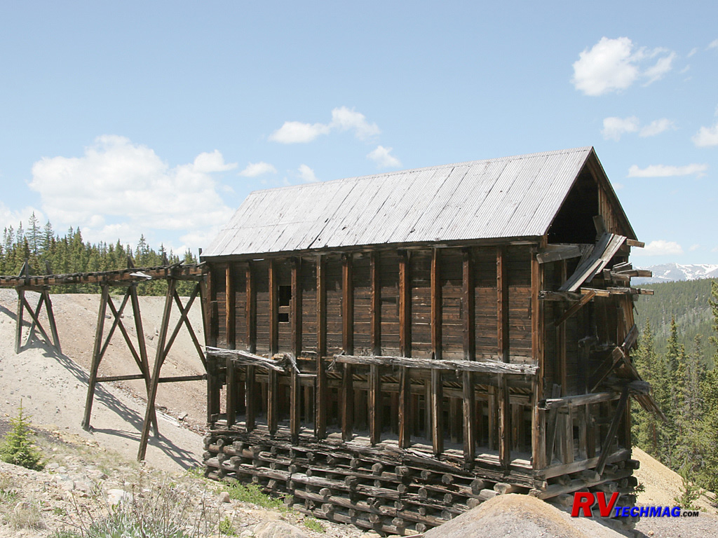
Mill
Mills were used to process the mineral from the ore. The ore entered the mill at the top via carts and was dumped into the
machine works to be ground and processed. The tailings were dumped in the surrounding area and the mineral was loaded into wagons via chutes at the
bottom of the far side of the building.
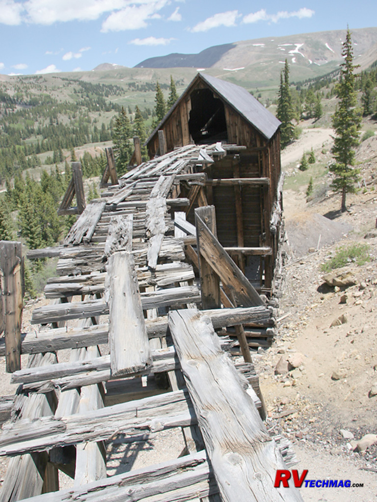
Mill Track
The ore was brought into the mill via carts that passed along this track, which connected the top of the mill to the slope
nearby. Presumably it was in better shape back then.
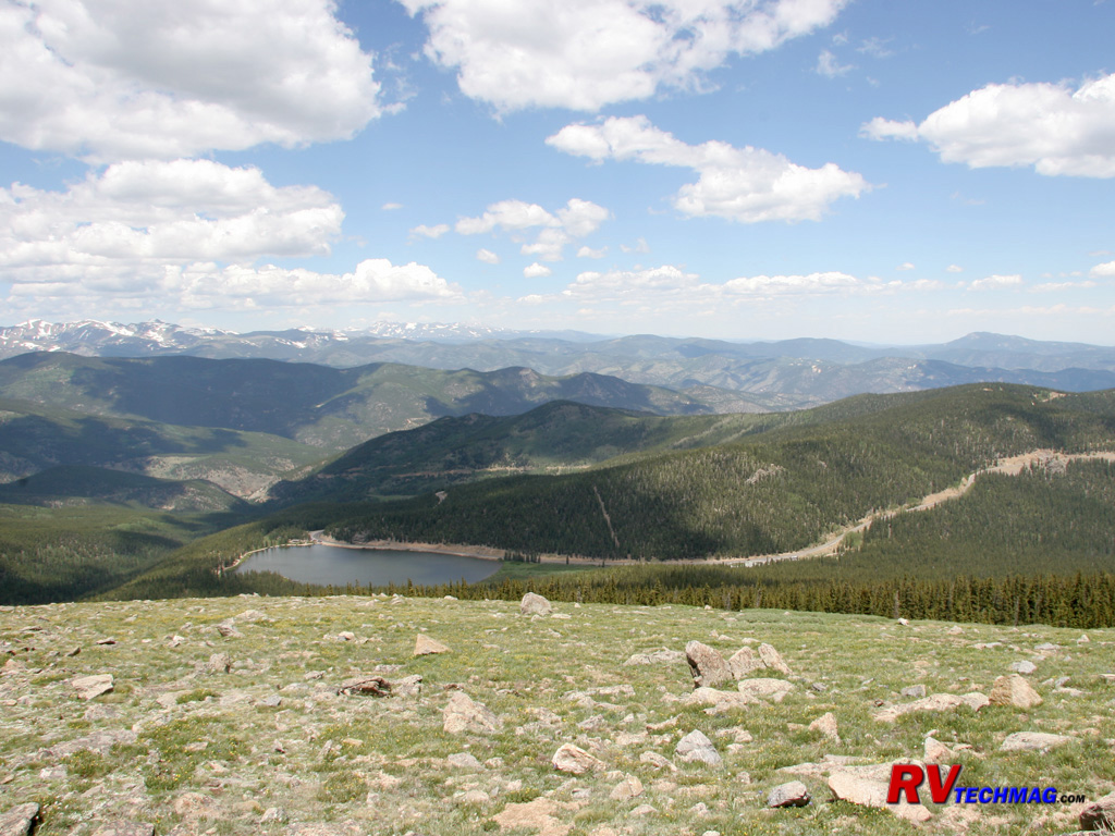
Turquoise Lake
Immediately west of Leadville lies Turquoise Lake. This image was taken from high up in the California Gulch mine district.

Mount Elbert
Mount Elbert is the highest peak in Colorado. At 14,433' it towers over the town of Leadville.
Return to Home Page
If you enjoyed this article be sure to recommend RVtechMag.com to your friends, like us on Facebook or Twitter
or subscribe to our RSS feed.


|


