Colorado
A Photo Journal of America's Rocky Mountain State
Article Date: January, 2015
Article and Photography by Mark Quasius
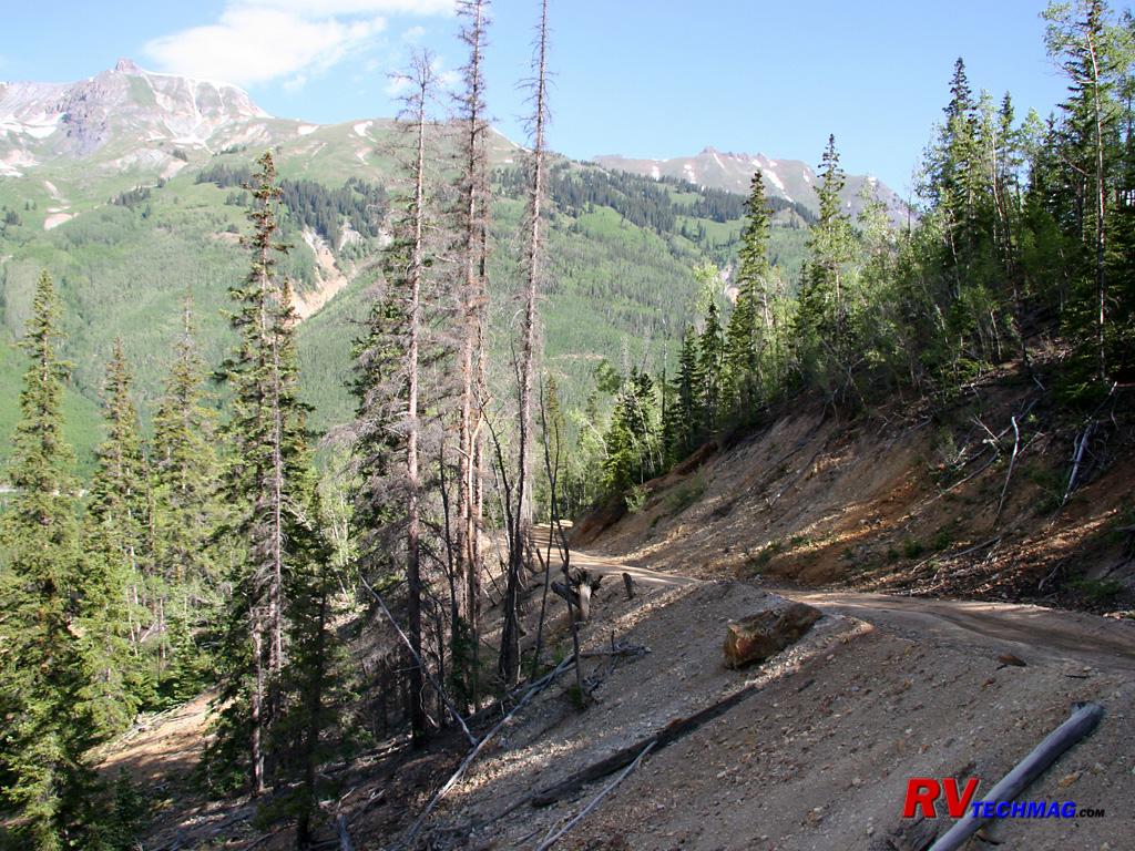
Silverton and Animas Forks
Located south of Ouray, Silverton sits in the middle of the Million Dollar Highway, which begins to the south in Durango.
Nestled high in a mountain valley at 9,318', Silverton is another mining town that was famous for its silver mines but it also was connected to
Durango to the south via the Silverton-Durango Railroad. This narrow gauge line gave the miners a cost effective way to transport goods in and ore
out of the mountains. This railroad winds its way through the tight valleys and clings to the sides of the San Juans. Today this railroad has been
restored and now transports passengers on a one hour trip through some amazing scenery.
Silverton was founded in 1875 but the original 100 inhabitants grew to 500 in 1876. Life wasn't easy for them and the
statistics from Silverton's cemetery indicate that 117 died from snowslides, 143 from miner's consumption, 161 from pneumonia, 138 from influenza
(most in the 1918 epidemic), and 202 from mine accidents. At first they came by foot and with mules but in 1879 the wagon road over Stony Pass
opened and in 1887 the railroad from Durango reached Silverton. Railroads also reached Ouray from the north but there was no connection between
Ouray and Silverton due to the rugged terrain in the Uncompahgre canyon. Mining reached its peak between 1900 and 1912 and Silverton flourished
and most building were built at that time. After that the mining industry went through booms and busts and Silverton rode them out but when Lake Emma
flooded the Sunnyside Mine in 1978 that was pretty much the end of Silverton's mining era. Silverton is also known for its winters. Silverton is not
an agricultural area and the growing season is only 14 days long. Tucked in the San Juan mountains, it receives an average of 200 inches of snow
per year. In 1932 Silverton was snowed in for 32 days at one time but modern snow removal equipment has changed that and it's now rare to be isolated
for more than one day at a time.
Today Silverton has much to offer. Nearby mines are easily accessed via Jeep trails and the scenic setting is another draw
for tourism. Animas Forks, a nearby ghost town is in remarkable shape after all these years and a popular spot for 4WD vehicles. Molas Pass, jut
south of Silverton, has the distinction of having the cleanest and clearest high quality air, as shown by government research. 95% of the lands in
this area are public lands so there is much to see and do. Leaving Silverton to the north, you'll finish your drive on the Million Dollar Highway by
passing through the spectacular Uncompahgre River canyon and emptying in Ouray's amphitheatre setting. Driving south you'll climb Molas Pass and
eventually the road descends as the valley widens on its way to Durango.
Mineral Creek
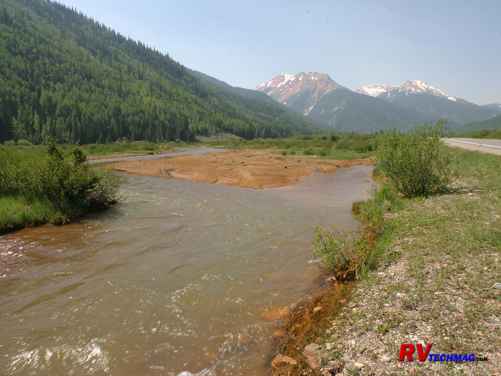
North of Silverton, Mineral Creek flows alongside the Million Dollar Highway. As snowmelt and rain water runs downhill from the
mines it picks up traces of the minerals from the tailing piles that are abundant in this area.
Beaver Dam
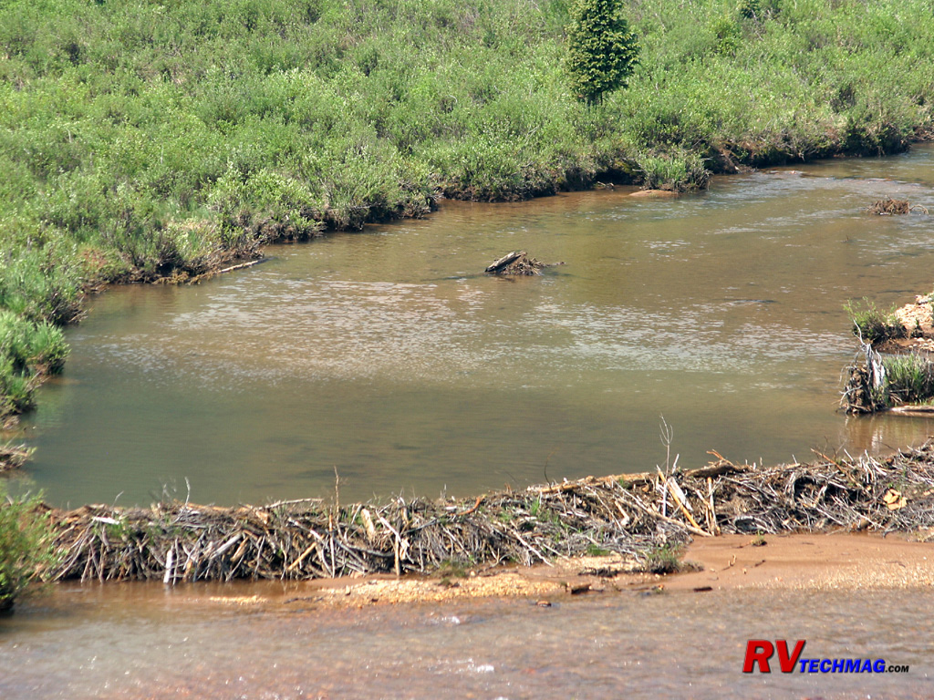
Beaver locate their dens anywhere there are Aspen nearby. By creating a dam they control the water level near their lodge.
The Silverton
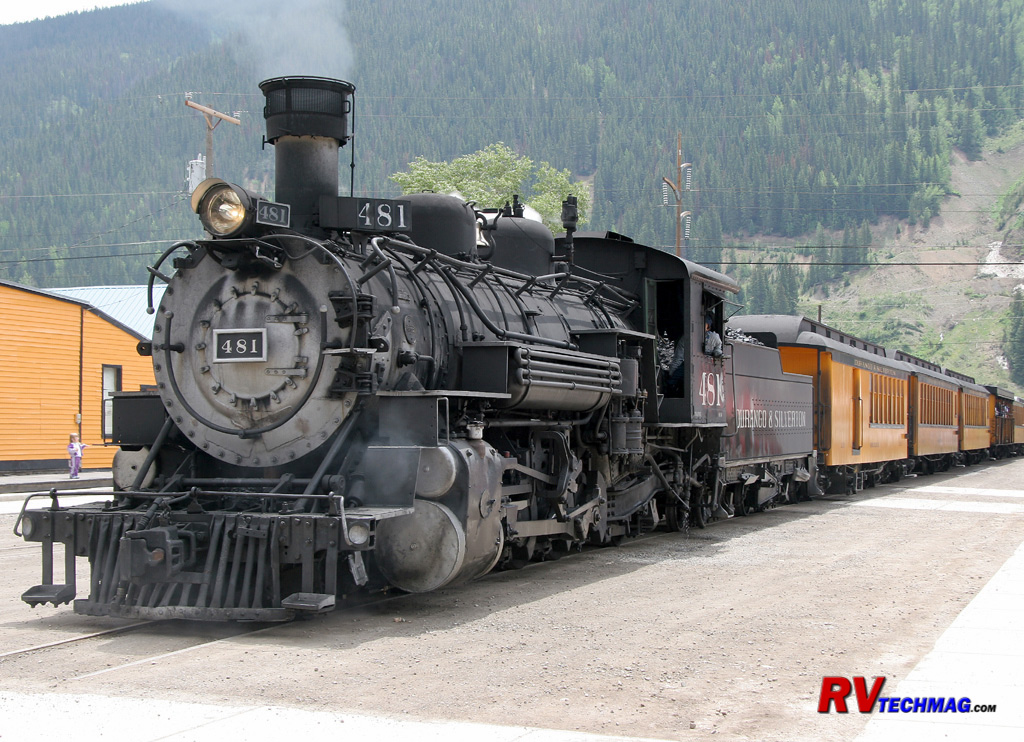
The restored Durango and Silverton narrow gauge railroad now hauls tourists rather than mining supplies through the twisting
valleys and over the mountain passes between Durango and Silverton, docking right in downtown Silverton.
Snow Melt
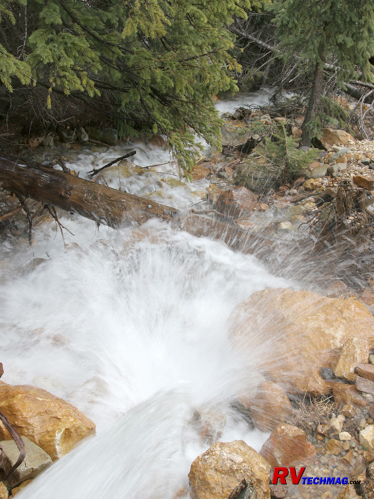
The heavy snow cover takes time to melt and the numerous streams in the area are filled with rushing water thought most of the
summer.
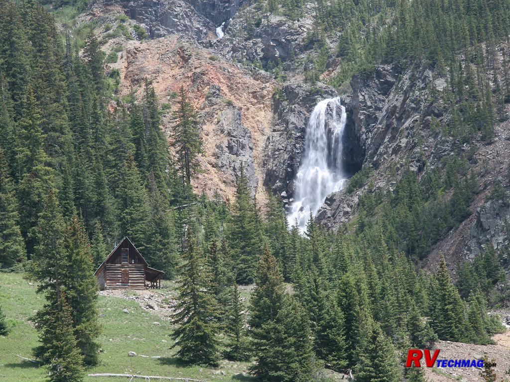
Cabin and Waterfall
Tucked against a slope, this miner's cabin has found the perfect scenic setting next to a waterfall.
Eureka Mill Ruins
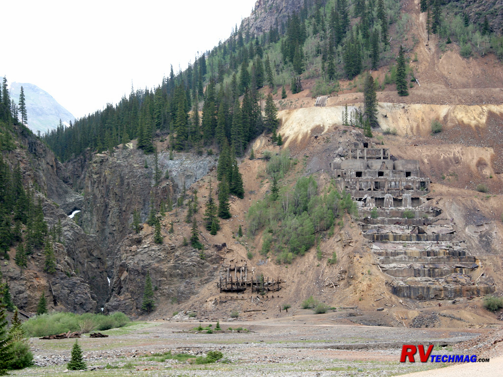
Where there are mines, there are mills. Mills are used to process the ore and remove the precious metals from the ore. This
mill at the Eureka townsite was built in steps upon the mountain. The heavy machinery required large concrete foundations to support the weight and
stress of their operation. After the years have taken their toll, all that remains is the concrete footings as the wood was either removed or
destroyed in avalanches.
June Runoff
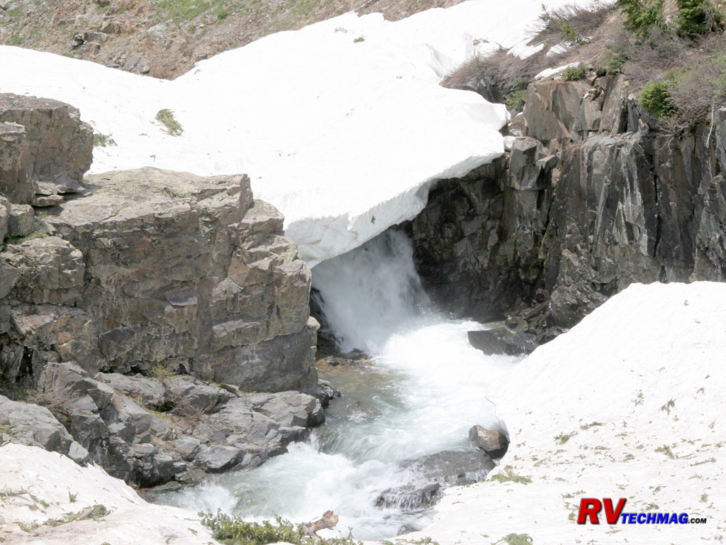
In the end of June, many ditches and gullies are still snow covered as the water flows beneath them.
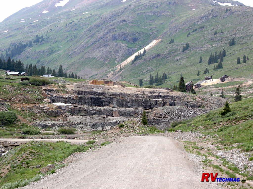
Entering Animas Forks
As you enter Animas Forks, the foundations of the old mill are found at the entrance to town. This pile of concrete and
large steel anchor bolts is all that remains.
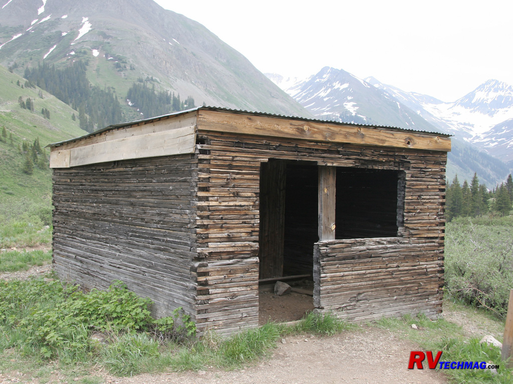
Miner's Hut
Mining wasn't easy and conditions at this altitude, especially during winter, wasn't overly hospitable. This miner's hut
was the home for two miners.
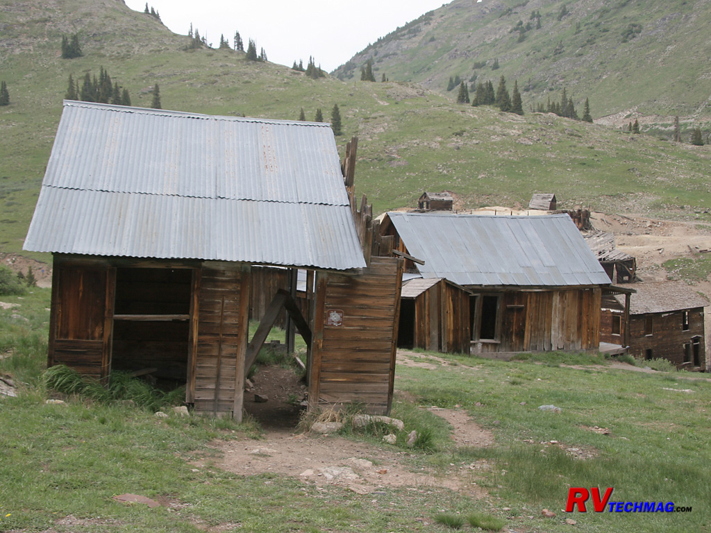
Residential Area
Animas Forks began in 1875. Its sign advertised it as the "largest town in the world" and then, in small print "at this altitude"
which was 11,300' above sea level. It was a short lived community and the mining lasted for maybe 20 years. Its biggest enemy was the constant
avalanches that occurred in this valley, some of which would road down one side and up the other because the valley was so narrow. This section of
Animas Forks was a residential section and a few houses remain.
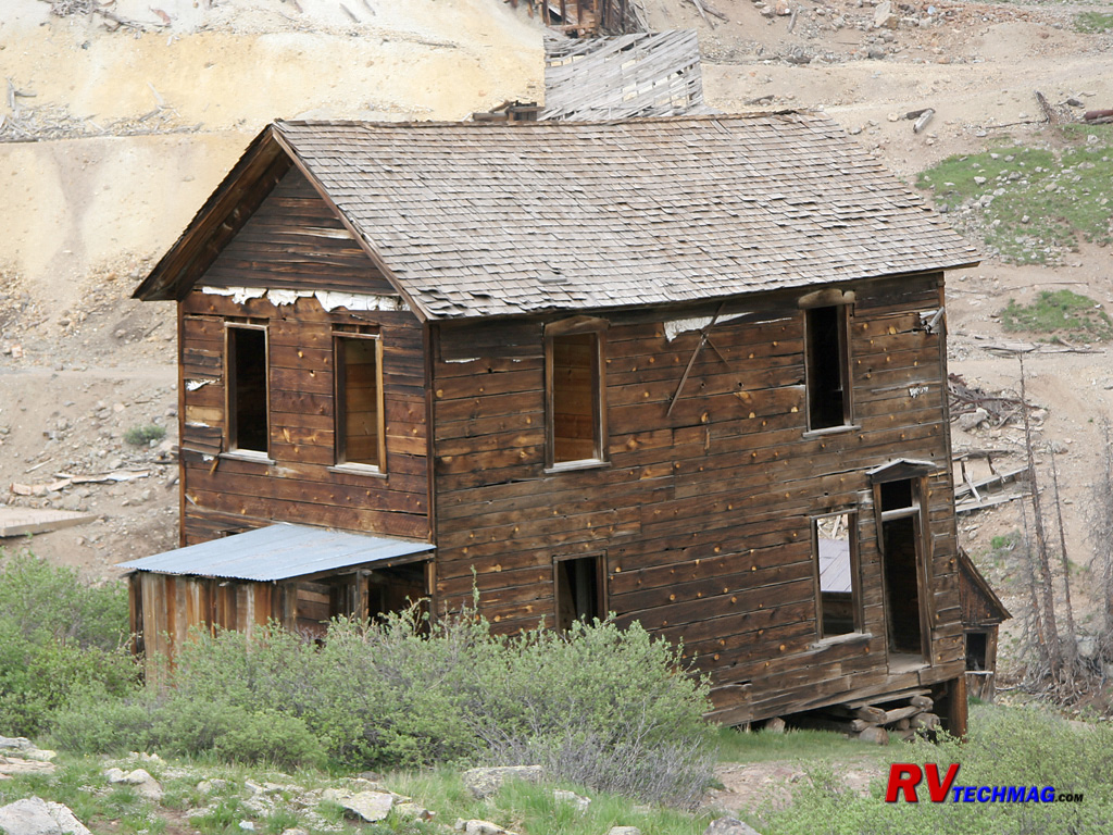
Walsh House
This rear view of the Walsh House shows some of the newer interior lumber. Some of the structures in Animas Forks are being
reinforced to prevent further decay.
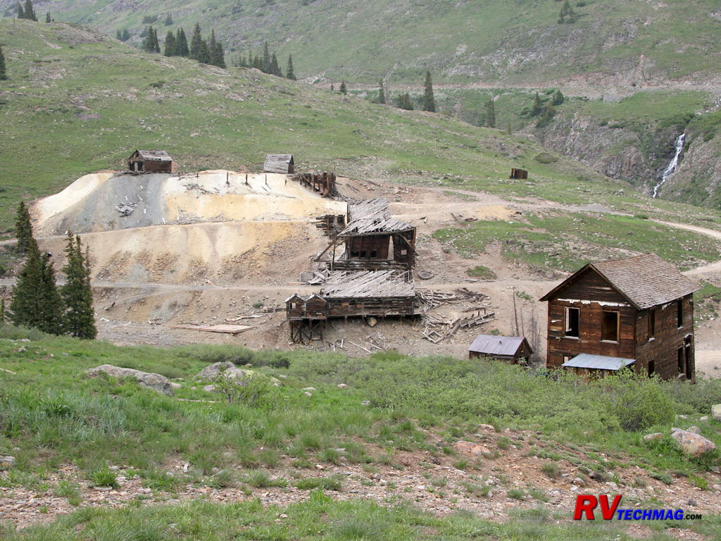
Bunkhouse RuinsForks
This view shows the remains of the Columbus Mine, as well as the bunkhouse or boarding house, which also served "other needs"
for lonely miners. Many bunkhouses were built right on the mine site and surrounded by piles of tailings from the mining operation. Being situated on
slopes these were prime targets for destruction by avalanches. Most miners would retreat in the fall and return again in spring because to remain in
Animas Forks over winter meant dealing with the threat of avalanches as well as total isolation.
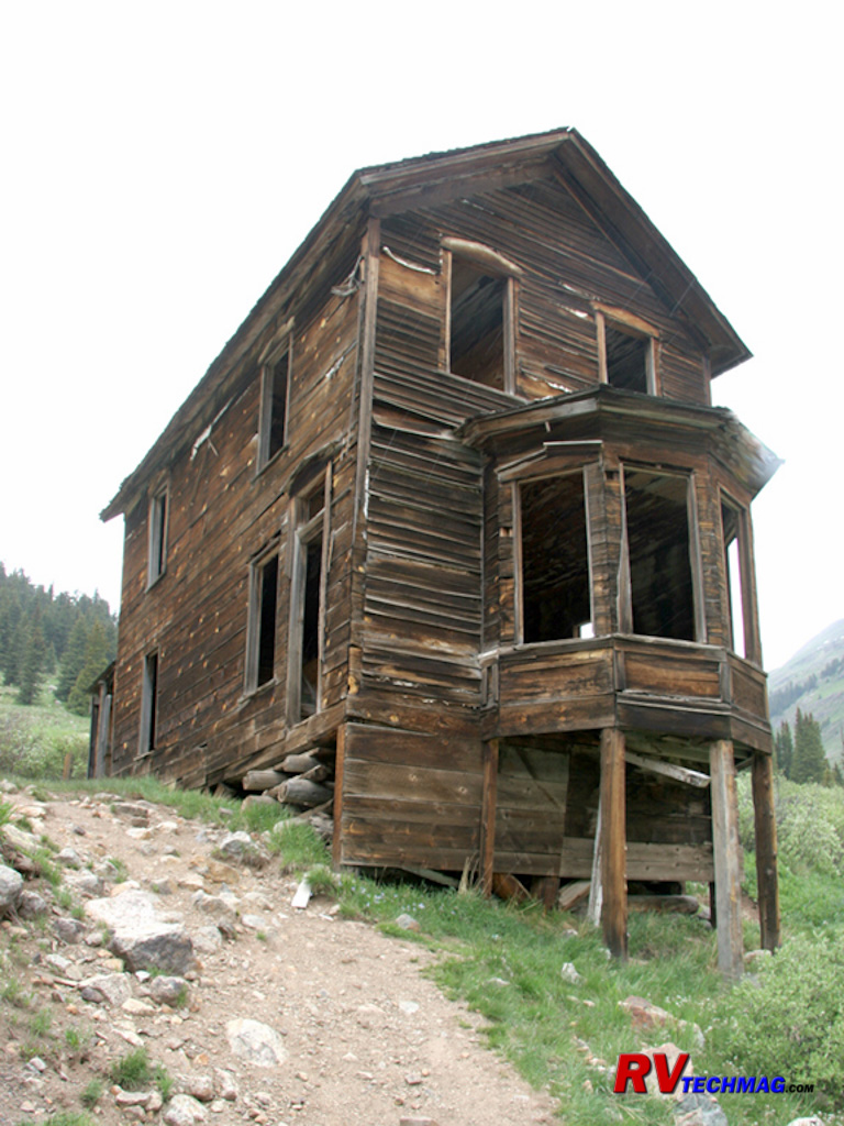
Bay Window House
The Walsh House, also know as the Bay Window House, was the home of Evelyn Walsh McLean, the daughter of Tom Walsh, who
discovered the famous Camp Bird Mine and owned the Hope Diamond.
Return to Home Page
If you enjoyed this article be sure to recommend RVtechMag.com to your friends, like us on Facebook or Twitter
or subscribe to our RSS feed.


|


